Glacier NP – Going to the Sun Road Introduction
Going-to-the-Sun Road is the defining journey through Glacier National Park, crossing the northern Rocky Mountains from the forests and lakes of the park’s western valleys to the open landscapes of the east side. Nearly 50 miles long, the road follows Lake McDonald and McDonald Creek before beginning its remarkable ascent along the Garden Wall to Logan Pass, where it crosses the Continental Divide. From there, the route descends through alpine country toward St. Mary Lake. Waterfalls, glacial valleys, sheer rock faces, mountain meadows, and distant peaks unfold continuously along a road designed not simply to cross Glacier, but to reveal the scale and drama of its landscape.
Building a highway through this terrain was one of the National Park Service’s great early engineering challenges. Construction began in the early 1920s, and the transmountain route was completed across Logan Pass in 1932 before its formal dedication the following year. Engineers deliberately rejected a plan that would have climbed toward the pass through numerous switchbacks, instead carving a much longer route into the mountainside along the Garden Wall. The resulting road used stone retaining walls, bridges, tunnels, and other features intended to harmonize with the surrounding landscape rather than dominate it. Its combination of engineering and landscape design became influential in the development of roads throughout the National Park System, and Going-to-the-Sun Road is now recognized as a National Historic Landmark.
Driving Going-to-the-Sun Road is consequently as much a part of experiencing Glacier as any individual overlook, trail, lake, or summit. The journey moves through dramatically different environments, from dense forests and broad glacial lakes to the exposed alpine world surrounding Logan Pass, with opportunities along the way to encounter waterfalls, wildflowers, mountain goats, bighorn sheep, and other wildlife. Yet some of the road’s most memorable moments come simply from following its narrow course across the mountainside, with the Garden Wall rising above and immense valleys falling away below. More than a route between two sides of Glacier National Park, Going-to-the-Sun Road is a carefully constructed passage through the park’s geography—one that transformed how generations of visitors have experienced the heart of Glacier.
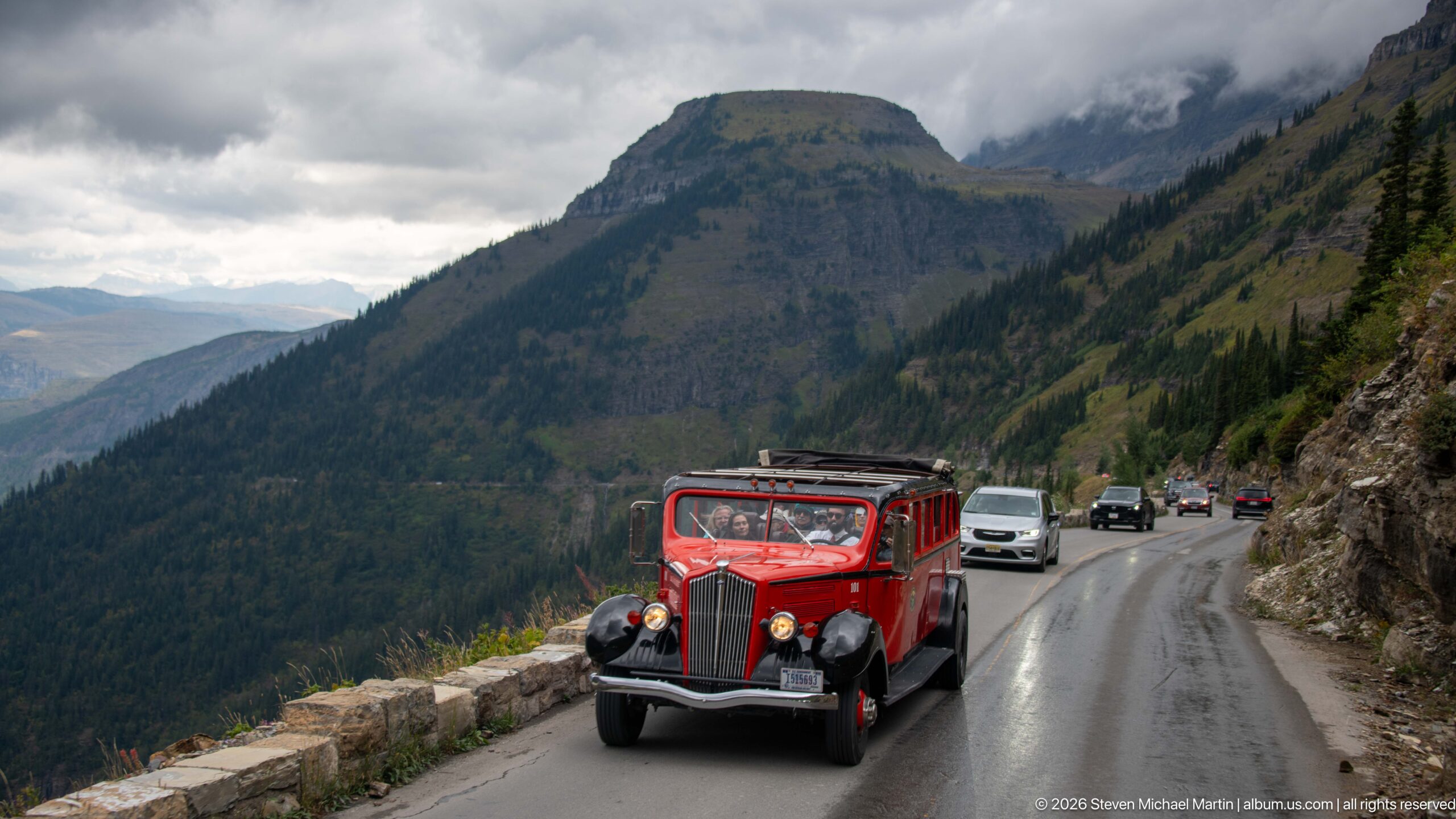
One of Glacier National Park’s distinctive red tour buses approaches along a narrow section of Going-to-the-Sun Road, sharing the cliffside pavement with modern vehicles. Its bright body and open sightseeing windows stand out against the stone guardwall and dark mountain slopes. The encounter brings together two enduring parts of the park experience: the historic mountain highway and the fleet of sightseeing vehicles long associated with guided travel through Glacier.
Caption
One of Glacier National Park’s distinctive red tour buses approaches along a narrow section of Going-to-the-Sun Road, sharing the cliffside pavement with modern vehicles. Its bright body and open sightseeing windows stand out against the stone guardwall and dark mountain slopes. The encounter brings together two enduring parts of the park experience: the historic mountain highway and the fleet of sightseeing vehicles long associated with guided travel through Glacier.
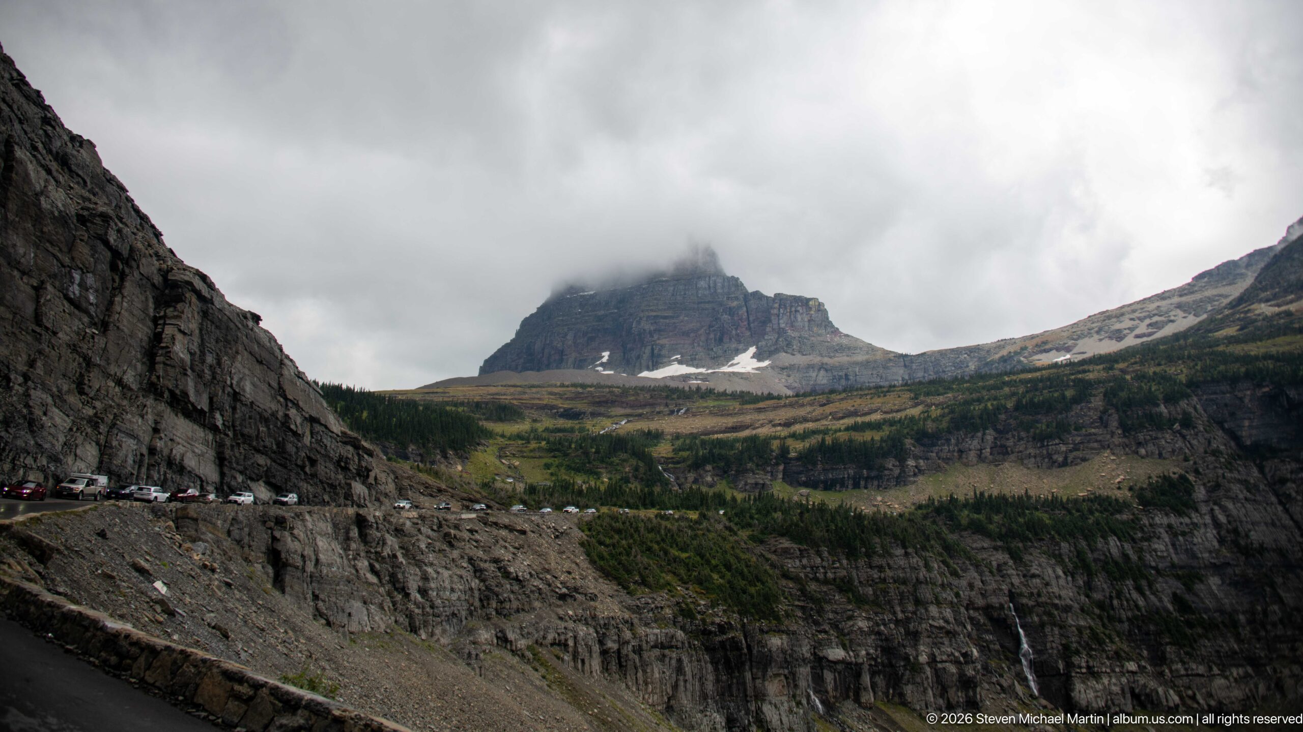
Going-to-the-Sun Road threads across a steep mountainside beneath massive stratified cliffs, with a cloud-wrapped summit rising beyond the curve. Cars appear tiny along the roadway, providing a vivid measure of the surrounding rock faces. Sparse alpine vegetation and lingering snow patches mark the transition from forested slopes toward the park's higher elevations.
Caption
Going-to-the-Sun Road threads across a steep mountainside beneath massive stratified cliffs, with a cloud-wrapped summit rising beyond the curve. Cars appear tiny along the roadway, providing a vivid measure of the surrounding rock faces. Sparse alpine vegetation and lingering snow patches mark the transition from forested slopes toward the park's higher elevations.
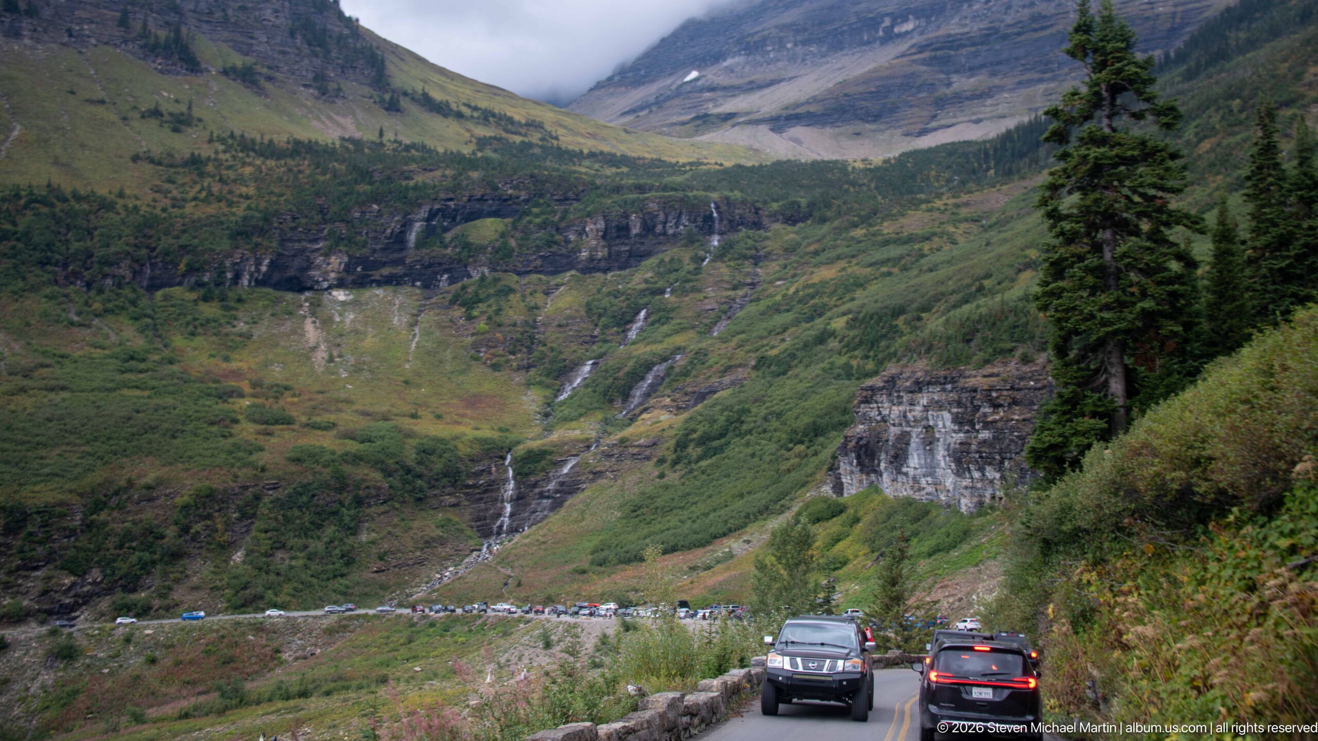
Traffic moves through a narrow bend of Going-to-the-Sun Road beneath steep green slopes and layered cliffs. A slender waterfall descends from the hanging terrain ahead, while stone roadside construction separates the pavement from the drop-off. The photograph shows the road as an active transportation corridor embedded in the mountain landscape, where drivers share close quarters with rock walls, runoff, and dramatic changes in elevation.
Caption
Traffic moves through a narrow bend of Going-to-the-Sun Road beneath steep green slopes and layered cliffs. A slender waterfall descends from the hanging terrain ahead, while stone roadside construction separates the pavement from the drop-off. The photograph shows the road as an active transportation corridor embedded in the mountain landscape, where drivers share close quarters with rock walls, runoff, and dramatic changes in elevation.
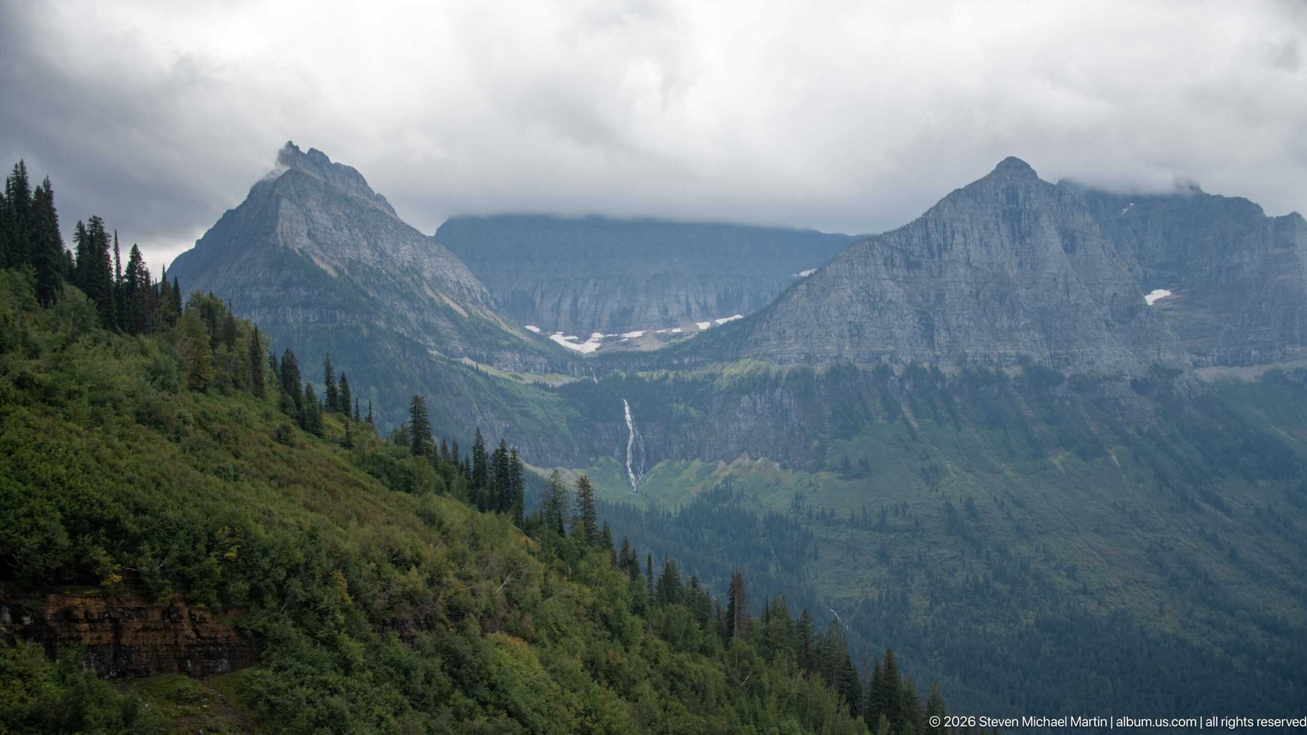
Sharp, stratified peaks frame a deep green valley while low clouds obscure the highest ridges. Small snowfields and a distant ribbon of falling water remain visible across the opposing slopes, revealing the steep relief shaped by glaciers and continuing erosion. The elevated roadside viewpoint compresses forest, exposed rock, snow, and cloud into a layered view characteristic of the high country along Going-to-the-Sun Road.
Caption
Sharp, stratified peaks frame a deep green valley while low clouds obscure the highest ridges. Small snowfields and a distant ribbon of falling water remain visible across the opposing slopes, revealing the steep relief shaped by glaciers and continuing erosion. The elevated roadside viewpoint compresses forest, exposed rock, snow, and cloud into a layered view characteristic of the high country along Going-to-the-Sun Road.
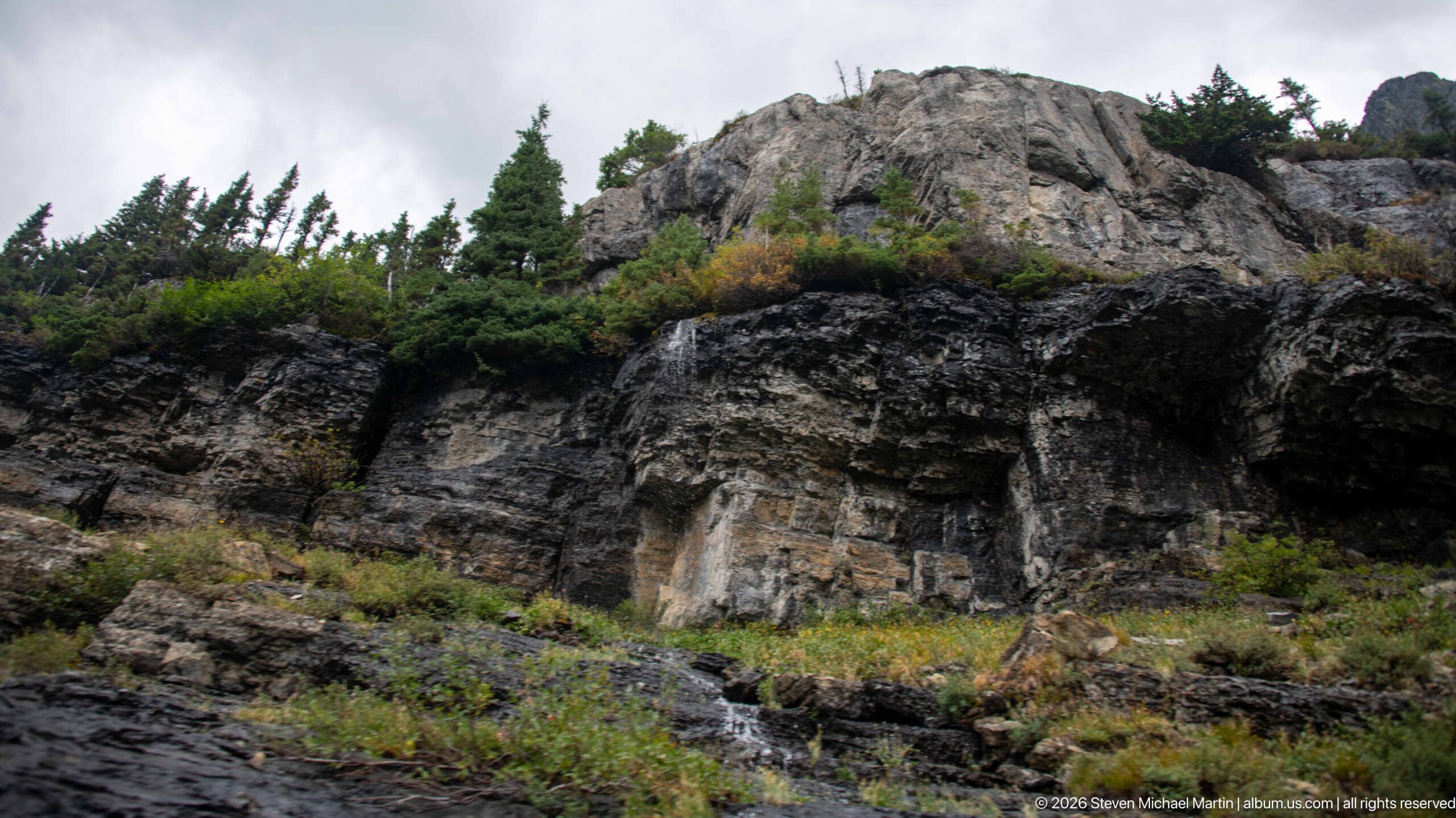
A close roadside exposure shows thin, nearly horizontal rock layers broken by fractures, weathered blocks, and small pockets of vegetation. Conifers cling to ledges above the cut, while darker surfaces mark parts of the lower face. This intimate view contrasts with the surrounding mountain panoramas and shows the layered bedrock through which Going-to-the-Sun Road was constructed.
Caption
A close roadside exposure shows thin, nearly horizontal rock layers broken by fractures, weathered blocks, and small pockets of vegetation. Conifers cling to ledges above the cut, while darker surfaces mark parts of the lower face. This intimate view contrasts with the surrounding mountain panoramas and shows the layered bedrock through which Going-to-the-Sun Road was constructed.
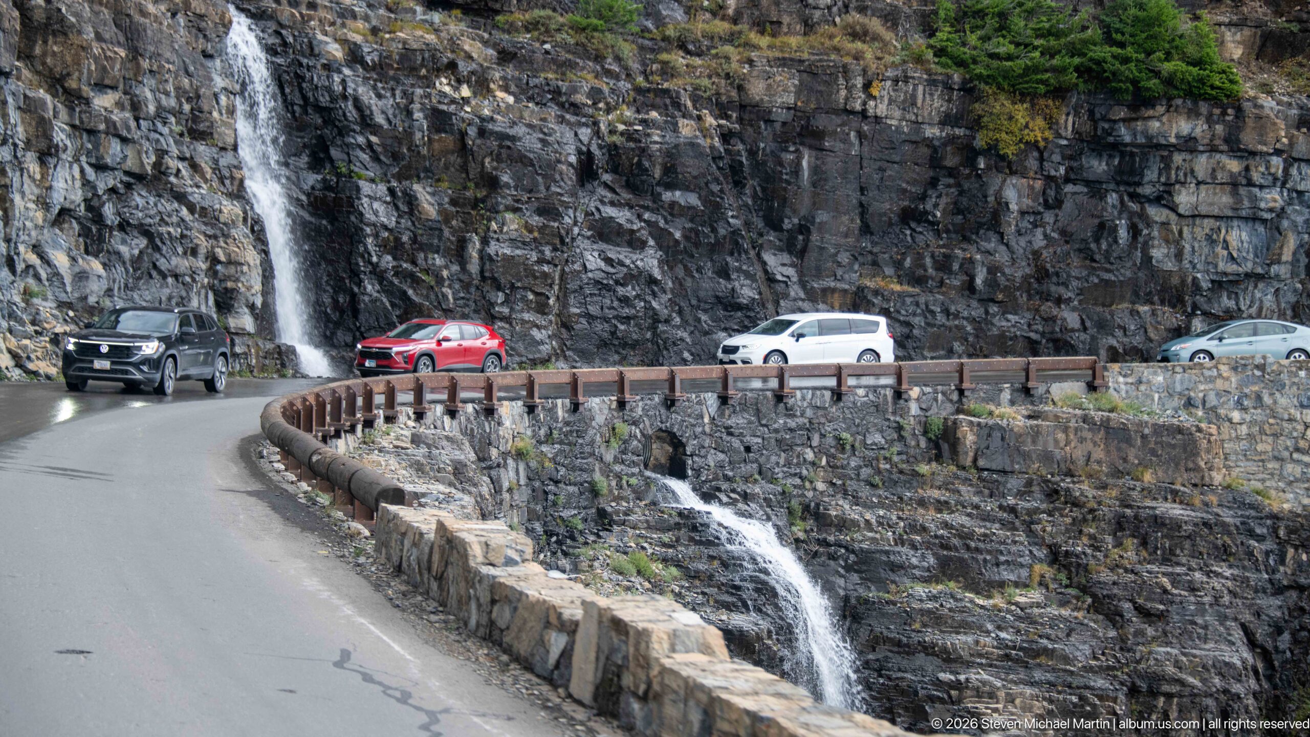
A waterfall drops immediately beside Going-to-the-Sun Road as vehicles round a tight curve cut into the cliff. Water continues below the pavement along the stone retaining structure, visually linking the mountain drainage to the engineered road. The scene illustrates one of the route’s defining challenges: accommodating persistent runoff while carrying traffic across exceptionally steep terrain with minimal separation between rock face, roadway, and drop-off.
Caption
A waterfall drops immediately beside Going-to-the-Sun Road as vehicles round a tight curve cut into the cliff. Water continues below the pavement along the stone retaining structure, visually linking the mountain drainage to the engineered road. The scene illustrates one of the route’s defining challenges: accommodating persistent runoff while carrying traffic across exceptionally steep terrain with minimal separation between rock face, roadway, and drop-off.
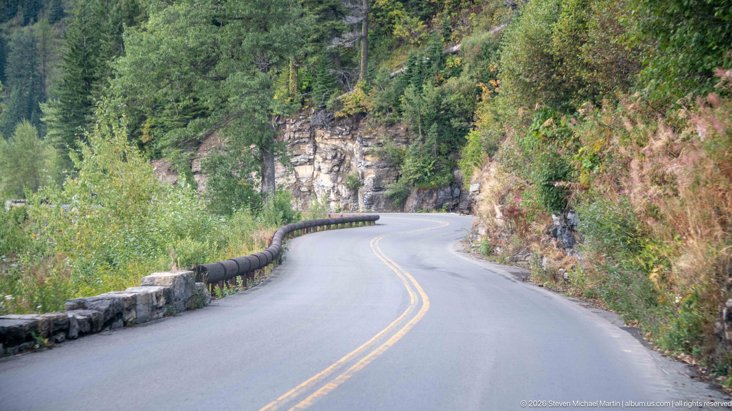
Going-to-the-Sun Road bends around a rock-cut slope, its double yellow centerline leading toward a narrow curve bordered by a low stone guardwall. Dense shrubs and conifers crowd the roadside while exposed bedrock rises immediately beyond the pavement. This close road-level view emphasizes the careful fit between the historic mountain highway and Glacier National Park’s steep terrain, where curves, retaining structures, and rock cuts negotiate limited space.
Caption
Going-to-the-Sun Road bends around a rock-cut slope, its double yellow centerline leading toward a narrow curve bordered by a low stone guardwall. Dense shrubs and conifers crowd the roadside while exposed bedrock rises immediately beyond the pavement. This close road-level view emphasizes the careful fit between the historic mountain highway and Glacier National Park’s steep terrain, where curves, retaining structures, and rock cuts negotiate limited space.
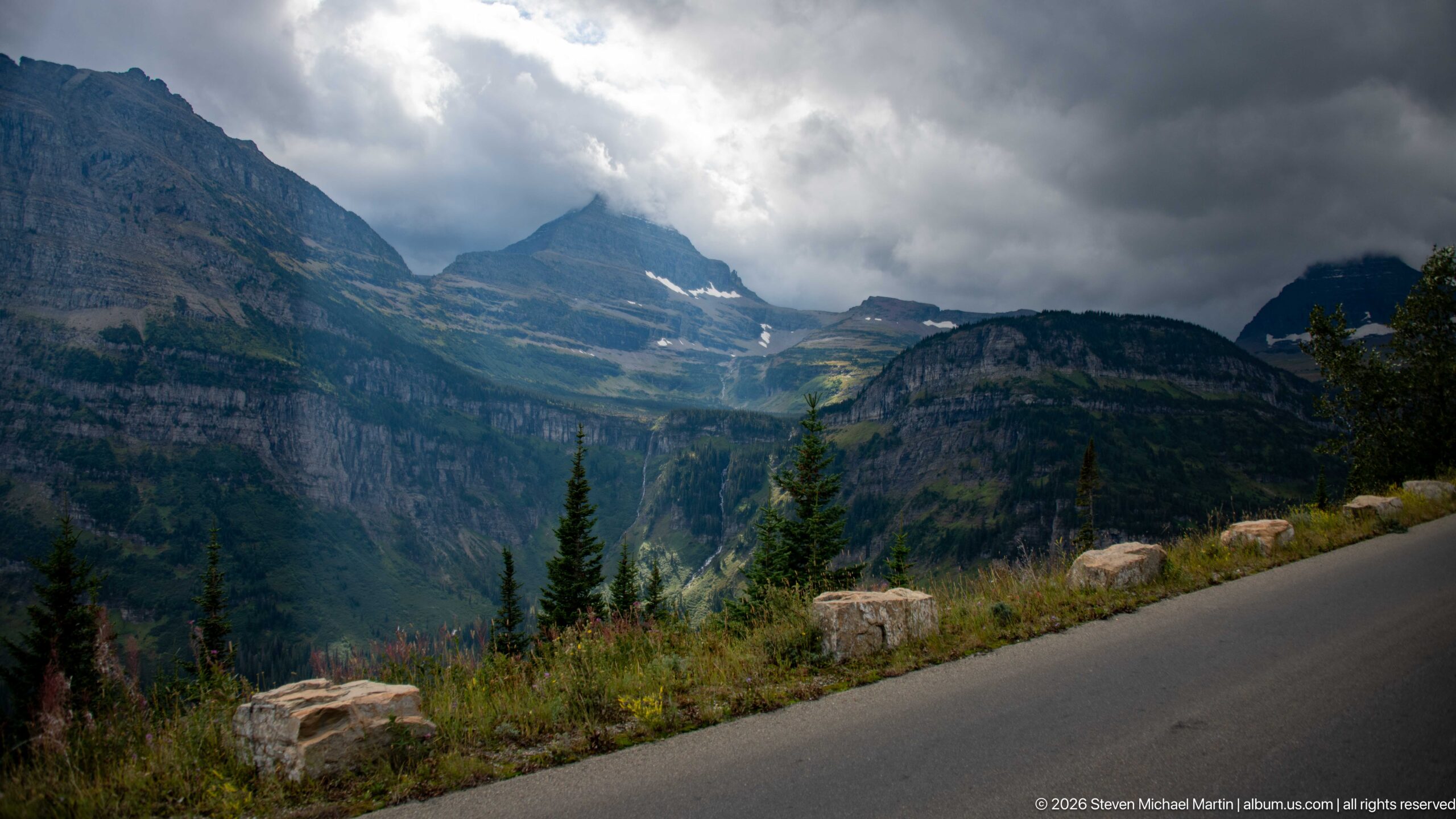
Dark storm clouds gather over a rugged alpine basin while broken light reaches portions of the layered mountain walls. Conifers and roadside stone blocks occupy the lower slope, linking the dramatic weather directly to the Going-to-the-Sun Road corridor. Small snow patches remain in high recesses beneath the serrated skyline.
Caption
Dark storm clouds gather over a rugged alpine basin while broken light reaches portions of the layered mountain walls. Conifers and roadside stone blocks occupy the lower slope, linking the dramatic weather directly to the Going-to-the-Sun Road corridor. Small snow patches remain in high recesses beneath the serrated skyline.
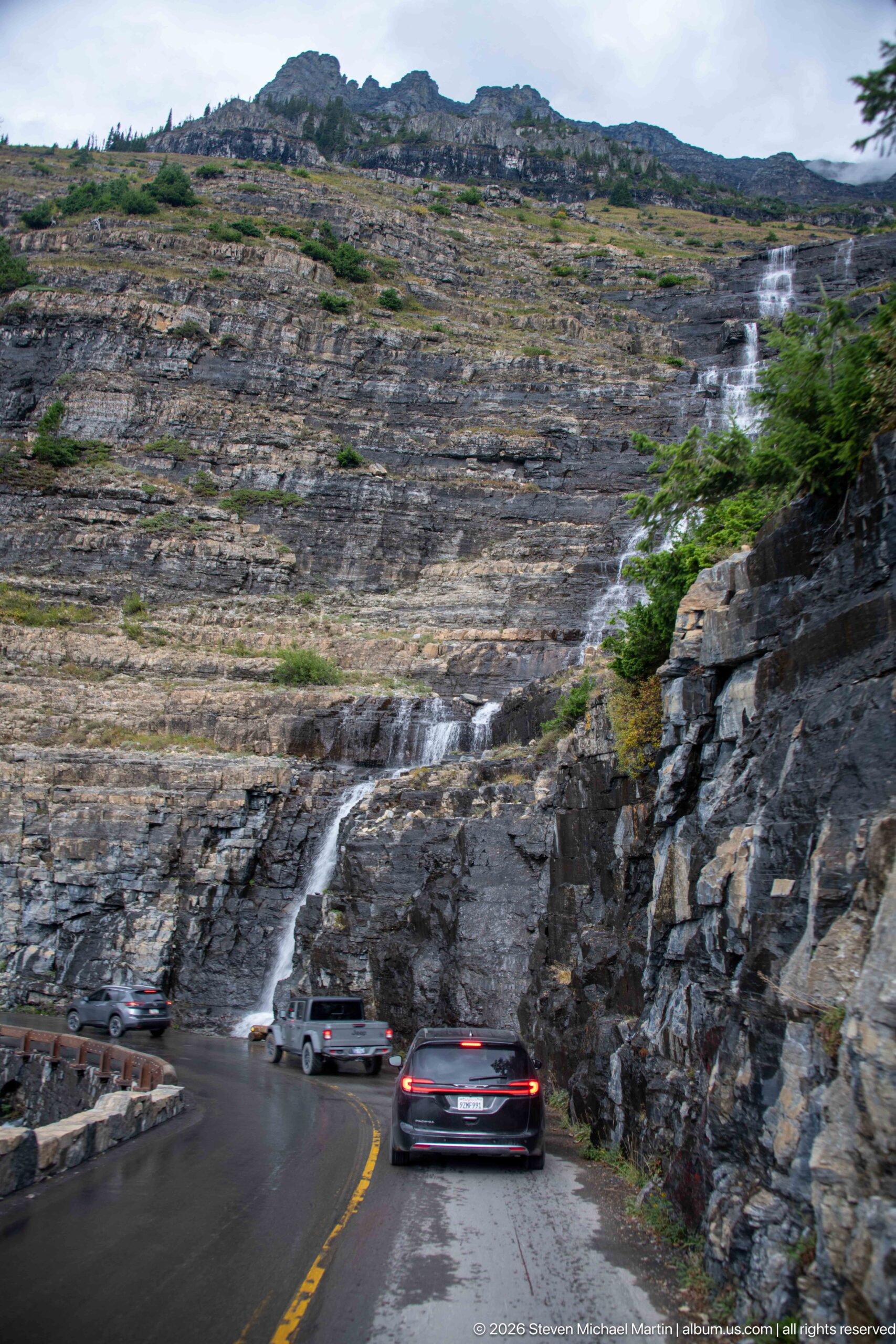
Going-to-the-Sun Road curves directly below a broad cascade spilling across an immense stepped rock face. Cars pass through the wet section of pavement while water descends in multiple channels from the open slope above. The photograph makes the road’s exposure to mountain runoff particularly clear, showing how the historic route occupies a narrow shelf between the cliff and the valley while natural drainage continues across the same terrain.
Caption
Going-to-the-Sun Road curves directly below a broad cascade spilling across an immense stepped rock face. Cars pass through the wet section of pavement while water descends in multiple channels from the open slope above. The photograph makes the road’s exposure to mountain runoff particularly clear, showing how the historic route occupies a narrow shelf between the cliff and the valley while natural drainage continues across the same terrain.
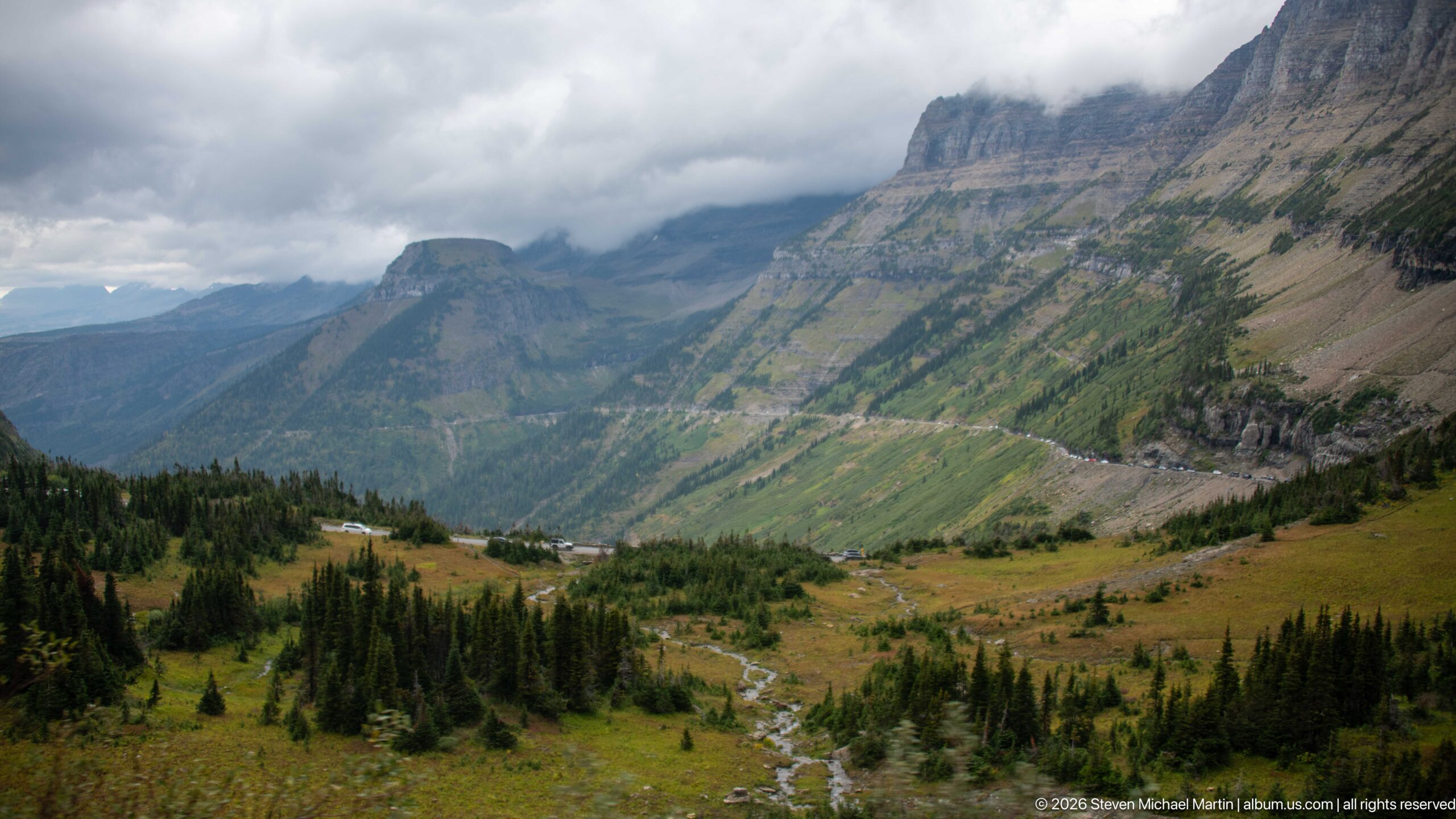
An open alpine valley stretches beneath steep, banded mountain walls, with low cloud obscuring the highest ridges. A small stream winds through meadow and scattered conifers on the valley floor while the Going-to-the-Sun Road traces the opposite slope. The elevated viewpoint brings the road, drainage, forest, and geology into a single landscape.
Caption
An open alpine valley stretches beneath steep, banded mountain walls, with low cloud obscuring the highest ridges. A small stream winds through meadow and scattered conifers on the valley floor while the Going-to-the-Sun Road traces the opposite slope. The elevated viewpoint brings the road, drainage, forest, and geology into a single landscape.
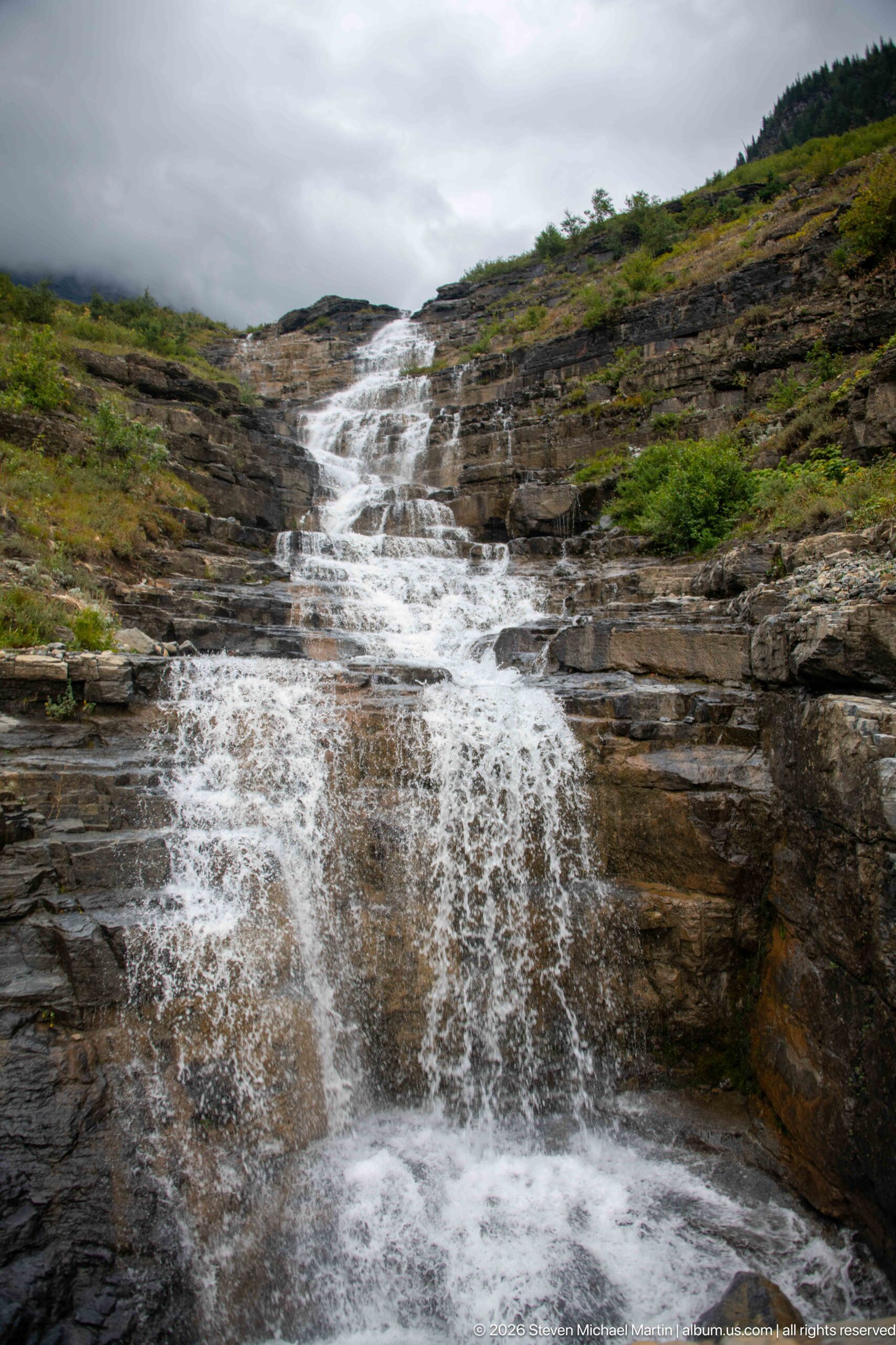
A broad alpine cascade spreads across stepped, horizontally layered rock, breaking into white ribbons and shallow sheets as it descends through low vegetation. The close viewpoint emphasizes the interaction of flowing water with the exposed sedimentary bedrock, a characteristic element of Glacier National Park’s steep, glacially carved mountain terrain. Cloud cover softens the scene and keeps attention on the texture of water, stone, and tundra-like vegetation.
Caption
A broad alpine cascade spreads across stepped, horizontally layered rock, breaking into white ribbons and shallow sheets as it descends through low vegetation. The close viewpoint emphasizes the interaction of flowing water with the exposed sedimentary bedrock, a characteristic element of Glacier National Park’s steep, glacially carved mountain terrain. Cloud cover softens the scene and keeps attention on the texture of water, stone, and tundra-like vegetation.
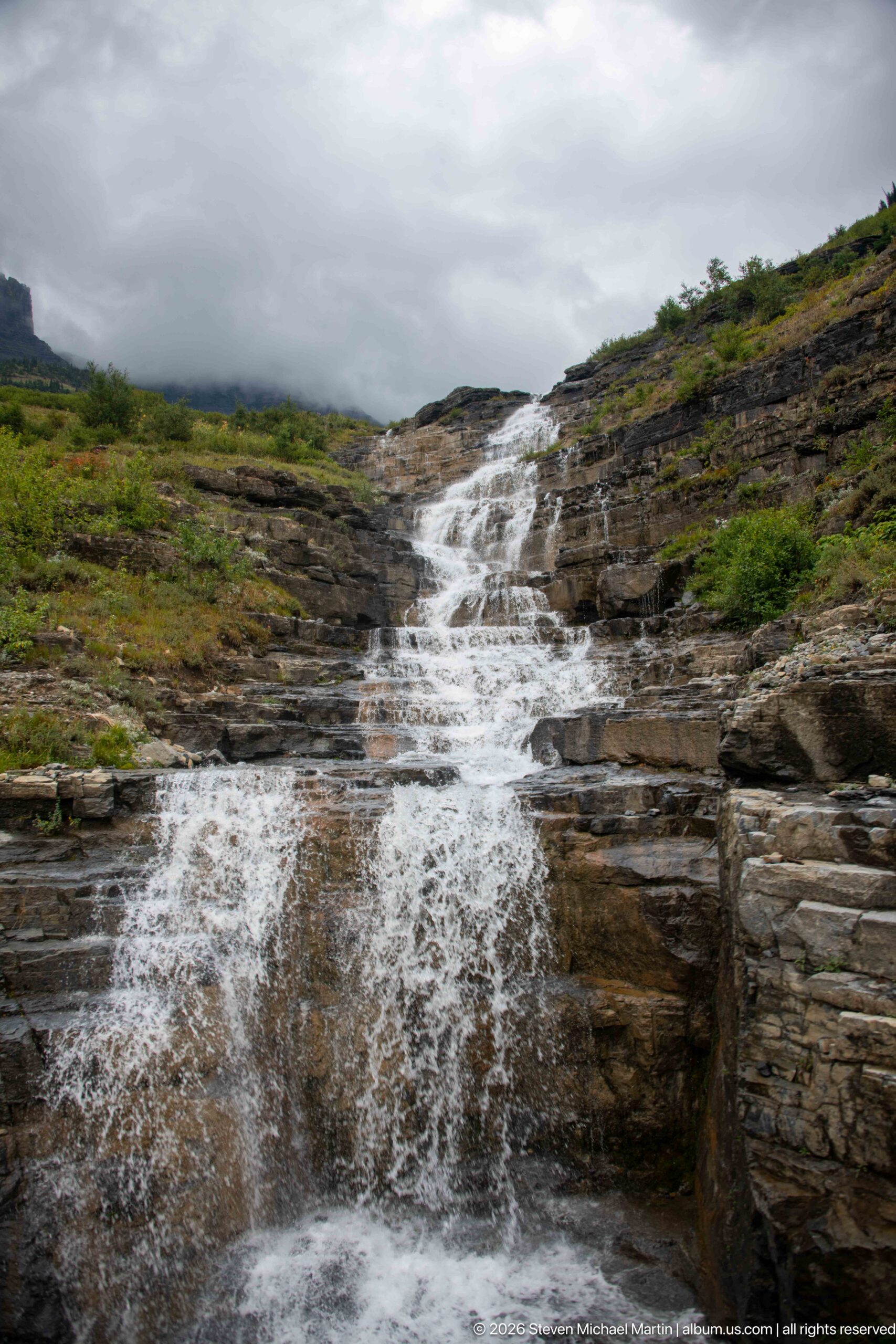
Water fans over a sequence of broad rock shelves, forming a stepped cascade across the open mountainside. Compared with the tighter view nearby, this composition shows more of the surrounding low vegetation and the cascade’s course as it descends from the cloud-covered high country. The exposed strata provide a clear visual record of the resistant sedimentary layers that help shape Glacier National Park’s cliffs, ledges, and waterfalls.
Caption
Water fans over a sequence of broad rock shelves, forming a stepped cascade across the open mountainside. Compared with the tighter view nearby, this composition shows more of the surrounding low vegetation and the cascade’s course as it descends from the cloud-covered high country. The exposed strata provide a clear visual record of the resistant sedimentary layers that help shape Glacier National Park’s cliffs, ledges, and waterfalls.
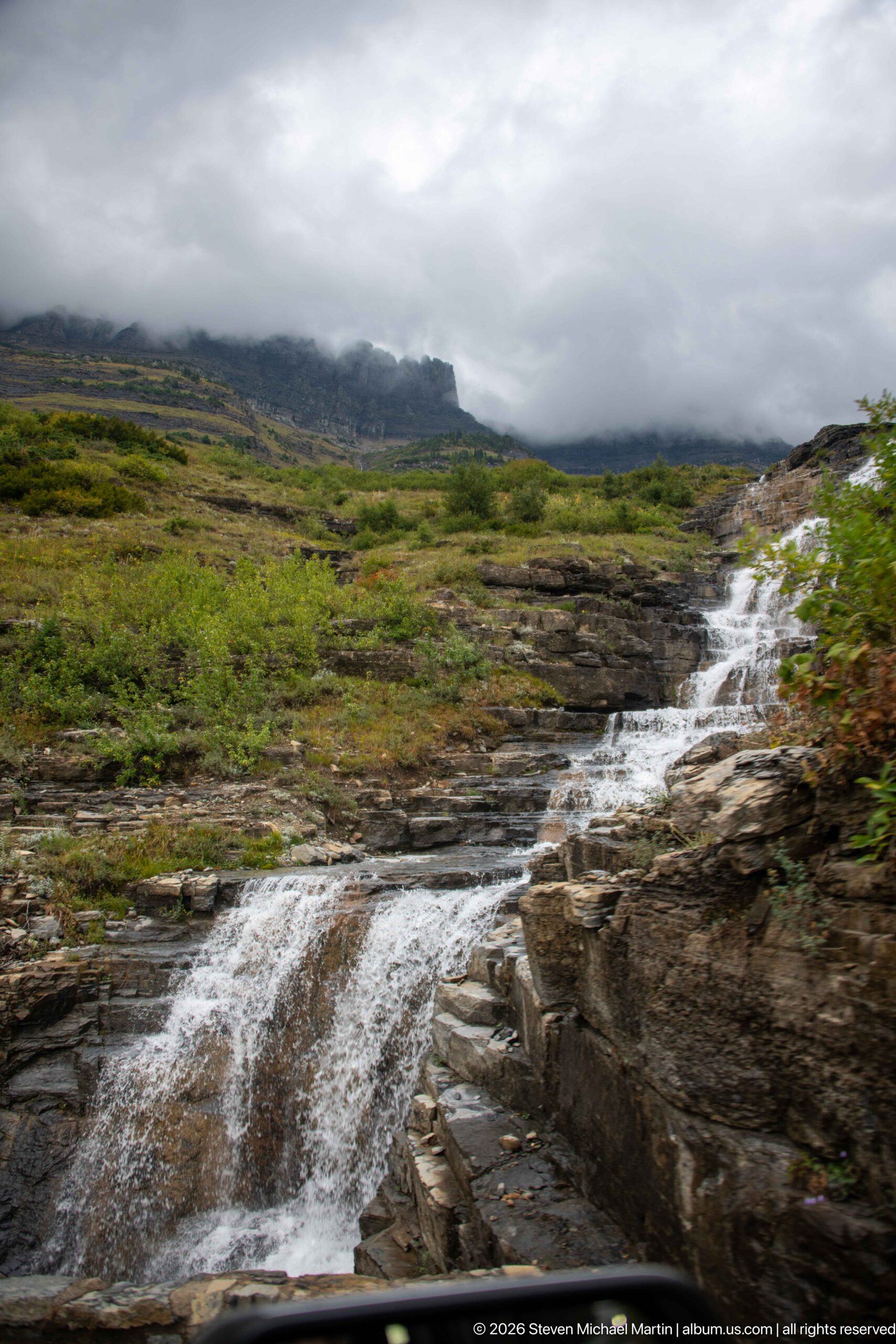
A lower section of the cascade slips over dark, fractured ledges beside the road, with wet rock and low shrubs filling the foreground. The oblique viewpoint reveals how mountain runoff follows joints and steps in the exposed bedrock rather than forming a single vertical drop. Above, a broad green slope disappears into a ceiling of cloud, placing the intimate water detail within Glacier’s larger alpine landscape.
Caption
A lower section of the cascade slips over dark, fractured ledges beside the road, with wet rock and low shrubs filling the foreground. The oblique viewpoint reveals how mountain runoff follows joints and steps in the exposed bedrock rather than forming a single vertical drop. Above, a broad green slope disappears into a ceiling of cloud, placing the intimate water detail within Glacier’s larger alpine landscape.
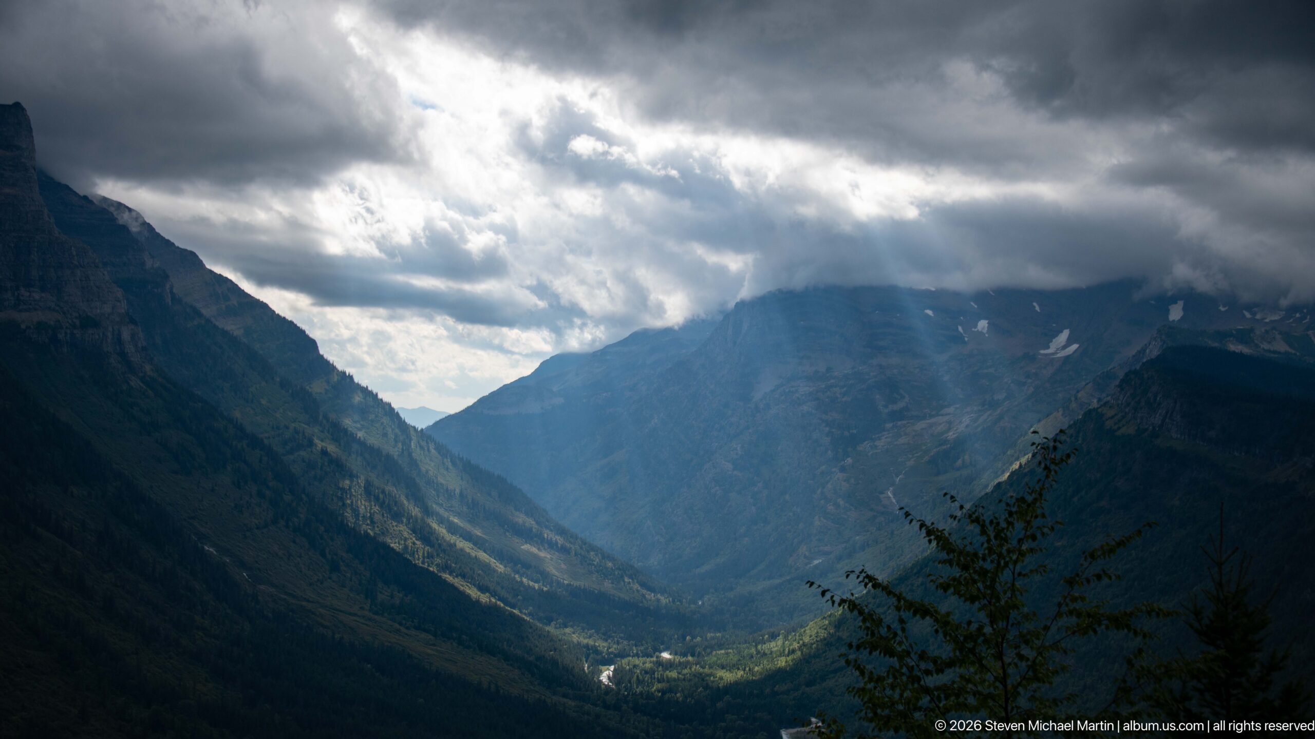
Shafts of sunlight break through heavy storm clouds and illuminate isolated sections of a deep mountain valley. Forested slopes descend toward a narrow watercourse on the valley floor while the surrounding ridges remain in shadow. The dramatic contrast makes the valley’s glacial form especially legible: steep walls, a broad trough, and a distant headwall all emerge through alternating bands of light and darkness.
Caption
Shafts of sunlight break through heavy storm clouds and illuminate isolated sections of a deep mountain valley. Forested slopes descend toward a narrow watercourse on the valley floor while the surrounding ridges remain in shadow. The dramatic contrast makes the valley’s glacial form especially legible: steep walls, a broad trough, and a distant headwall all emerge through alternating bands of light and darkness.
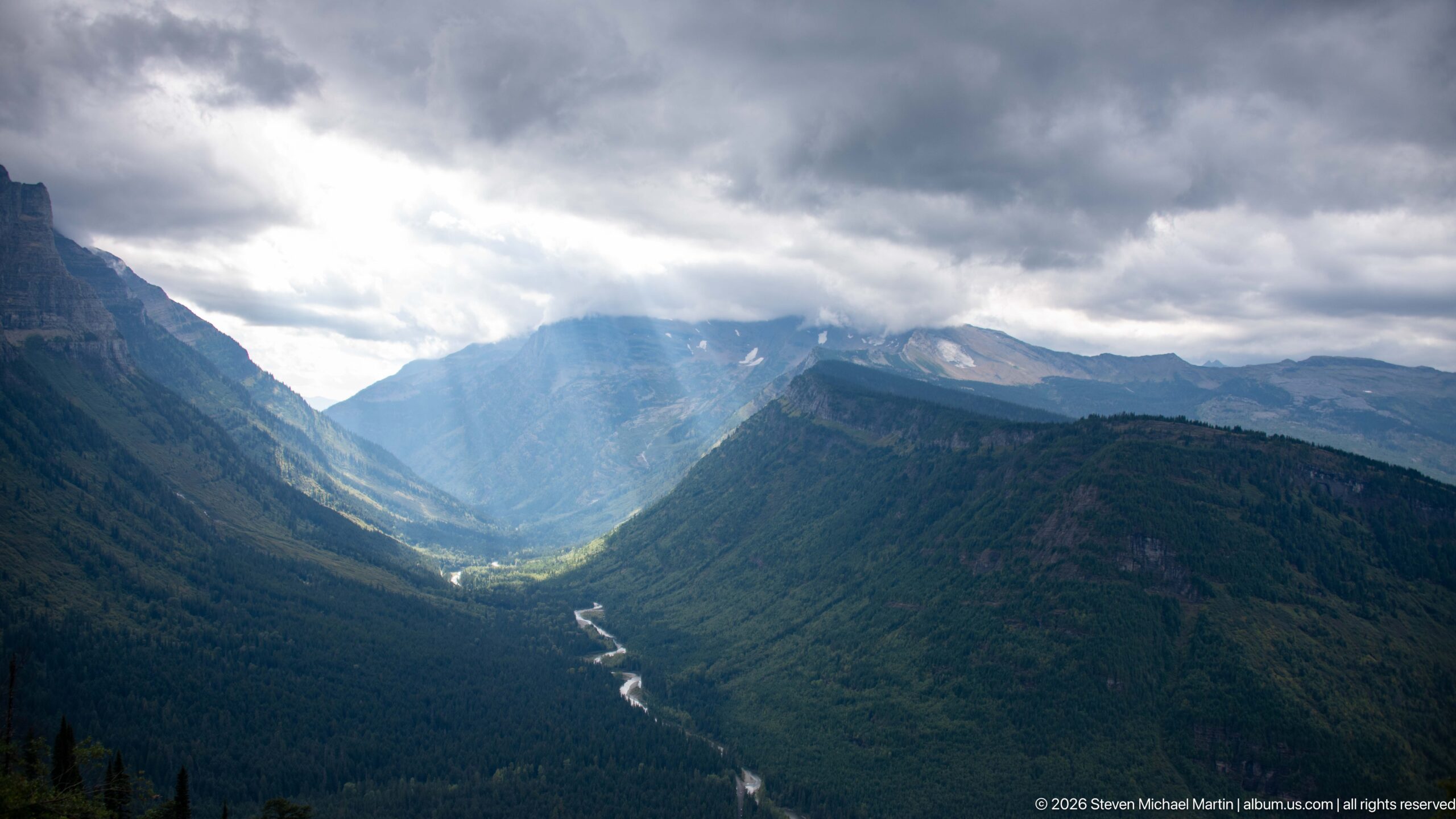
From high on the mountainside, the view follows a pale, winding watercourse through a densely forested valley toward distant ridges. Heavy clouds hang over the head of the valley, but a break in the weather sends a broad shaft of light onto the center of the scene. The photograph pairs the engineered elevation of Going-to-the-Sun Road with the immense vertical scale of Glacier National Park’s terrain.
Caption
From high on the mountainside, the view follows a pale, winding watercourse through a densely forested valley toward distant ridges. Heavy clouds hang over the head of the valley, but a break in the weather sends a broad shaft of light onto the center of the scene. The photograph pairs the engineered elevation of Going-to-the-Sun Road with the immense vertical scale of Glacier National Park’s terrain.
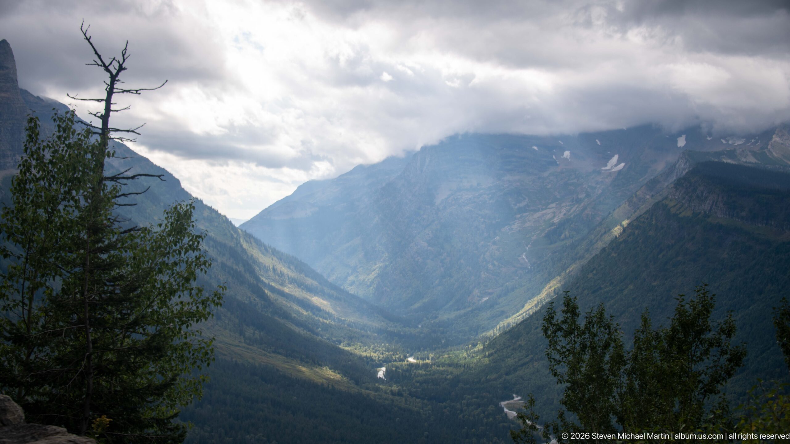
A narrow watercourse catches the light as it winds through the bottom of a deep, forested valley. Dark mountain walls converge toward a cloud-covered headwall, while foreground trees frame the view from the roadside. The subdued weather gives the scene unusual depth, separating the bright valley floor from shadowed slopes and demonstrating how quickly changing clouds can transform the high-elevation scenery along Going-to-the-Sun Road.
Caption
A narrow watercourse catches the light as it winds through the bottom of a deep, forested valley. Dark mountain walls converge toward a cloud-covered headwall, while foreground trees frame the view from the roadside. The subdued weather gives the scene unusual depth, separating the bright valley floor from shadowed slopes and demonstrating how quickly changing clouds can transform the high-elevation scenery along Going-to-the-Sun Road.
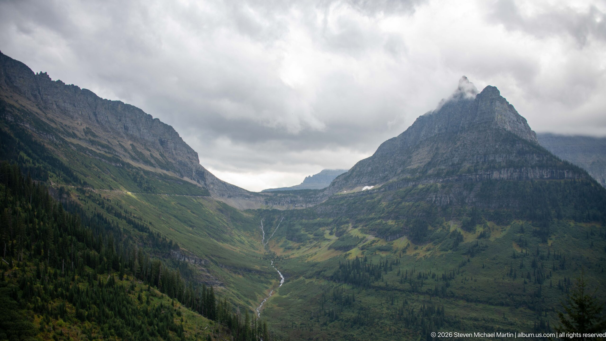
A sharply pointed, horizontally banded mountain rises above a green valley where a slender stream descends from the high basin. Low clouds gather around the summit and adjacent ridges, accentuating the peak’s steep triangular profile. Forest and open subalpine vegetation divide the lower slopes, while the exposed sedimentary strata above make the mountain’s structure unusually prominent in this roadside view.
Caption
A sharply pointed, horizontally banded mountain rises above a green valley where a slender stream descends from the high basin. Low clouds gather around the summit and adjacent ridges, accentuating the peak’s steep triangular profile. Forest and open subalpine vegetation divide the lower slopes, while the exposed sedimentary strata above make the mountain’s structure unusually prominent in this roadside view.
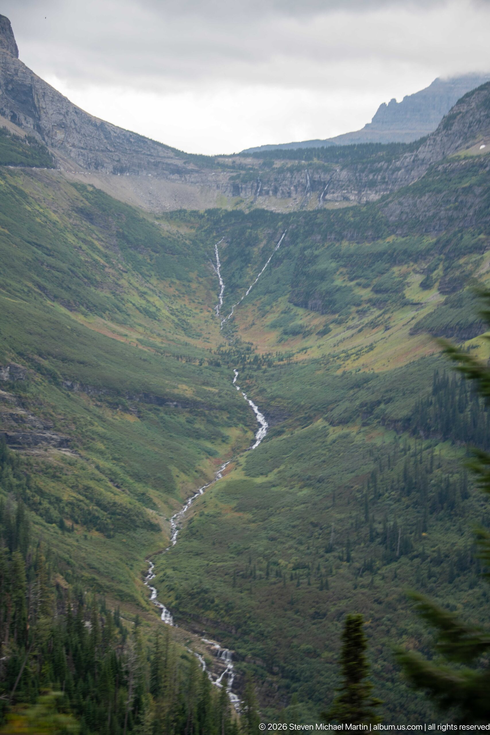
A narrow stream traces a bright, sinuous line down an open green basin, gathering runoff from the higher slopes before disappearing toward the forest below. The broad view shows the drainage pattern with unusual clarity, including small tributary threads and changes in gradient across the meadow-like terrain. Exposed rock bands along the upper slope reinforce the layered geology underlying Glacier National Park’s high country.
Caption
A narrow stream traces a bright, sinuous line down an open green basin, gathering runoff from the higher slopes before disappearing toward the forest below. The broad view shows the drainage pattern with unusual clarity, including small tributary threads and changes in gradient across the meadow-like terrain. Exposed rock bands along the upper slope reinforce the layered geology underlying Glacier National Park’s high country.
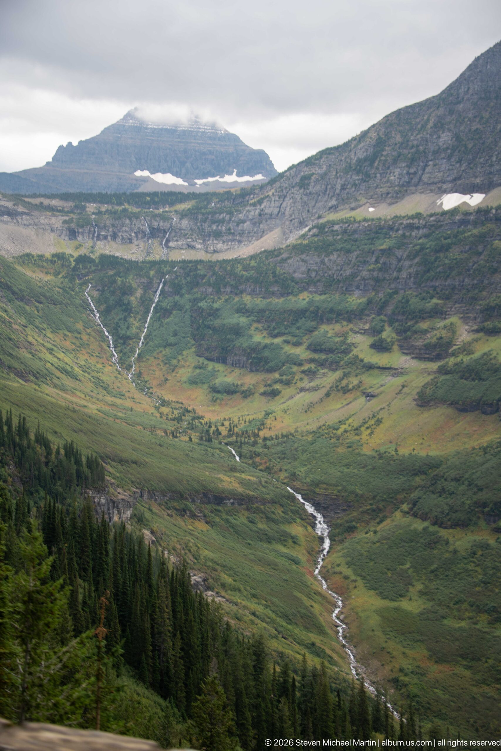
A bright stream threads through an open green valley from a high basin where patches of snow linger beneath layered rock benches. Conifers cluster along the lower edge while the upper slopes remain largely open, exposing the broad contours of the alpine terrain. The long view connects snow, runoff, vegetation, and bedrock in a single drainage system, showing how water moves from Glacier’s high country toward forested elevations below.
Caption
A bright stream threads through an open green valley from a high basin where patches of snow linger beneath layered rock benches. Conifers cluster along the lower edge while the upper slopes remain largely open, exposing the broad contours of the alpine terrain. The long view connects snow, runoff, vegetation, and bedrock in a single drainage system, showing how water moves from Glacier’s high country toward forested elevations below.
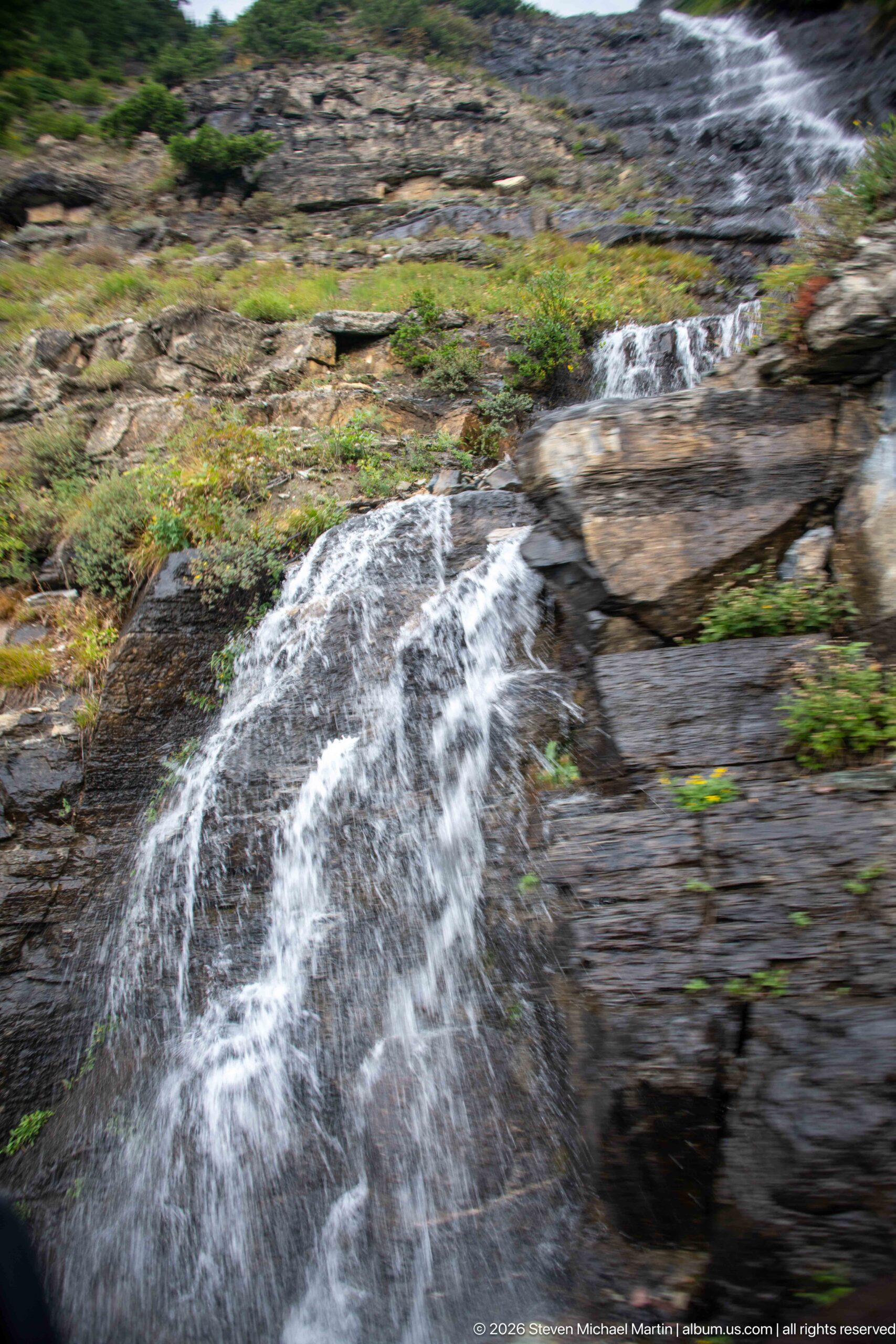
Fast-moving water sheets over a low rock ledge before dropping into a narrow channel, filling the foreground with white turbulence. The close view reveals thin sedimentary layers, fractures, mossy patches, and low vegetation at the water’s edge. By isolating a small section of the drainage, the photograph emphasizes the erosive relationship between seasonal mountain runoff and the exposed bedrock beside Going-to-the-Sun Road.
Caption
Fast-moving water sheets over a low rock ledge before dropping into a narrow channel, filling the foreground with white turbulence. The close view reveals thin sedimentary layers, fractures, mossy patches, and low vegetation at the water’s edge. By isolating a small section of the drainage, the photograph emphasizes the erosive relationship between seasonal mountain runoff and the exposed bedrock beside Going-to-the-Sun Road.
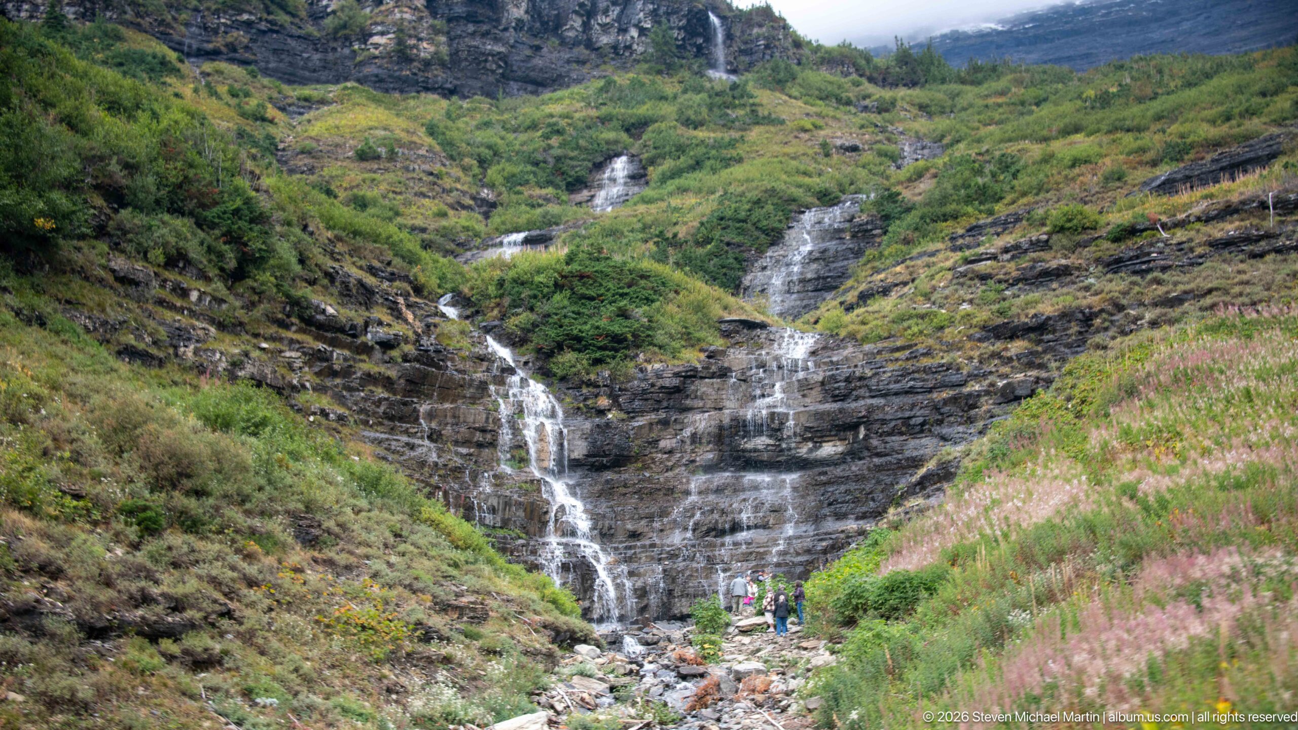
Several narrow falls descend a steep, dark rock face into a rocky channel bordered by dense green and pink-flowering vegetation. Small human figures near the base provide a strong sense of scale, revealing the height of the stepped cascade. Rather than a single plunge, the water divides across multiple ledges and gullies, a pattern shaped by the fractured, layered bedrock of Glacier National Park’s mountainsides.
Caption
Several narrow falls descend a steep, dark rock face into a rocky channel bordered by dense green and pink-flowering vegetation. Small human figures near the base provide a strong sense of scale, revealing the height of the stepped cascade. Rather than a single plunge, the water divides across multiple ledges and gullies, a pattern shaped by the fractured, layered bedrock of Glacier National Park’s mountainsides.
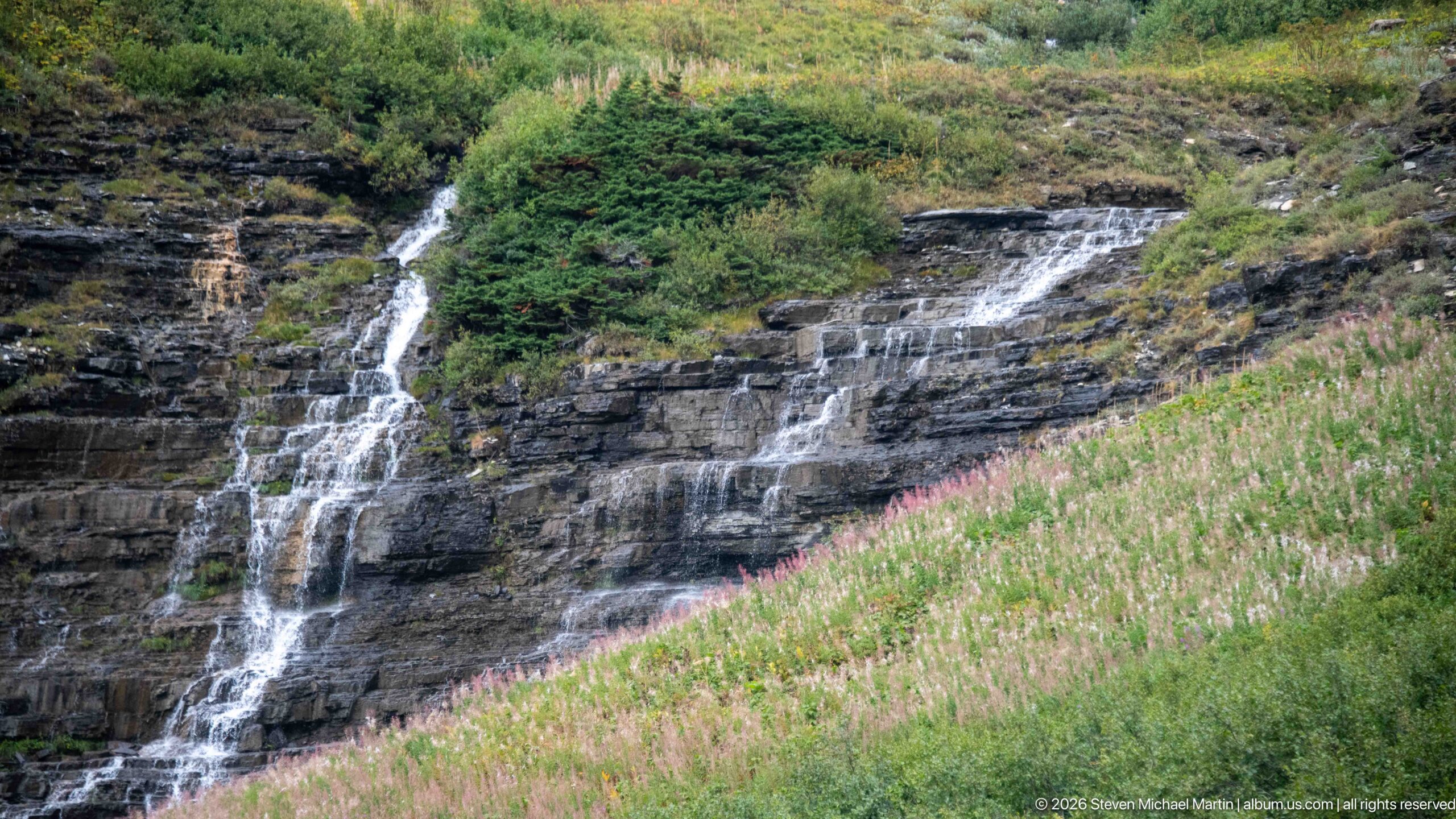
Two principal ribbons of water descend a dark, stratified rock face, breaking into smaller threads before reaching a slope filled with tall pink wildflowers. The closer composition removes most of the surrounding valley and concentrates on the contrast between white water, nearly black stone, and late-season vegetation. The scene illustrates how small alpine drainages create numerous seasonal cascades along the steep slopes bordering Going-to-the-Sun Road.
Caption
Two principal ribbons of water descend a dark, stratified rock face, breaking into smaller threads before reaching a slope filled with tall pink wildflowers. The closer composition removes most of the surrounding valley and concentrates on the contrast between white water, nearly black stone, and late-season vegetation. The scene illustrates how small alpine drainages create numerous seasonal cascades along the steep slopes bordering Going-to-the-Sun Road.
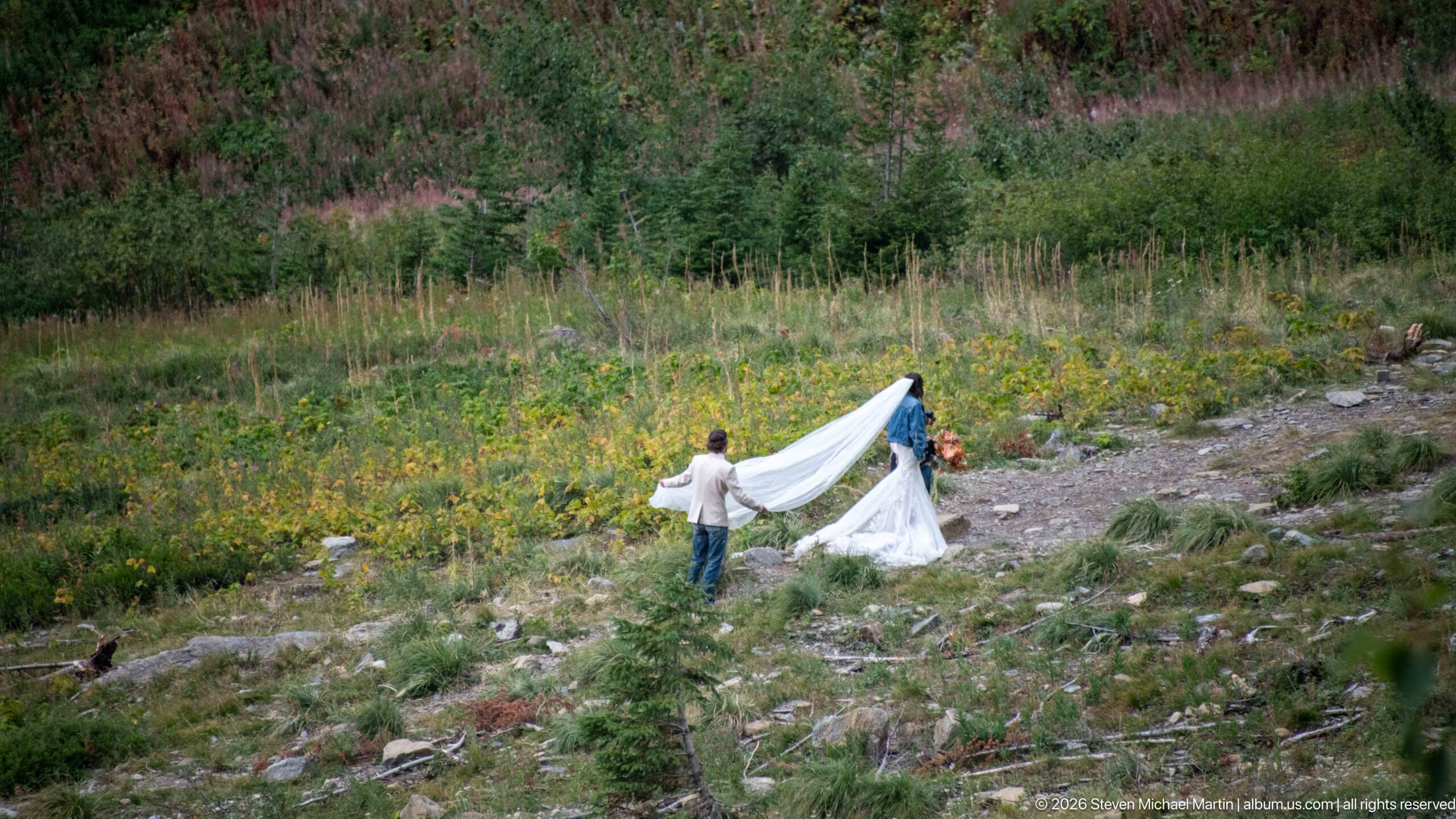
A wedding party prepares a portrait on a rocky, flower-dotted mountainside, with an assistant spreading the bride’s long white train while another person stands nearby. The formal clothing contrasts sharply with the rugged subalpine setting of shrubs, stones, and wildflowers. Seen from a distance, the scene records a human use of Glacier National Park’s dramatic roadside landscape rather than presenting the mountains solely as unoccupied wilderness.
Caption
A wedding party prepares a portrait on a rocky, flower-dotted mountainside, with an assistant spreading the bride’s long white train while another person stands nearby. The formal clothing contrasts sharply with the rugged subalpine setting of shrubs, stones, and wildflowers. Seen from a distance, the scene records a human use of Glacier National Park’s dramatic roadside landscape rather than presenting the mountains solely as unoccupied wilderness.
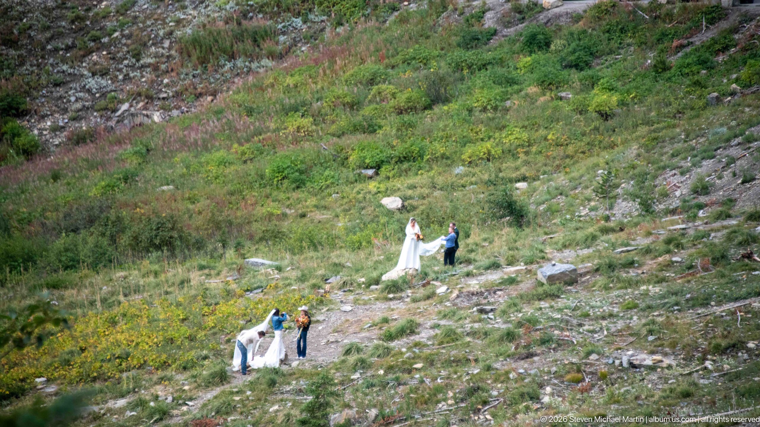
Several people stand at different elevations on a rocky, vegetated mountainside beside Going-to-the-Sun Road. White clothing and fabric provide bright accents against the green and gray slope, while the wide view emphasizes the scale and openness of the alpine terrain.
Caption
Several people stand at different elevations on a rocky, vegetated mountainside beside Going-to-the-Sun Road. White clothing and fabric provide bright accents against the green and gray slope, while the wide view emphasizes the scale and openness of the alpine terrain.
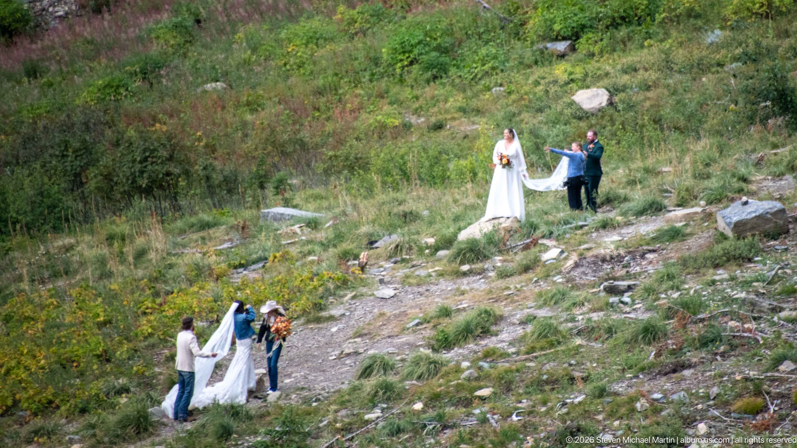
A bride stands higher on the slope as one companion gestures beside her and two people below arrange the long white train across the uneven ground. The composition captures the mechanics behind a formal outdoor portrait, with the dress repeatedly repositioned among rocks and low vegetation. The distant observational viewpoint also preserves the surrounding subalpine landscape, making the wedding session a small episode within Glacier’s much larger mountain environment.
Caption
A bride stands higher on the slope as one companion gestures beside her and two people below arrange the long white train across the uneven ground. The composition captures the mechanics behind a formal outdoor portrait, with the dress repeatedly repositioned among rocks and low vegetation. The distant observational viewpoint also preserves the surrounding subalpine landscape, making the wedding session a small episode within Glacier’s much larger mountain environment.
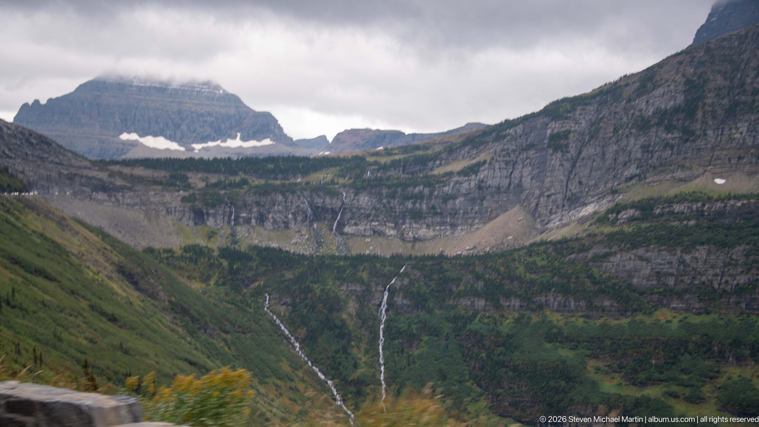
Two slender waterfalls drop from a high bench into the green valley below, separated by a broad section of forested and rocky slope. Above them, layered cliffs and lingering snow patches define the rim of the elevated basin. The paired drainages provide a clear example of water descending from hanging terrain left above the deeper main valley by glacial erosion, one of the characteristic landforms visible from Going-to-the-Sun Road.
Caption
Two slender waterfalls drop from a high bench into the green valley below, separated by a broad section of forested and rocky slope. Above them, layered cliffs and lingering snow patches define the rim of the elevated basin. The paired drainages provide a clear example of water descending from hanging terrain left above the deeper main valley by glacial erosion, one of the characteristic landforms visible from Going-to-the-Sun Road.
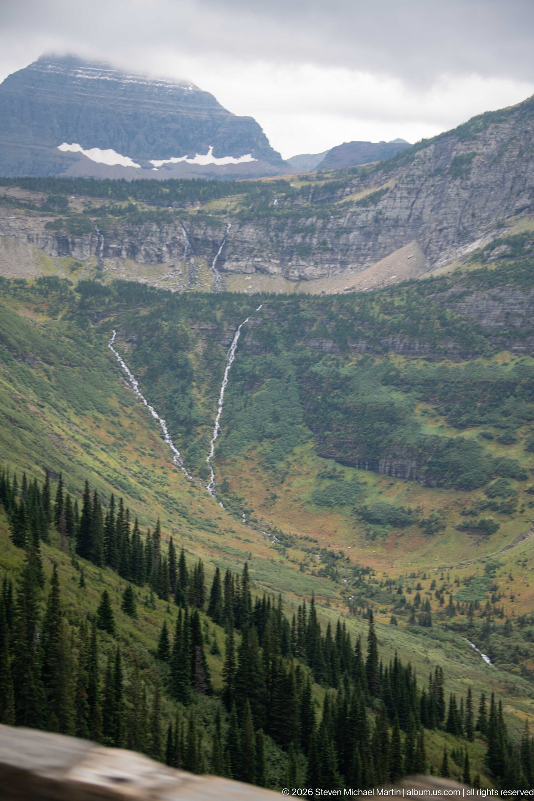
Two bright drainage lines descend from the upper rock benches and converge toward the floor of a broad alpine basin. Dark conifers form a foreground band while open green slopes dominate the middle distance, allowing the watercourses to be traced almost continuously from high terrain downward. The branching pattern makes this view especially useful for reading how snowmelt and rainfall are collected across Glacier National Park’s steep mountain slopes.
Caption
Two bright drainage lines descend from the upper rock benches and converge toward the floor of a broad alpine basin. Dark conifers form a foreground band while open green slopes dominate the middle distance, allowing the watercourses to be traced almost continuously from high terrain downward. The branching pattern makes this view especially useful for reading how snowmelt and rainfall are collected across Glacier National Park’s steep mountain slopes.
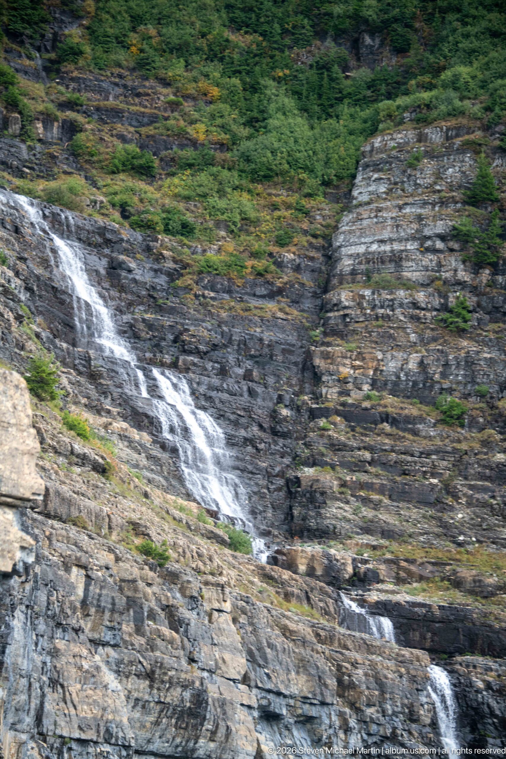
A white cascade cuts diagonally across a broad exposure of gray and brown layered rock, dropping in several short steps before continuing out of frame. The close roadside perspective makes the geology as prominent as the water: bedding planes, fractures, and weathered surfaces create a natural stairway for the runoff. Dense shrubs above the rock mark the transition from exposed cliff to vegetated mountainside.
Caption
A white cascade cuts diagonally across a broad exposure of gray and brown layered rock, dropping in several short steps before continuing out of frame. The close roadside perspective makes the geology as prominent as the water: bedding planes, fractures, and weathered surfaces create a natural stairway for the runoff. Dense shrubs above the rock mark the transition from exposed cliff to vegetated mountainside.
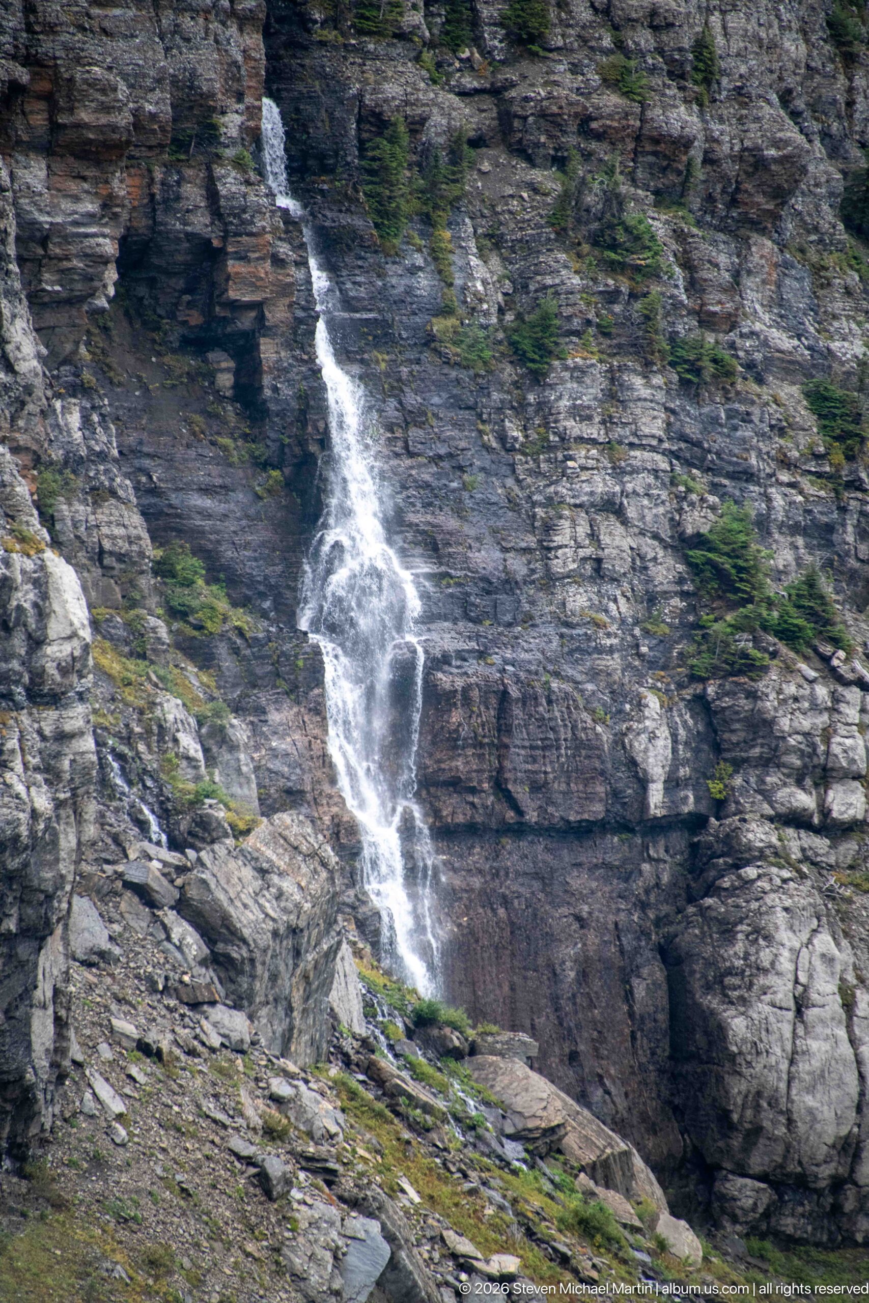
A narrow waterfall descends a dark, layered rock face beside the Going-to-the-Sun Road, breaking into several white ribbons as it crosses ledges and fractures. Small conifers and patches of alpine vegetation occupy pockets in the stone. The close view shows how runoff repeatedly intersects the road corridor along Glacier's steep mountain slopes.
Caption
A narrow waterfall descends a dark, layered rock face beside the Going-to-the-Sun Road, breaking into several white ribbons as it crosses ledges and fractures. Small conifers and patches of alpine vegetation occupy pockets in the stone. The close view shows how runoff repeatedly intersects the road corridor along Glacier's steep mountain slopes.
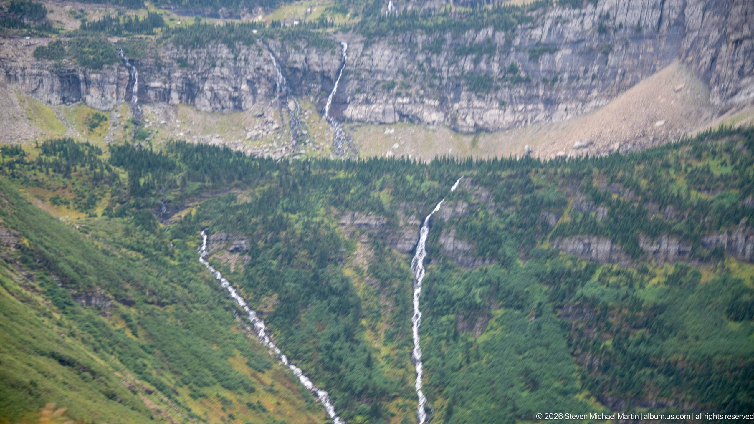
A telephoto view isolates two long waterfalls coursing down the opposing mountainside. Each stream follows a different path through green vegetation and exposed rock before disappearing into the forest below, while a massive layered cliff and talus slope rise behind them. The compressed perspective emphasizes the waterfalls’ vertical reach and the complex sequence of cliffs, benches, and forest that structures Glacier National Park’s glacial valleys.
Caption
A telephoto view isolates two long waterfalls coursing down the opposing mountainside. Each stream follows a different path through green vegetation and exposed rock before disappearing into the forest below, while a massive layered cliff and talus slope rise behind them. The compressed perspective emphasizes the waterfalls’ vertical reach and the complex sequence of cliffs, benches, and forest that structures Glacier National Park’s glacial valleys.
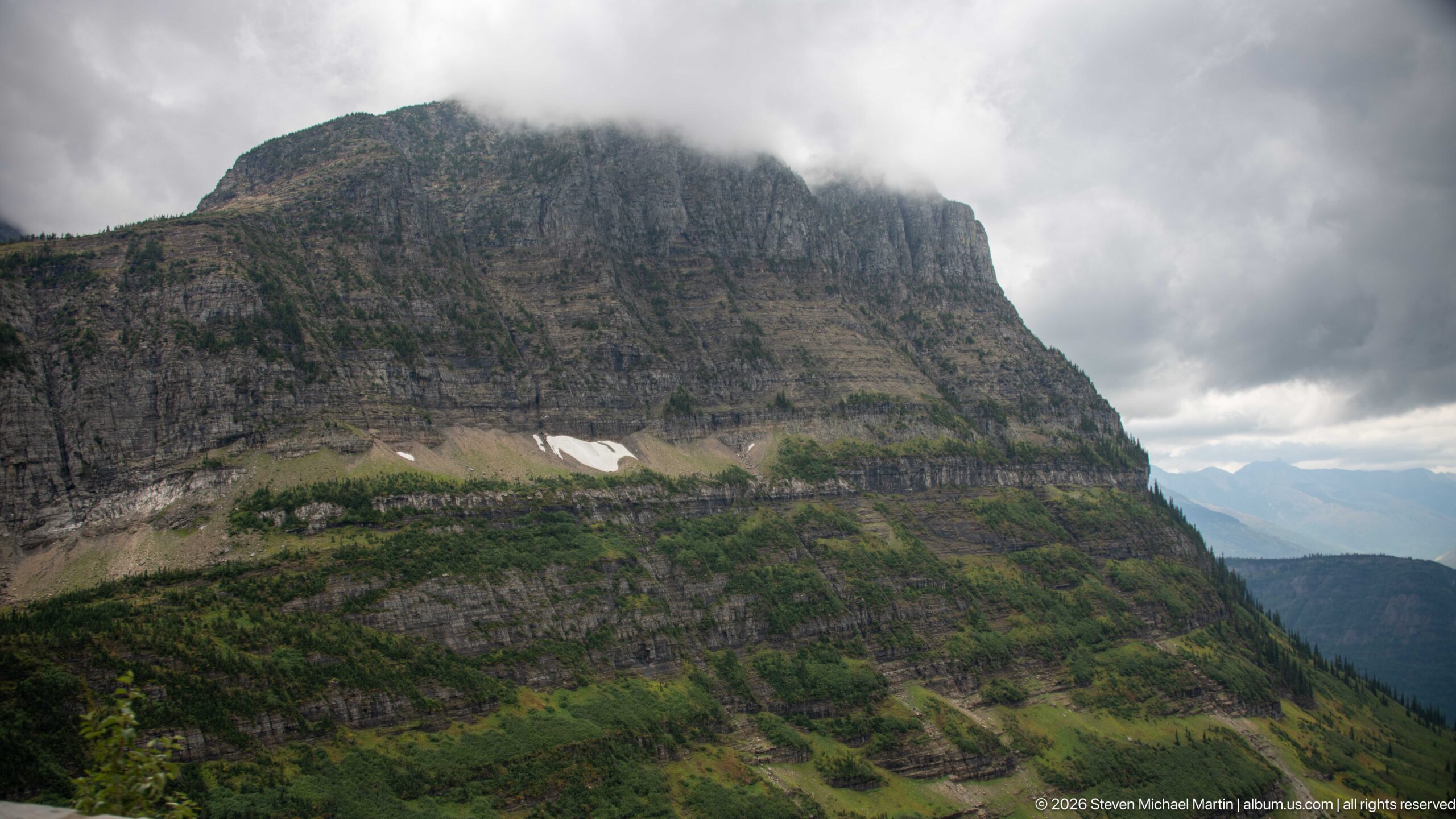
A massive, flat-topped mountain wall rises abruptly from green subalpine slopes, its horizontal rock strata exposed in dark bands beneath low cloud. Small patches of lingering snow occupy ledges near the base of the upper cliff. The close view emphasizes the architecture of Glacier National Park’s ancient sedimentary rocks, where resistant layers create sheer faces and broad benches above more gently vegetated slopes.
Caption
A massive, flat-topped mountain wall rises abruptly from green subalpine slopes, its horizontal rock strata exposed in dark bands beneath low cloud. Small patches of lingering snow occupy ledges near the base of the upper cliff. The close view emphasizes the architecture of Glacier National Park’s ancient sedimentary rocks, where resistant layers create sheer faces and broad benches above more gently vegetated slopes.
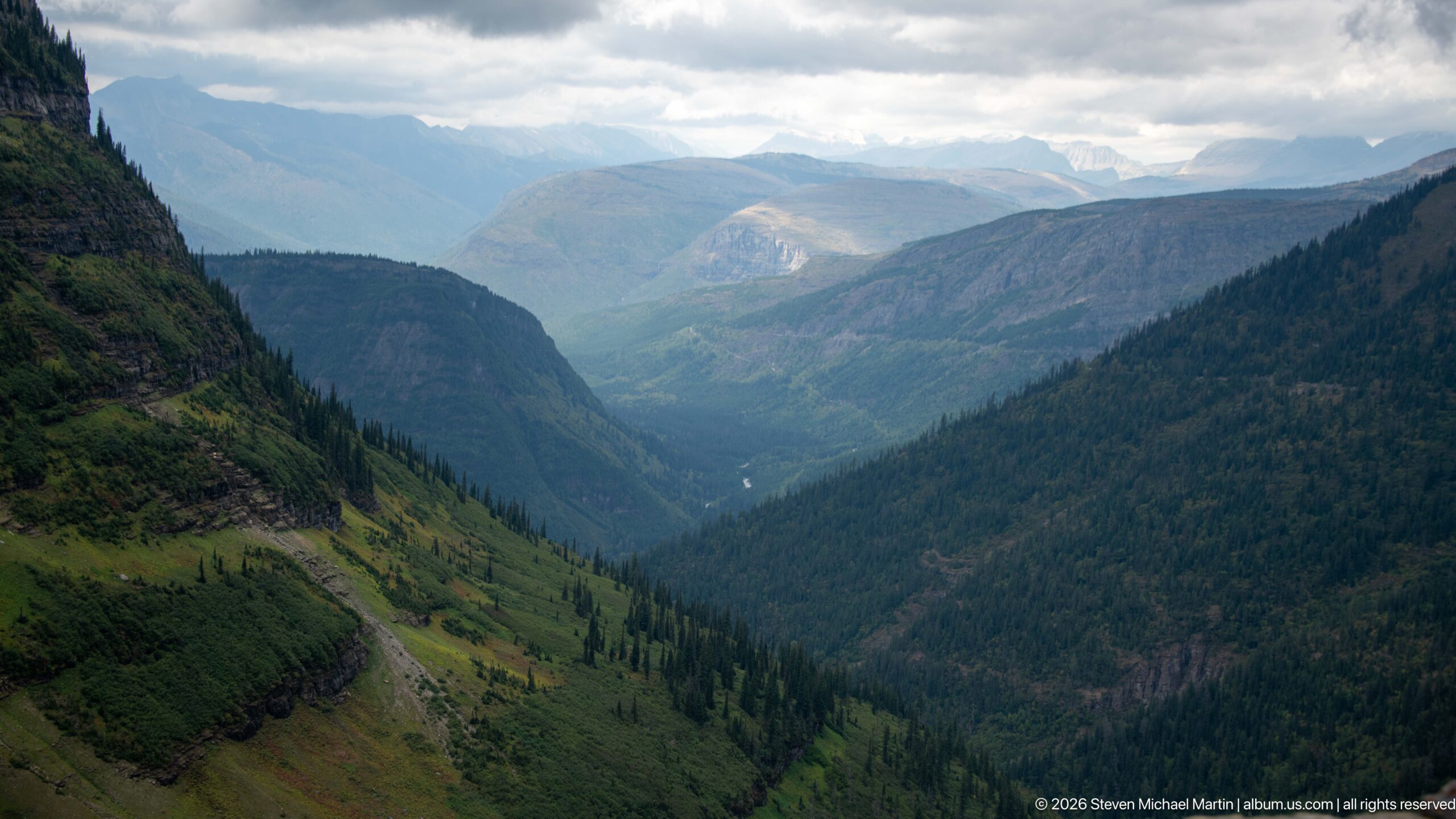
A long mountain valley extends between steep forested slopes toward a series of distant ridges beneath broken cloud. Open drainage corridors cut through the darker forest on the nearer slopes, while the valley narrows toward the center of the view. Seen from an elevated roadside overlook, the composition shows the broad scale and steep relief of the glacially shaped terrain along Going-to-the-Sun Road.
Caption
A long mountain valley extends between steep forested slopes toward a series of distant ridges beneath broken cloud. Open drainage corridors cut through the darker forest on the nearer slopes, while the valley narrows toward the center of the view. Seen from an elevated roadside overlook, the composition shows the broad scale and steep relief of the glacially shaped terrain along Going-to-the-Sun Road.
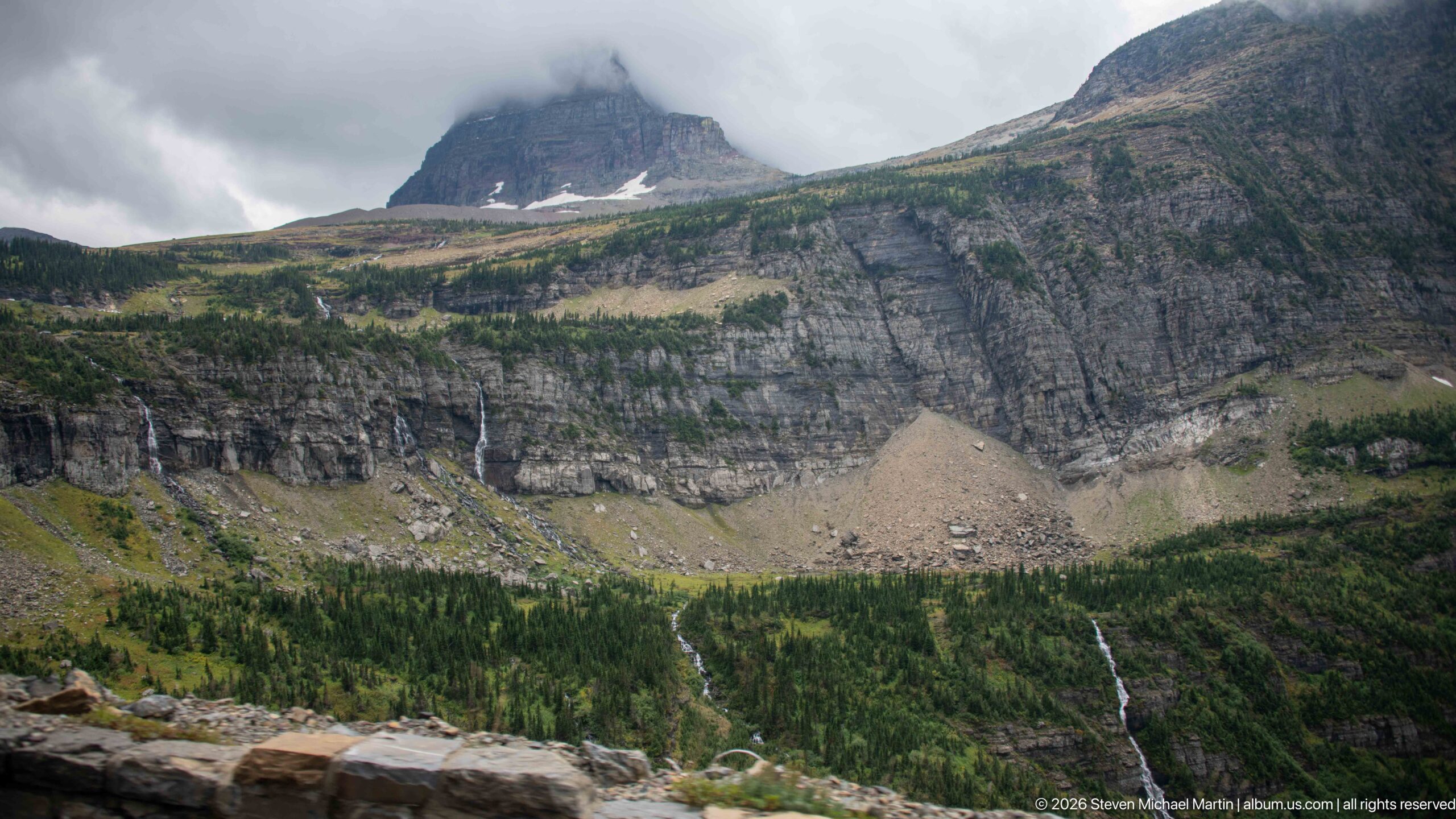
Several narrow streams descend from a high layered rock wall into a green mountain basin, while a broad pale talus fan spreads below the cliff. Remnant snow occupies protected hollows and low cloud wraps the darker peak behind the upper bench. The view clearly shows the relationship among exposed sedimentary cliffs, accumulated rockfall, snowmelt drainage, and forested lower slopes in Glacier National Park.
Caption
Several narrow streams descend from a high layered rock wall into a green mountain basin, while a broad pale talus fan spreads below the cliff. Remnant snow occupies protected hollows and low cloud wraps the darker peak behind the upper bench. The view clearly shows the relationship among exposed sedimentary cliffs, accumulated rockfall, snowmelt drainage, and forested lower slopes in Glacier National Park.
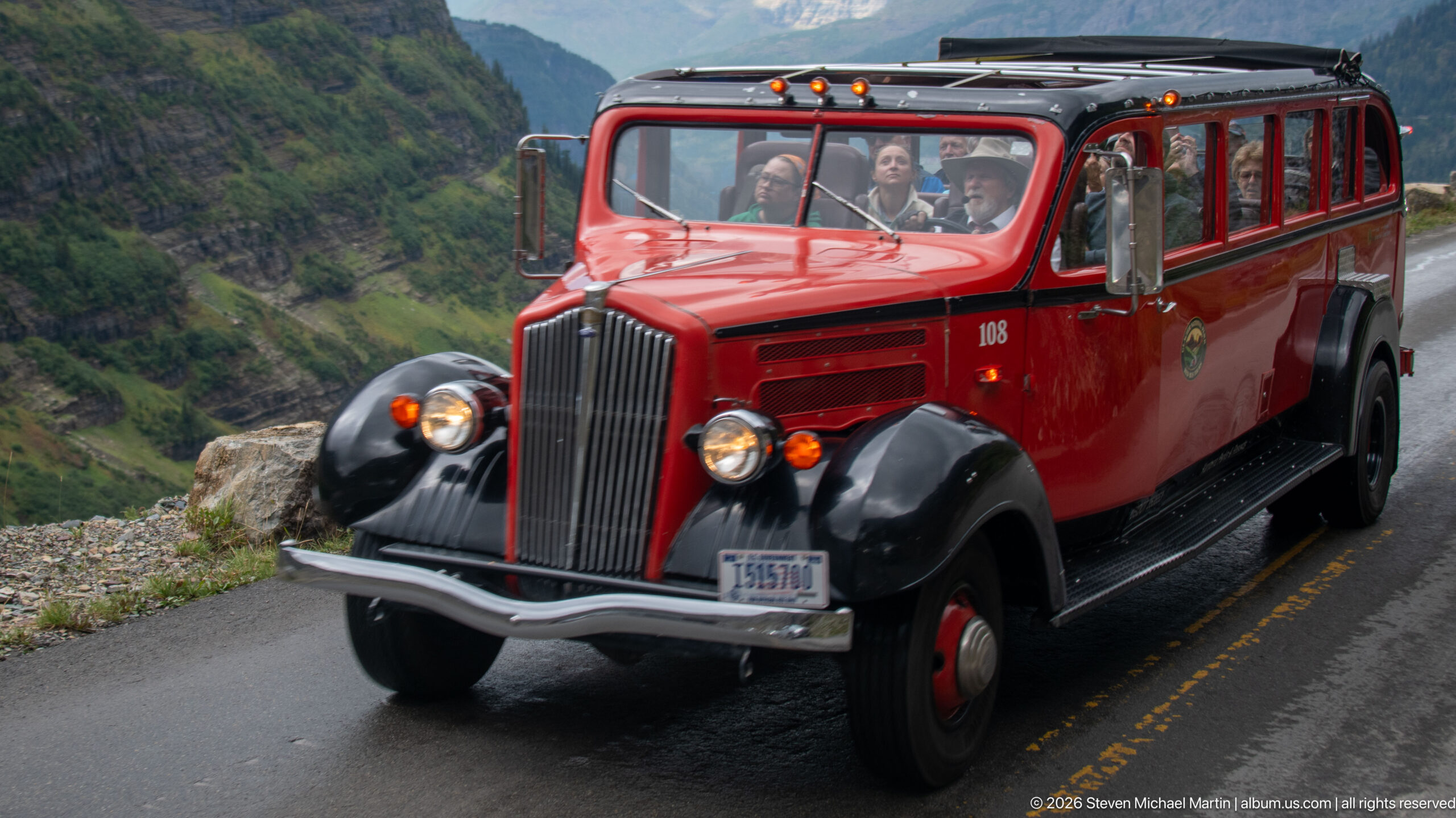
A Glacier National Park Red Bus fills the frame as it travels Going-to-the-Sun Road with passengers visible through its large windows. The vehicle’s bright red body, black fenders, upright grille, and vintage proportions preserve the visual character of the park’s long-established sightseeing fleet. Against the mountain backdrop, the bus becomes more than transportation: it is a recognizable part of the cultural landscape created around touring the park’s spectacular transmountain road.
Caption
A Glacier National Park Red Bus fills the frame as it travels Going-to-the-Sun Road with passengers visible through its large windows. The vehicle’s bright red body, black fenders, upright grille, and vintage proportions preserve the visual character of the park’s long-established sightseeing fleet. Against the mountain backdrop, the bus becomes more than transportation: it is a recognizable part of the cultural landscape created around touring the park’s spectacular transmountain road.
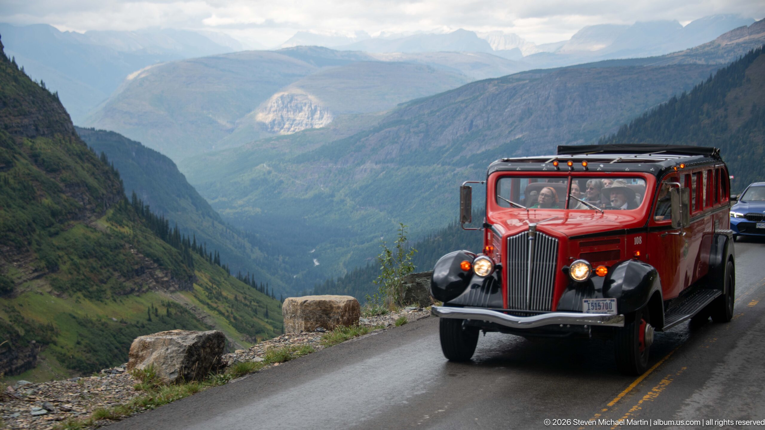
A red vintage-style park tour bus rounds the narrow Going-to-the-Sun Road above a deeply cut mountain valley. Its upright grille, black fenders, roof rack, and broad windows stand out against layered ridges fading into cloud. The roadside masonry and steep drop emphasize how closely traffic shares this engineered mountain corridor with Glacier's immense terrain.
Caption
A red vintage-style park tour bus rounds the narrow Going-to-the-Sun Road above a deeply cut mountain valley. Its upright grille, black fenders, roof rack, and broad windows stand out against layered ridges fading into cloud. The roadside masonry and steep drop emphasize how closely traffic shares this engineered mountain corridor with Glacier's immense terrain.
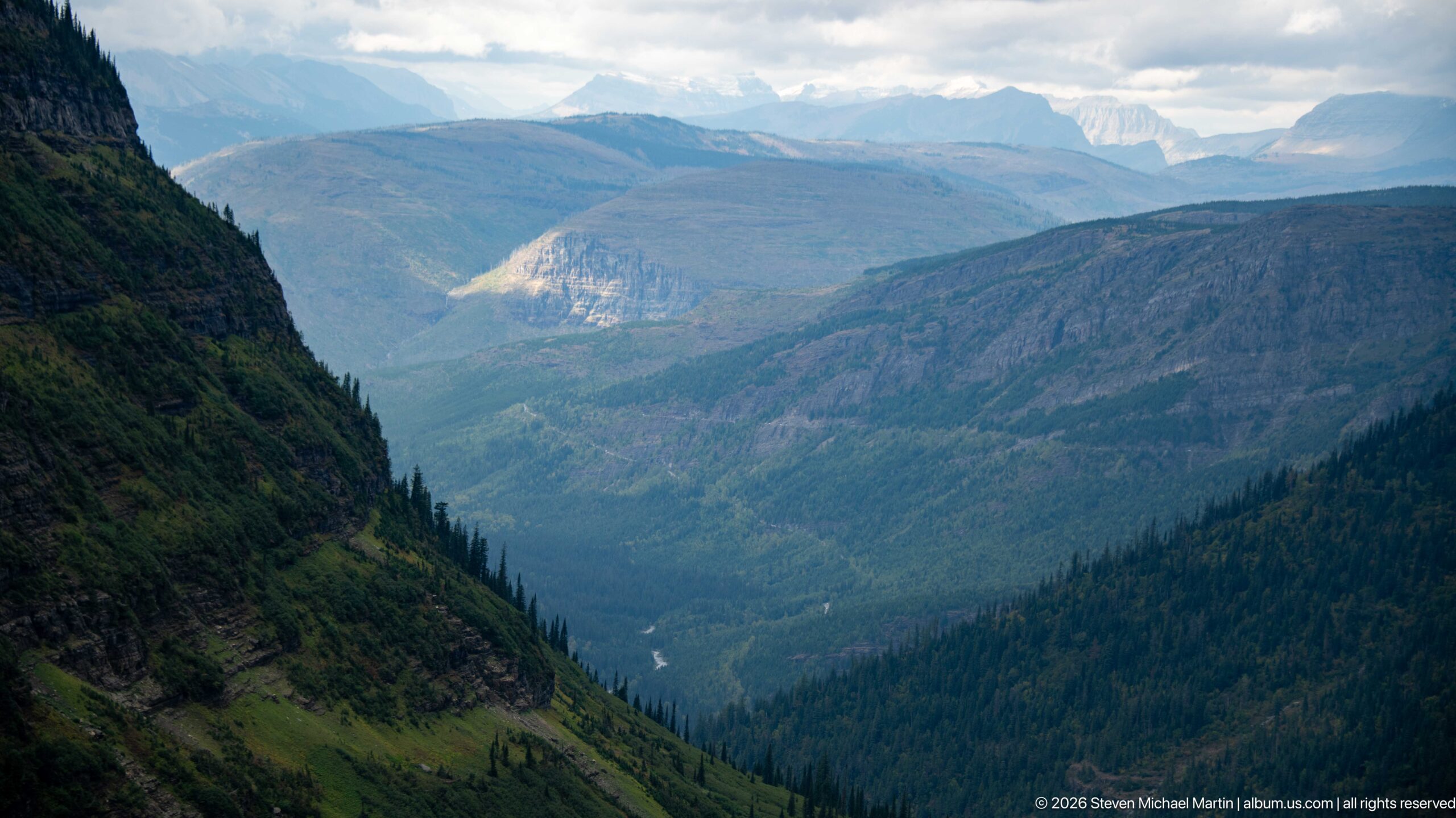
A broad view down a steep-sided mountain valley reveals the scale of Glacier's terrain from the Going-to-the-Sun Road. Forest blankets the lower slopes while exposed rock bands define the higher walls, and distant peaks recede beneath broken cloud. A pale ribbon of water far below traces drainage through the valley floor.
Caption
A broad view down a steep-sided mountain valley reveals the scale of Glacier's terrain from the Going-to-the-Sun Road. Forest blankets the lower slopes while exposed rock bands define the higher walls, and distant peaks recede beneath broken cloud. A pale ribbon of water far below traces drainage through the valley floor.
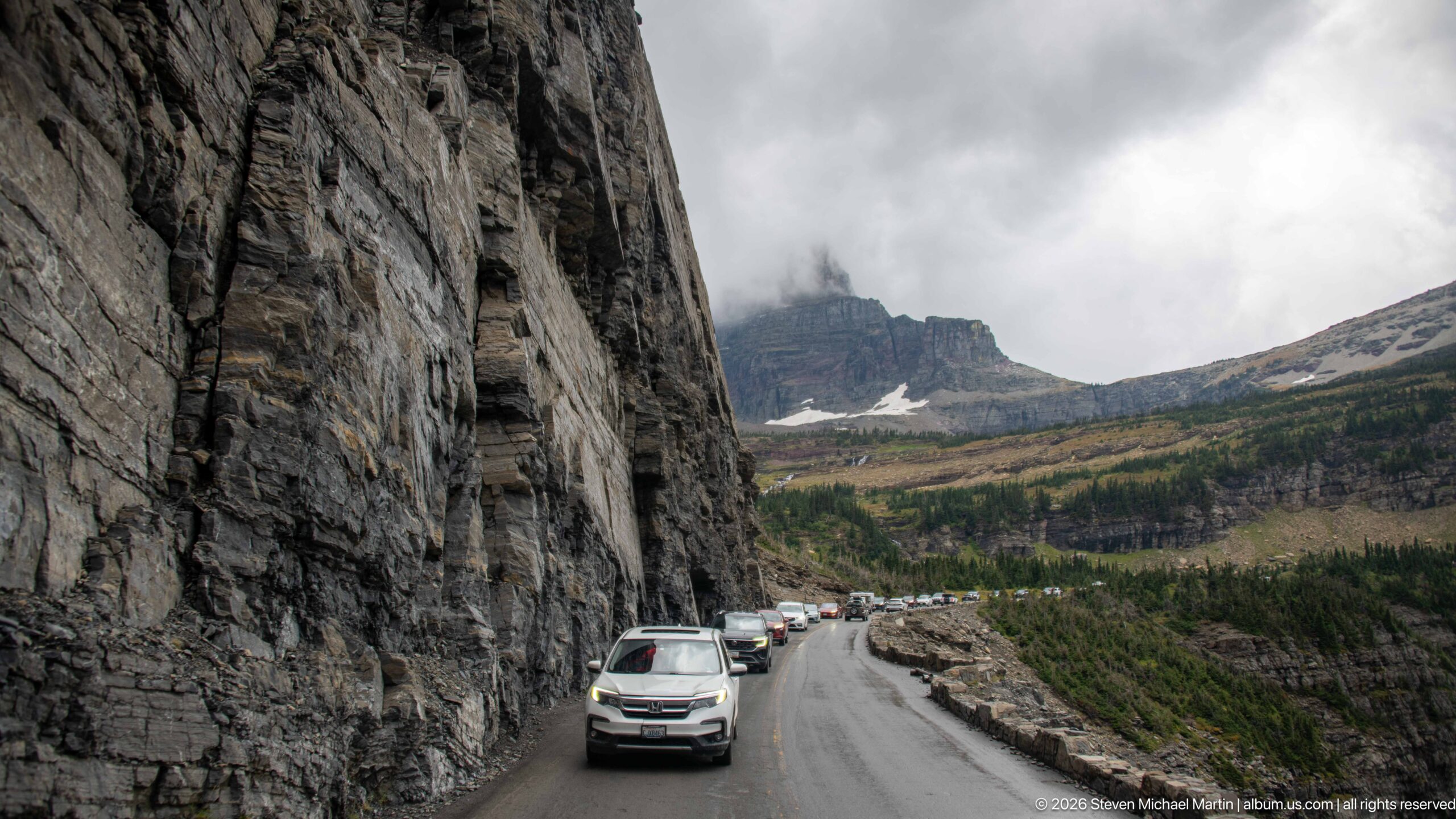
Traffic follows a wet section of Going-to-the-Sun Road where the pavement is squeezed between a sheer rock cut and an open alpine basin. Beyond the vehicles, a dark, flat-topped mountain rises into low cloud above lingering snow. The composition makes the road's constrained alignment through rugged terrain especially clear.
Caption
Traffic follows a wet section of Going-to-the-Sun Road where the pavement is squeezed between a sheer rock cut and an open alpine basin. Beyond the vehicles, a dark, flat-topped mountain rises into low cloud above lingering snow. The composition makes the road's constrained alignment through rugged terrain especially clear.
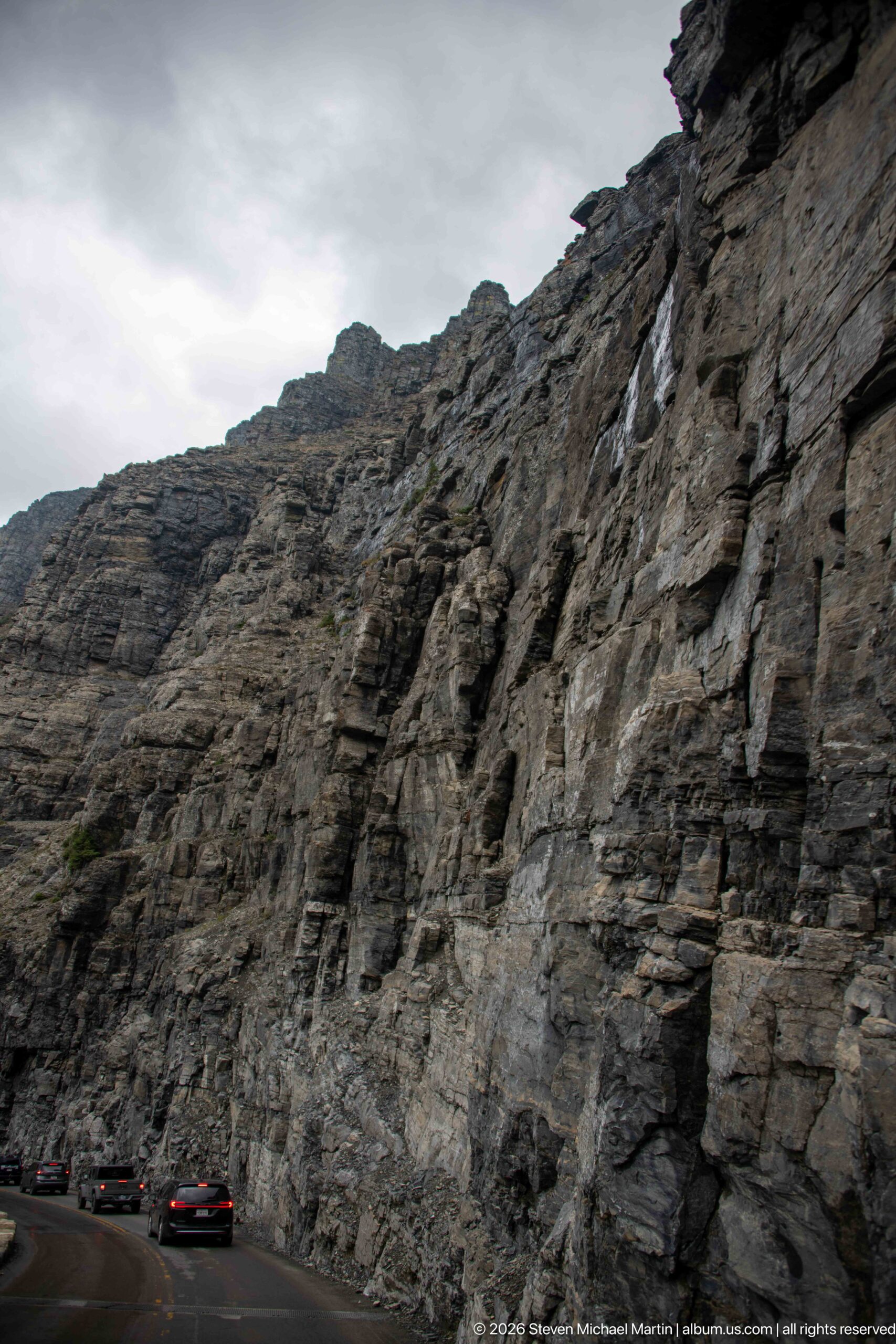
A towering roadside cut exposes sharply layered mountain rock directly beside Going-to-the-Sun Road. Thin beds, fractures, and weathered ledges create a complex wall above passing vehicles, which appear small at its base. The close relationship between cliff and pavement illustrates the difficult terrain through which the transmountain route was constructed.
Caption
A towering roadside cut exposes sharply layered mountain rock directly beside Going-to-the-Sun Road. Thin beds, fractures, and weathered ledges create a complex wall above passing vehicles, which appear small at its base. The close relationship between cliff and pavement illustrates the difficult terrain through which the transmountain route was constructed.
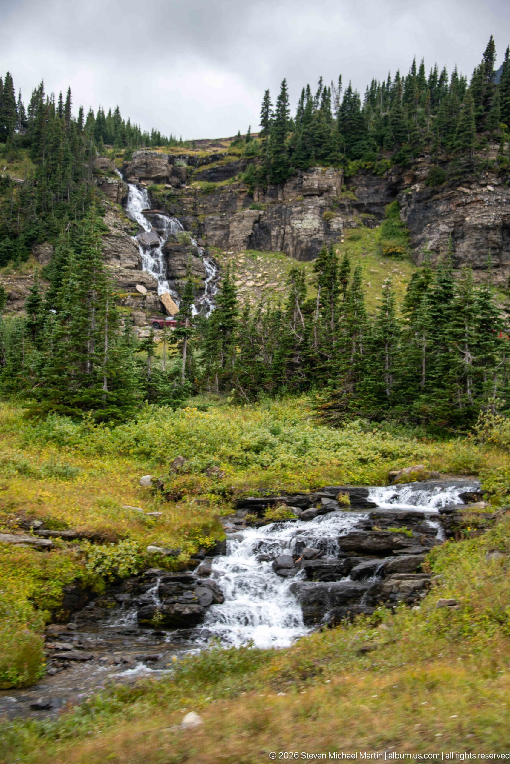
A lively alpine stream tumbles across dark rock through low meadow vegetation and scattered conifers. A second cascade descends the rocky slope behind it, creating two distinct tiers of moving water. The scene shows the wet, intricately drained terrain encountered near the higher reaches of Going-to-the-Sun Road.
Caption
A lively alpine stream tumbles across dark rock through low meadow vegetation and scattered conifers. A second cascade descends the rocky slope behind it, creating two distinct tiers of moving water. The scene shows the wet, intricately drained terrain encountered near the higher reaches of Going-to-the-Sun Road.
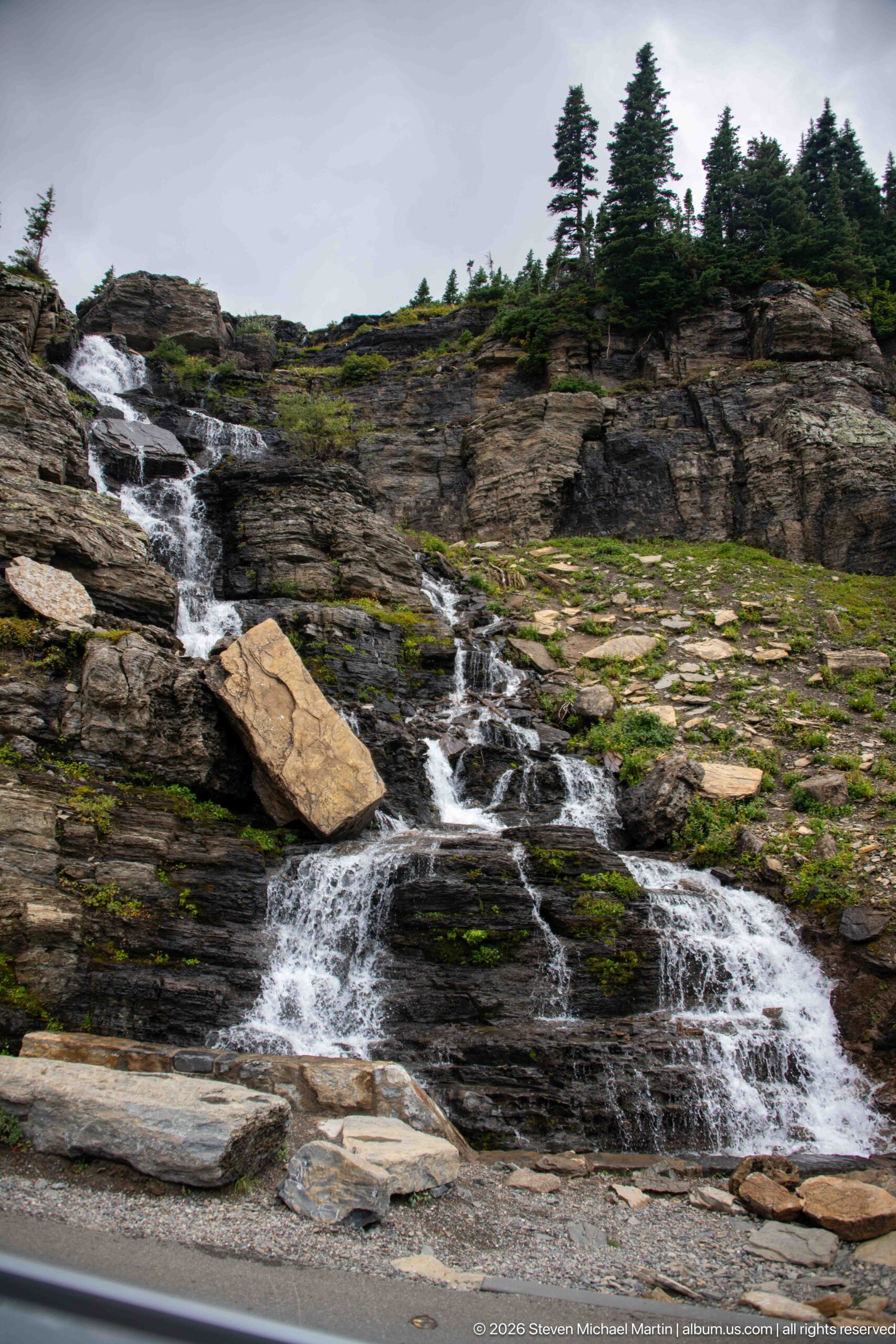
Water fans across broad slabs of dark bedrock in a roadside alpine cascade, dividing into multiple channels around a large tan boulder. Low vegetation clings to cracks and shelves above the road edge. The close composition highlights the repeated interaction of snowmelt and runoff with Glacier's exposed high-country rock.
Caption
Water fans across broad slabs of dark bedrock in a roadside alpine cascade, dividing into multiple channels around a large tan boulder. Low vegetation clings to cracks and shelves above the road edge. The close composition highlights the repeated interaction of snowmelt and runoff with Glacier's exposed high-country rock.
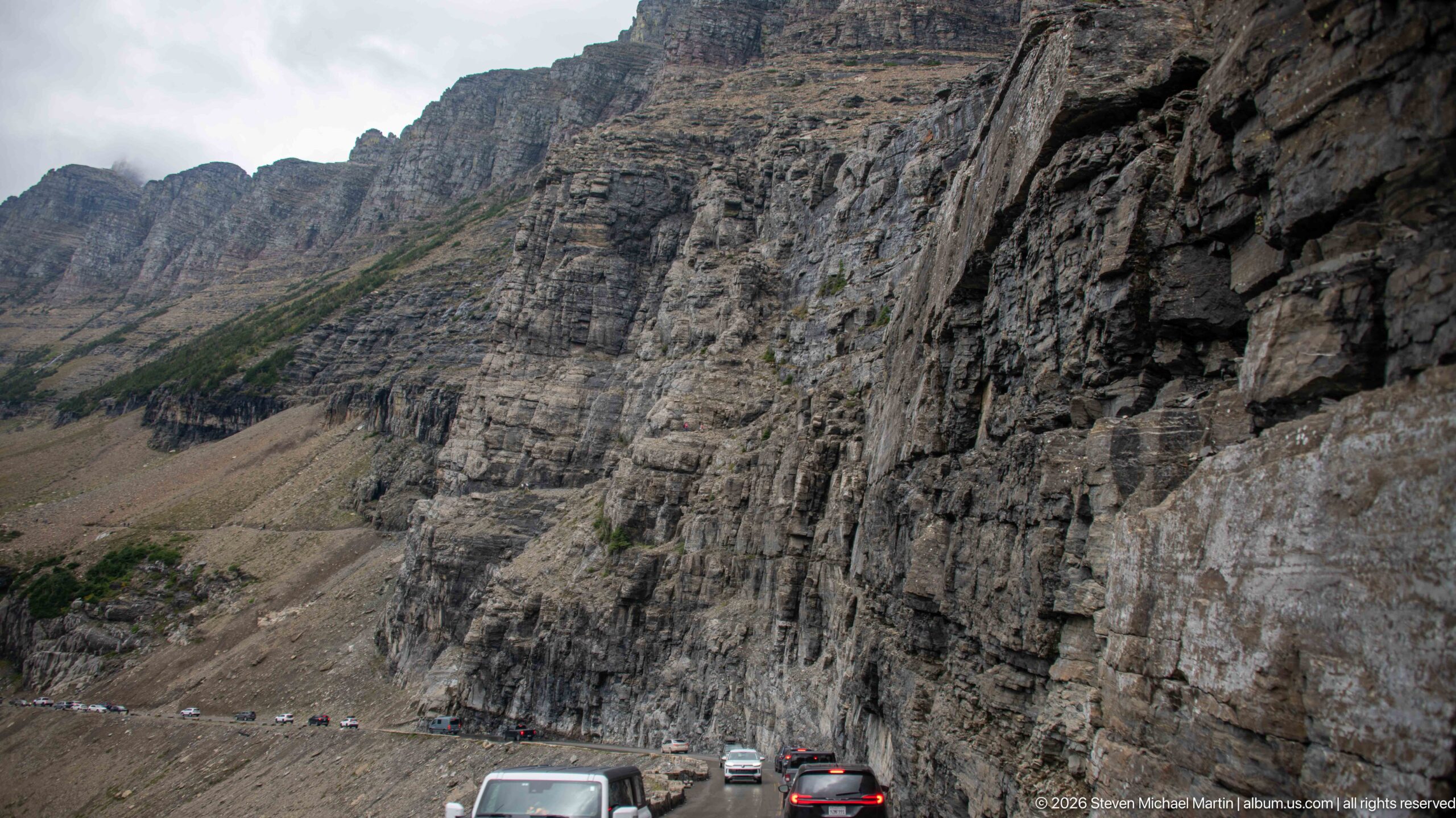
A massive wall of layered stone rises immediately beside the roadway, its fractured ledges and vertical joints dwarfing the line of vehicles below. The view concentrates on the physical scale of the mountain cut rather than the distant scenery, showing the narrow space available for Going-to-the-Sun Road along this steep section of Glacier.
Caption
A massive wall of layered stone rises immediately beside the roadway, its fractured ledges and vertical joints dwarfing the line of vehicles below. The view concentrates on the physical scale of the mountain cut rather than the distant scenery, showing the narrow space available for Going-to-the-Sun Road along this steep section of Glacier.
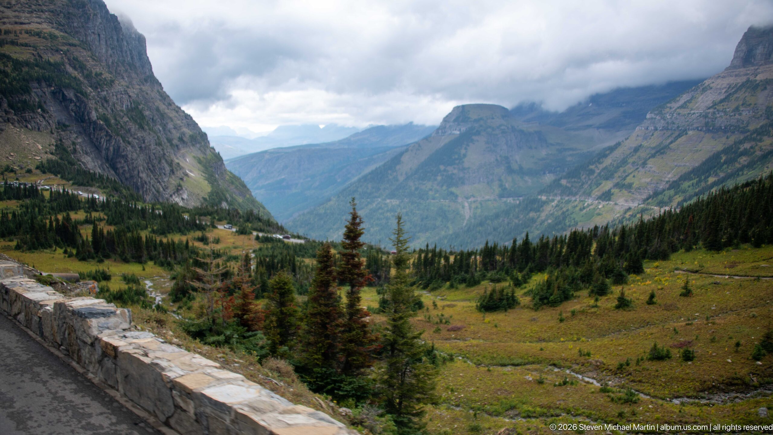
A stone roadside barrier frames a sweeping view into an alpine valley, where meadow, conifers, and a winding drainage descend between imposing mountain walls. Low clouds soften the upper ridges while patches of light move across the distant slopes. The foreground masonry anchors the landscape firmly to the experience of traveling Going-to-the-Sun Road.
Caption
A stone roadside barrier frames a sweeping view into an alpine valley, where meadow, conifers, and a winding drainage descend between imposing mountain walls. Low clouds soften the upper ridges while patches of light move across the distant slopes. The foreground masonry anchors the landscape firmly to the experience of traveling Going-to-the-Sun Road.
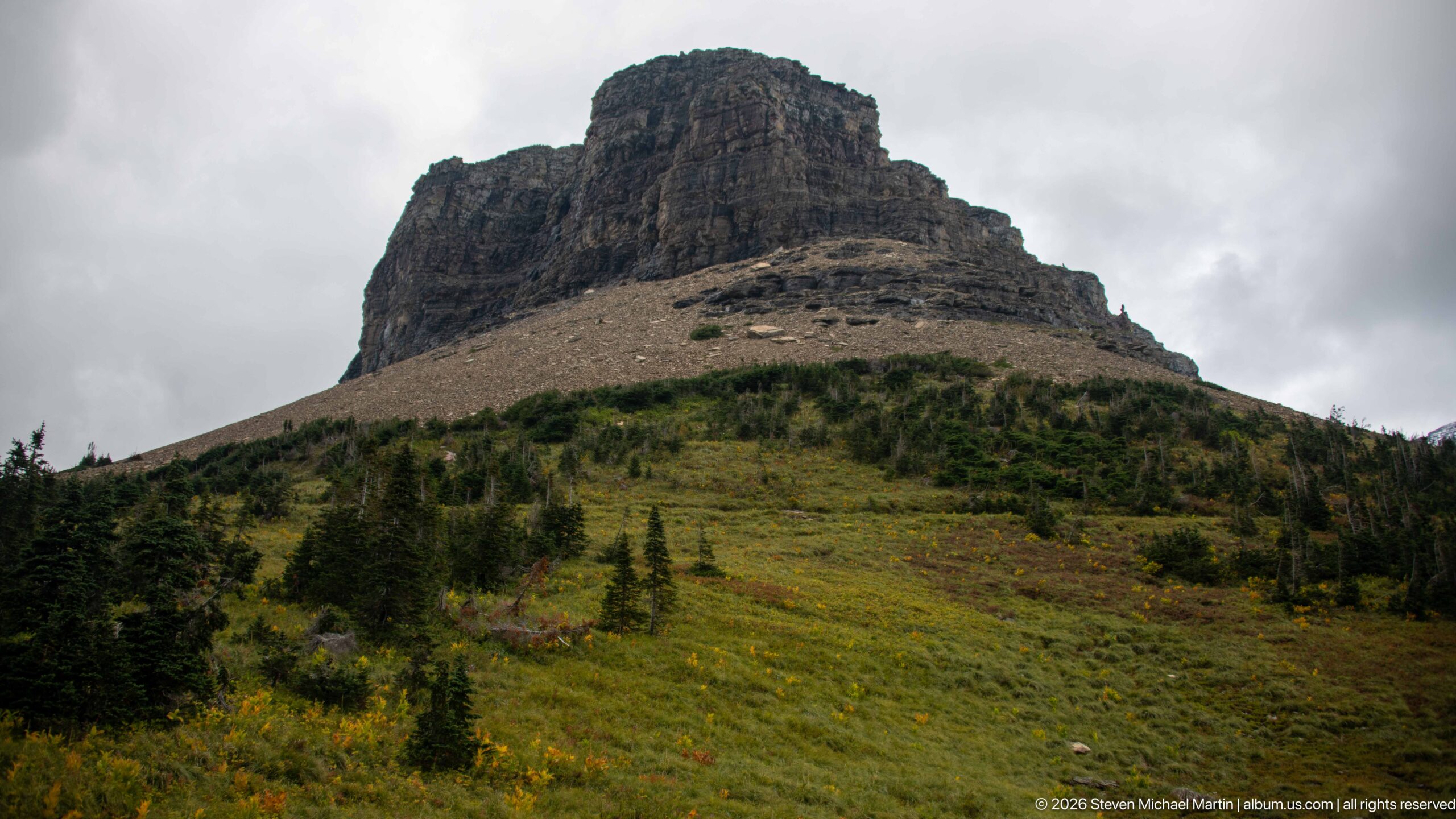
A blocky, flat-crested mountain mass rises abruptly above an open alpine slope dotted with conifers and low vegetation. Horizontal rock layers and a broad apron of loose stone are prominent beneath the summit cliffs. Cloudy light suppresses distant detail and gives unusual clarity to the mountain's stepped geological form.
Caption
A blocky, flat-crested mountain mass rises abruptly above an open alpine slope dotted with conifers and low vegetation. Horizontal rock layers and a broad apron of loose stone are prominent beneath the summit cliffs. Cloudy light suppresses distant detail and gives unusual clarity to the mountain's stepped geological form.
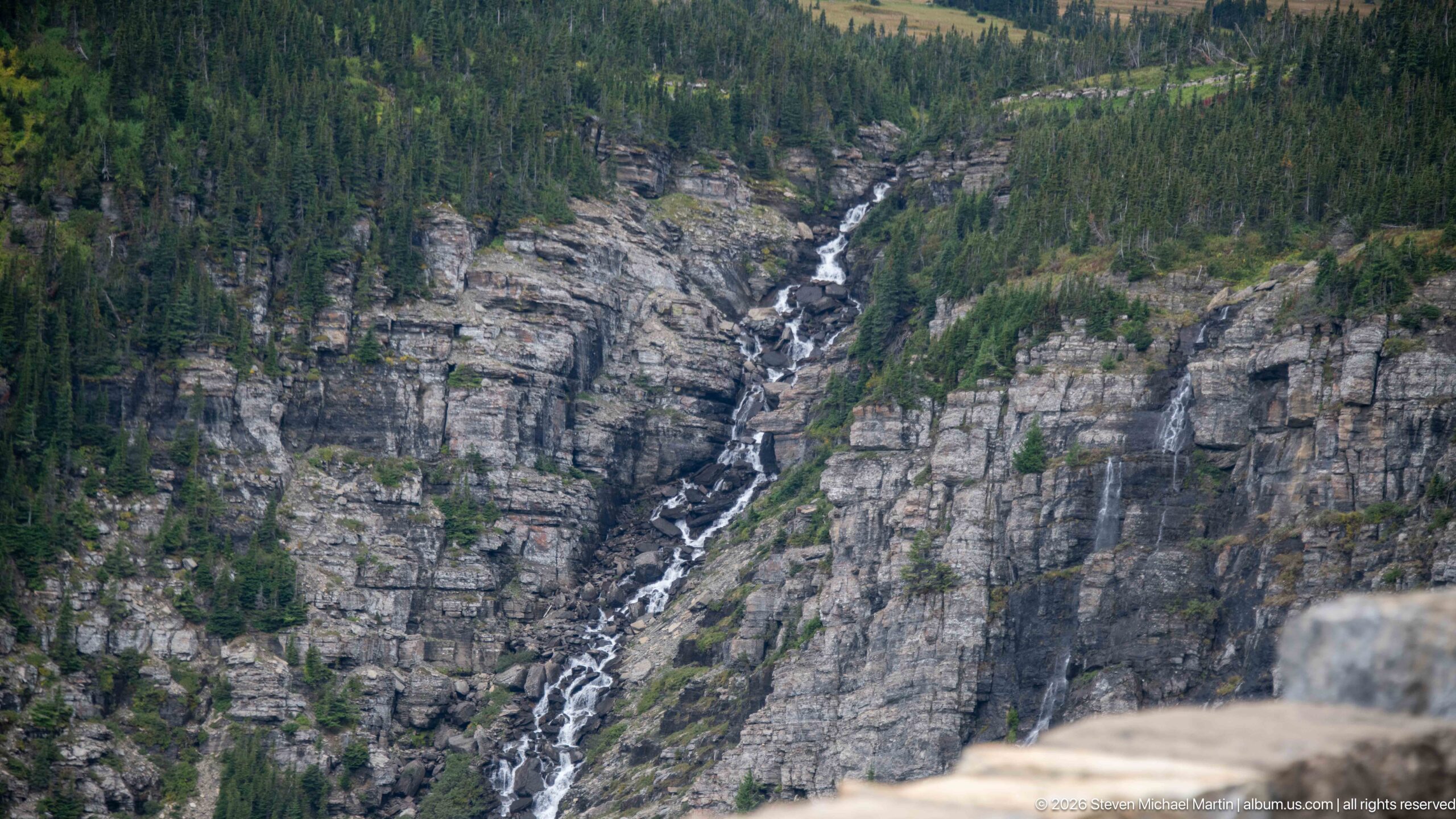
A long white waterfall threads down a deeply incised rock face across the valley, descending through a sequence of ledges between dense conifer stands. The distant viewpoint reveals the full vertical course of the cascade and the resistant layered rock that channels it. A blurred roadside barrier in the foreground locates the view along the mountain road.
Caption
A long white waterfall threads down a deeply incised rock face across the valley, descending through a sequence of ledges between dense conifer stands. The distant viewpoint reveals the full vertical course of the cascade and the resistant layered rock that channels it. A blurred roadside barrier in the foreground locates the view along the mountain road.
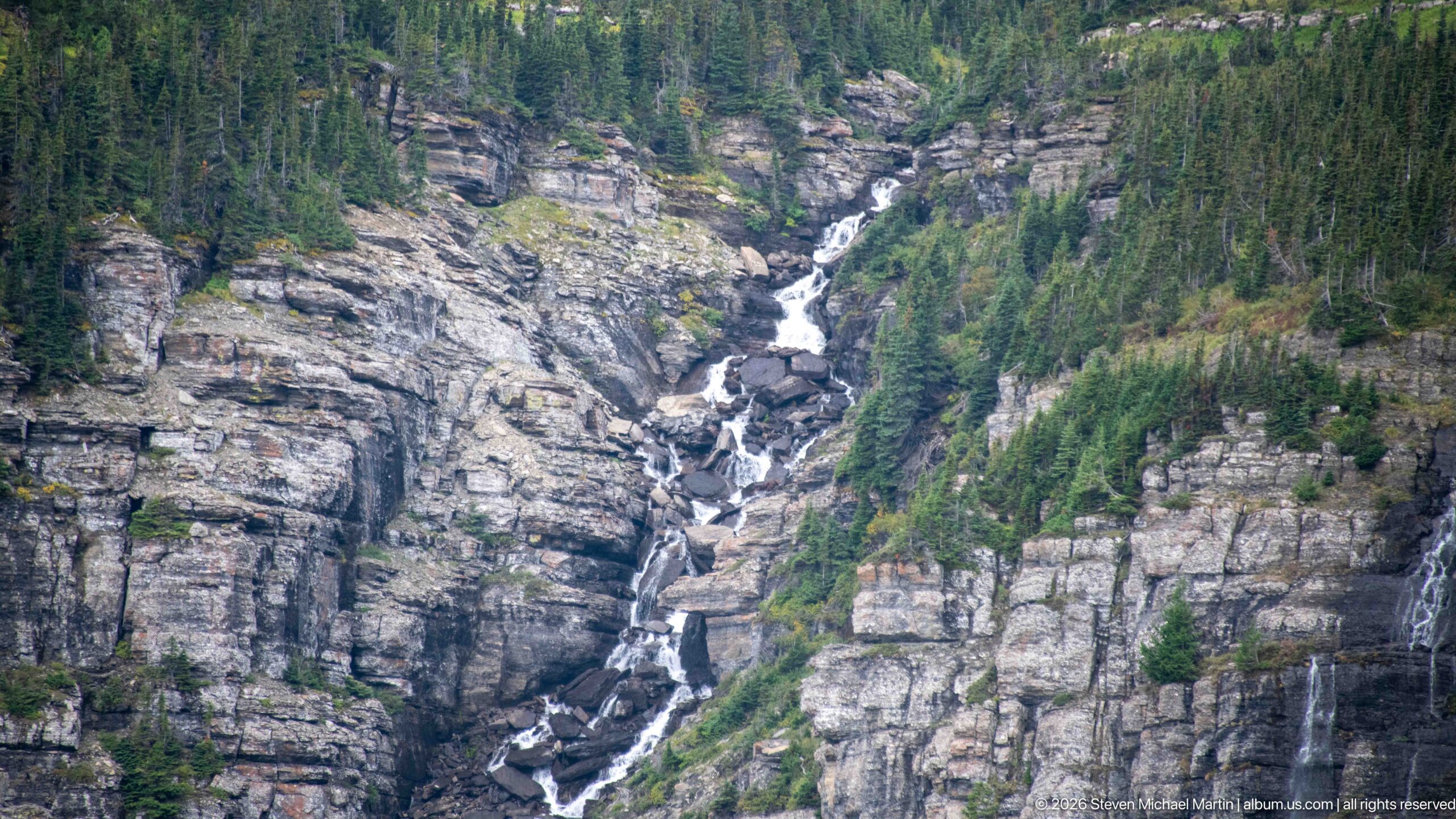
A multi-tier waterfall drops through a steep rocky cleft, repeatedly narrowing and widening as it crosses resistant ledges. Conifers crowd the upper rim and side slopes while exposed strata frame the watercourse. The tighter view isolates the cascade's stepped structure and the rugged channel it has followed down the mountainside.
Caption
A multi-tier waterfall drops through a steep rocky cleft, repeatedly narrowing and widening as it crosses resistant ledges. Conifers crowd the upper rim and side slopes while exposed strata frame the watercourse. The tighter view isolates the cascade's stepped structure and the rugged channel it has followed down the mountainside.
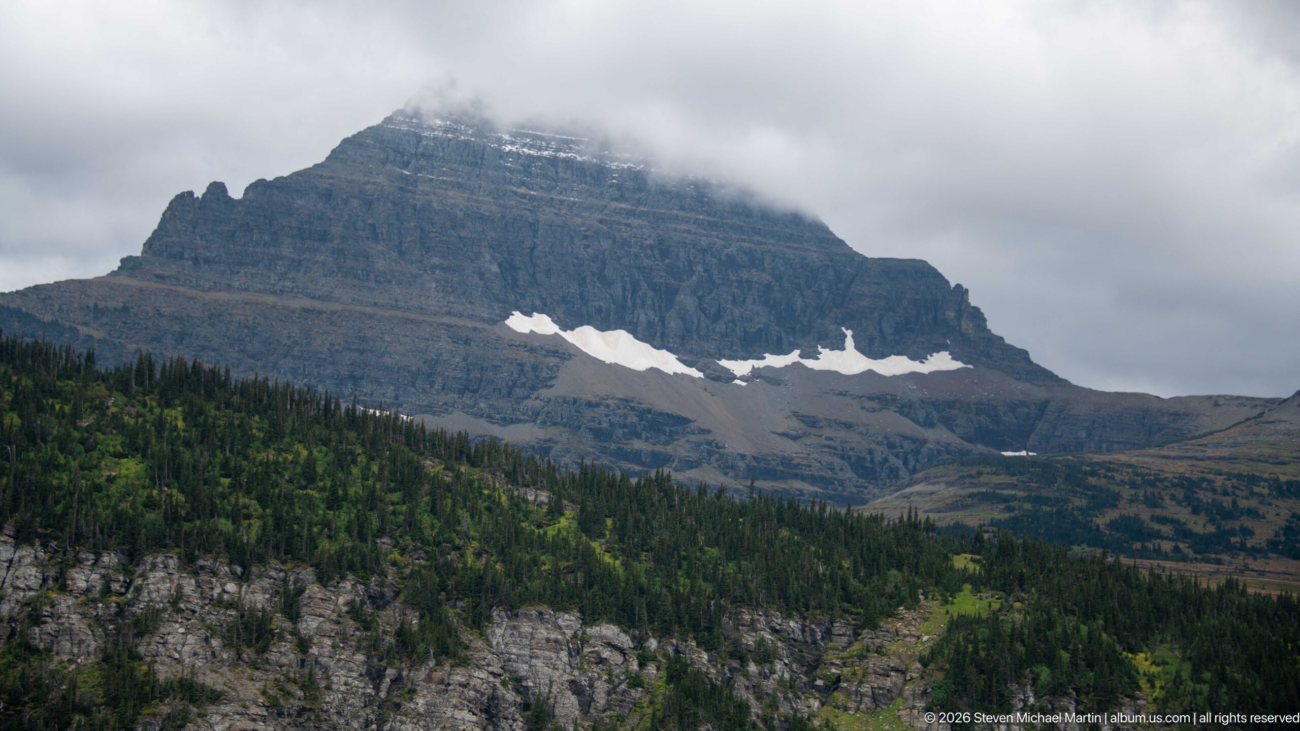
A broad, layered mountain rises above dark conifer forest, its upper slopes disappearing into low cloud. Irregular strips of lingering snow lie beneath the summit cliffs and emphasize shallow basins across the high slope. The subdued weather reveals the strong horizontal structure of the rock while partially concealing the mountain's crest.
Caption
A broad, layered mountain rises above dark conifer forest, its upper slopes disappearing into low cloud. Irregular strips of lingering snow lie beneath the summit cliffs and emphasize shallow basins across the high slope. The subdued weather reveals the strong horizontal structure of the rock while partially concealing the mountain's crest.
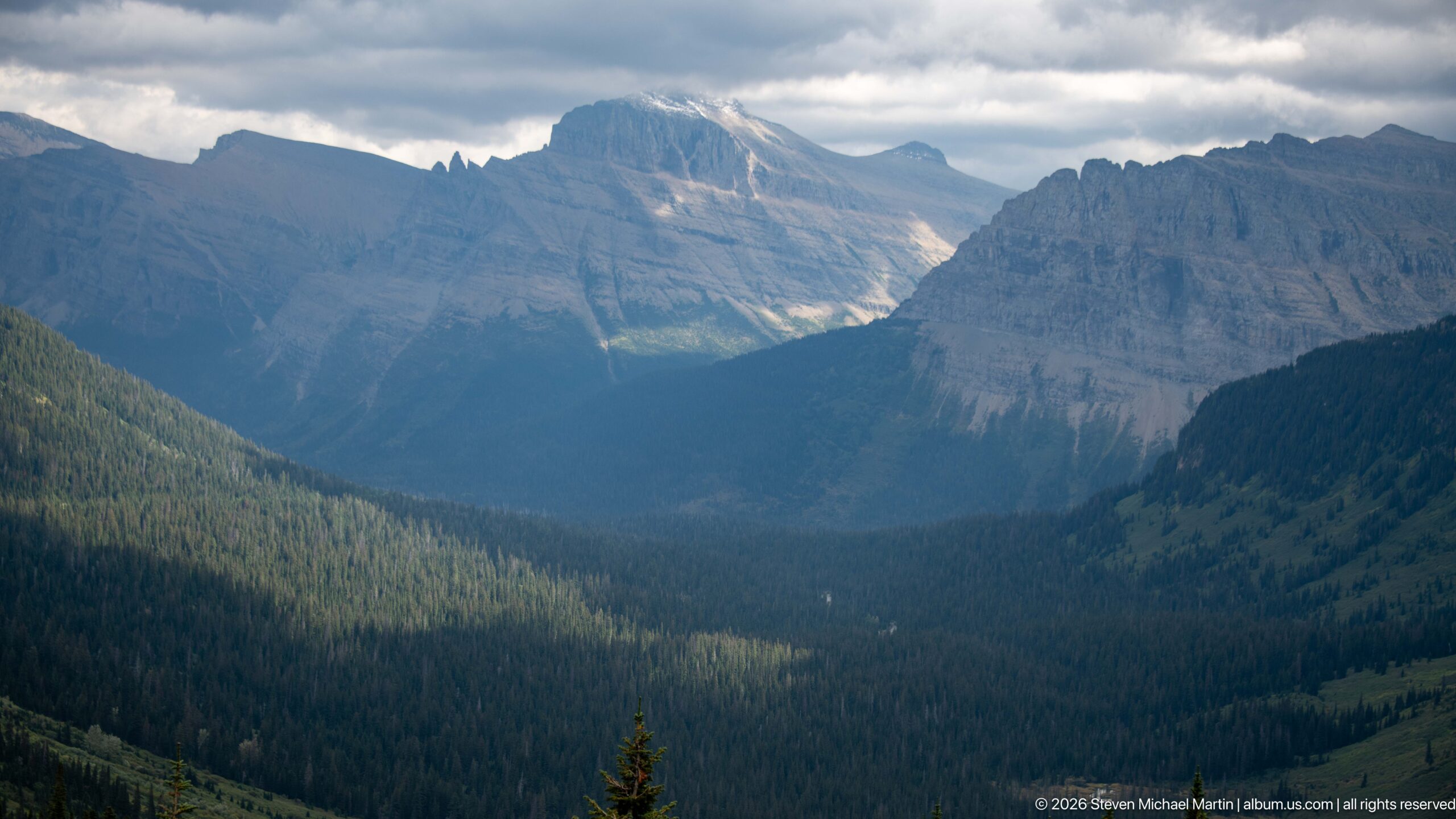
Sunlight reaches a distant mountain face while the deep forested valley below remains largely in shadow. Rugged peaks frame both sides of the view, creating a strong sense of depth through overlapping ridges and the broad U-shaped basin. The changing light gives particular definition to the valley's glacially sculpted scale.
Caption
Sunlight reaches a distant mountain face while the deep forested valley below remains largely in shadow. Rugged peaks frame both sides of the view, creating a strong sense of depth through overlapping ridges and the broad U-shaped basin. The changing light gives particular definition to the valley's glacially sculpted scale.
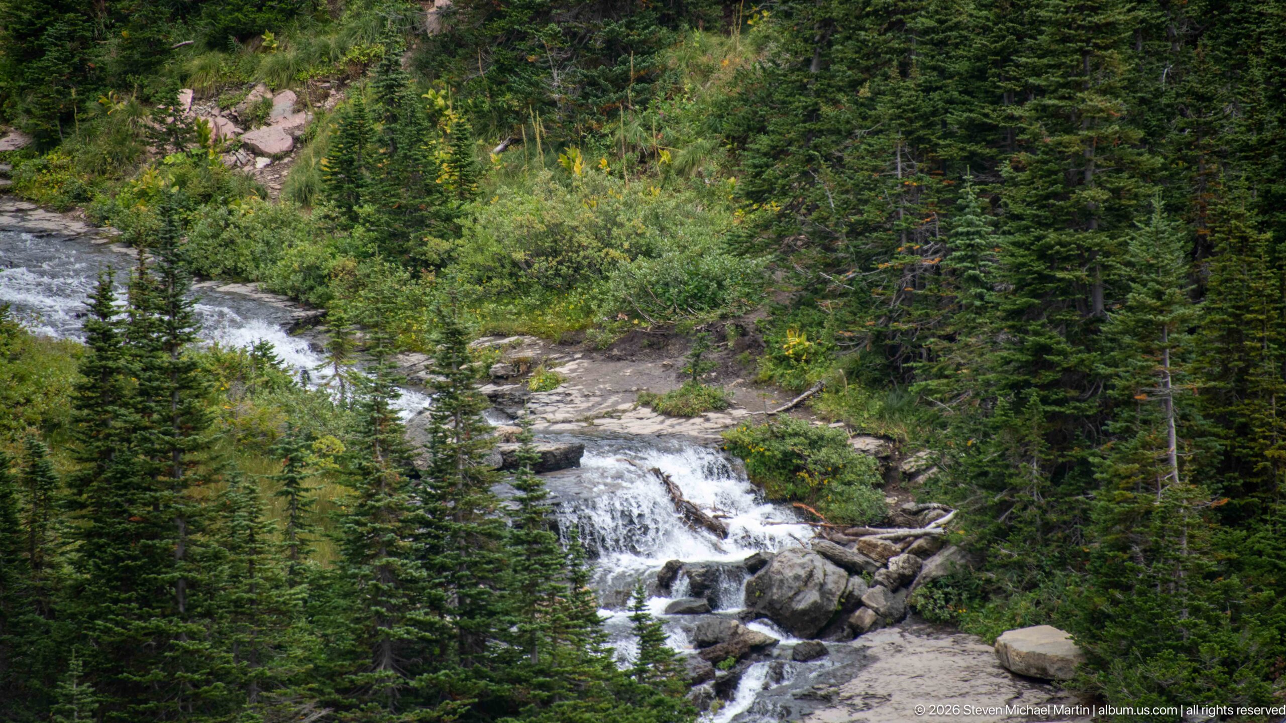
A mountain stream rushes over pale boulders and bedrock through dense conifer forest, forming a compact white cascade before continuing downslope. Shrubs and groundcover crowd the banks, giving the watercourse an enclosed character unlike the open alpine cascades higher along the road. The view emphasizes Glacier's transition into wetter forest habitat.
Caption
A mountain stream rushes over pale boulders and bedrock through dense conifer forest, forming a compact white cascade before continuing downslope. Shrubs and groundcover crowd the banks, giving the watercourse an enclosed character unlike the open alpine cascades higher along the road. The view emphasizes Glacier's transition into wetter forest habitat.
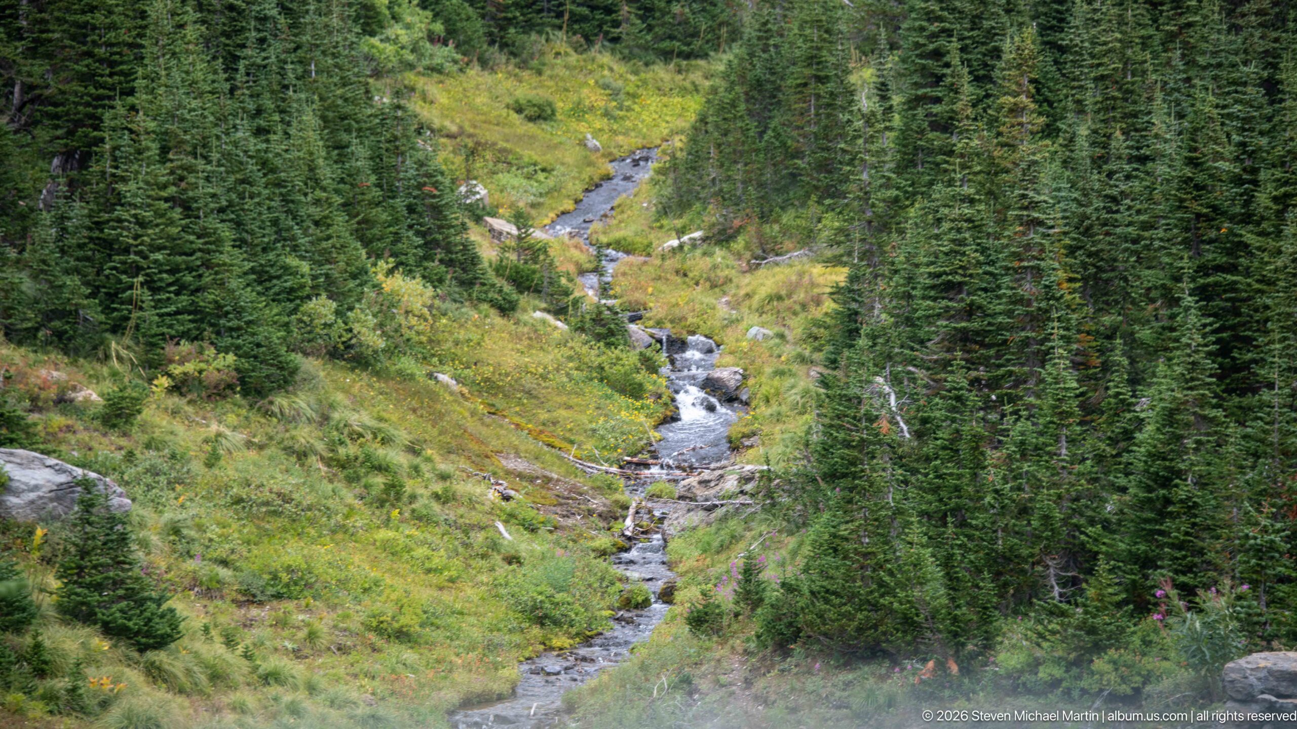
A narrow creek descends through a green mountainside, stepping over small rocks between dense conifers and low shrubs. The elevated viewpoint follows the watercourse along its winding channel and shows the close mosaic of stream, meadow-like openings, and forest. Its modest scale contrasts with the larger waterfalls visible elsewhere along the route.
Caption
A narrow creek descends through a green mountainside, stepping over small rocks between dense conifers and low shrubs. The elevated viewpoint follows the watercourse along its winding channel and shows the close mosaic of stream, meadow-like openings, and forest. Its modest scale contrasts with the larger waterfalls visible elsewhere along the route.
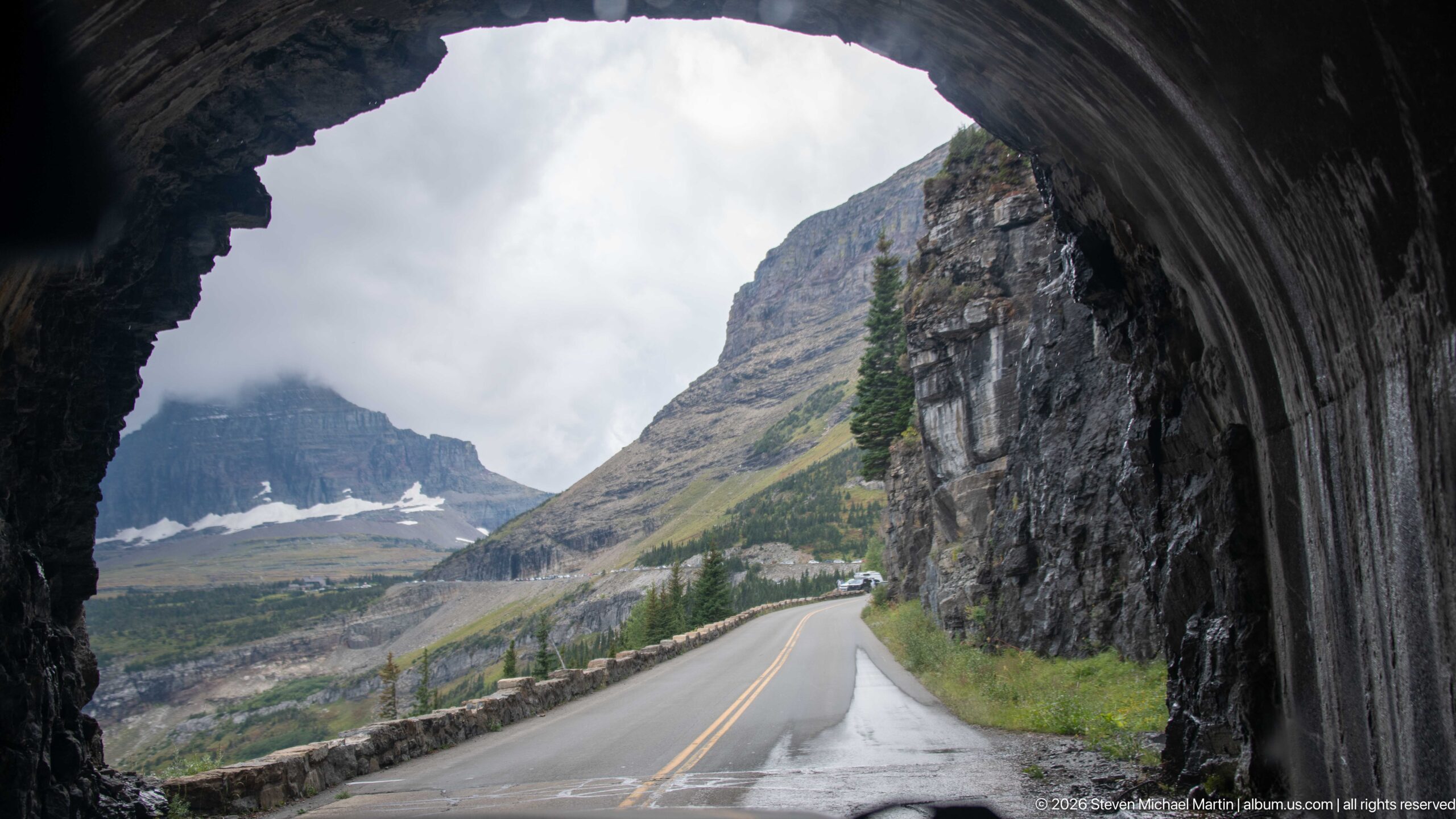
The roadway curves out from beneath a rock tunnel toward open alpine terrain, framed dramatically by the dark arch overhead. A stone guardwall follows the outside edge while a layered mountain and patches of snow appear beyond. The view joins two characteristic elements of Going-to-the-Sun Road: engineered passage through bedrock and expansive mountain scenery.
Caption
The roadway curves out from beneath a rock tunnel toward open alpine terrain, framed dramatically by the dark arch overhead. A stone guardwall follows the outside edge while a layered mountain and patches of snow appear beyond. The view joins two characteristic elements of Going-to-the-Sun Road: engineered passage through bedrock and expansive mountain scenery.
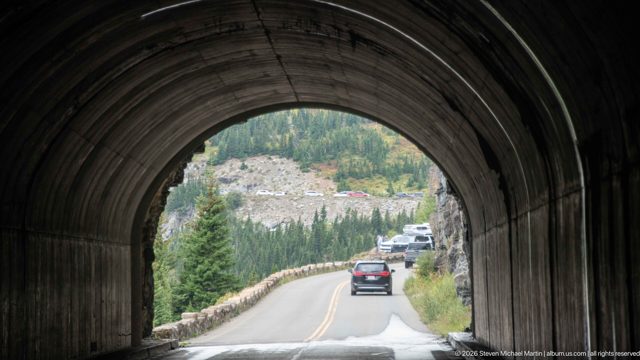
The rounded interior of a short mountain tunnel frames traffic continuing along Going-to-the-Sun Road. Outside the dark opening, vehicles follow a narrow curve bordered by a stone guardwall and steep rocky terrain. The tunnel's ribbed interior creates a strong architectural frame for the bright roadway and forested slope beyond.
Caption
The rounded interior of a short mountain tunnel frames traffic continuing along Going-to-the-Sun Road. Outside the dark opening, vehicles follow a narrow curve bordered by a stone guardwall and steep rocky terrain. The tunnel's ribbed interior creates a strong architectural frame for the bright roadway and forested slope beyond.
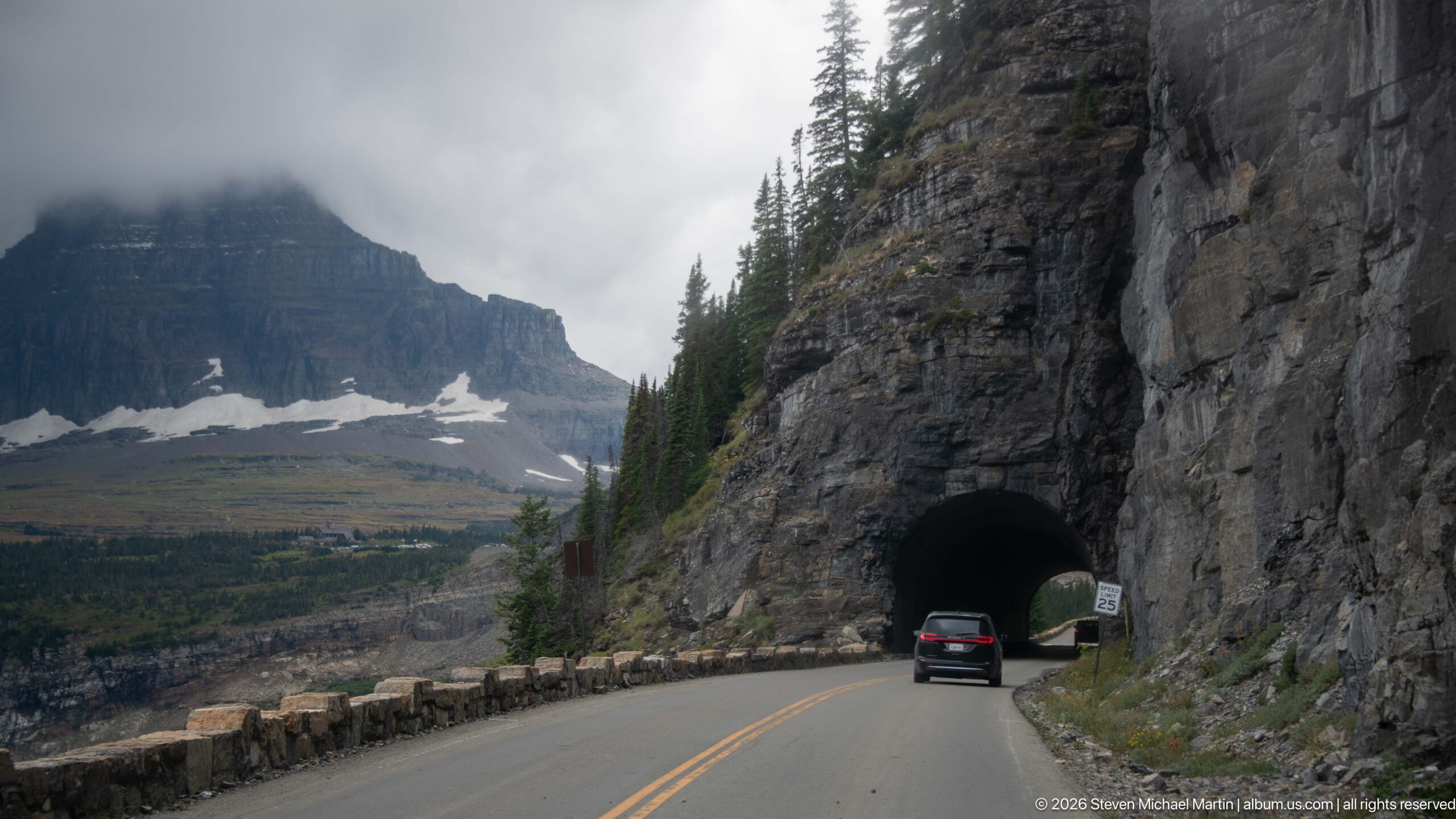
A compact tunnel portal opens directly through a massive roadside cliff as a car approaches along Going-to-the-Sun Road. Stone guardwalls line the opposite edge, beyond which a cloud-wrapped mountain and lingering snowfields rise across the basin. The scene clearly shows how the road alternates between exposed ledges and passages cut through bedrock.
Caption
A compact tunnel portal opens directly through a massive roadside cliff as a car approaches along Going-to-the-Sun Road. Stone guardwalls line the opposite edge, beyond which a cloud-wrapped mountain and lingering snowfields rise across the basin. The scene clearly shows how the road alternates between exposed ledges and passages cut through bedrock.
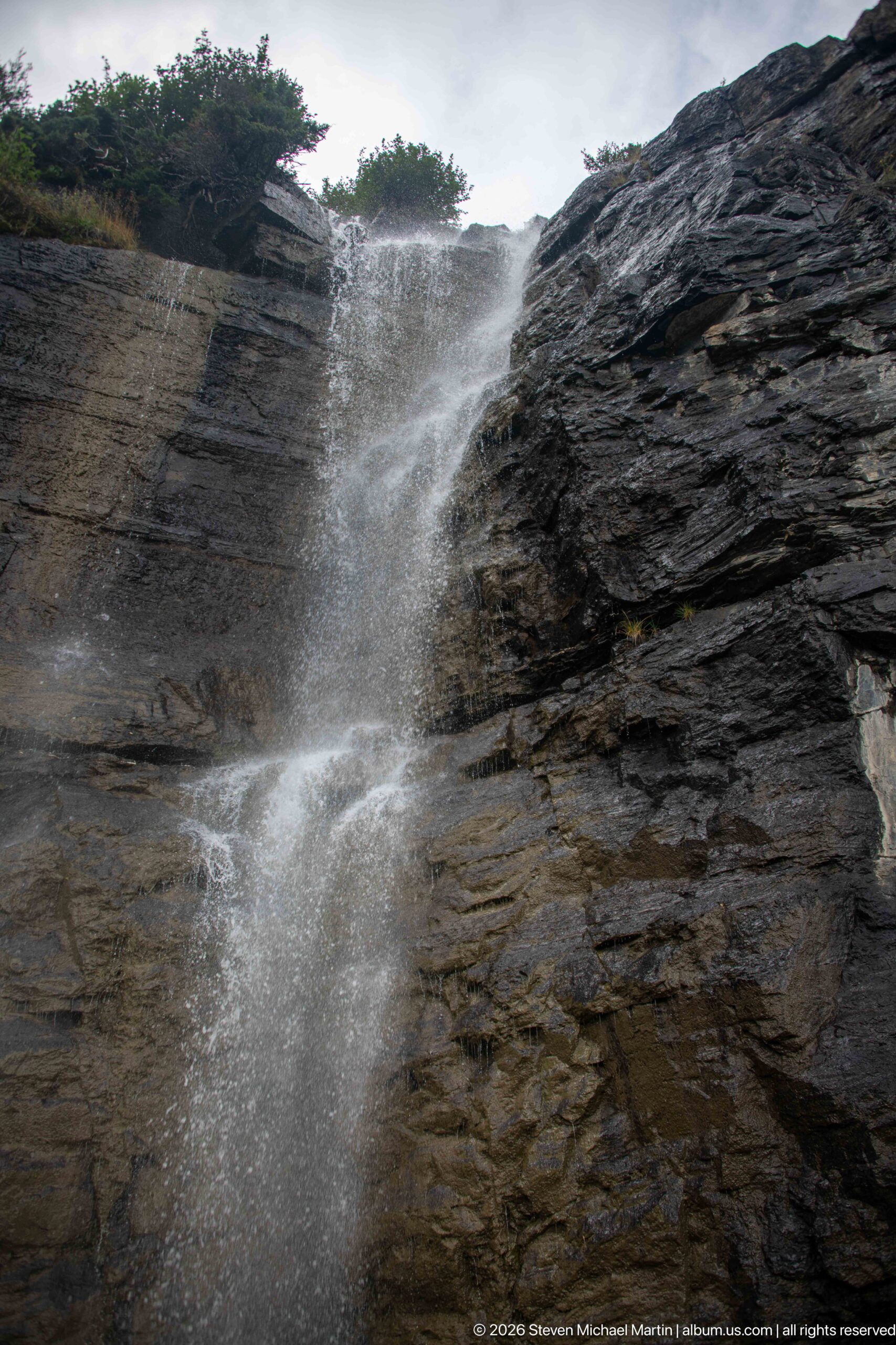
A thin waterfall spills over the lip of a layered cliff and breaks into spray before reaching the lower rock face. Wind pushes the falling water outward, revealing how exposed these roadside cascades are in Glacier's high mountain terrain. Sparse vegetation crowns the ledge while dark horizontal strata dominate the close view.
Caption
A thin waterfall spills over the lip of a layered cliff and breaks into spray before reaching the lower rock face. Wind pushes the falling water outward, revealing how exposed these roadside cascades are in Glacier's high mountain terrain. Sparse vegetation crowns the ledge while dark horizontal strata dominate the close view.
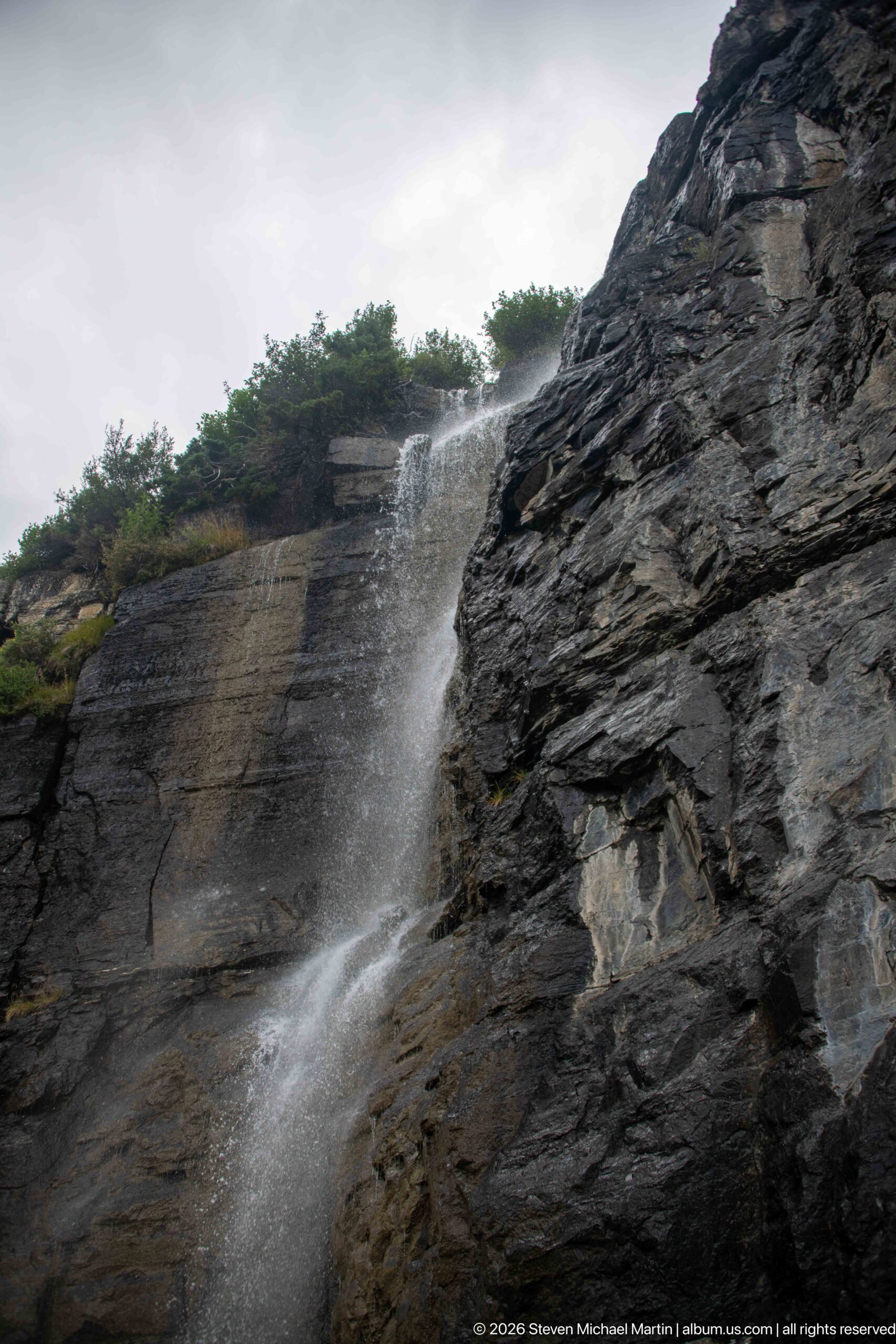
Water pours from a high ledge across dark, fractured bedrock, spreading into mist as it descends the near-vertical face. The oblique angle reveals the cliff's projecting layers and the vegetation rooted along its upper edge. This close roadside view emphasizes the combination of water, weather, and exposed geology encountered along the mountain route.
Caption
Water pours from a high ledge across dark, fractured bedrock, spreading into mist as it descends the near-vertical face. The oblique angle reveals the cliff's projecting layers and the vegetation rooted along its upper edge. This close roadside view emphasizes the combination of water, weather, and exposed geology encountered along the mountain route.
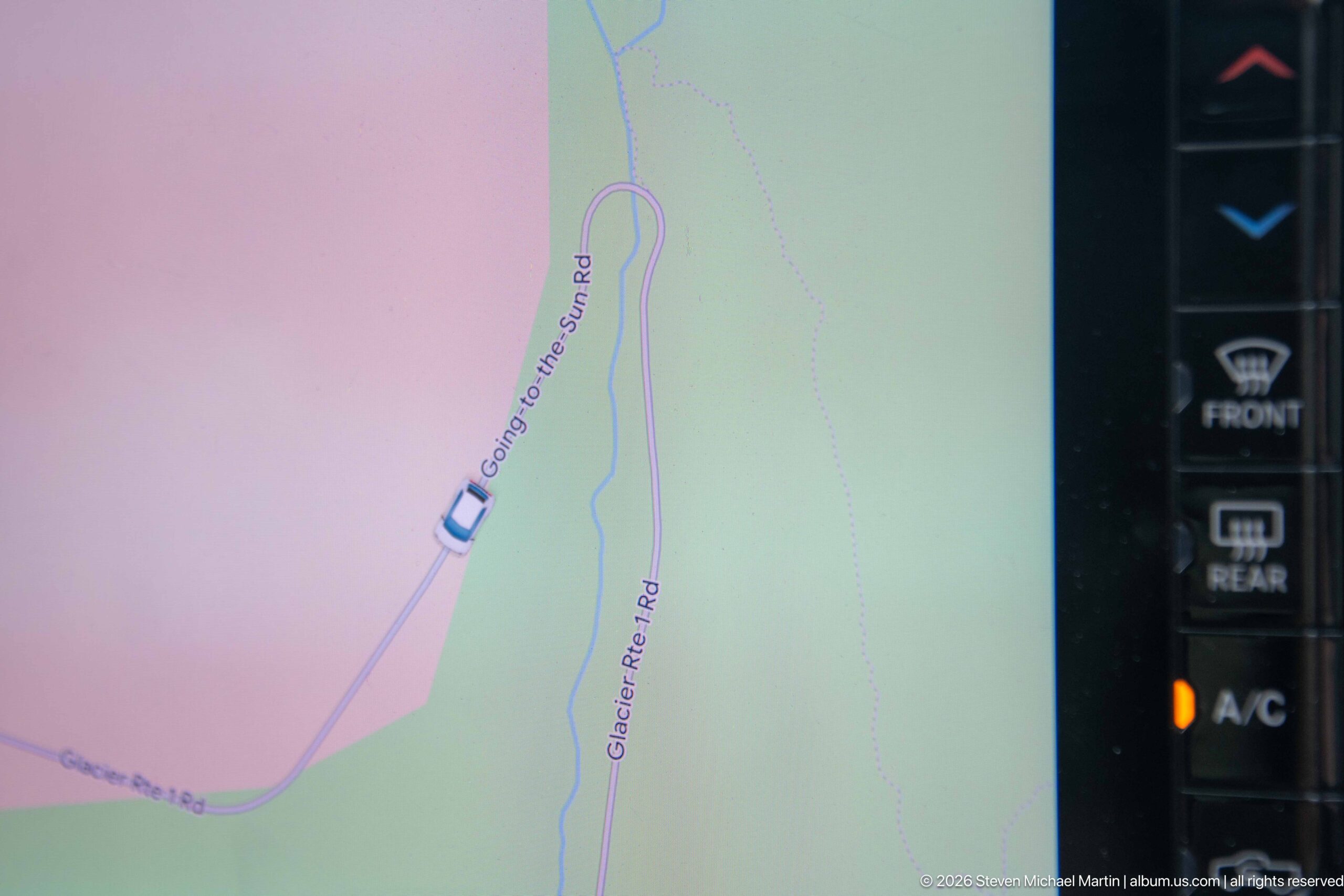
An in-vehicle navigation display traces the car's position on Going-to-the-Sun Road, with nearby Glacier Route Road also labeled on the map. The close view records the route from inside the vehicle rather than the surrounding landscape, documenting the practical navigation of Glacier's winding transmountain corridor.
Caption
An in-vehicle navigation display traces the car's position on Going-to-the-Sun Road, with nearby Glacier Route Road also labeled on the map. The close view records the route from inside the vehicle rather than the surrounding landscape, documenting the practical navigation of Glacier's winding transmountain corridor.
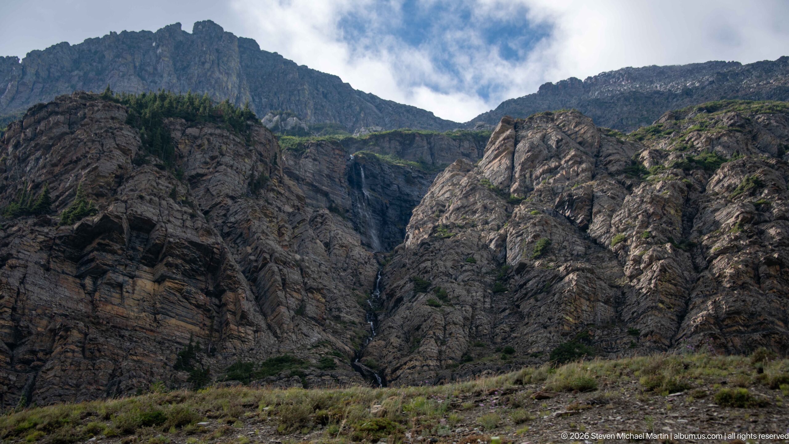
A slender waterfall descends a dark cleft between massive, folded-looking rock walls, nearly disappearing against the shadowed stone. Sparse vegetation covers the lower foreground while the upper ridgeline opens to patches of blue sky. The distant cascade provides scale for the rugged rock formations enclosing this narrow mountain drainage.
Caption
A slender waterfall descends a dark cleft between massive, folded-looking rock walls, nearly disappearing against the shadowed stone. Sparse vegetation covers the lower foreground while the upper ridgeline opens to patches of blue sky. The distant cascade provides scale for the rugged rock formations enclosing this narrow mountain drainage.
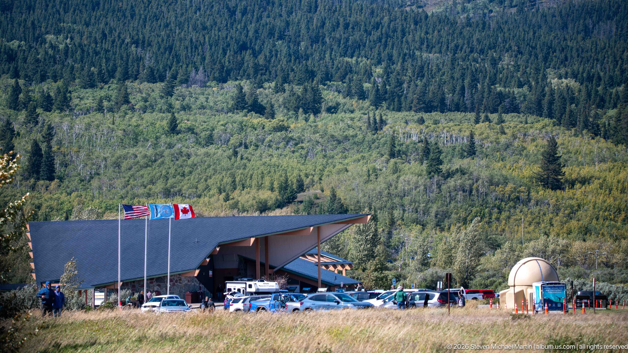
A low, angular-roofed park facility sits against a densely forested mountainside, with the United States and Canadian flags flying prominently in front. Vehicles and visitors gather around the building, giving the scene the character of a busy roadside service or visitor stop along the international border-region landscape of Glacier.
Caption
A low, angular-roofed park facility sits against a densely forested mountainside, with the United States and Canadian flags flying prominently in front. Vehicles and visitors gather around the building, giving the scene the character of a busy roadside service or visitor stop along the international border-region landscape of Glacier.
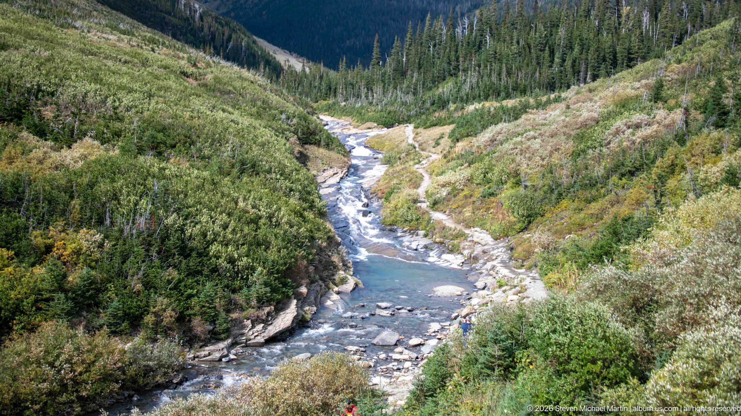
Clear blue-green water runs through a rocky channel bordered by dense shrubs and conifers, viewed from above as the river bends down the valley. Pale boulders and exposed bedrock interrupt the current while steep wooded slopes rise beyond. The elevated perspective reveals both the water's color and the narrow mountain corridor it occupies.
Caption
Clear blue-green water runs through a rocky channel bordered by dense shrubs and conifers, viewed from above as the river bends down the valley. Pale boulders and exposed bedrock interrupt the current while steep wooded slopes rise beyond. The elevated perspective reveals both the water's color and the narrow mountain corridor it occupies.
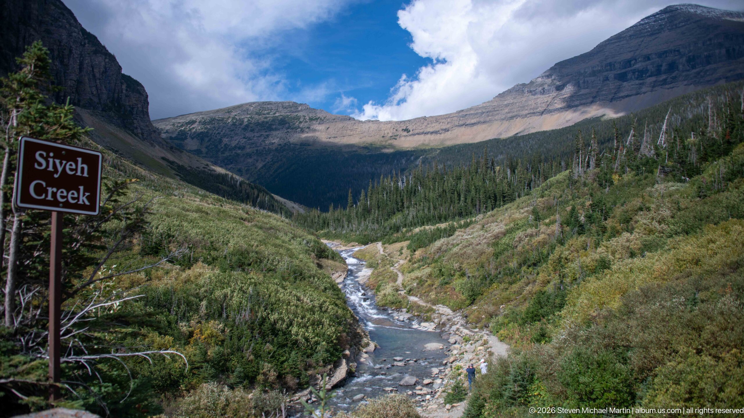
A roadside sign identifies Siyeh Creek beside a view upstream into a steep mountain valley. The creek flows through a pale rocky channel bordered by dense shrubs and conifers, while layered slopes rise toward open alpine terrain under bright clouds. The sign and landscape together provide unusually strong visual evidence for the drainage's identification.
Caption
A roadside sign identifies Siyeh Creek beside a view upstream into a steep mountain valley. The creek flows through a pale rocky channel bordered by dense shrubs and conifers, while layered slopes rise toward open alpine terrain under bright clouds. The sign and landscape together provide unusually strong visual evidence for the drainage's identification.
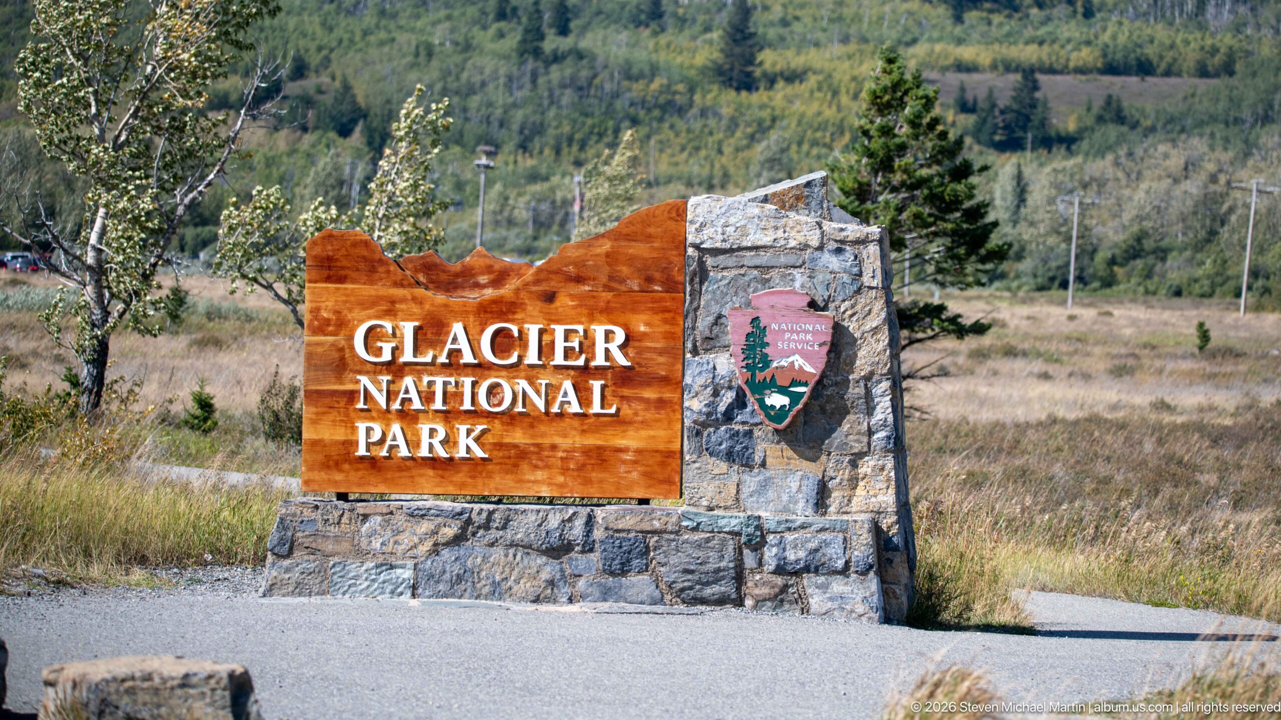
A large timber-and-stone monument announces Glacier National Park beside the roadway, pairing carved white lettering with the National Park Service arrowhead emblem. Open grass, scattered trees, and a forested hillside form a subdued backdrop. The sign provides a clear visual threshold for the park and a fitting endpoint to this road sequence.
Caption
A large timber-and-stone monument announces Glacier National Park beside the roadway, pairing carved white lettering with the National Park Service arrowhead emblem. Open grass, scattered trees, and a forested hillside form a subdued backdrop. The sign provides a clear visual threshold for the park and a fitting endpoint to this road sequence.
Field Guide
A Road Through the Continental Divide
Going-to-the-Sun Road crosses Glacier National Park as a journey through changing mountain landscapes. From forested valleys and broad lakes, the route climbs into increasingly exposed terrain where steep slopes, rock walls, alpine vegetation, and distant peaks dominate the view. The road makes the scale of the northern Rocky Mountains legible through movement: each turn changes the relationship among valley, ridge, water, forest, and sky, culminating in the high country around Logan Pass and the Continental Divide.
Glacial Landscapes Written in Stone
The scenery surrounding Going-to-the-Sun Road reflects a landscape shaped by geology and glaciation. Broad valleys, steep mountain faces, cirques, ridges, and waterfalls reveal the effects of ice, erosion, flowing water, and weather on an ancient mountain environment. The road provides unusually direct views into this terrain, allowing visitors to read the park at multiple scales—from exposed rock beside the roadway to immense valleys and mountain walls extending across the horizon.
Engineering the Going-to-the-Sun Road
Building a transmountain road through Glacier required engineers to negotiate steep grades, unstable slopes, severe winter weather, and terrain where conventional road construction would have overwhelmed the landscape. Construction began in the early 1920s, and the route across Logan Pass was completed in 1932. Rather than relying on a dense series of switchbacks, designers carried the road along the mountainside, using retaining walls, bridges, tunnels, and carefully fitted stonework to create a route that responded to the contours of the land.
A Landmark of National Park Road Design
Going-to-the-Sun Road represents the early National Park Service ideal that visitor infrastructure could provide access to extraordinary scenery while remaining visually subordinate to it. Its engineering and landscape design became influential within the National Park System, and the road is recognized as a National Historic Landmark. Its significance lies not only in the difficulty of its construction, but in the deliberate effort to make the journey itself an interpretive experience of Glacier's mountains.
From Forest to Alpine Country
The road's elevation change carries visitors through a sequence of habitats. Lower sections pass through forested valleys and watersheds, while the climb toward Logan Pass reaches open meadows and alpine environments shaped by shorter growing seasons, persistent snow, wind, and exposure. Wildflowers and low-growing vegetation occupy the high country during the brief summer season. These transitions make the route a cross-section of Glacier's ecological diversity as well as its topography.
Wildlife Along the Mountain Corridor
Glacier's mountain habitats support wildlife adapted to forests, rocky slopes, meadows, and alpine terrain. Along Going-to-the-Sun Road, animals may appear close to developed viewpoints and road corridors as they move through habitat that extends far beyond the pavement. Mountain goats and bighorn sheep are especially associated with steep and high-elevation environments, while the broader park supports a much wider community of mammals and birds. Wildlife should be understood as part of a functioning mountain ecosystem rather than as an attraction confined to particular stops.
The Road as a Sequence of Views
Going-to-the-Sun Road is best understood as a continuous experience rather than a collection of isolated overlooks. Forest, lake, waterfall, cliff, meadow, and mountain views appear in succession as the road gains elevation and crosses the park. Narrow sections cut into the mountainside create dramatic contrasts between rock rising immediately beside the roadway and valleys dropping away below. The changing viewpoints explain why the road itself has become one of Glacier National Park's defining visitor experiences.
Reading the Glacier Landscape
Photographs made along Going-to-the-Sun Road can be read for relationships as much as for individual landmarks. Tree line and vegetation indicate elevation and exposure; waterfalls reveal the movement of water down steep terrain; layered ridges show the depth of glacial valleys; and retaining walls or roadway edges demonstrate how human engineering was inserted into the mountain setting. Together these details connect geology, ecology, transportation history, and landscape design—the principal themes that distinguish this route through Glacier National Park.