Philipsburg, MT Introduction
Philipsburg, Montana, preserves one of the state’s most engaging historic commercial districts, a remarkably intact reminder of the mining economy that brought permanent settlement to this part of the Flint Creek Valley. Founded during the silver boom of the 1860s and named for mining engineer Philip Deidesheimer, the town developed as the commercial center for nearby mines and mills. Unlike many Montana mining settlements that disappeared when their mineral wealth declined, Philipsburg endured, leaving behind a compact downtown where nineteenth- and early-twentieth-century buildings still define the streetscape. Brick business blocks, elaborate storefronts, hotels, saloons, churches, civic buildings, and residences together make the town feel less like a reconstruction of the mining era than a community that has simply continued to evolve within it.
A walk through Philipsburg reveals how quickly the rough necessities of a mining camp gave way to increasingly substantial and ambitious architecture. The town’s historic walking tour identifies buildings associated with merchants, bankers, hoteliers, fraternal organizations, government, and the many businesses that served miners and their families. Commercial façades display the decorative brickwork, tall windows, cornices, recessed entrances, and cast-iron or wooden storefront elements characteristic of prosperous western towns around the turn of the twentieth century. Beyond the principal business streets, churches and residences broaden the story, showing the institutions and neighborhoods that developed as Philipsburg became an established community rather than merely an outpost dependent upon the next mineral strike.
Today, much of Philipsburg’s appeal comes from the relationship between those surviving buildings and an active small town that still occupies them. Historic storefronts have been adapted for contemporary shops, restaurants, galleries, and other businesses while retaining enough architectural detail to make the town’s earlier layers readily visible. The surrounding mountains and traces of the region’s mining landscape provide a constant reminder of why Philipsburg arose here, but its architecture explains why the community itself survived. Taken together, the buildings form an unusually coherent record of a Montana mining town’s transformation—from an isolated nineteenth-century industrial settlement into the enduring civic and commercial center visible today.
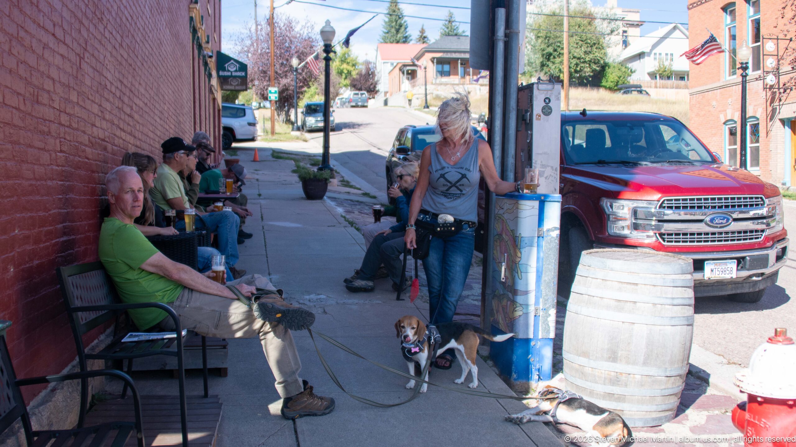
People and dogs gather along a shaded brick storefront on a Philipsburg sidewalk, turning the historic commercial district into an everyday social space. A beagle on leash approaches another dog near a barrel and lamppost while others sit against the building. Parked vehicles, flags, and the rising residential street beyond place the scene firmly within the active contemporary town.
Caption
People and dogs gather along a shaded brick storefront on a Philipsburg sidewalk, turning the historic commercial district into an everyday social space. A beagle on leash approaches another dog near a barrel and lamppost while others sit against the building. Parked vehicles, flags, and the rising residential street beyond place the scene firmly within the active contemporary town.
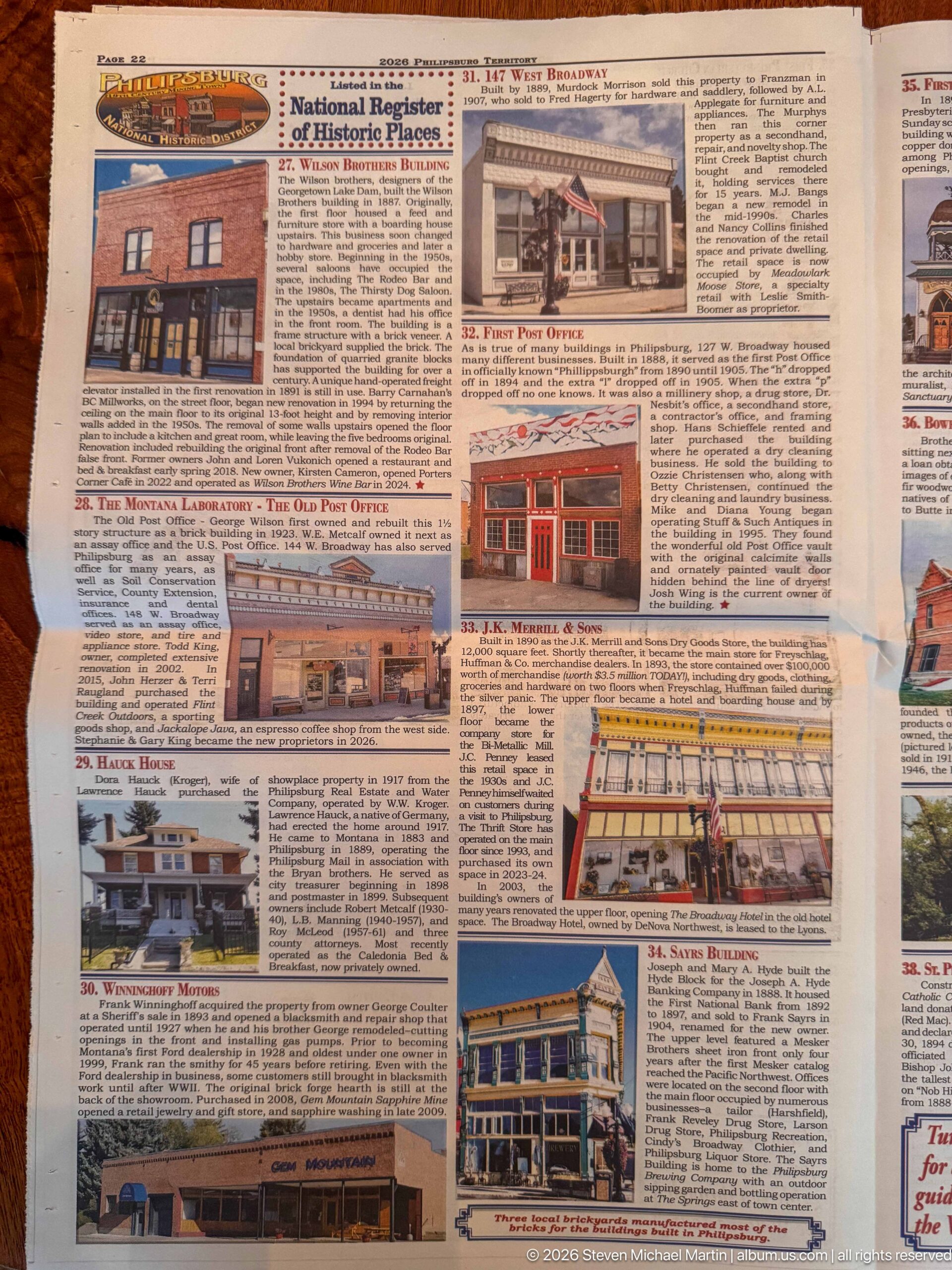
Entries 27–34 of the Philipsburg Territory walking tour document a sequence of commercial and residential properties, including the Wilson Brothers Building, Montana Laboratory–Old Post Office, Hauck House, Winninghoff Motors, 147 West Broadway, the First Post Office, J.K. Merrill & Sons, and the Sayrs Building. Their reference photographs preserve façade details useful for matching buildings in the downtown streetscape.
Caption
Entries 27–34 of the Philipsburg Territory walking tour document a sequence of commercial and residential properties, including the Wilson Brothers Building, Montana Laboratory–Old Post Office, Hauck House, Winninghoff Motors, 147 West Broadway, the First Post Office, J.K. Merrill & Sons, and the Sayrs Building. Their reference photographs preserve façade details useful for matching buildings in the downtown streetscape.
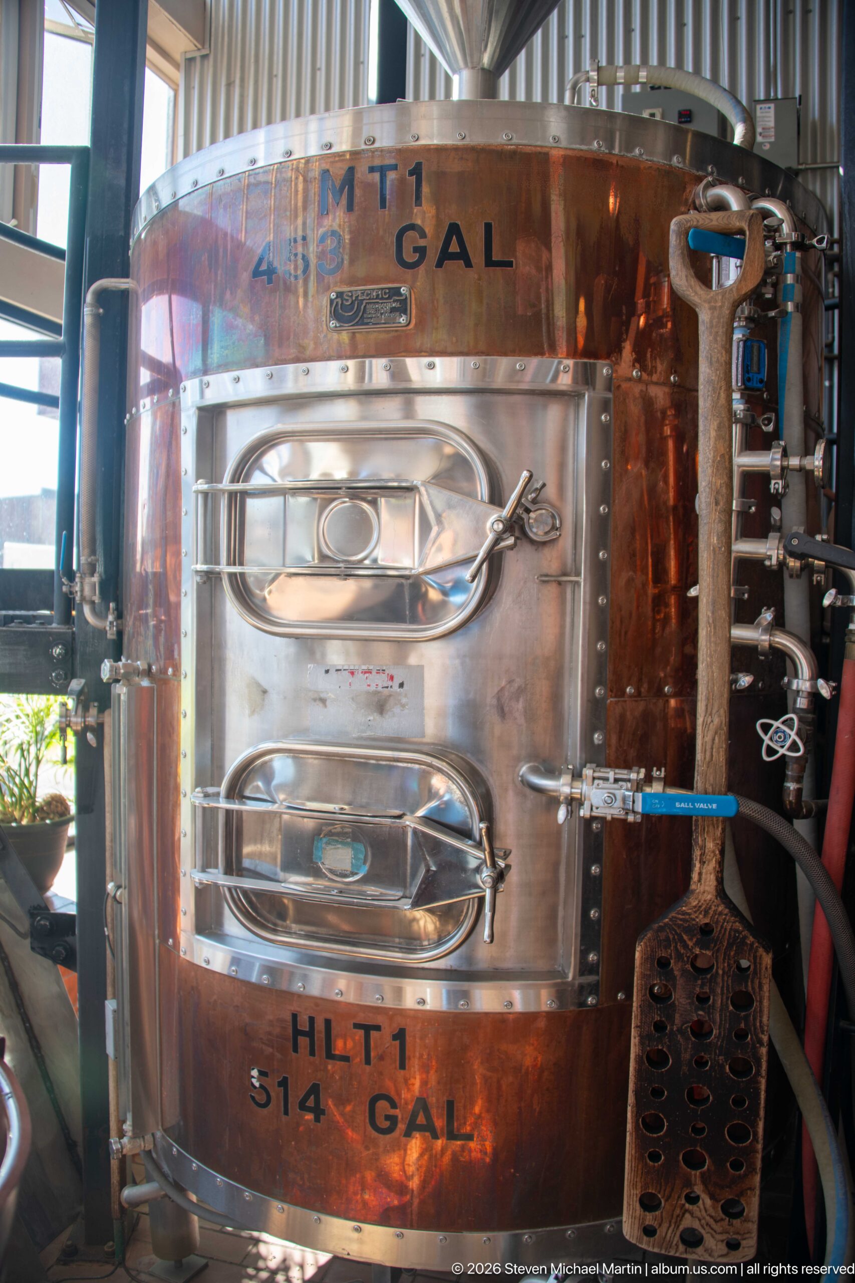
A close view of a copper-clad brewing vessel reveals its stainless-steel access doors, heavy latches, valves, and working fittings. The marked capacity of 514 gallons emphasizes the equipment’s functional scale, while the warm copper exterior contrasts with the polished steel components. A long perforated brewing tool hangs beside the tank, adding another visible element of the production process.
Caption
A close view of a copper-clad brewing vessel reveals its stainless-steel access doors, heavy latches, valves, and working fittings. The marked capacity of 514 gallons emphasizes the equipment’s functional scale, while the warm copper exterior contrasts with the polished steel components. A long perforated brewing tool hangs beside the tank, adding another visible element of the production process.
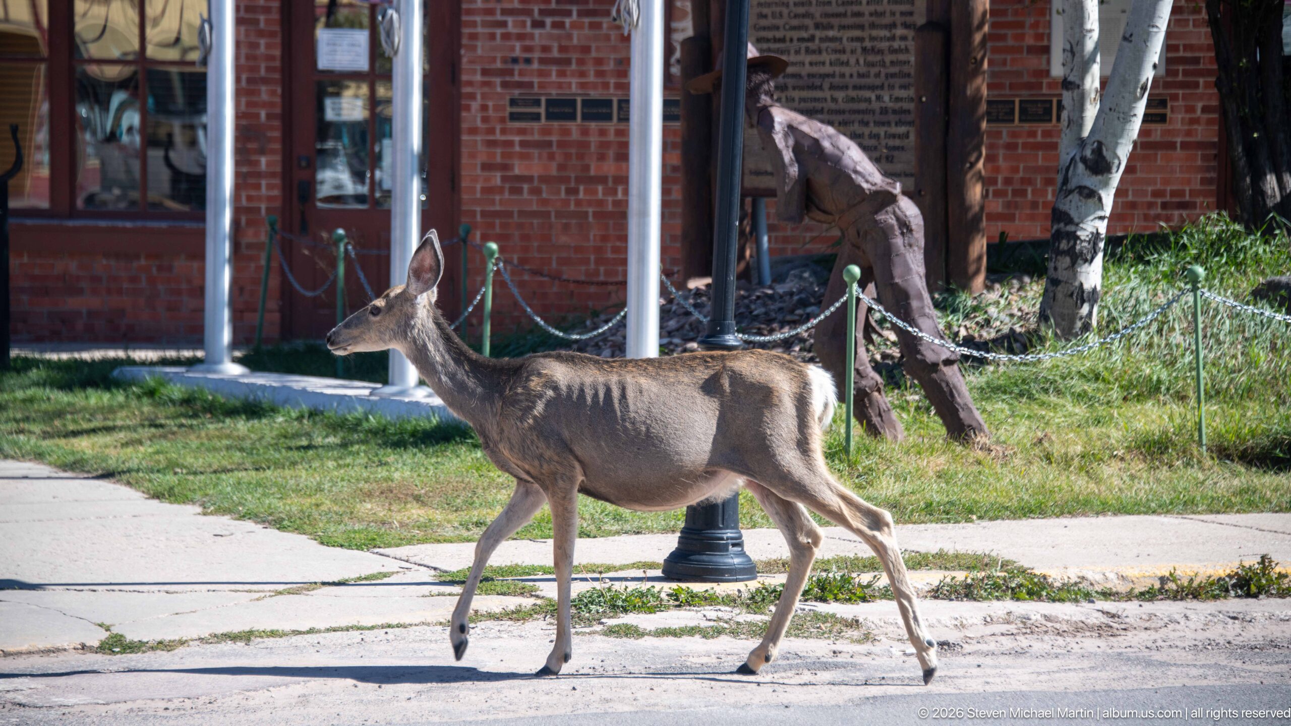
A mule deer strides across the edge of a Philipsburg street, one foreleg lifted as it passes a lamppost and grassy verge. Rustic metal figures and a brick building form the background, placing the wild animal within the same downtown setting seen in the preceding view. The side profile clearly shows the deer’s long legs, oversized ears, and gray-brown summer coat.
Caption
A mule deer strides across the edge of a Philipsburg street, one foreleg lifted as it passes a lamppost and grassy verge. Rustic metal figures and a brick building form the background, placing the wild animal within the same downtown setting seen in the preceding view. The side profile clearly shows the deer’s long legs, oversized ears, and gray-brown summer coat.

A beagle stands alert on the front seat beside the driver, looking through the windshield as the vehicle pauses in bright mountain weather. The dog’s upright posture and forward gaze give this road-trip photograph a sense of anticipation, while blue sky and wooded terrain outside connect the travel moment to the landscape surrounding Philipsburg.
Caption
A beagle stands alert on the front seat beside the driver, looking through the windshield as the vehicle pauses in bright mountain weather. The dog’s upright posture and forward gaze give this road-trip photograph a sense of anticipation, while blue sky and wooded terrain outside connect the travel moment to the landscape surrounding Philipsburg.
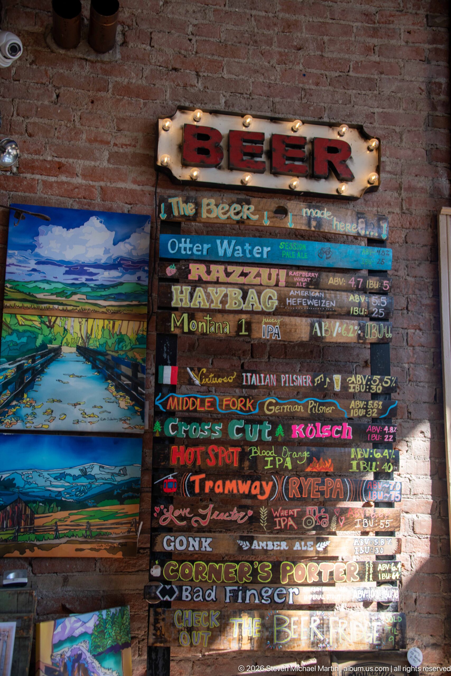
A hand-painted beer board turns a practical menu into a piece of folk-style interior decoration. Individual horizontal slats list beer names in varied lettering and colors beneath a prominent “BEER” header, while landscape paintings hang alongside. The layered signs suggest the informal visual character of a local taproom or brewery and provide a colorful counterpoint to its industrial brewing equipment.
Caption
A hand-painted beer board turns a practical menu into a piece of folk-style interior decoration. Individual horizontal slats list beer names in varied lettering and colors beneath a prominent “BEER” header, while landscape paintings hang alongside. The layered signs suggest the informal visual character of a local taproom or brewery and provide a colorful counterpoint to its industrial brewing equipment.
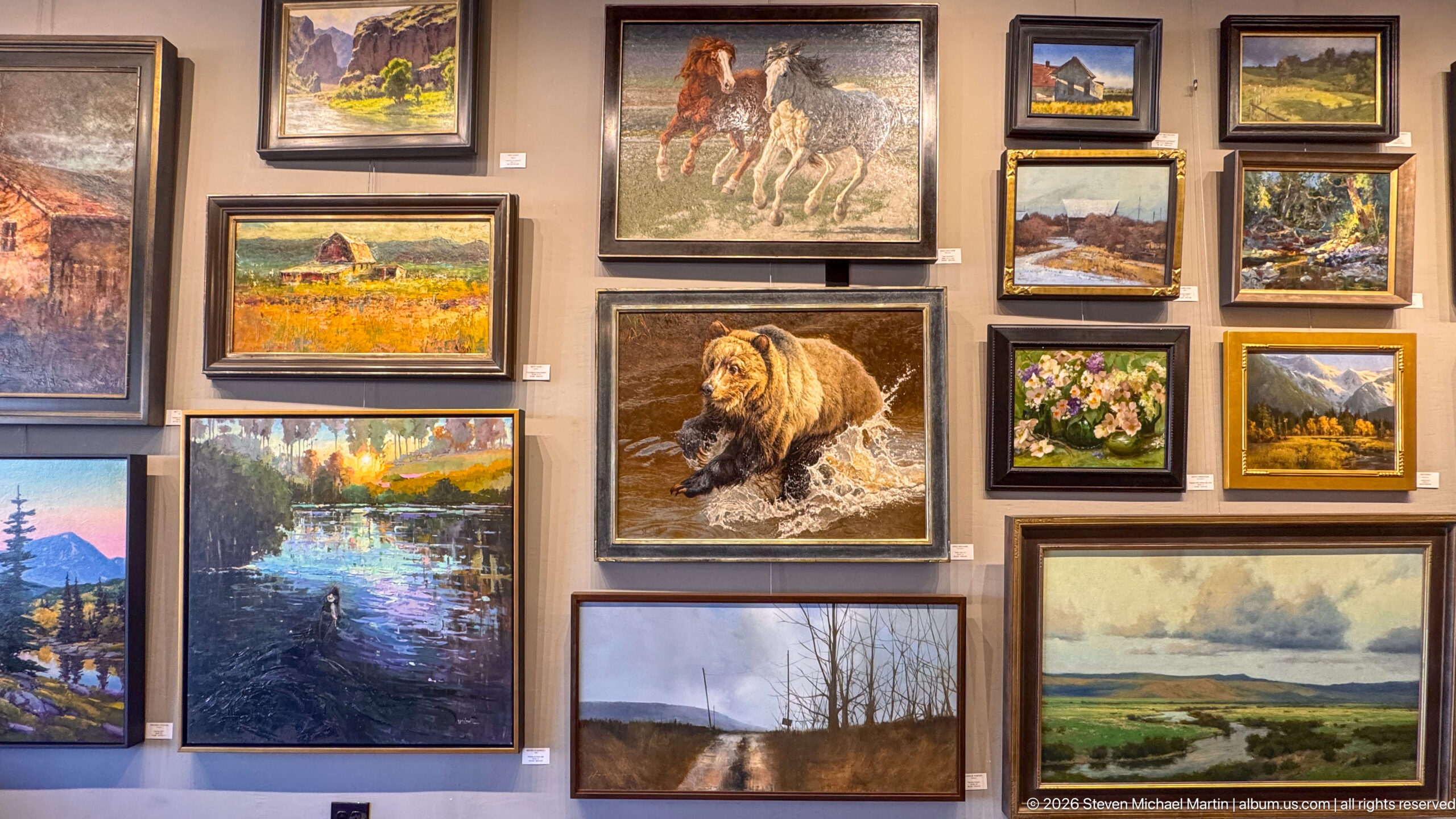
Wildlife and landscape paintings cover this gallery wall, with a large image of a bear moving through water anchoring the display beneath a painting of horses. Smaller works depict mountains, flowers, waterways, and open country. The varied subjects form a visual catalogue of the animals and landscapes associated with Montana and the broader Rocky Mountain West.
Caption
Wildlife and landscape paintings cover this gallery wall, with a large image of a bear moving through water anchoring the display beneath a painting of horses. Smaller works depict mountains, flowers, waterways, and open country. The varied subjects form a visual catalogue of the animals and landscapes associated with Montana and the broader Rocky Mountain West.
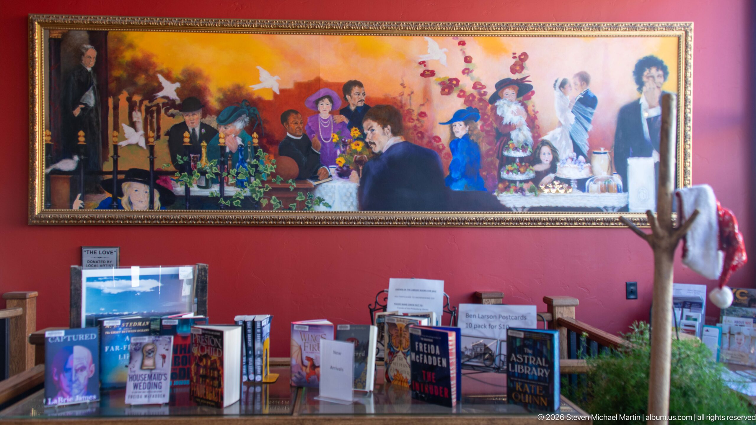
A large, colorful figurative painting dominates a red wall above a table of featured books inside the Philipsburg Public Library. The artwork’s crowded cast of characters contrasts with the orderly display of novels and nonfiction below, giving the small-town library an unexpectedly theatrical focal point. Shelving, notices, and reading material around the edges reinforce the room’s active community-library setting.
Caption
A large, colorful figurative painting dominates a red wall above a table of featured books inside the Philipsburg Public Library. The artwork’s crowded cast of characters contrasts with the orderly display of novels and nonfiction below, giving the small-town library an unexpectedly theatrical focal point. Shelving, notices, and reading material around the edges reinforce the room’s active community-library setting.
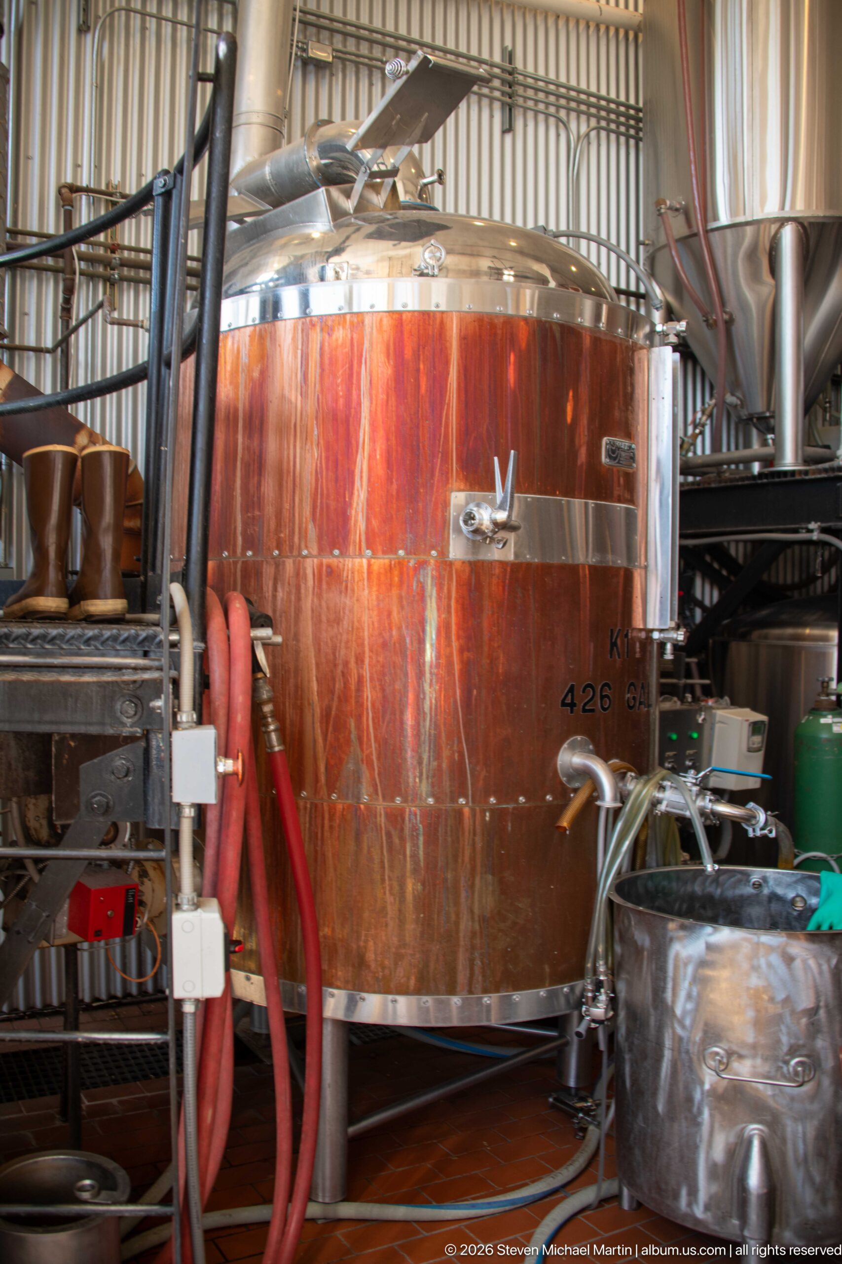
A copper-clad brewing vessel rises amid stainless-steel tanks, hoses, valves, and fittings in a working brewery interior. The polished industrial equipment illustrates small-scale contemporary production within Philipsburg’s commercial district, where modern businesses occupy a townscape shaped by earlier mining-era commerce and industry.
Caption
A copper-clad brewing vessel rises amid stainless-steel tanks, hoses, valves, and fittings in a working brewery interior. The polished industrial equipment illustrates small-scale contemporary production within Philipsburg’s commercial district, where modern businesses occupy a townscape shaped by earlier mining-era commerce and industry.
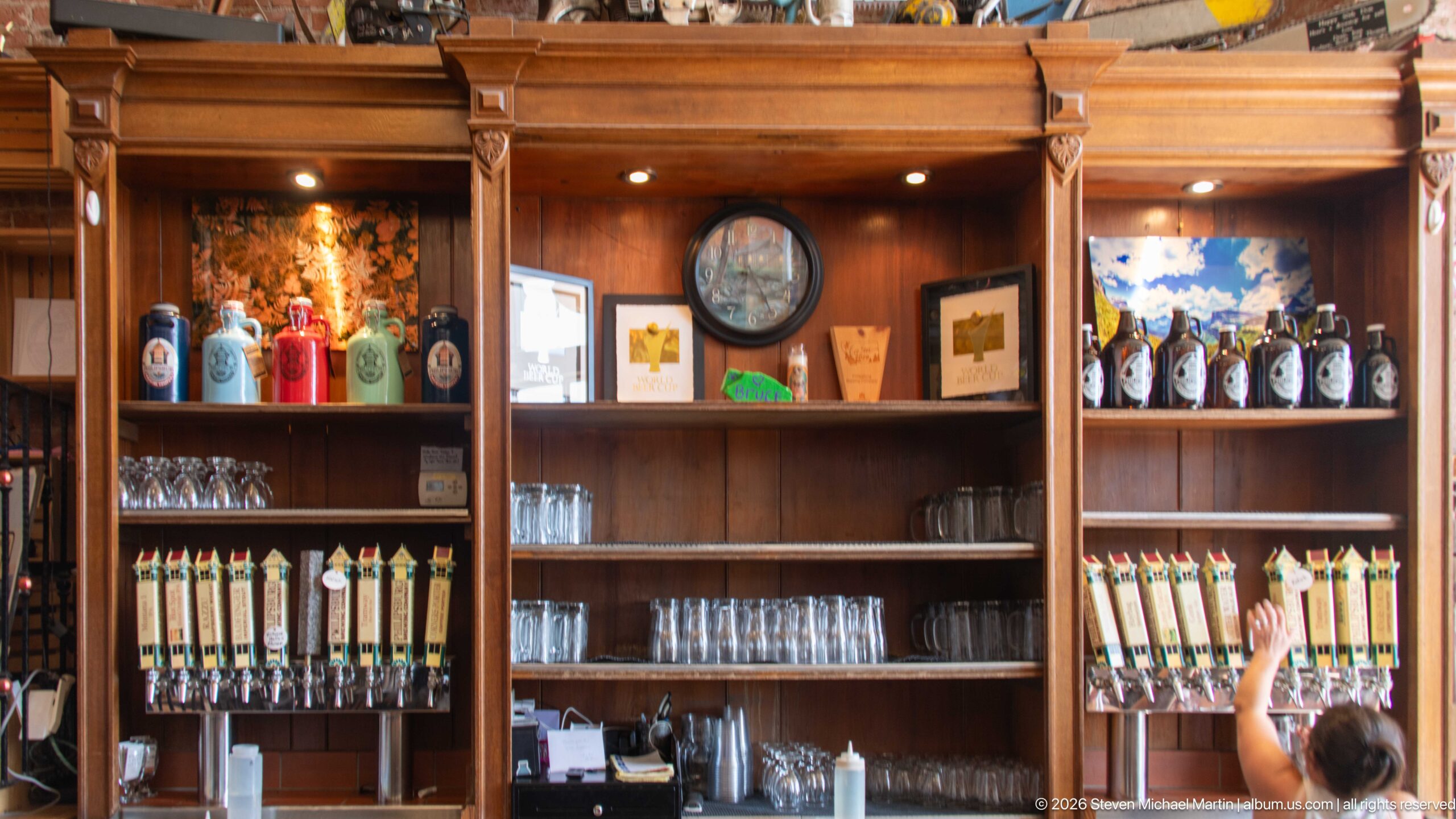
Rows of tap handles flank the wood shelving behind the bar at Philipsburg Brewing Company, with glassware arranged across the lower shelves and branded growlers or bottles displayed above. Warm woodwork gives the taproom a traditional saloon-like character while the numerous taps advertise a contemporary craft-beer operation. A staff member reaches toward the right-hand bank of taps during service.
Caption
Rows of tap handles flank the wood shelving behind the bar at Philipsburg Brewing Company, with glassware arranged across the lower shelves and branded growlers or bottles displayed above. Warm woodwork gives the taproom a traditional saloon-like character while the numerous taps advertise a contemporary craft-beer operation. A staff member reaches toward the right-hand bank of taps during service.
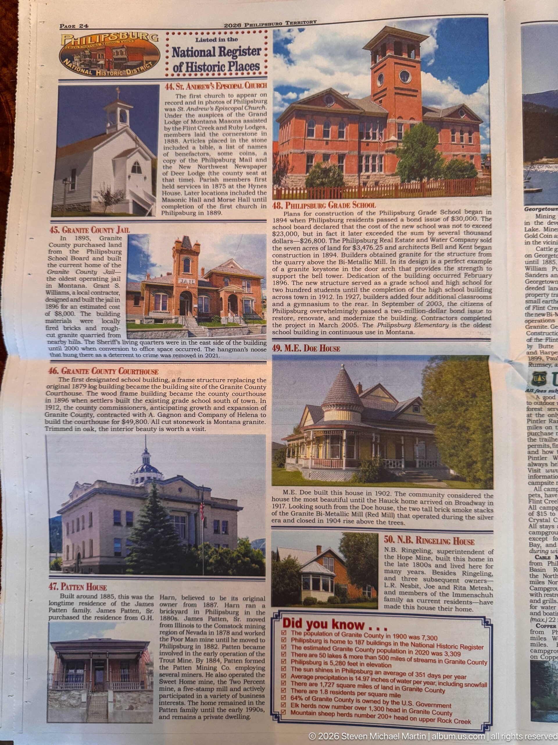
The Philipsburg Territory historic walking-tour article groups entries 44–50 around the town’s civic, educational, religious, and residential landmarks. Visible photographs include St. Andrew’s Episcopal Church, the Granite County Jail and Courthouse, the 1894 Philipsburg Grade School, and several historic houses. The page provides direct reference images for identifying these structures elsewhere in the portfolio.
Caption
The Philipsburg Territory historic walking-tour article groups entries 44–50 around the town’s civic, educational, religious, and residential landmarks. Visible photographs include St. Andrew’s Episcopal Church, the Granite County Jail and Courthouse, the 1894 Philipsburg Grade School, and several historic houses. The page provides direct reference images for identifying these structures elsewhere in the portfolio.
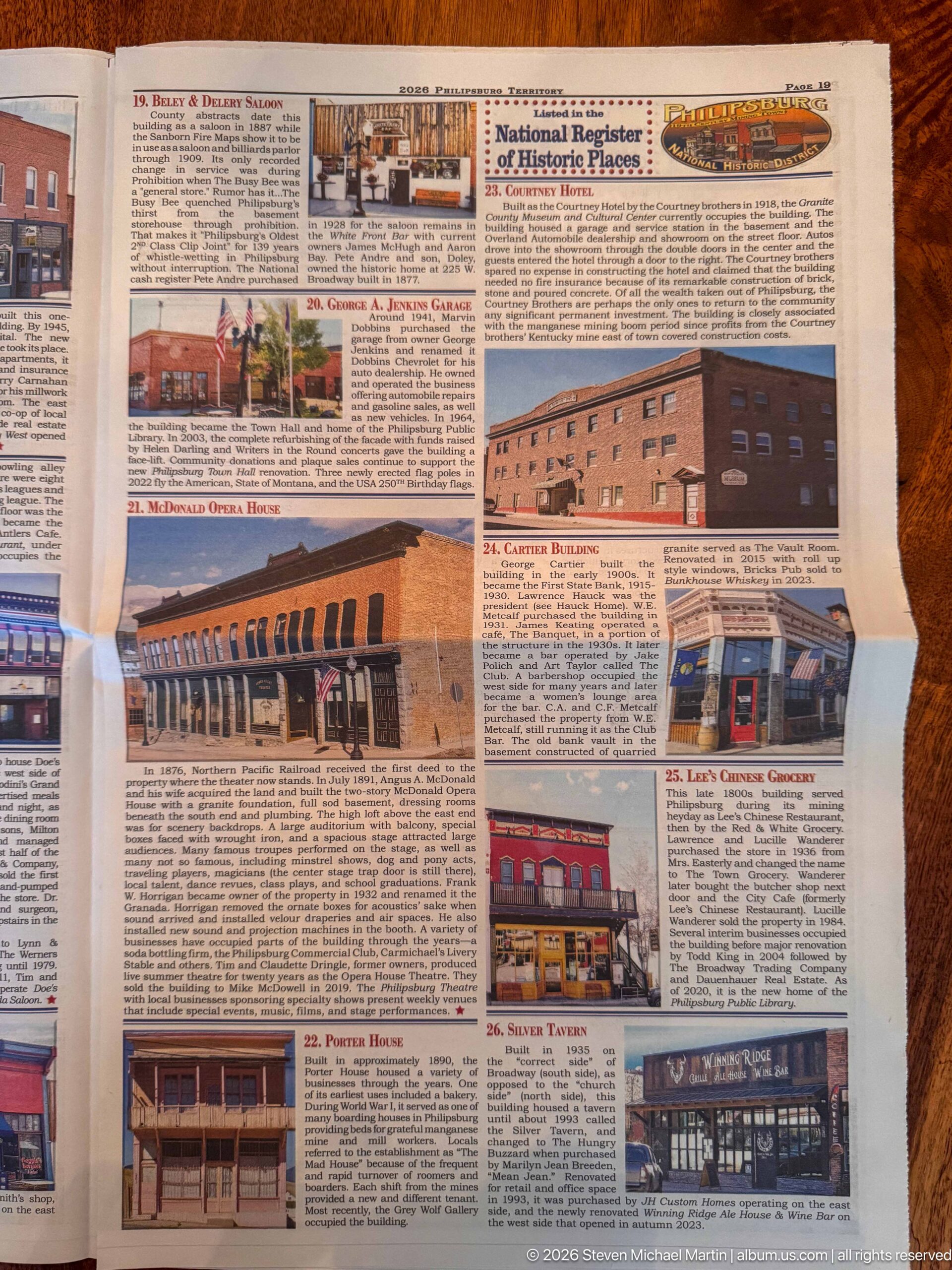
This Philipsburg Territory walking-tour page covers entries 19–26, beginning with the Beley & Delery Saloon and continuing through the George A. Jenkins Garage, McDonald Opera House, Porter House, Courtney Hotel, Carter Building, Lee’s Chinese Grocery, and Silver Tavern. The accompanying façade photographs provide a valuable visual key to some of the town’s best-known commercial buildings.
Caption
This Philipsburg Territory walking-tour page covers entries 19–26, beginning with the Beley & Delery Saloon and continuing through the George A. Jenkins Garage, McDonald Opera House, Porter House, Courtney Hotel, Carter Building, Lee’s Chinese Grocery, and Silver Tavern. The accompanying façade photographs provide a valuable visual key to some of the town’s best-known commercial buildings.
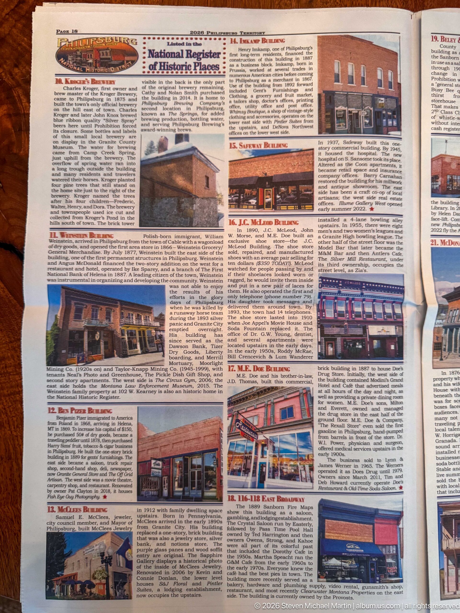
Entries 10–18 of the Philipsburg Territory walking tour trace another section of the commercial district, including Kroger’s Brewery, the Weinstein Building, B. Pizer Building, McClees Building, Inkamp Building, Safeway Building, J.C. McLeod Building, M.E. Doe Building, and 116–118 East Broadway. The photographs and descriptions establish a reference set for distinguishing neighboring brick storefronts.
Caption
Entries 10–18 of the Philipsburg Territory walking tour trace another section of the commercial district, including Kroger’s Brewery, the Weinstein Building, B. Pizer Building, McClees Building, Inkamp Building, Safeway Building, J.C. McLeod Building, M.E. Doe Building, and 116–118 East Broadway. The photographs and descriptions establish a reference set for distinguishing neighboring brick storefronts.
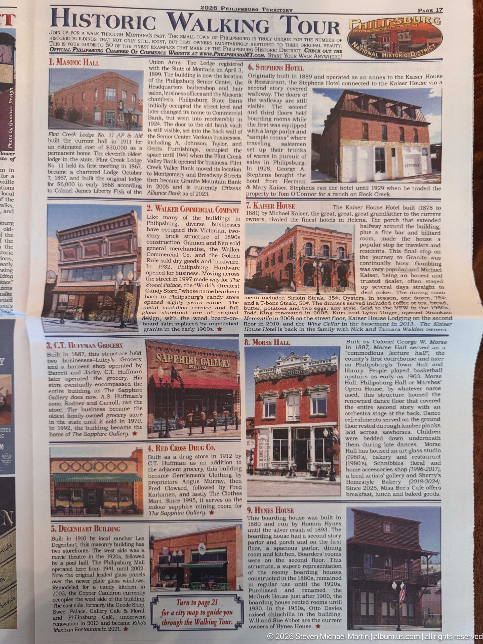
The opening page of the Philipsburg historic walking tour introduces entries 1–9: Masonic Hall, Walker Commercial Company, C.T. Huffman Grocery, Red Cross Drug Co., Degenhart Building, Stephens Hotel, Kaiser House, Morse Hall, and Hynes House. Its reference photographs establish the appearance of several prominent downtown façades, including buildings that now house contemporary businesses.
Caption
The opening page of the Philipsburg historic walking tour introduces entries 1–9: Masonic Hall, Walker Commercial Company, C.T. Huffman Grocery, Red Cross Drug Co., Degenhart Building, Stephens Hotel, Kaiser House, Morse Hall, and Hynes House. Its reference photographs establish the appearance of several prominent downtown façades, including buildings that now house contemporary businesses.
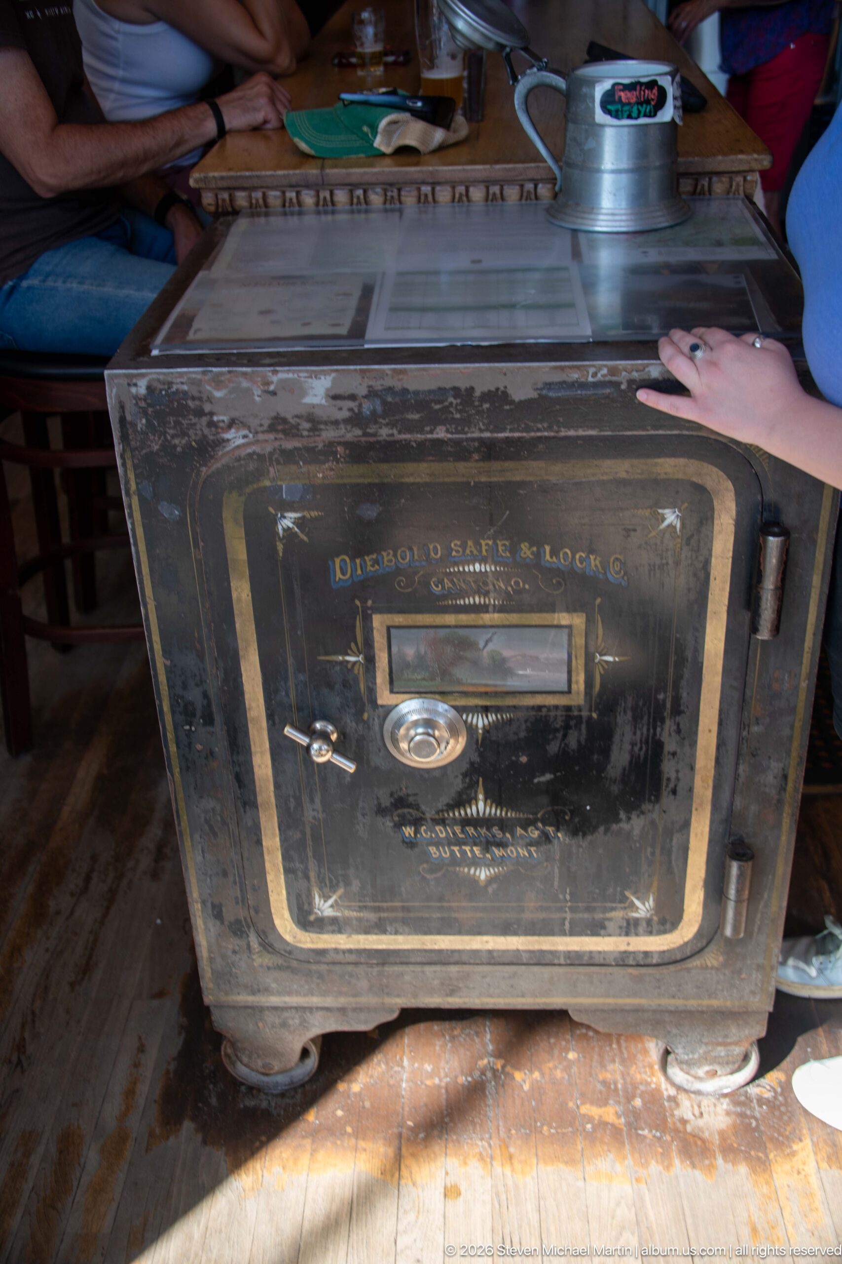
A heavy floor safe bearing the name Diebold Safe & Lock Co. survives as a substantial piece of commercial equipment. Its painted door, combination dial, handle, thick hinges, and worn metal surface convey the physical security once required for cash, records, and valuables in western businesses, while the surrounding wood floor reinforces its historic interior setting.
Caption
A heavy floor safe bearing the name Diebold Safe & Lock Co. survives as a substantial piece of commercial equipment. Its painted door, combination dial, handle, thick hinges, and worn metal surface convey the physical security once required for cash, records, and valuables in western businesses, while the surrounding wood floor reinforces its historic interior setting.
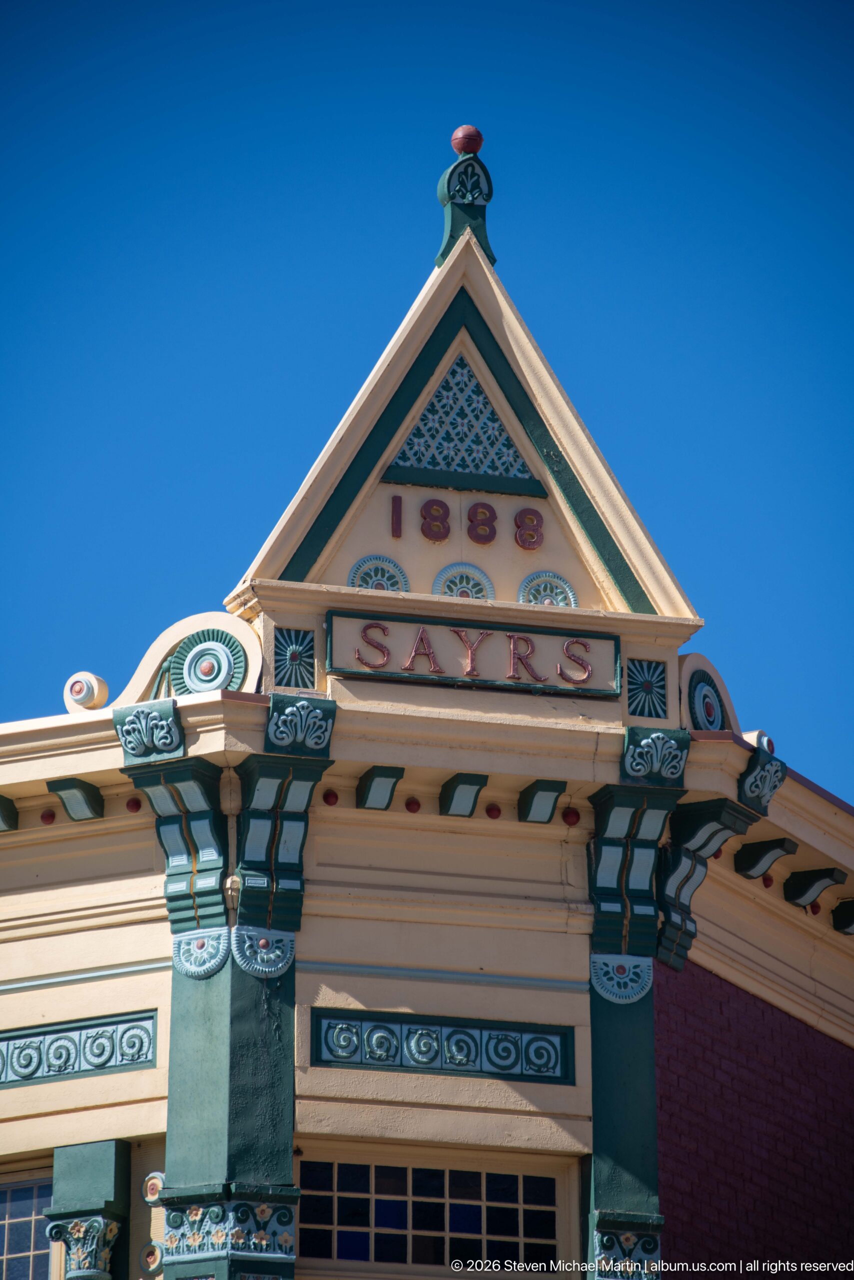
An exuberantly painted historic façade rises against a cloudless blue sky, concentrating ornament in a triangular pediment and projecting cornice. Scrollwork, patterned panels, brackets, rosettes, and contrasting cream and green paint turn the upper story into a richly modeled architectural display. The close viewpoint isolates the craftsmanship that gives Philipsburg’s commercial streetscape much of its late-nineteenth-century character.
Caption
An exuberantly painted historic façade rises against a cloudless blue sky, concentrating ornament in a triangular pediment and projecting cornice. Scrollwork, patterned panels, brackets, rosettes, and contrasting cream and green paint turn the upper story into a richly modeled architectural display. The close viewpoint isolates the craftsmanship that gives Philipsburg’s commercial streetscape much of its late-nineteenth-century character.
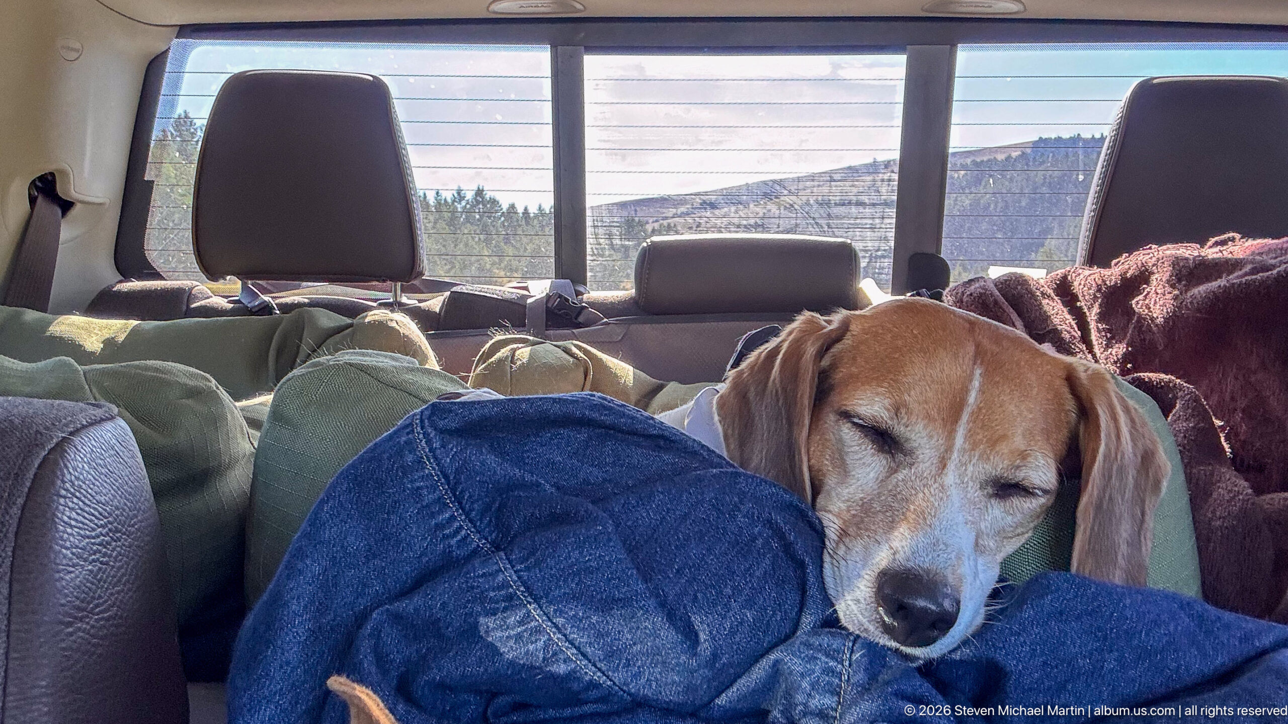
A beagle settles into a pile of blankets in the rear of the vehicle during the Philipsburg outing, eyes nearly closed as sunlight enters through the back window. The quiet travel moment contrasts with the architectural documentation elsewhere in the portfolio and records the practical rhythm of exploring western Montana by road with dogs along for the journey.
Caption
A beagle settles into a pile of blankets in the rear of the vehicle during the Philipsburg outing, eyes nearly closed as sunlight enters through the back window. The quiet travel moment contrasts with the architectural documentation elsewhere in the portfolio and records the practical rhythm of exploring western Montana by road with dogs along for the journey.

A driver holds a small beagle upright beside the steering wheel while paused during the trip through the Philipsburg area. Bright blue sky and forested slopes appear through the windshield and side window, placing the intimate travel scene within the mountainous western Montana landscape that surrounds the historic town.
Caption
A driver holds a small beagle upright beside the steering wheel while paused during the trip through the Philipsburg area. Bright blue sky and forested slopes appear through the windshield and side window, placing the intimate travel scene within the mountainous western Montana landscape that surrounds the historic town.

A dense gallery wall presents contemporary western art in a variety of sizes and frames. The central painting shows pack animals and riders moving through glowing woodland light, surrounded by mountain landscapes and other regional scenes. The arrangement reflects the continuing importance of western scenery, wildlife, and outdoor culture in Philipsburg’s present-day commercial and artistic life.
Caption
A dense gallery wall presents contemporary western art in a variety of sizes and frames. The central painting shows pack animals and riders moving through glowing woodland light, surrounded by mountain landscapes and other regional scenes. The arrangement reflects the continuing importance of western scenery, wildlife, and outdoor culture in Philipsburg’s present-day commercial and artistic life.
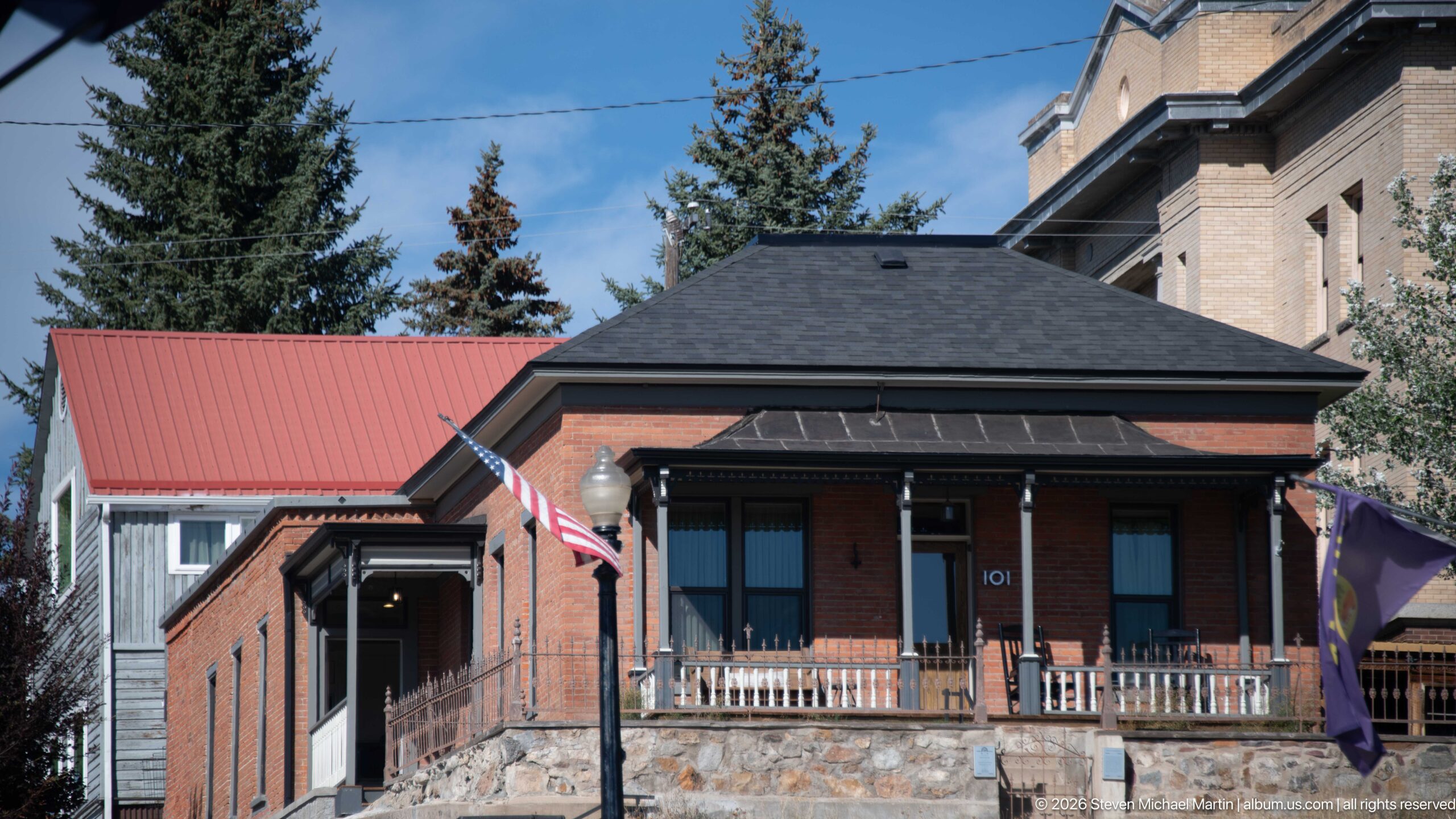
A compact historic brick building stands above a stone retaining wall, its shaded porch supported by slender posts and enclosed with a simple wooden balustrade. The street number 101 is visible beside the entrance. A dark hipped roof, tall windows, and restrained masonry give the structure a domestic scale despite the larger commercial and institutional buildings rising nearby.
Caption
A compact historic brick building stands above a stone retaining wall, its shaded porch supported by slender posts and enclosed with a simple wooden balustrade. The street number 101 is visible beside the entrance. A dark hipped roof, tall windows, and restrained masonry give the structure a domestic scale despite the larger commercial and institutional buildings rising nearby.
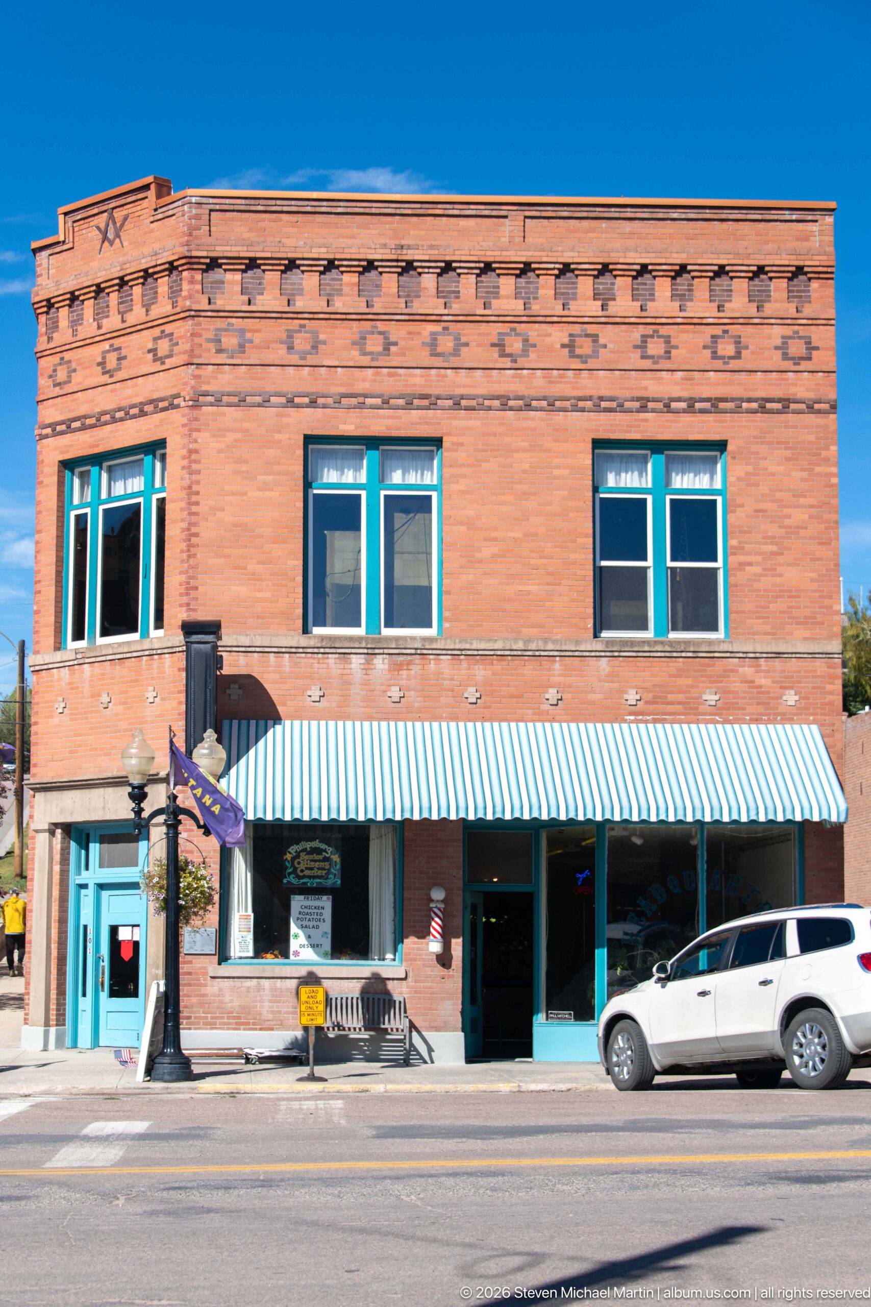
A two-story brick commercial block presents a restrained but carefully detailed façade to Philipsburg’s main street. Decorative brick corbelling runs beneath the roofline, while evenly spaced upper windows sit above a broad striped awning and remodeled ground-floor storefronts. The building’s simple rectangular mass and masonry ornament typify the durable commercial architecture that anchors the historic downtown.
Caption
A two-story brick commercial block presents a restrained but carefully detailed façade to Philipsburg’s main street. Decorative brick corbelling runs beneath the roofline, while evenly spaced upper windows sit above a broad striped awning and remodeled ground-floor storefronts. The building’s simple rectangular mass and masonry ornament typify the durable commercial architecture that anchors the historic downtown.
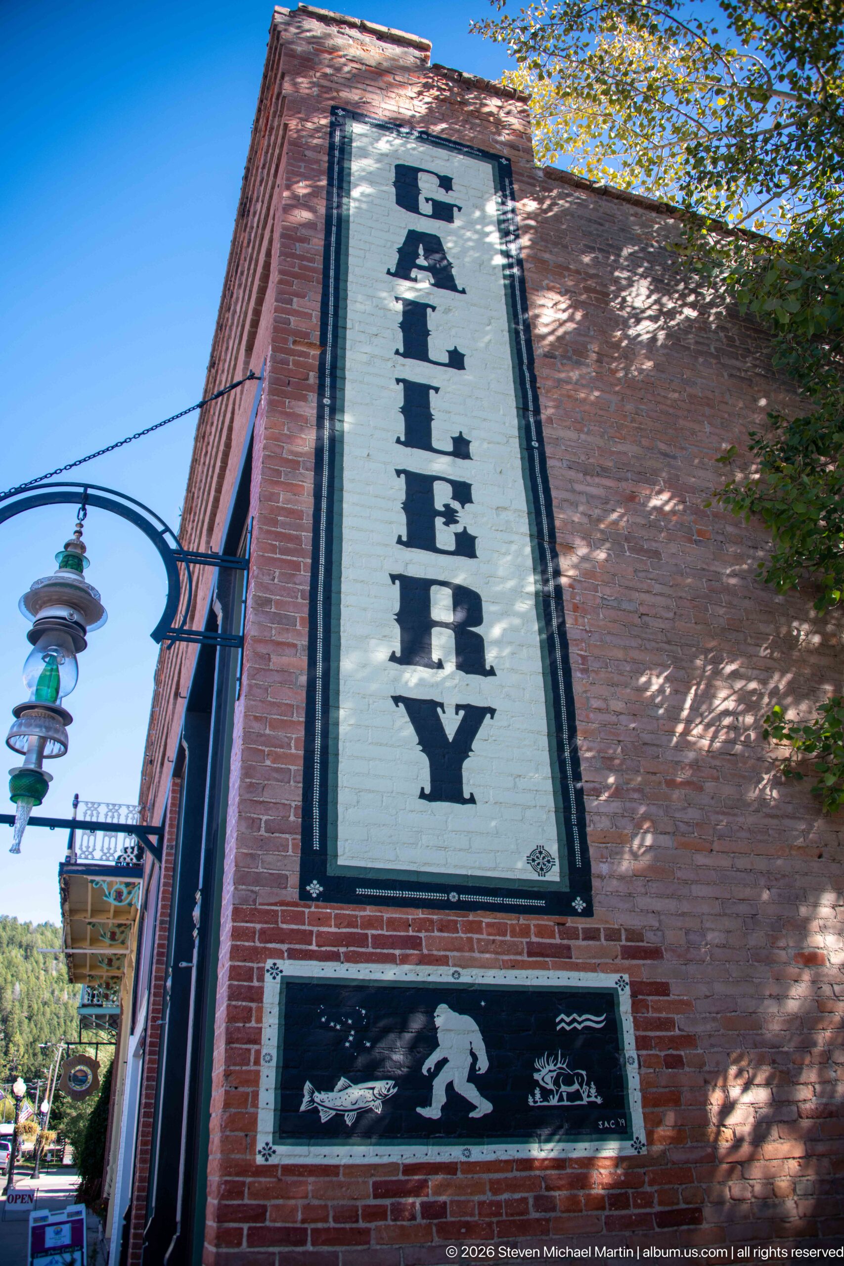
A tall painted “ALLEYWAY” sign occupies the side wall of a red-brick downtown building, transforming an otherwise utilitarian elevation into a conspicuous wayfinding feature. Below it, a black panel carries white silhouettes and smaller graphics, while decorative street fixtures project into the view. The oblique angle emphasizes the narrow urban edge between Philipsburg’s storefronts and side passages.
Caption
A tall painted “ALLEYWAY” sign occupies the side wall of a red-brick downtown building, transforming an otherwise utilitarian elevation into a conspicuous wayfinding feature. Below it, a black panel carries white silhouettes and smaller graphics, while decorative street fixtures project into the view. The oblique angle emphasizes the narrow urban edge between Philipsburg’s storefronts and side passages.
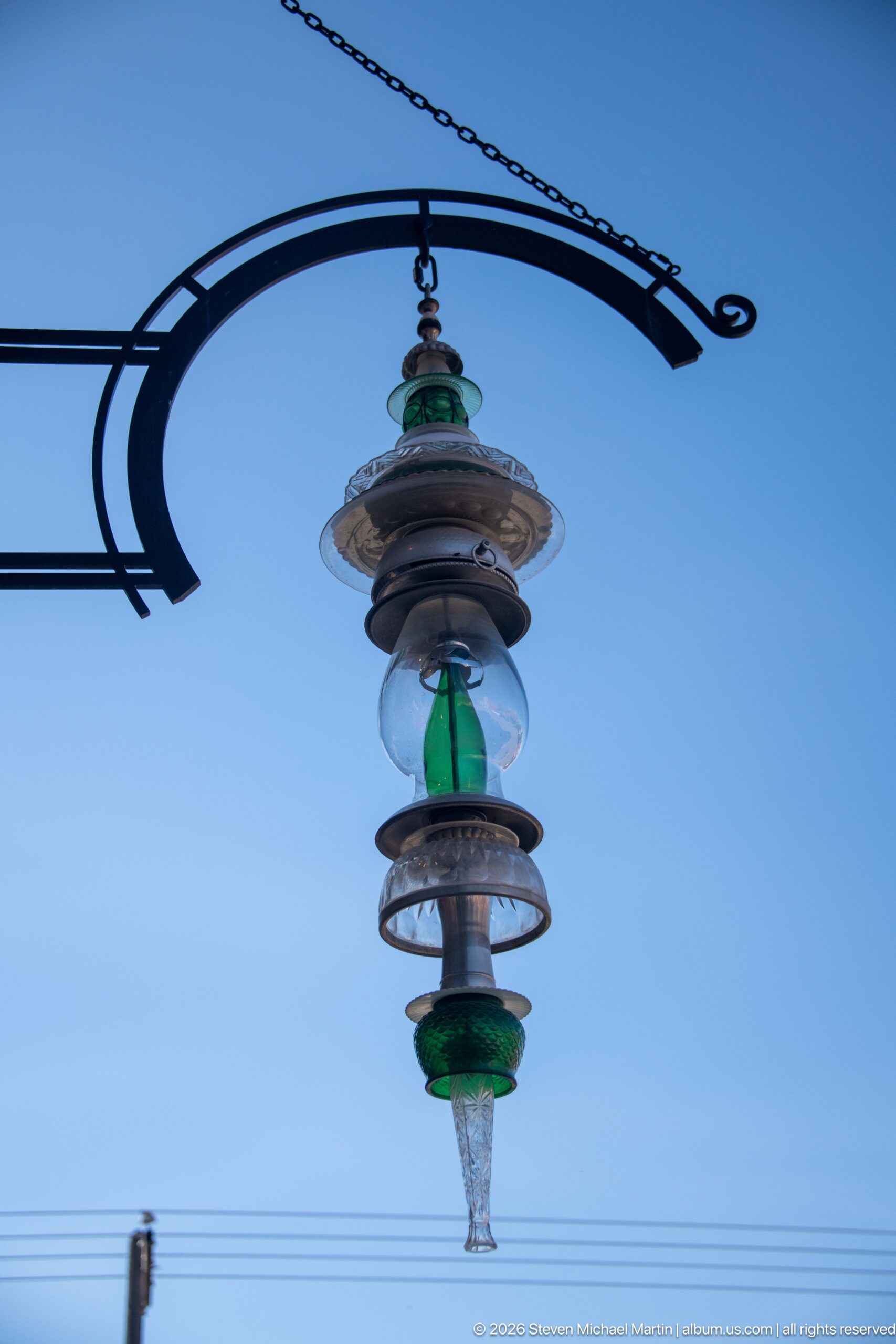
A decorative hanging light is suspended from a sweeping black metal bracket against the clear blue sky. Stacked circular metal shades surround green glass elements, with a pointed clear-glass pendant at the bottom. The unusual fixture functions as both street furniture and visual ornament, contributing a handcrafted character to Philipsburg’s downtown pedestrian environment.
Caption
A decorative hanging light is suspended from a sweeping black metal bracket against the clear blue sky. Stacked circular metal shades surround green glass elements, with a pointed clear-glass pendant at the bottom. The unusual fixture functions as both street furniture and visual ornament, contributing a handcrafted character to Philipsburg’s downtown pedestrian environment.
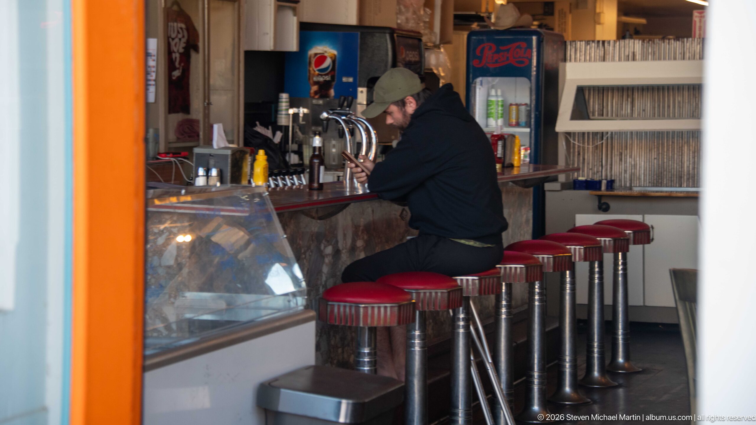
Chrome stools with red seats line a compact counter inside a Philipsburg business, where beverage taps, coolers, and service equipment fill the work area behind them. The polished metal bases and round upholstered seats evoke a classic lunch-counter aesthetic, while the active worker and modern appliances show the space functioning as a contemporary commercial interior.
Caption
Chrome stools with red seats line a compact counter inside a Philipsburg business, where beverage taps, coolers, and service equipment fill the work area behind them. The polished metal bases and round upholstered seats evoke a classic lunch-counter aesthetic, while the active worker and modern appliances show the space functioning as a contemporary commercial interior.

Projecting signs line the sidewalk near the historic McClees Building, whose walking-tour entry identifies SAJ Floral on the lower level and Pinter Suites in the upstairs lodging space. The nearest round SAJ Sage sign advertises the contemporary lifestyle and floral boutique, while additional signs, a traditional streetlamp, flags, and distant hills layer modern commerce onto Philipsburg’s historic district.
Caption
Projecting signs line the sidewalk near the historic McClees Building, whose walking-tour entry identifies SAJ Floral on the lower level and Pinter Suites in the upstairs lodging space. The nearest round SAJ Sage sign advertises the contemporary lifestyle and floral boutique, while additional signs, a traditional streetlamp, flags, and distant hills layer modern commerce onto Philipsburg’s historic district.
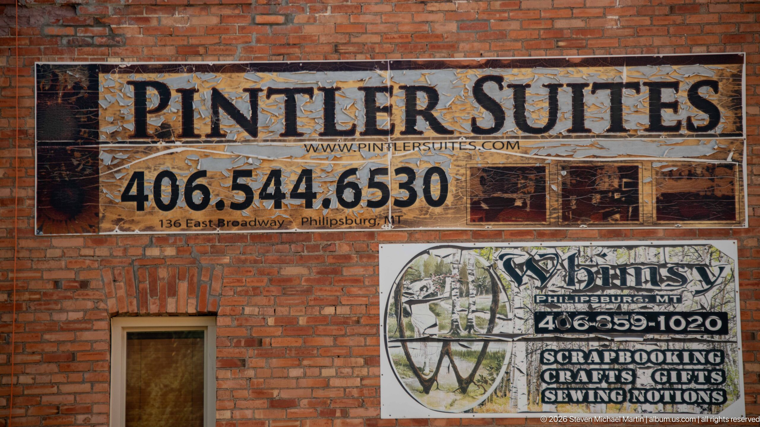
A weathered wall advertisement for Pinter Suites gives an address at 136 East Broadway, with a smaller Whimsy sign below. The supplied Philipsburg walking-tour article identifies Pinter Suites as the upstairs lodging use of the historic McClees Building and SAJ Floral as a lower-level occupant, connecting this contemporary signage with one of the district’s documented nineteenth-century commercial properties.
Caption
A weathered wall advertisement for Pinter Suites gives an address at 136 East Broadway, with a smaller Whimsy sign below. The supplied Philipsburg walking-tour article identifies Pinter Suites as the upstairs lodging use of the historic McClees Building and SAJ Floral as a lower-level occupant, connecting this contemporary signage with one of the district’s documented nineteenth-century commercial properties.
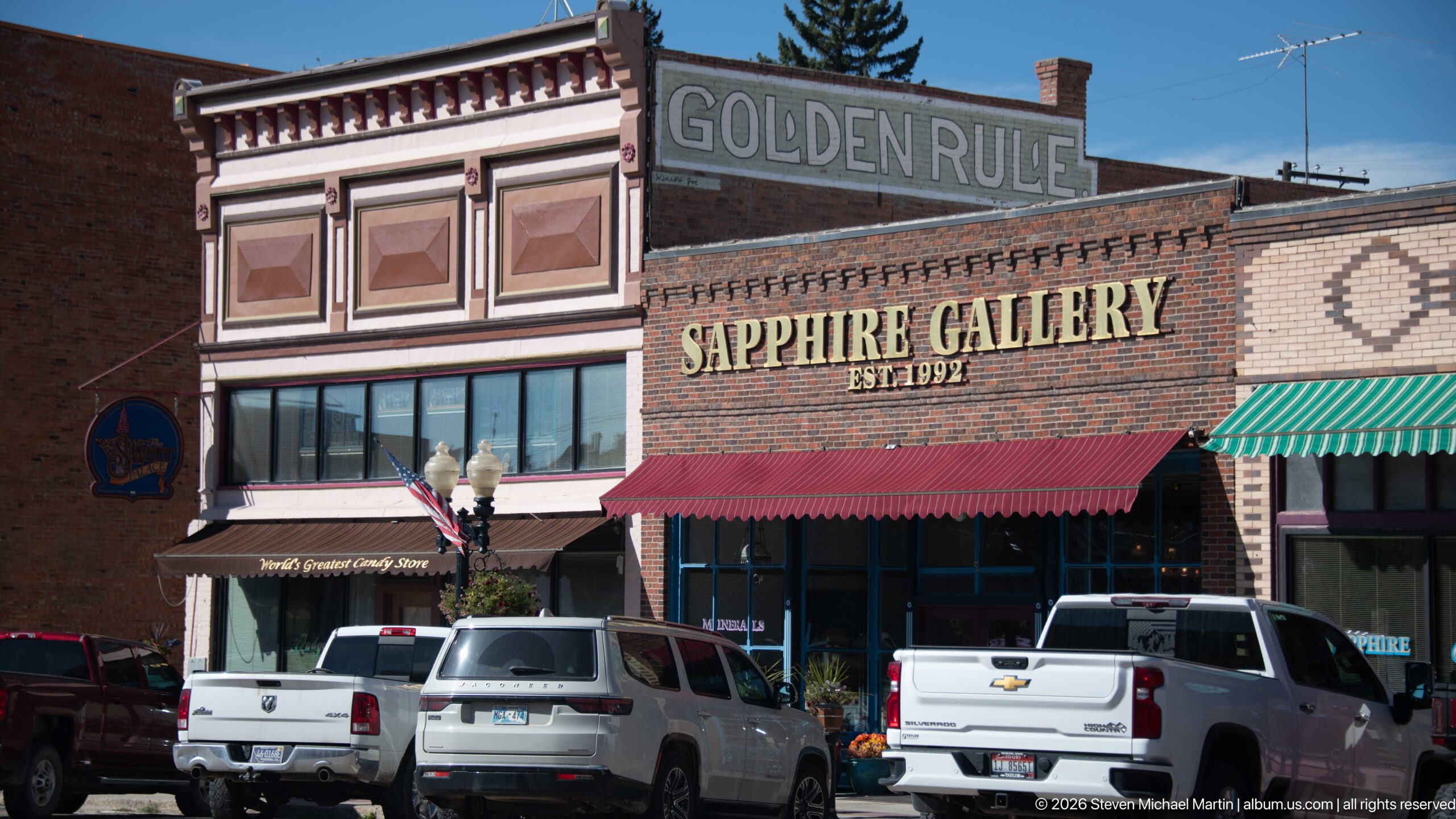
Two documented historic storefronts stand side by side: the ornate former Walker Commercial Company building at left and the former C.T. Huffman Grocery building at right, identified in the supplied walking-tour article as the home of the Sapphire Gallery. The surviving “GOLDEN RULE” and “SAPPHIRE GALLERY” lettering, decorative panels, brickwork, awnings, and broad display windows preserve the block’s layered commercial history.
Caption
Two documented historic storefronts stand side by side: the ornate former Walker Commercial Company building at left and the former C.T. Huffman Grocery building at right, identified in the supplied walking-tour article as the home of the Sapphire Gallery. The surviving “GOLDEN RULE” and “SAPPHIRE GALLERY” lettering, decorative panels, brickwork, awnings, and broad display windows preserve the block’s layered commercial history.
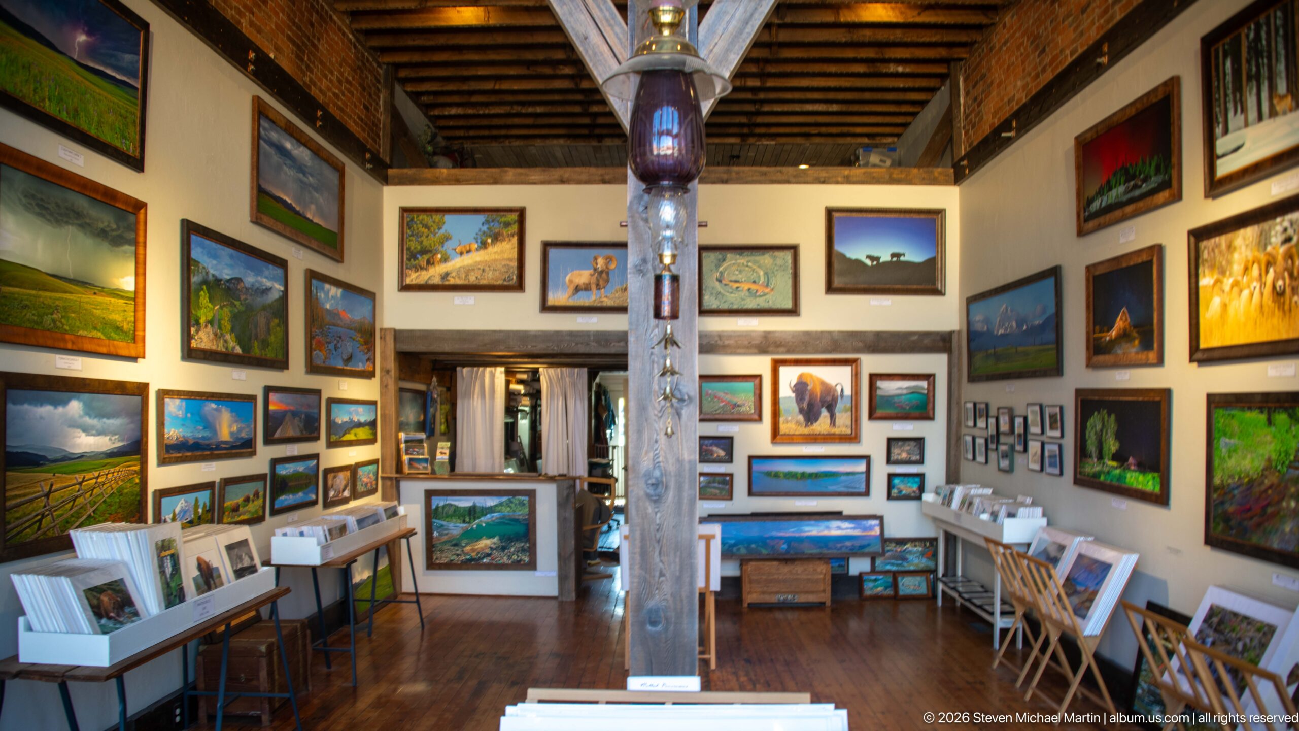
A narrow gallery interior is densely hung with paintings of mountains, wildlife, ranch country, and western landscapes. Artwork extends from eye level nearly to the exposed-beam ceiling, while additional framed pieces rest on tables and easels below. A central metal column and polished wood floor lead the eye toward a rear doorway, giving the room the intimate scale of a downtown storefront gallery.
Caption
A narrow gallery interior is densely hung with paintings of mountains, wildlife, ranch country, and western landscapes. Artwork extends from eye level nearly to the exposed-beam ceiling, while additional framed pieces rest on tables and easels below. A central metal column and polished wood floor lead the eye toward a rear doorway, giving the room the intimate scale of a downtown storefront gallery.
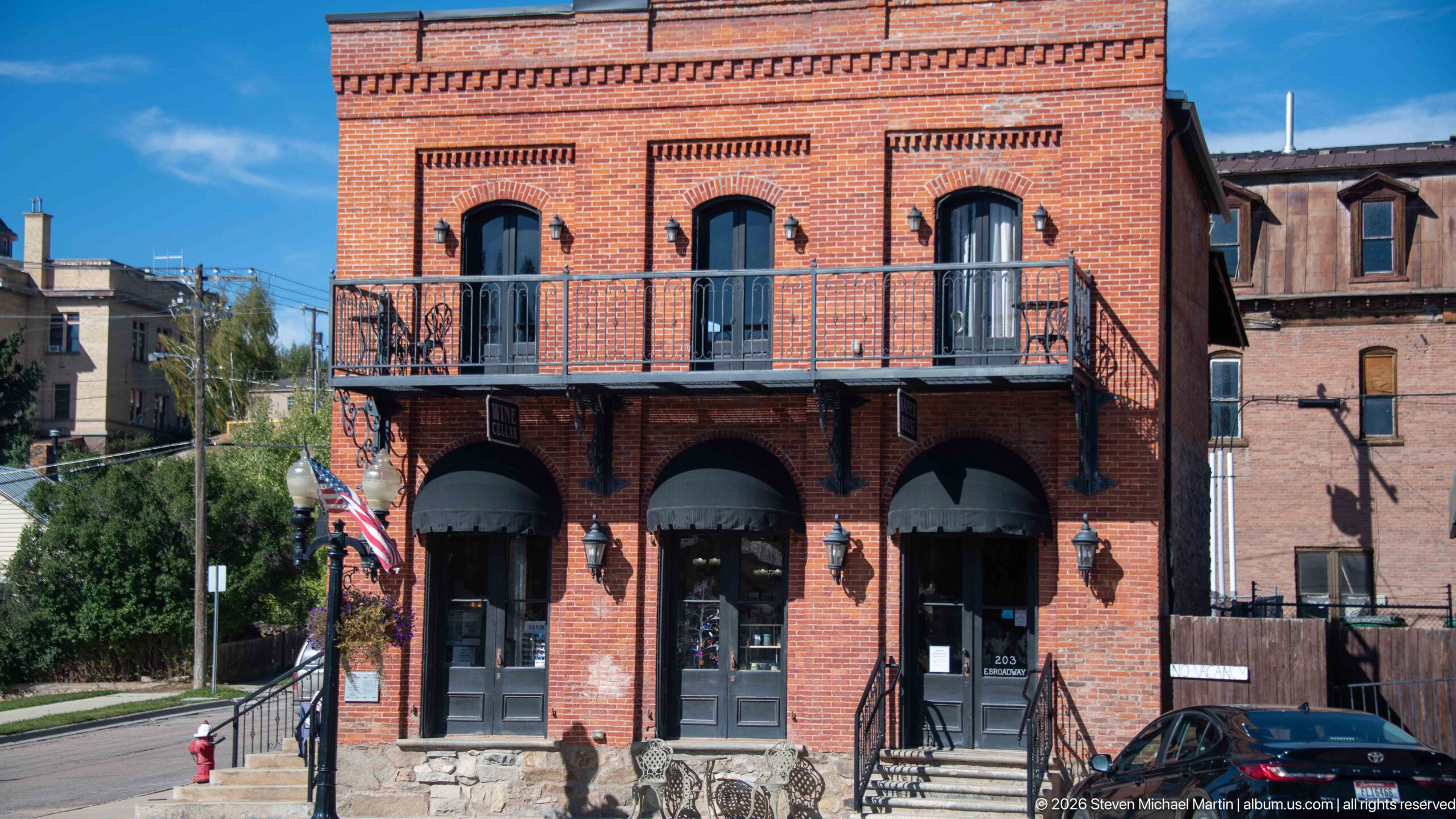
A two-story red-brick building faces the street with three broad arched ground-floor bays and a slender iron balcony spanning the upper story. Tall second-floor openings are capped by decorative brick arches, while stone at the base adds visual weight. The symmetrical façade and surviving masonry details make this one of the more distinctive historic commercial buildings in the photographed streetscape.
Caption
A two-story red-brick building faces the street with three broad arched ground-floor bays and a slender iron balcony spanning the upper story. Tall second-floor openings are capped by decorative brick arches, while stone at the base adds visual weight. The symmetrical façade and surviving masonry details make this one of the more distinctive historic commercial buildings in the photographed streetscape.
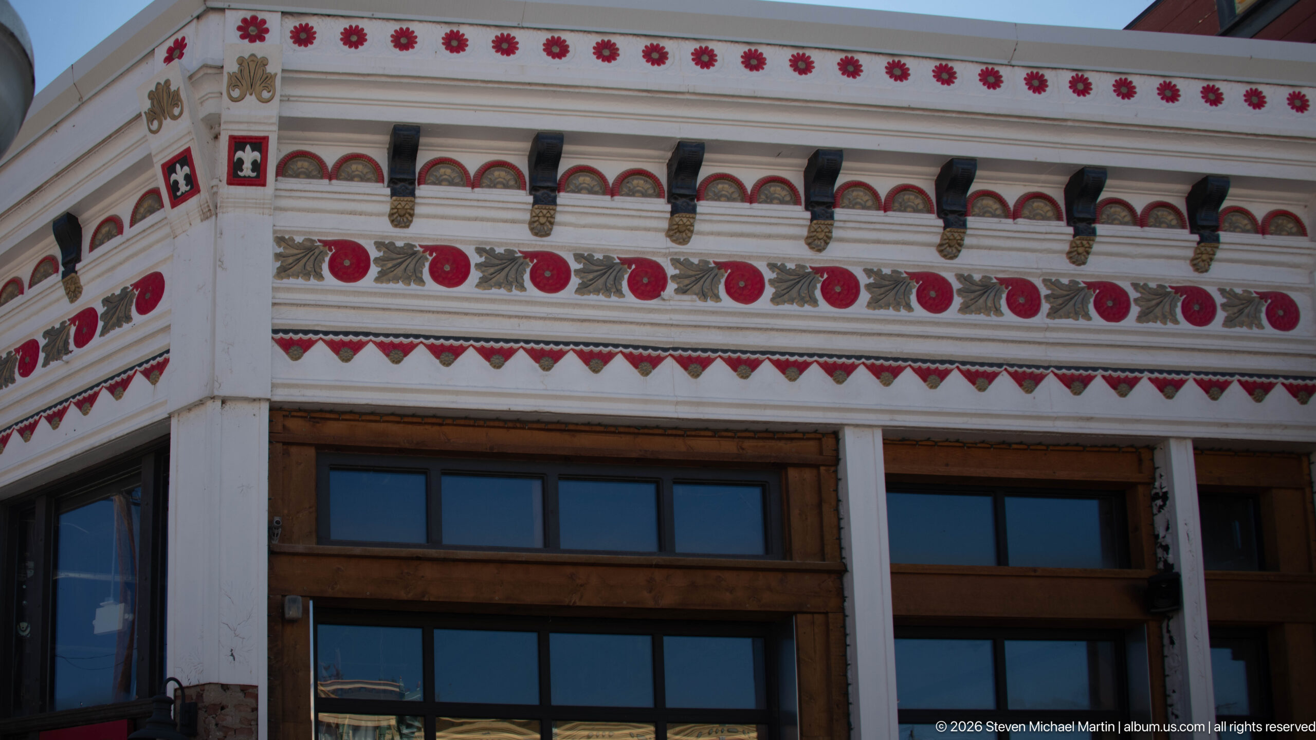
Painted ornament on the historic J.C. McLeod Building fills this close architectural study. The supplied Philipsburg walking-tour article identifies the 1890 building and illustrates the same distinctive façade, with red circular motifs, dark projecting brackets, patterned bands, and elaborate polychrome trim. The tight view isolates the exuberant decoration that distinguishes the former shoe-store building from its more restrained brick neighbors.
Caption
Painted ornament on the historic J.C. McLeod Building fills this close architectural study. The supplied Philipsburg walking-tour article identifies the 1890 building and illustrates the same distinctive façade, with red circular motifs, dark projecting brackets, patterned bands, and elaborate polychrome trim. The tight view isolates the exuberant decoration that distinguishes the former shoe-store building from its more restrained brick neighbors.
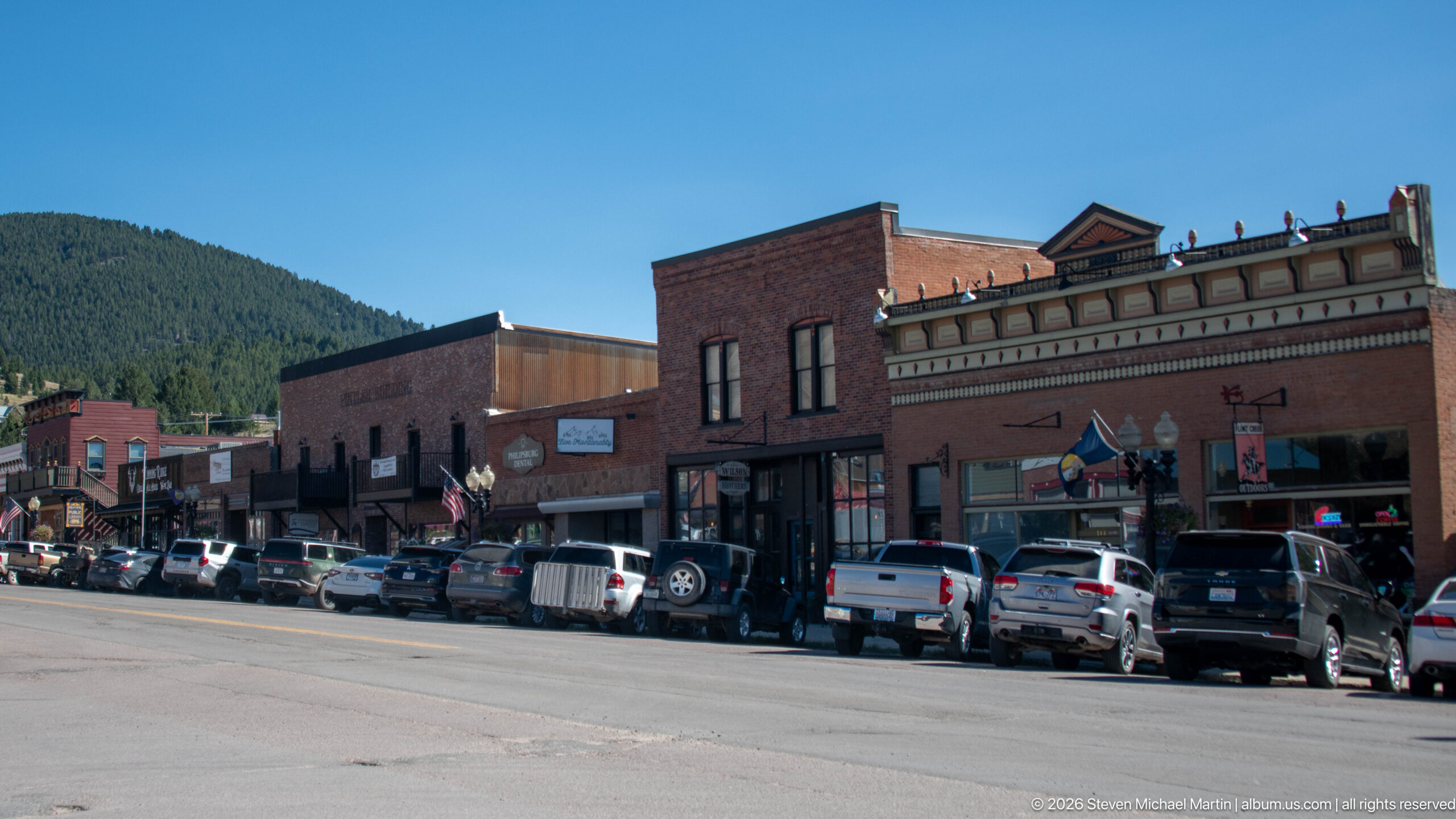
A broad view along Philipsburg’s historic commercial district shows a nearly continuous line of nineteenth- and early-twentieth-century storefronts beneath a forested mountain slope. The supplied walking-tour article documents many of these East Broadway properties individually, helping distinguish the surviving business blocks within the larger streetscape. Brick façades, decorative cornices, signs, awnings, and curbside vehicles show the district functioning as an active town center.
Caption
A broad view along Philipsburg’s historic commercial district shows a nearly continuous line of nineteenth- and early-twentieth-century storefronts beneath a forested mountain slope. The supplied walking-tour article documents many of these East Broadway properties individually, helping distinguish the surviving business blocks within the larger streetscape. Brick façades, decorative cornices, signs, awnings, and curbside vehicles show the district functioning as an active town center.
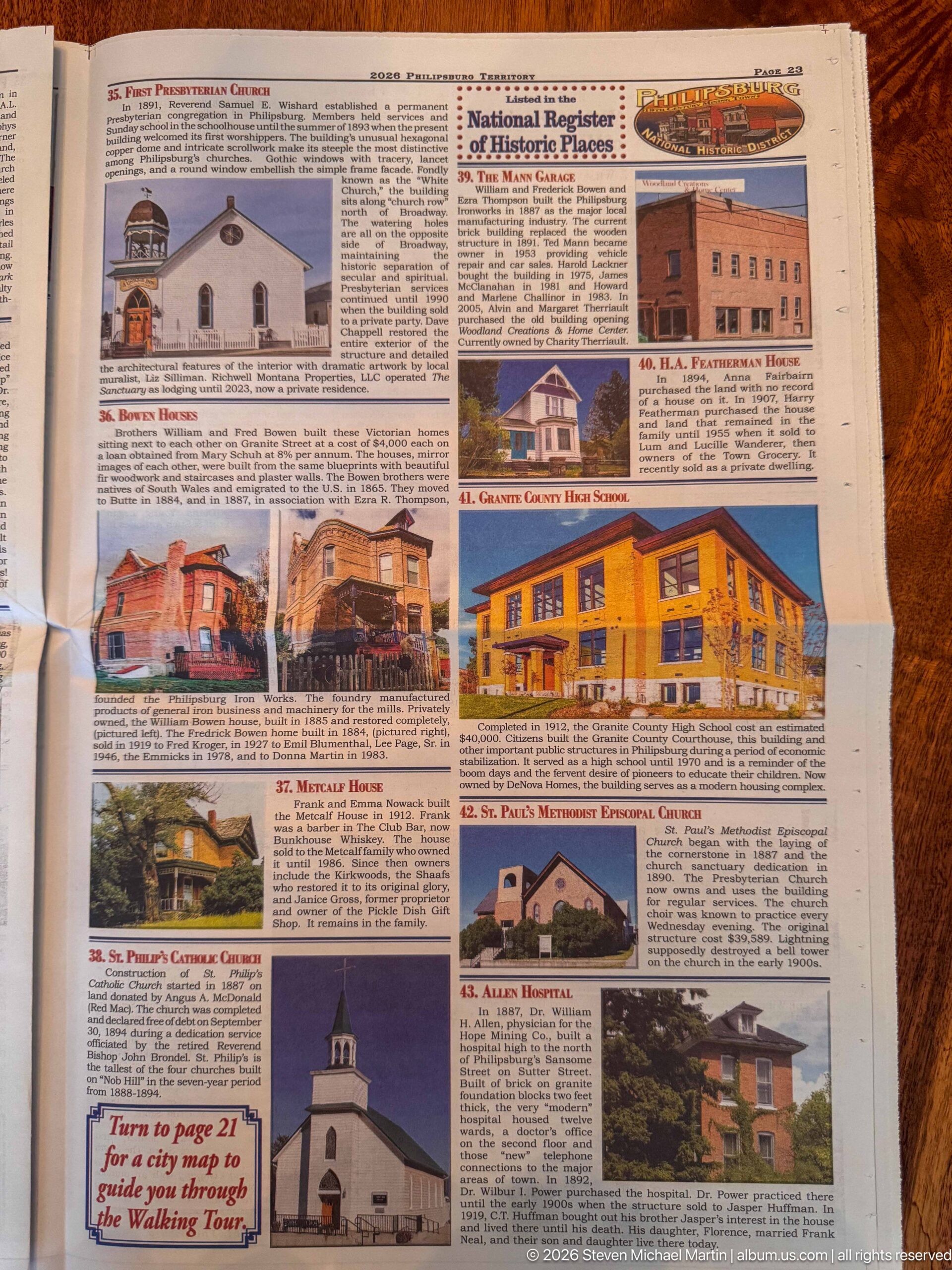
This page of the Philipsburg historic walking-tour guide focuses on larger community landmarks, including churches, hotels, and public or institutional buildings. Photographs of substantial masonry and wood-frame structures accompany numbered entries, broadening the architectural story beyond downtown storefronts and illustrating the civic, religious, and hospitality institutions that developed alongside the mining economy.
Caption
This page of the Philipsburg historic walking-tour guide focuses on larger community landmarks, including churches, hotels, and public or institutional buildings. Photographs of substantial masonry and wood-frame structures accompany numbered entries, broadening the architectural story beyond downtown storefronts and illustrating the civic, religious, and hospitality institutions that developed alongside the mining economy.
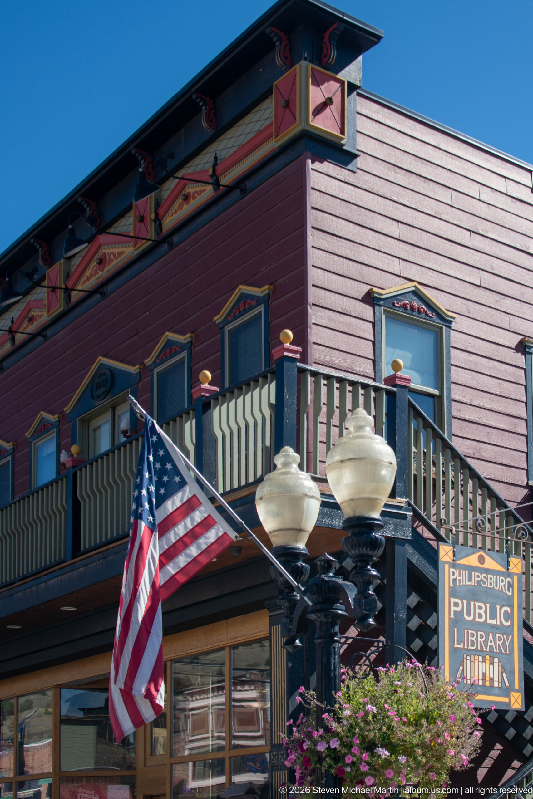
A broad second-story balcony wraps the corner of the wood-frame building now marked by a PHILIPSBURG PUBLIC LIBRARY sign. Painted brackets, patterned window hoods, decorative panels, and a deep projecting cornice give the upper story a lively, handcrafted appearance. An American flag and traditional streetlamps frame the corner, while the library use demonstrates the continuing adaptation of historic downtown buildings for community purposes.
Caption
A broad second-story balcony wraps the corner of the wood-frame building now marked by a PHILIPSBURG PUBLIC LIBRARY sign. Painted brackets, patterned window hoods, decorative panels, and a deep projecting cornice give the upper story a lively, handcrafted appearance. An American flag and traditional streetlamps frame the corner, while the library use demonstrates the continuing adaptation of historic downtown buildings for community purposes.
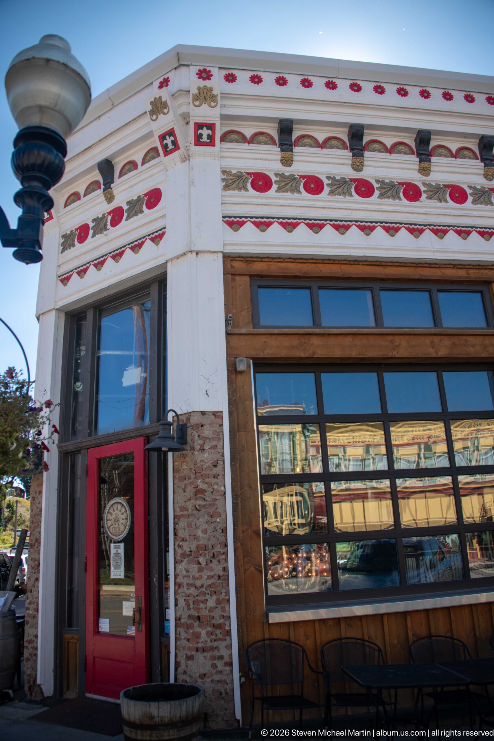
Elaborate painted ornament wraps the corner of this compact historic storefront, where red circular motifs, dark brackets, patterned bands, and a white parapet frame tall windows and a red entrance door. Areas of exposed brick reveal changes in the wall finish, while reflections of neighboring historic buildings animate the glass. The oblique view emphasizes the depth and layering of the unusually decorative façade.
Caption
Elaborate painted ornament wraps the corner of this compact historic storefront, where red circular motifs, dark brackets, patterned bands, and a white parapet frame tall windows and a red entrance door. Areas of exposed brick reveal changes in the wall finish, while reflections of neighboring historic buildings animate the glass. The oblique view emphasizes the depth and layering of the unusually decorative façade.
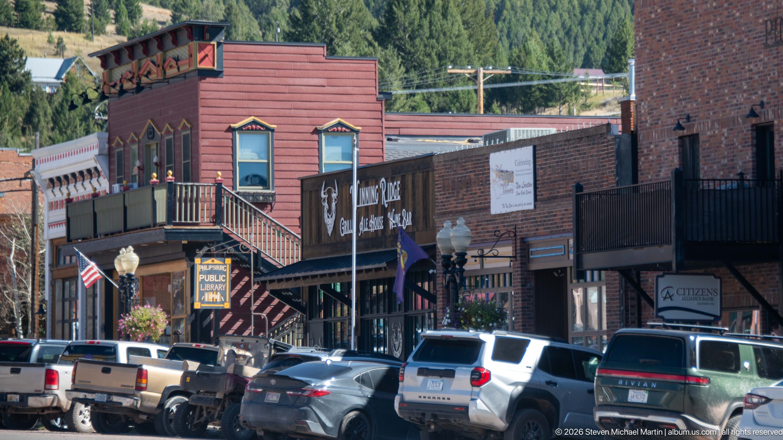
A closer streetscape view compresses several Philipsburg storefronts into a lively block of signs, awnings, balconies, and brick walls. An upper-story wooden balcony and pointed window trim distinguish the reddish building at left, while neighboring businesses occupy lower commercial fronts. Parked cars crowd the curb, showing how the historic architecture remains embedded in the daily life of the modern town.
Caption
A closer streetscape view compresses several Philipsburg storefronts into a lively block of signs, awnings, balconies, and brick walls. An upper-story wooden balcony and pointed window trim distinguish the reddish building at left, while neighboring businesses occupy lower commercial fronts. Parked cars crowd the curb, showing how the historic architecture remains embedded in the daily life of the modern town.
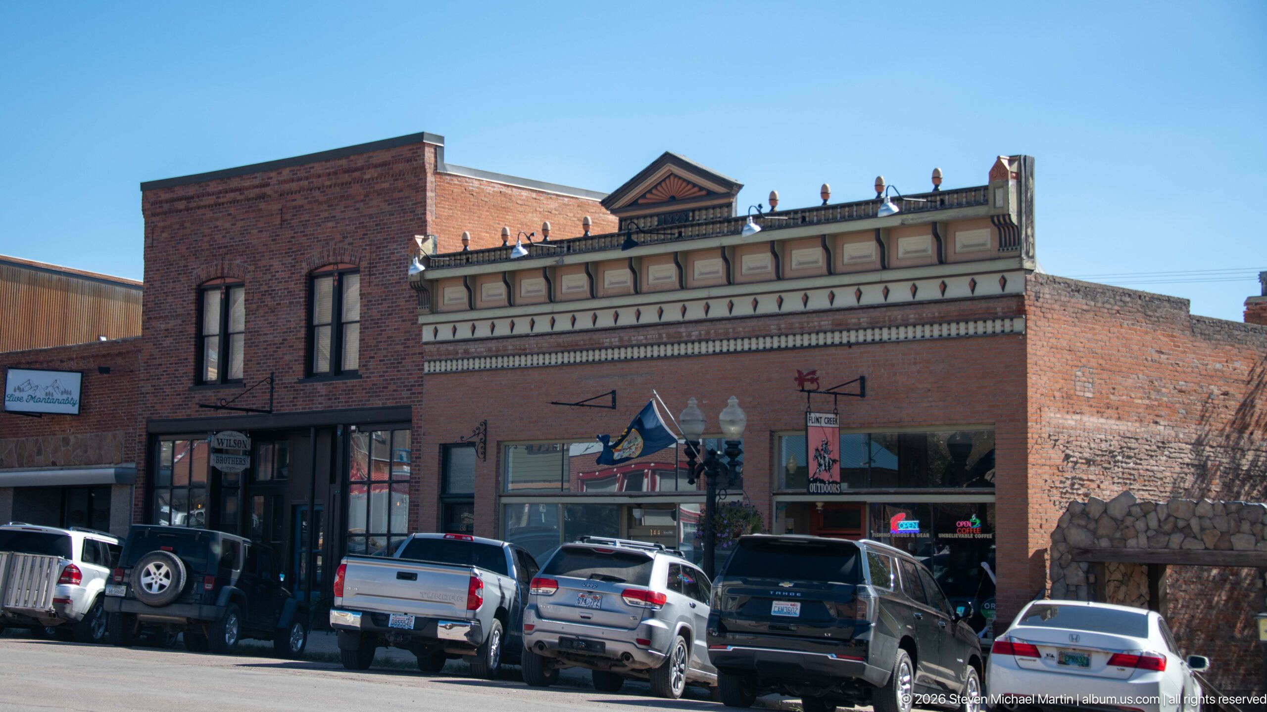
The J.C. McLeod Building presents one of Philipsburg’s most distinctive commercial façades, with a richly ornamented upper cornice above broad street-level windows. The supplied historic walking-tour article identifies the building and illustrates the same combination of patterned trim, projecting brackets, circular motifs, and central pediment. Parked vehicles and active storefronts show the elaborate historic building continuing to serve the downtown commercial district.
Caption
The J.C. McLeod Building presents one of Philipsburg’s most distinctive commercial façades, with a richly ornamented upper cornice above broad street-level windows. The supplied historic walking-tour article identifies the building and illustrates the same combination of patterned trim, projecting brackets, circular motifs, and central pediment. Parked vehicles and active storefronts show the elaborate historic building continuing to serve the downtown commercial district.
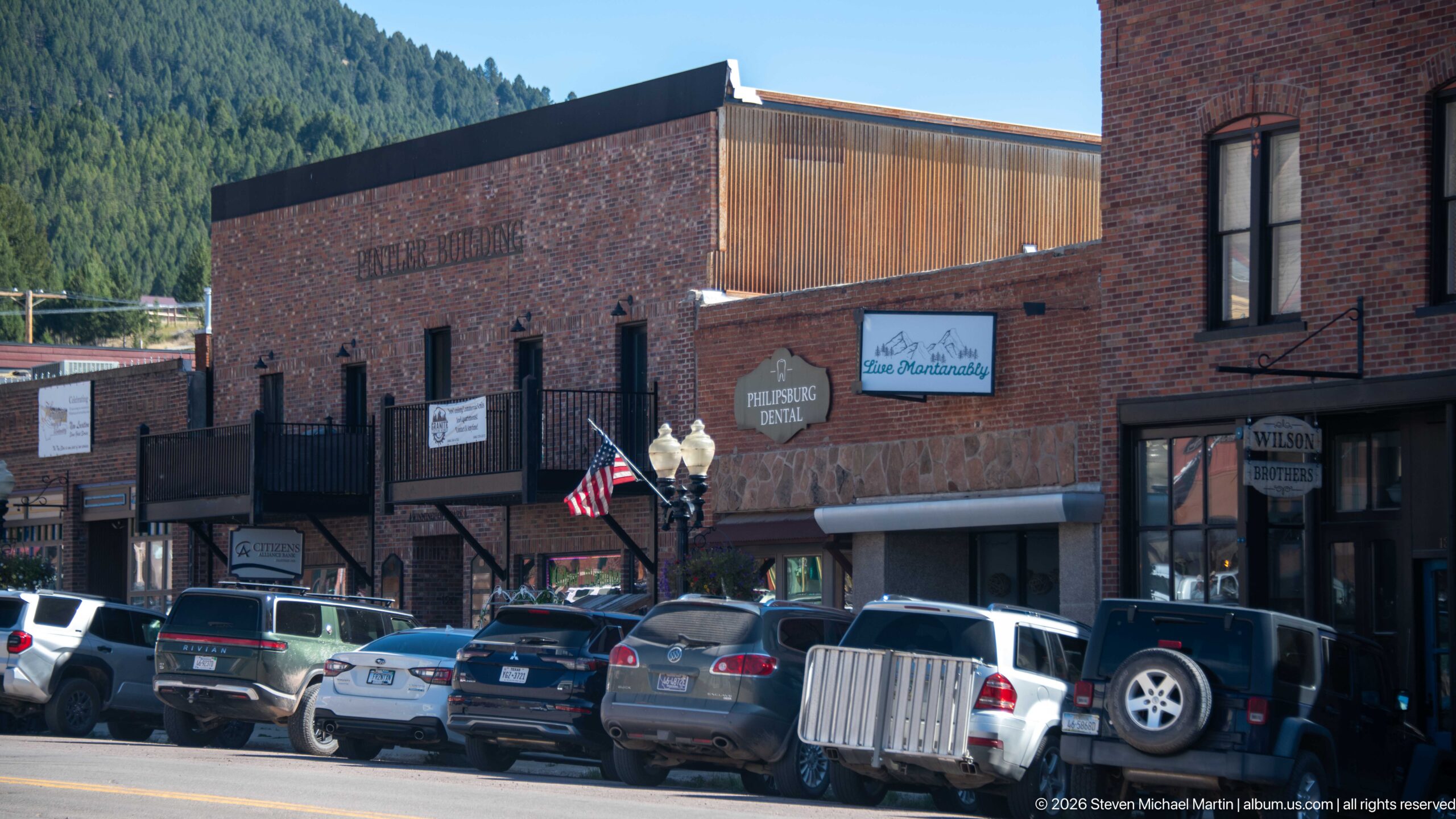
A row of brick commercial buildings steps along the Philipsburg streetscape, where contemporary businesses occupy older masonry storefronts. Signs for Philipsburg Dental and neighboring establishments appear beneath simple upper façades, while balconies, exterior stairs, and parked vehicles create a layered working-town scene. The view complements the walking-tour article by showing how historic commercial fabric continues beyond the district’s most ornate landmark buildings.
Caption
A row of brick commercial buildings steps along the Philipsburg streetscape, where contemporary businesses occupy older masonry storefronts. Signs for Philipsburg Dental and neighboring establishments appear beneath simple upper façades, while balconies, exterior stairs, and parked vehicles create a layered working-town scene. The view complements the walking-tour article by showing how historic commercial fabric continues beyond the district’s most ornate landmark buildings.
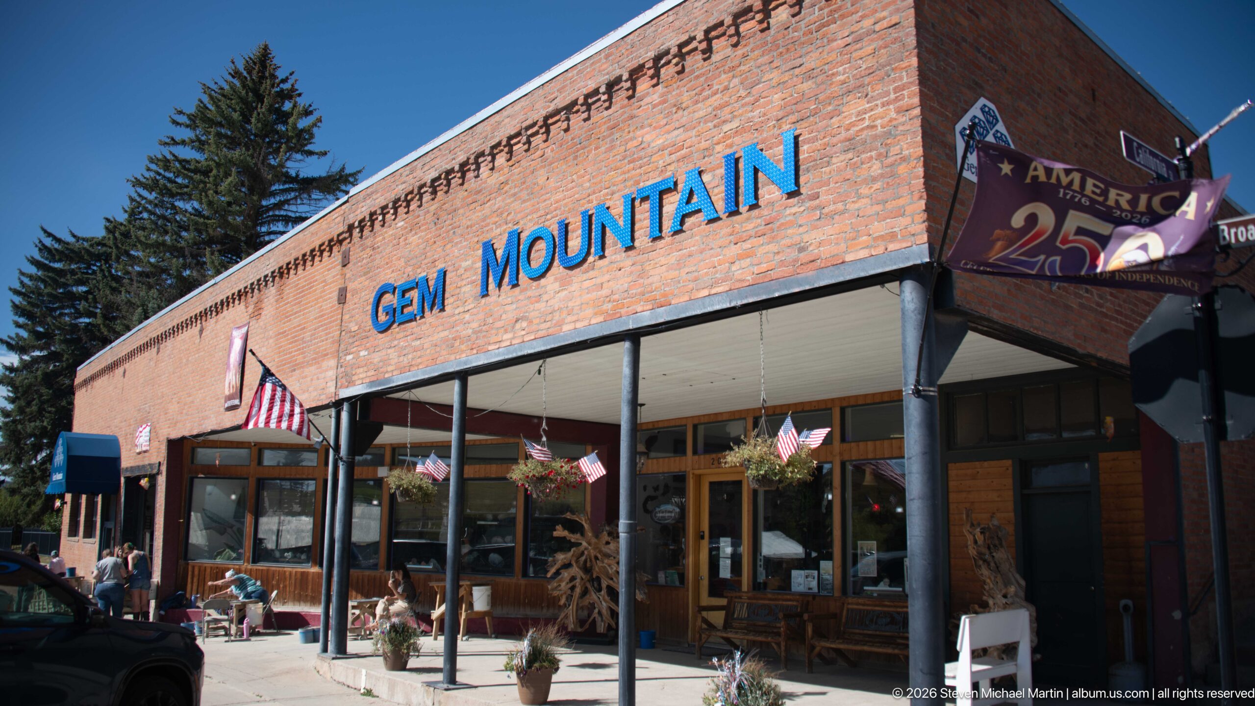
Large blue GEM MOUNTAIN letters identify this long brick storefront, where a deep sidewalk canopy shelters display windows and outdoor merchandise. American flags and a commemorative banner animate the otherwise restrained façade. The business reflects Philipsburg’s continuing association with Montana sapphires, while the substantial brick commercial block places that contemporary mineral-related trade within the town’s historic downtown setting.
Caption
Large blue GEM MOUNTAIN letters identify this long brick storefront, where a deep sidewalk canopy shelters display windows and outdoor merchandise. American flags and a commemorative banner animate the otherwise restrained façade. The business reflects Philipsburg’s continuing association with Montana sapphires, while the substantial brick commercial block places that contemporary mineral-related trade within the town’s historic downtown setting.
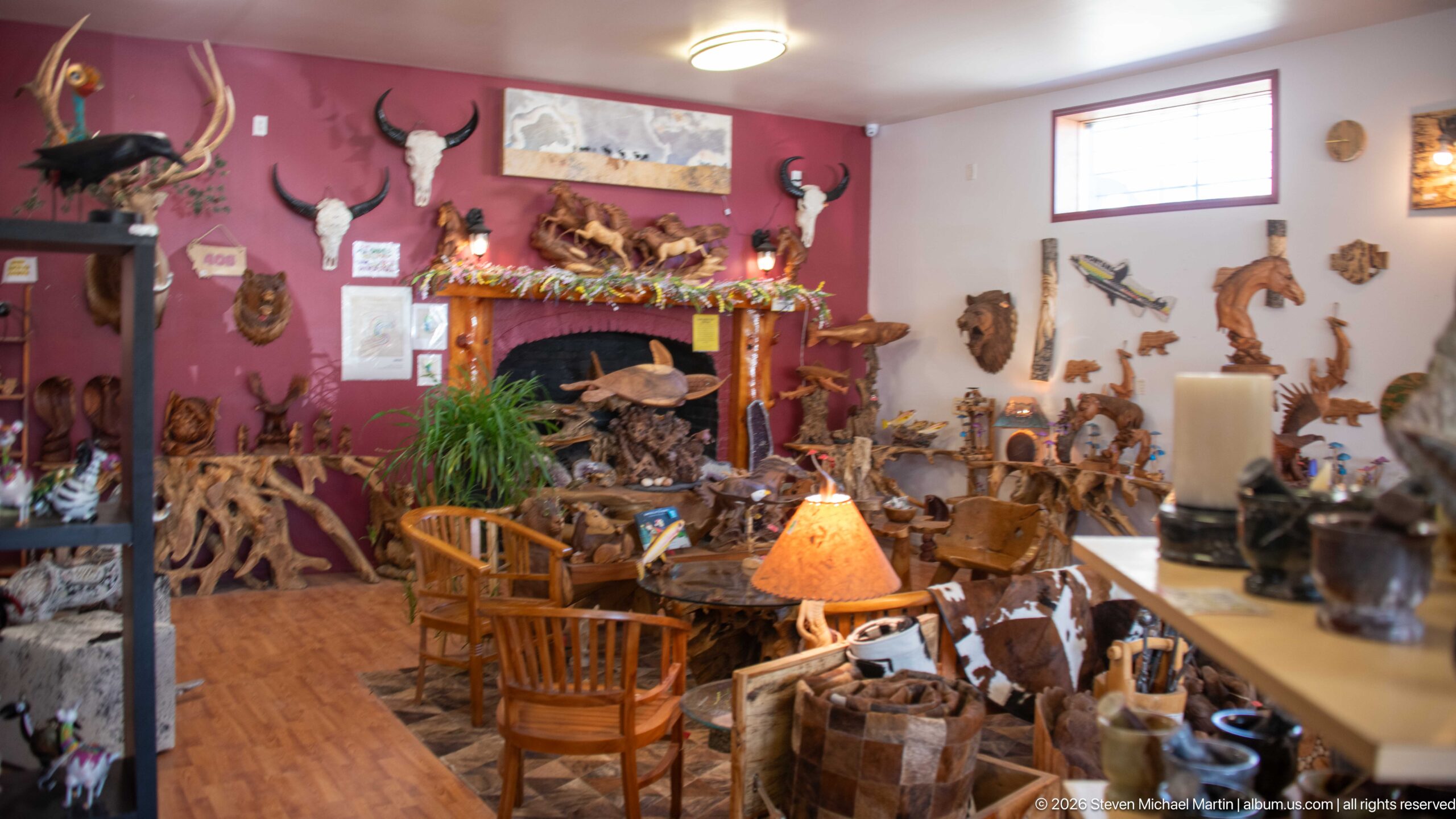
Carved wooden animals, antlers, rustic furniture, lamps, and western decorative objects fill this densely arranged Philipsburg shop. A fireplace mantel anchors the back wall beneath mounted horns and wildlife imagery, while sculpted birds and mammals occupy shelves and floor displays. The interior demonstrates how contemporary downtown retail draws on the wildlife, forests, and western visual culture associated with the surrounding Montana landscape.
Caption
Carved wooden animals, antlers, rustic furniture, lamps, and western decorative objects fill this densely arranged Philipsburg shop. A fireplace mantel anchors the back wall beneath mounted horns and wildlife imagery, while sculpted birds and mammals occupy shelves and floor displays. The interior demonstrates how contemporary downtown retail draws on the wildlife, forests, and western visual culture associated with the surrounding Montana landscape.
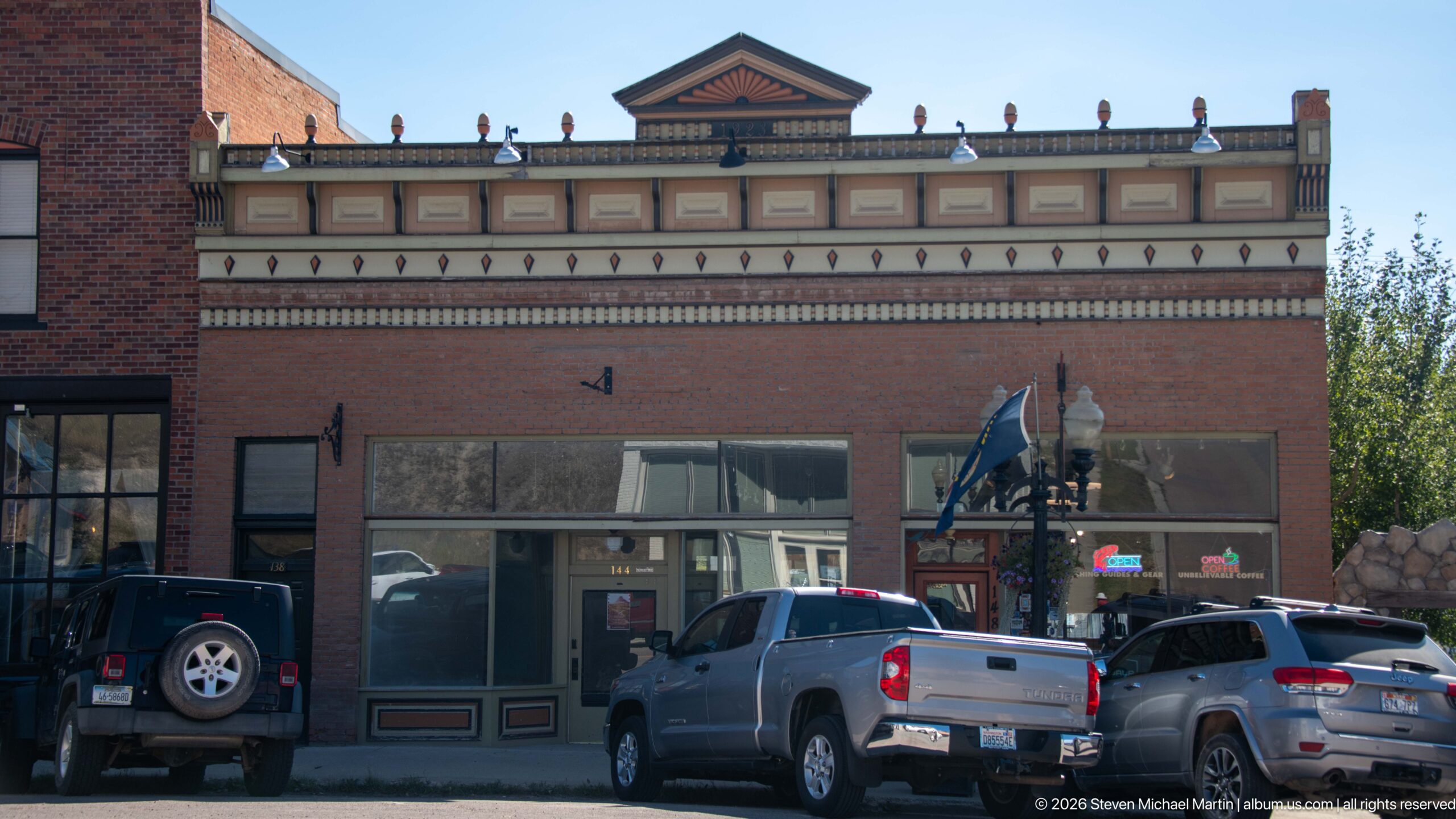
Seen nearly straight on, the J.C. McLeod Building’s elaborate upper façade becomes a study in symmetry. A central triangular pediment crowns bands of brackets, patterned panels, circular ornaments, and contrasting painted trim above the brick storefront. The supplied walking-tour article identifies the building and its characteristic ornament, allowing this wider view to connect the close architectural details with the complete commercial frontage.
Caption
Seen nearly straight on, the J.C. McLeod Building’s elaborate upper façade becomes a study in symmetry. A central triangular pediment crowns bands of brackets, patterned panels, circular ornaments, and contrasting painted trim above the brick storefront. The supplied walking-tour article identifies the building and its characteristic ornament, allowing this wider view to connect the close architectural details with the complete commercial frontage.
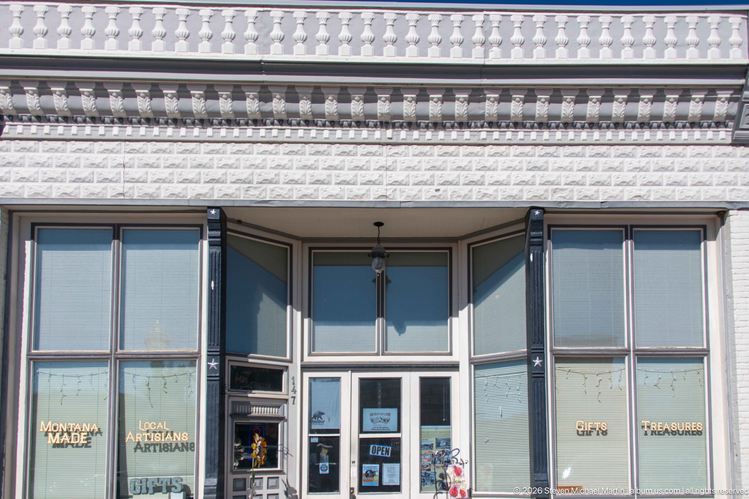
A compact white-painted storefront is wrapped in unusually elaborate relief ornament, with repeating red circular motifs, dark brackets, patterned bands, and a balustraded parapet above tall display windows. Gold window lettering advertises Montana-made goods, local artisans, gifts, and treasures. The close frontal view emphasizes the decorative treatment while preserving the contemporary retail use of this historic downtown building.
Caption
A compact white-painted storefront is wrapped in unusually elaborate relief ornament, with repeating red circular motifs, dark brackets, patterned bands, and a balustraded parapet above tall display windows. Gold window lettering advertises Montana-made goods, local artisans, gifts, and treasures. The close frontal view emphasizes the decorative treatment while preserving the contemporary retail use of this historic downtown building.
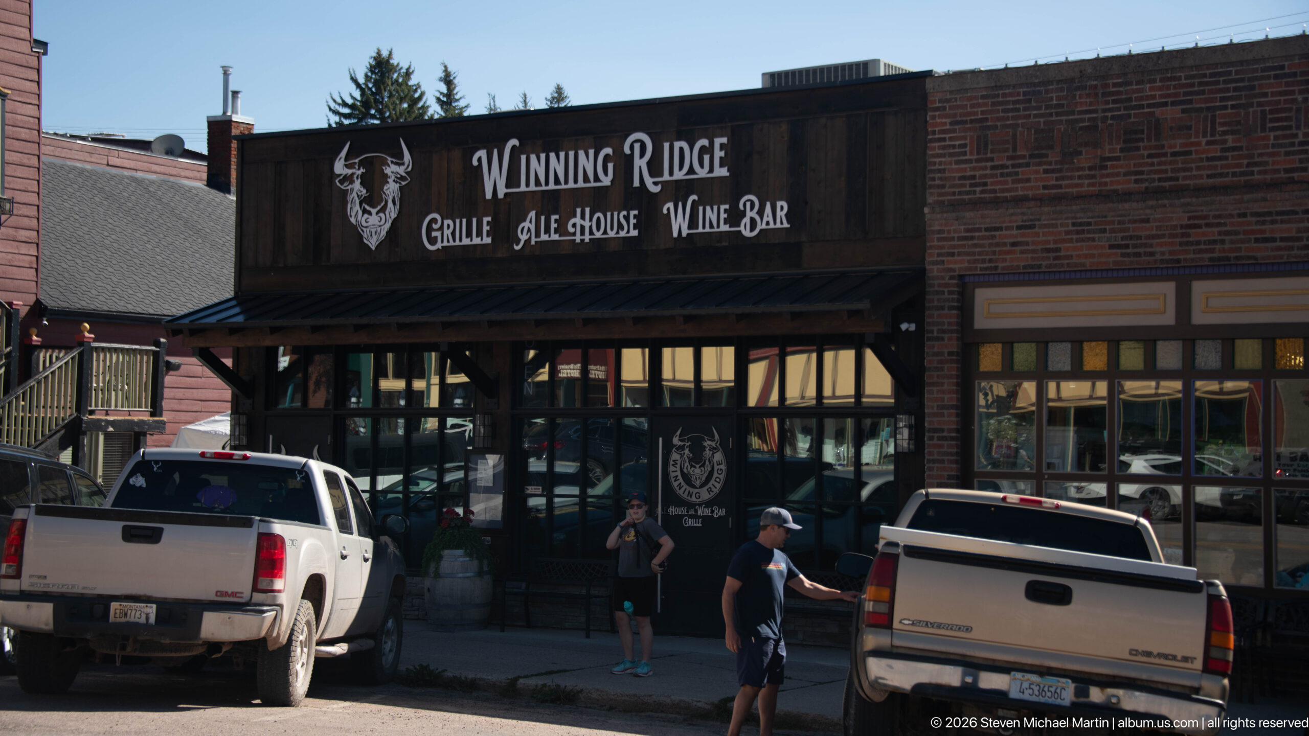
Winning Ridge announces itself across a dark wood storefront as a grille, ale house, and wine bar. Broad windows beneath a shallow awning open the contemporary restaurant to the sidewalk, while brick walls and neighboring historic façades keep the business visually integrated with Philipsburg’s older commercial district. Trucks parked at the curb and pedestrians near the entrance give the scene an everyday downtown character.
Caption
Winning Ridge announces itself across a dark wood storefront as a grille, ale house, and wine bar. Broad windows beneath a shallow awning open the contemporary restaurant to the sidewalk, while brick walls and neighboring historic façades keep the business visually integrated with Philipsburg’s older commercial district. Trucks parked at the curb and pedestrians near the entrance give the scene an everyday downtown character.
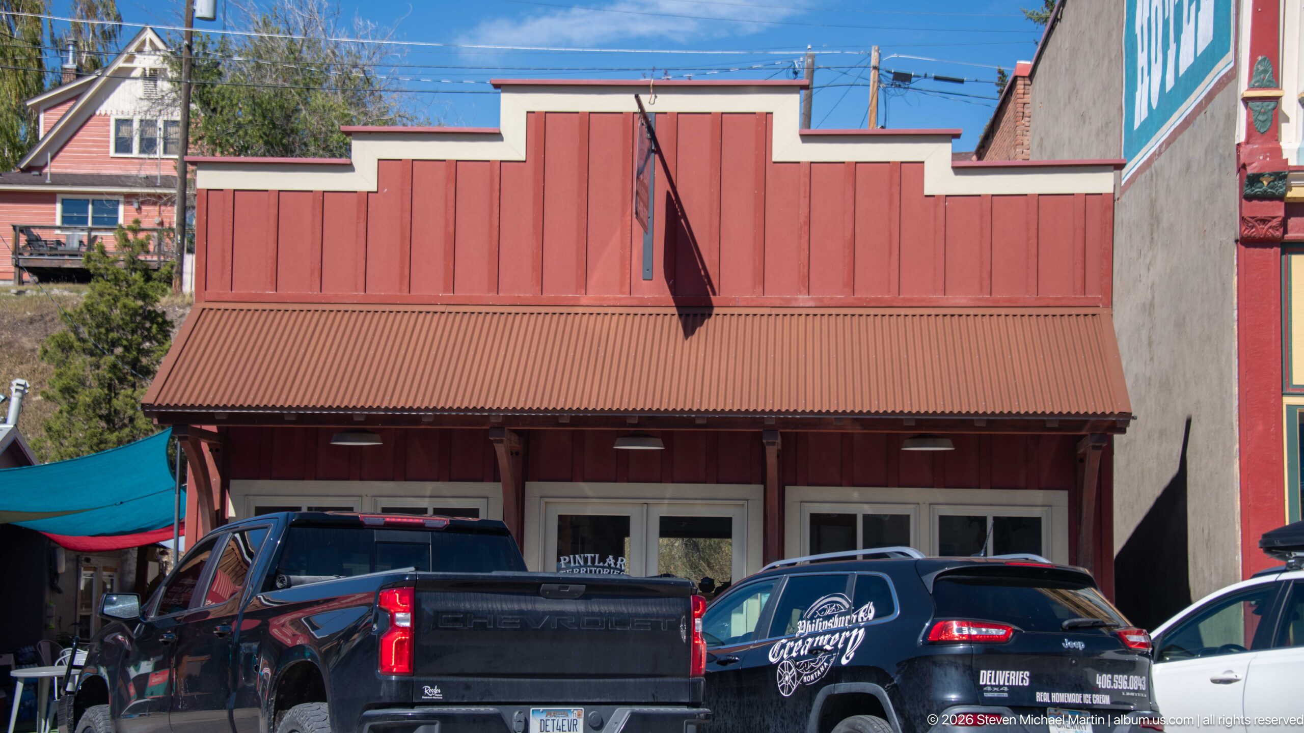
A stepped red false front rises above a deep corrugated-metal awning on this modest Philipsburg commercial building. Vertical board siding, a centered flag, paired display windows, and simple posts give the storefront a distinctly western profile without the masonry ornament of neighboring business blocks. Parked vehicles partly screen the ground floor, emphasizing the building’s small scale within the active downtown streetscape.
Caption
A stepped red false front rises above a deep corrugated-metal awning on this modest Philipsburg commercial building. Vertical board siding, a centered flag, paired display windows, and simple posts give the storefront a distinctly western profile without the masonry ornament of neighboring business blocks. Parked vehicles partly screen the ground floor, emphasizing the building’s small scale within the active downtown streetscape.
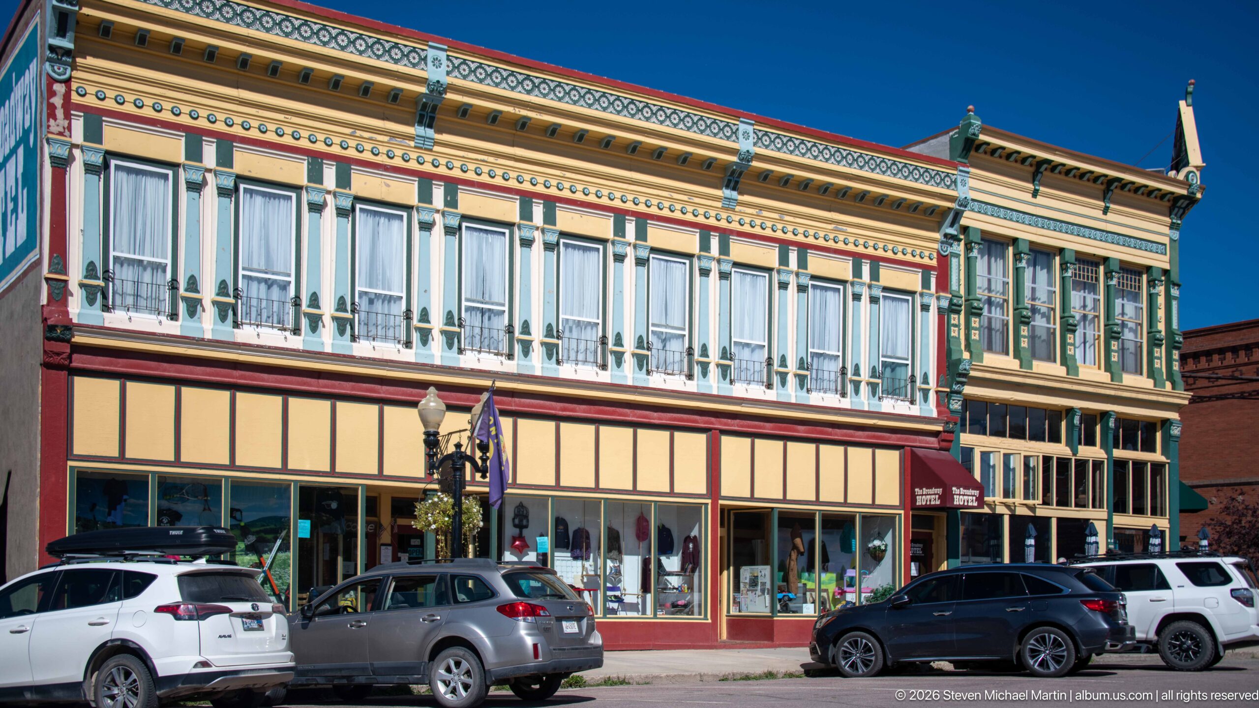
The former Walker Commercial Company building stretches across the block in an exuberant display of painted late-nineteenth-century commercial ornament. The supplied Philipsburg walking-tour article identifies this landmark and illustrates its long upper window band, decorative cornice, and richly detailed corner section. Large ground-floor storefronts continue to support modern businesses, preserving the building’s original commercial relationship with the street.
Caption
The former Walker Commercial Company building stretches across the block in an exuberant display of painted late-nineteenth-century commercial ornament. The supplied Philipsburg walking-tour article identifies this landmark and illustrates its long upper window band, decorative cornice, and richly detailed corner section. Large ground-floor storefronts continue to support modern businesses, preserving the building’s original commercial relationship with the street.
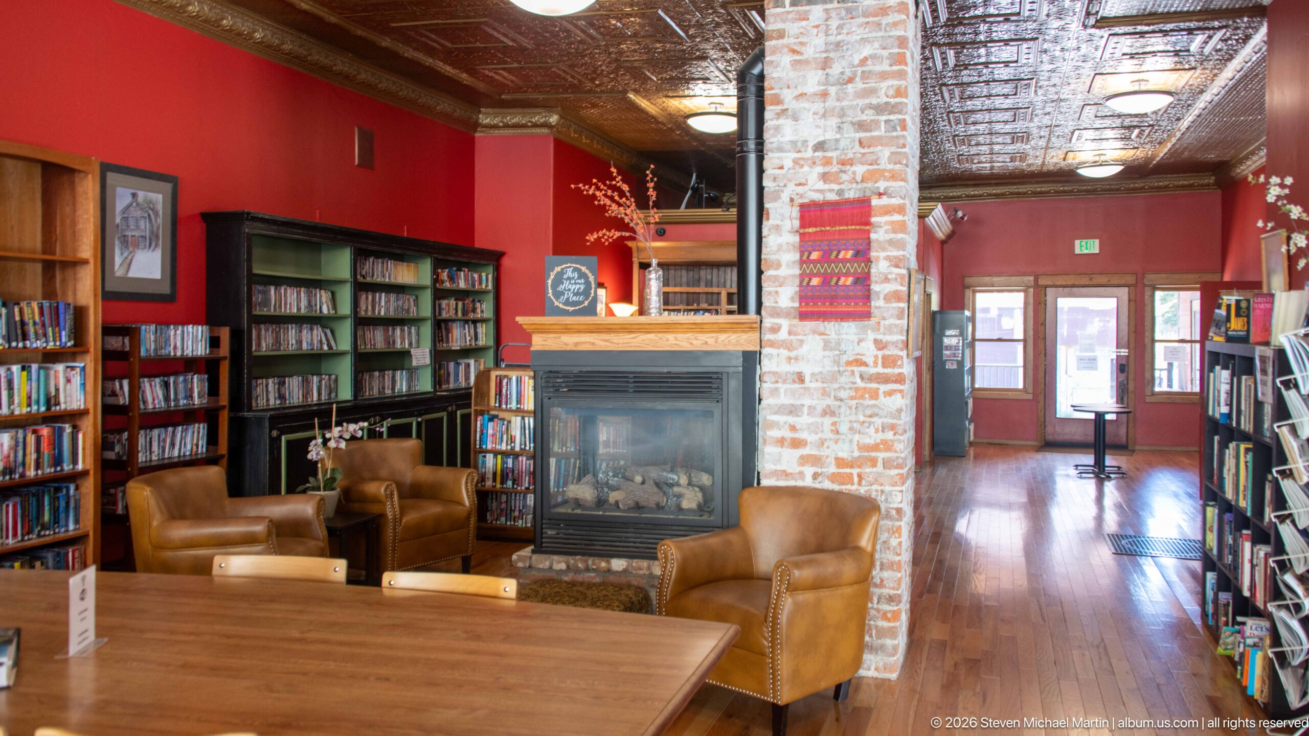
Leather chairs gather around a freestanding fireplace in a quiet reading area of the Philipsburg Public Library. Bookcases line the red walls, while an exposed-brick pier and pressed-metal ceiling preserve tactile elements of the historic interior. Warm wood floors and a long communal table create a comfortable reading room that combines contemporary library service with the character of an adapted downtown building.
Caption
Leather chairs gather around a freestanding fireplace in a quiet reading area of the Philipsburg Public Library. Bookcases line the red walls, while an exposed-brick pier and pressed-metal ceiling preserve tactile elements of the historic interior. Warm wood floors and a long communal table create a comfortable reading room that combines contemporary library service with the character of an adapted downtown building.
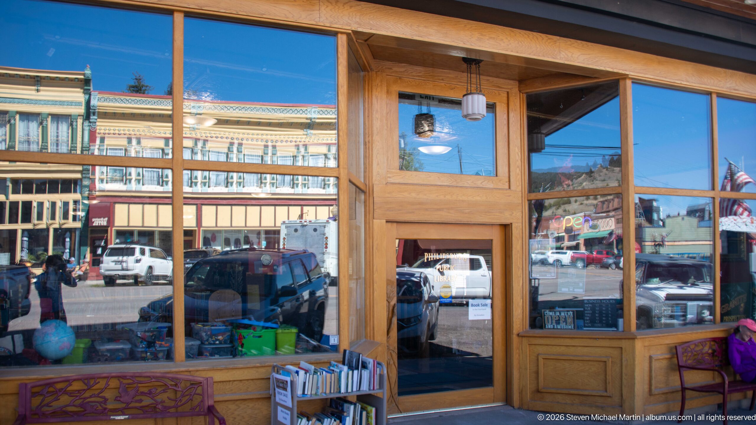
A wood-framed shop entrance becomes a layered portrait of downtown Philipsburg through reflections in its broad display glass. Across the street, the ornate Walker Commercial Company building appears mirrored in the windows alongside parked vehicles and pedestrians. Books and merchandise near the doorway remain visible through the reflection, blending the contemporary storefront interior with the historic architecture opposite.
Caption
A wood-framed shop entrance becomes a layered portrait of downtown Philipsburg through reflections in its broad display glass. Across the street, the ornate Walker Commercial Company building appears mirrored in the windows alongside parked vehicles and pedestrians. Books and merchandise near the doorway remain visible through the reflection, blending the contemporary storefront interior with the historic architecture opposite.
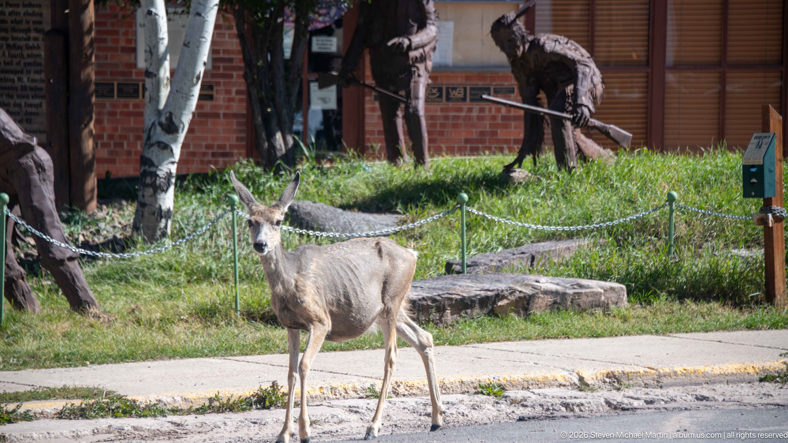
A mule deer pauses beside a downtown sidewalk, ears raised toward the camera while rustic metal figures stand among the grass and trees behind it. The animal’s large ears, gray-brown coat, and dark-tipped tail area are characteristic of mule deer common in western Montana. Its presence among buildings and public art illustrates how wildlife moves directly through Philipsburg’s developed townscape.
Caption
A mule deer pauses beside a downtown sidewalk, ears raised toward the camera while rustic metal figures stand among the grass and trees behind it. The animal’s large ears, gray-brown coat, and dark-tipped tail area are characteristic of mule deer common in western Montana. Its presence among buildings and public art illustrates how wildlife moves directly through Philipsburg’s developed townscape.

A mule deer crosses the roadway between parked pickups and cars in the center of Philipsburg. Its alert head and steady walking posture contrast with the surrounding traffic and pavement, creating a direct encounter between wildlife and the built environment. The unobstructed side view records the animal at street level rather than in the mountain habitat more commonly associated with Montana deer.
Caption
A mule deer crosses the roadway between parked pickups and cars in the center of Philipsburg. Its alert head and steady walking posture contrast with the surrounding traffic and pavement, creating a direct encounter between wildlife and the built environment. The unobstructed side view records the animal at street level rather than in the mountain habitat more commonly associated with Montana deer.
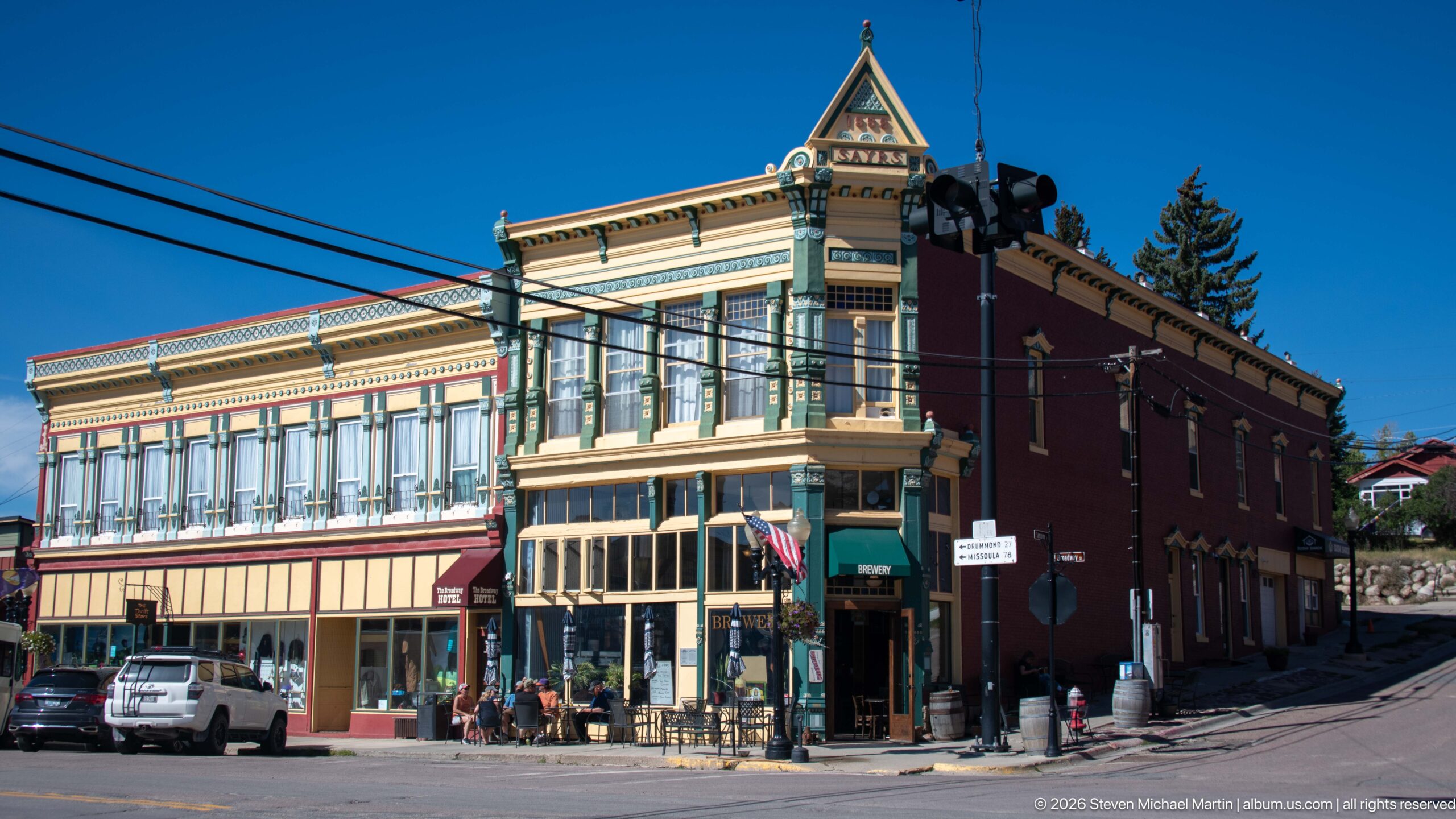
The former Walker Commercial Company building anchors a Philipsburg street corner with its long polychrome façade and a taller, richly ornamented corner pavilion. The supplied walking-tour article identifies the building and confirms the distinctive upper windows, elaborate cornice, and decorative corner treatment. Modern storefronts and outdoor seating occupy the ground floor, demonstrating the continued commercial life of this prominent historic block.
Caption
The former Walker Commercial Company building anchors a Philipsburg street corner with its long polychrome façade and a taller, richly ornamented corner pavilion. The supplied walking-tour article identifies the building and confirms the distinctive upper windows, elaborate cornice, and decorative corner treatment. Modern storefronts and outdoor seating occupy the ground floor, demonstrating the continued commercial life of this prominent historic block.
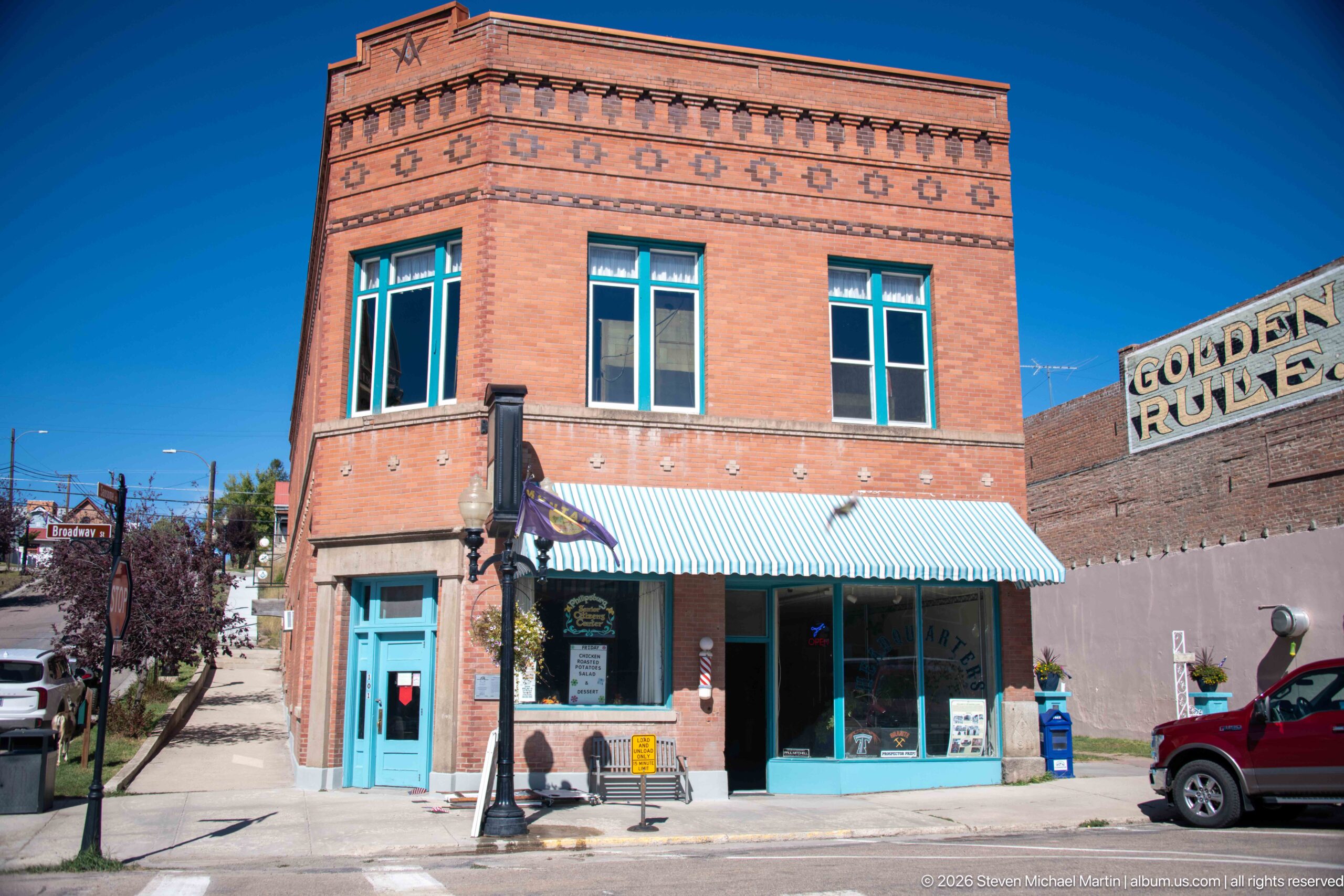
A compact two-story brick corner building stands beside the large painted GOLDEN RULE wall advertisement that marks this part of Philipsburg’s historic commercial district. Blue-trimmed windows, a striped awning, and a turquoise storefront brighten the otherwise restrained masonry façade. The walking-tour article helps situate the scene among the documented East Broadway business blocks without requiring an uncertain historic name for this particular structure.
Caption
A compact two-story brick corner building stands beside the large painted GOLDEN RULE wall advertisement that marks this part of Philipsburg’s historic commercial district. Blue-trimmed windows, a striped awning, and a turquoise storefront brighten the otherwise restrained masonry façade. The walking-tour article helps situate the scene among the documented East Broadway business blocks without requiring an uncertain historic name for this particular structure.
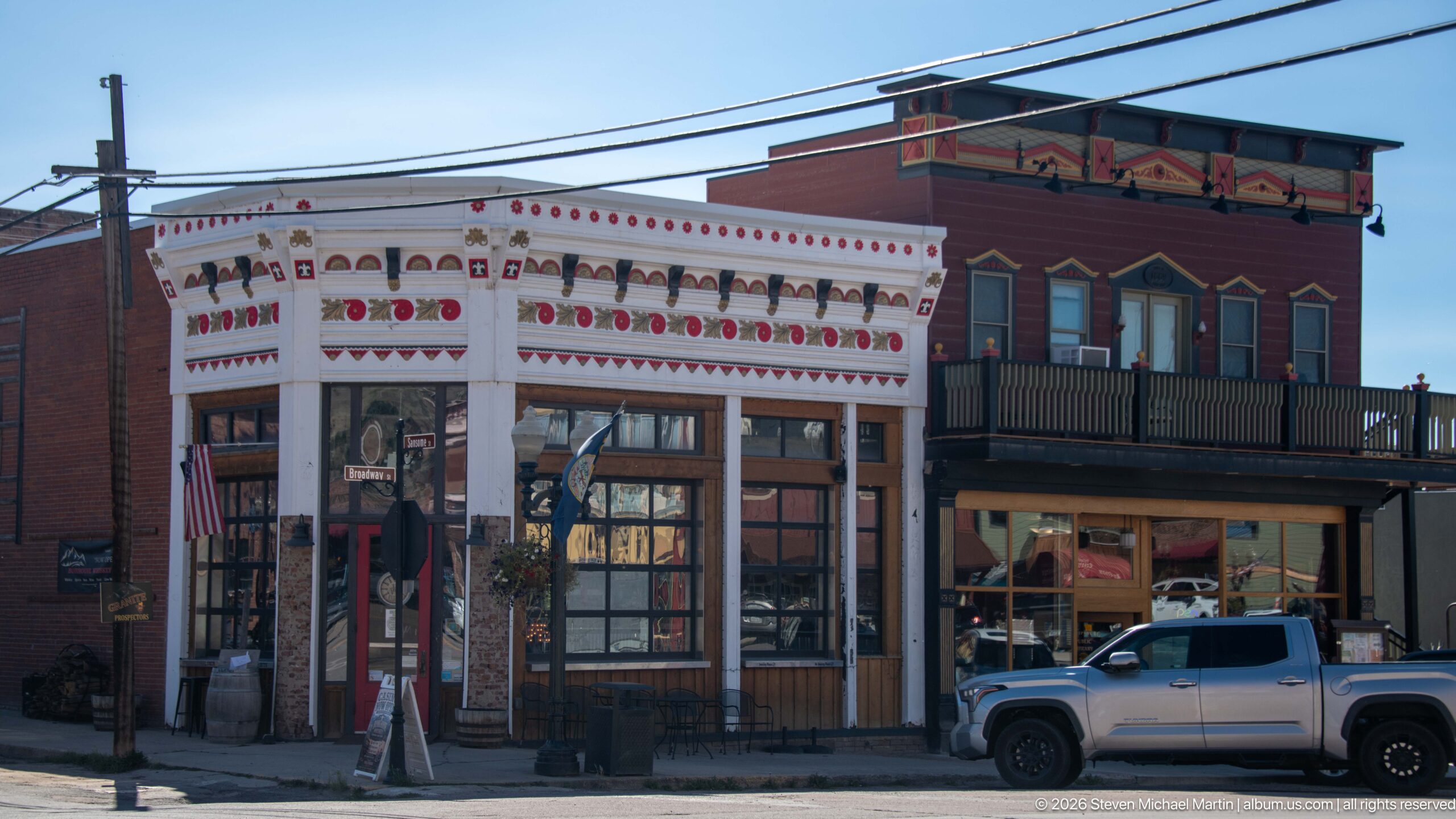
Two contrasting historic storefronts meet along the Philipsburg block: an ornate white façade with red circular motifs and dark brackets at left, and a painted wood building with a full-width upper balcony at right. Their different materials and decorative vocabularies demonstrate the architectural variety preserved within the compact district. Utility lines and a parked pickup underscore the buildings’ continued place in an active town.
Caption
Two contrasting historic storefronts meet along the Philipsburg block: an ornate white façade with red circular motifs and dark brackets at left, and a painted wood building with a full-width upper balcony at right. Their different materials and decorative vocabularies demonstrate the architectural variety preserved within the compact district. Utility lines and a parked pickup underscore the buildings’ continued place in an active town.
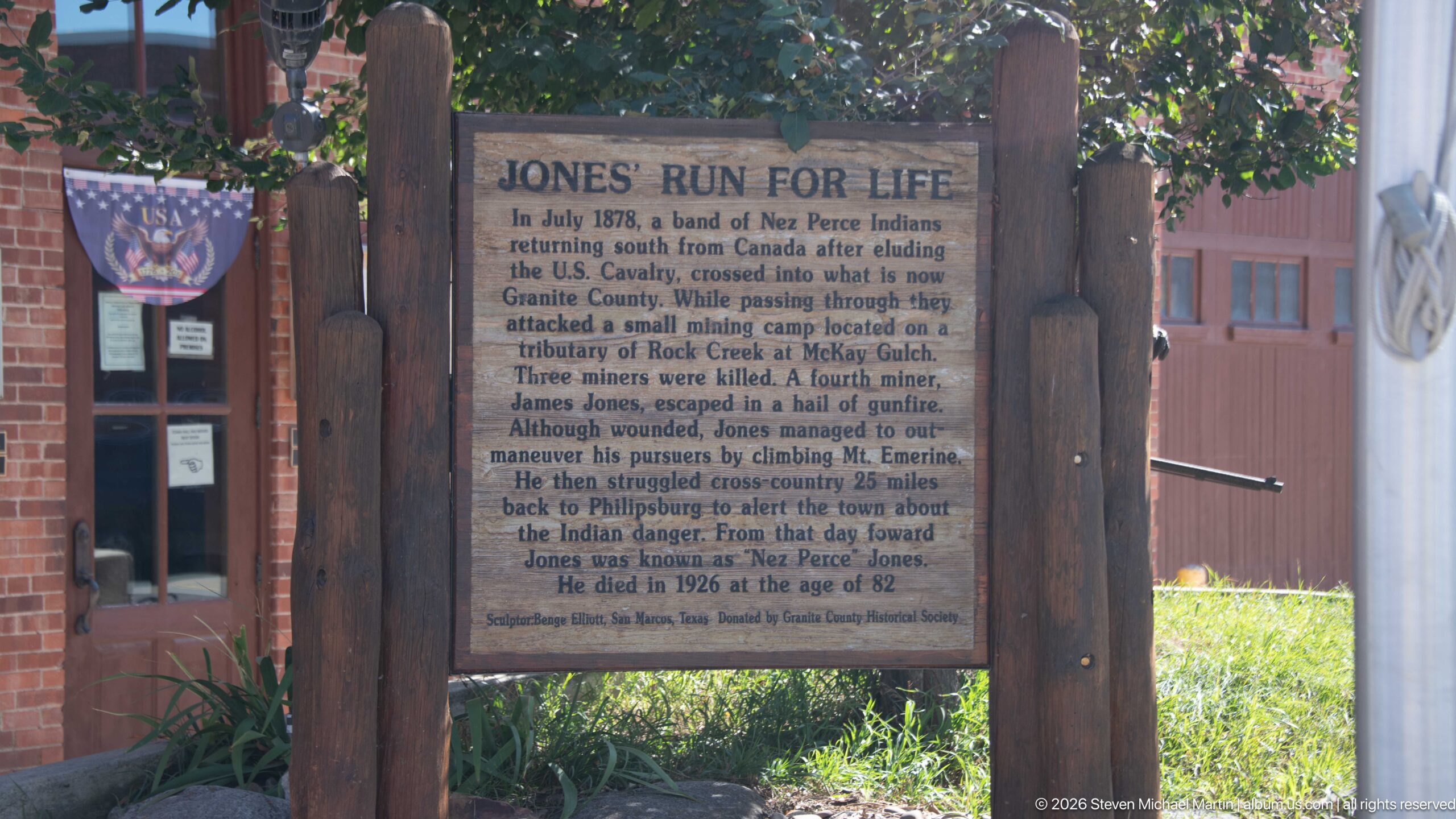
The “JONES’ RUN FOR LIFE” marker recounts an 1878 episode in which John Jones encountered Nez Perce Indians returning north from Canada after eluding the U.S. Cavalry. The text describes Jones being wounded and pursuing help toward Philipsburg, placing a specific episode of regional conflict and movement within the town’s interpreted historical landscape. The wooden-framed sign stands beside a brick building and shaded lawn.
Caption
The “JONES’ RUN FOR LIFE” marker recounts an 1878 episode in which John Jones encountered Nez Perce Indians returning north from Canada after eluding the U.S. Cavalry. The text describes Jones being wounded and pursuing help toward Philipsburg, placing a specific episode of regional conflict and movement within the town’s interpreted historical landscape. The wooden-framed sign stands beside a brick building and shaded lawn.
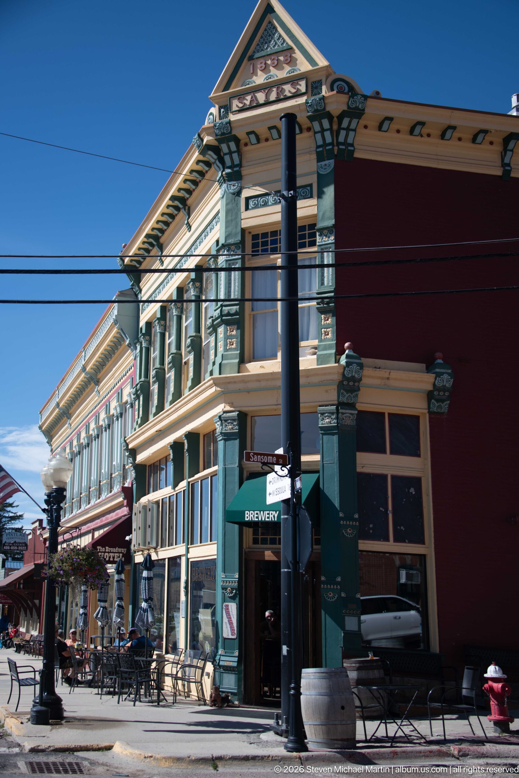
The historic Walker Commercial Company building rises above the entrance to Philipsburg Brewing Company, its elaborate corner pavilion, painted brackets, tall upper windows, and patterned cornice preserved above the modern brewery storefront. The supplied walking-tour article identifies the larger commercial block, while visible BREWERY signage records its contemporary use. Outdoor tables extend the business onto the sidewalk at the prominent downtown corner.
Caption
The historic Walker Commercial Company building rises above the entrance to Philipsburg Brewing Company, its elaborate corner pavilion, painted brackets, tall upper windows, and patterned cornice preserved above the modern brewery storefront. The supplied walking-tour article identifies the larger commercial block, while visible BREWERY signage records its contemporary use. Outdoor tables extend the business onto the sidewalk at the prominent downtown corner.
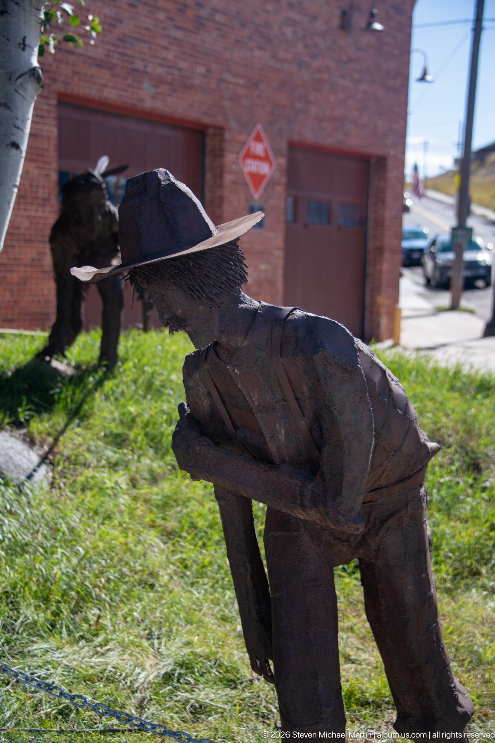
A life-size rustic metal figure bends deeply forward in a grassy outdoor installation, its body assembled from weathered sheet metal and irregular fabricated forms. Another dark figure appears farther back near the brick building. The rough surfaces and exaggerated posture give the sculpture a laboring, almost animated presence, adding an unexpected piece of public art to the historic downtown setting.
Caption
A life-size rustic metal figure bends deeply forward in a grassy outdoor installation, its body assembled from weathered sheet metal and irregular fabricated forms. Another dark figure appears farther back near the brick building. The rough surfaces and exaggerated posture give the sculpture a laboring, almost animated presence, adding an unexpected piece of public art to the historic downtown setting.
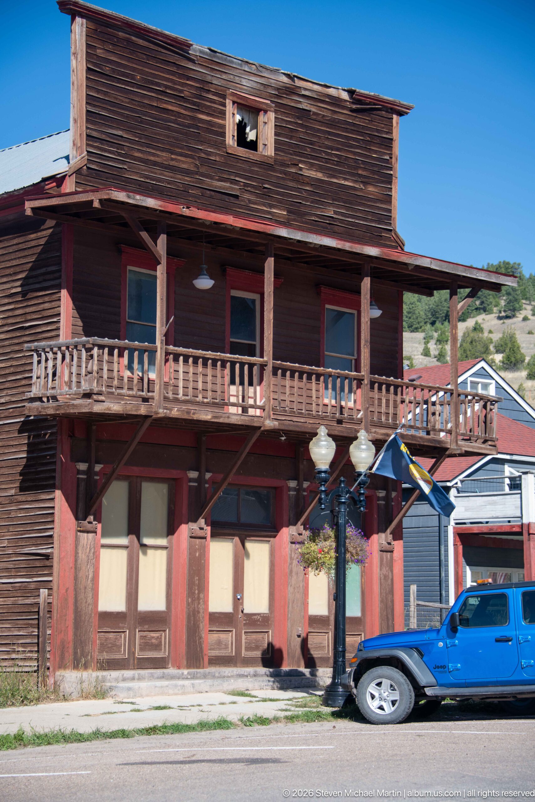
A large weathered wood building presents a deep two-story frontage with a continuous upper balcony supported by heavy posts. Faded red paint survives around boarded ground-floor openings and structural members, while exposed brown siding dominates the upper wall. The worn surfaces and altered openings preserve a markedly different character from Philipsburg’s restored brick storefronts, suggesting the utilitarian side of the historic commercial landscape.
Caption
A large weathered wood building presents a deep two-story frontage with a continuous upper balcony supported by heavy posts. Faded red paint survives around boarded ground-floor openings and structural members, while exposed brown siding dominates the upper wall. The worn surfaces and altered openings preserve a markedly different character from Philipsburg’s restored brick storefronts, suggesting the utilitarian side of the historic commercial landscape.
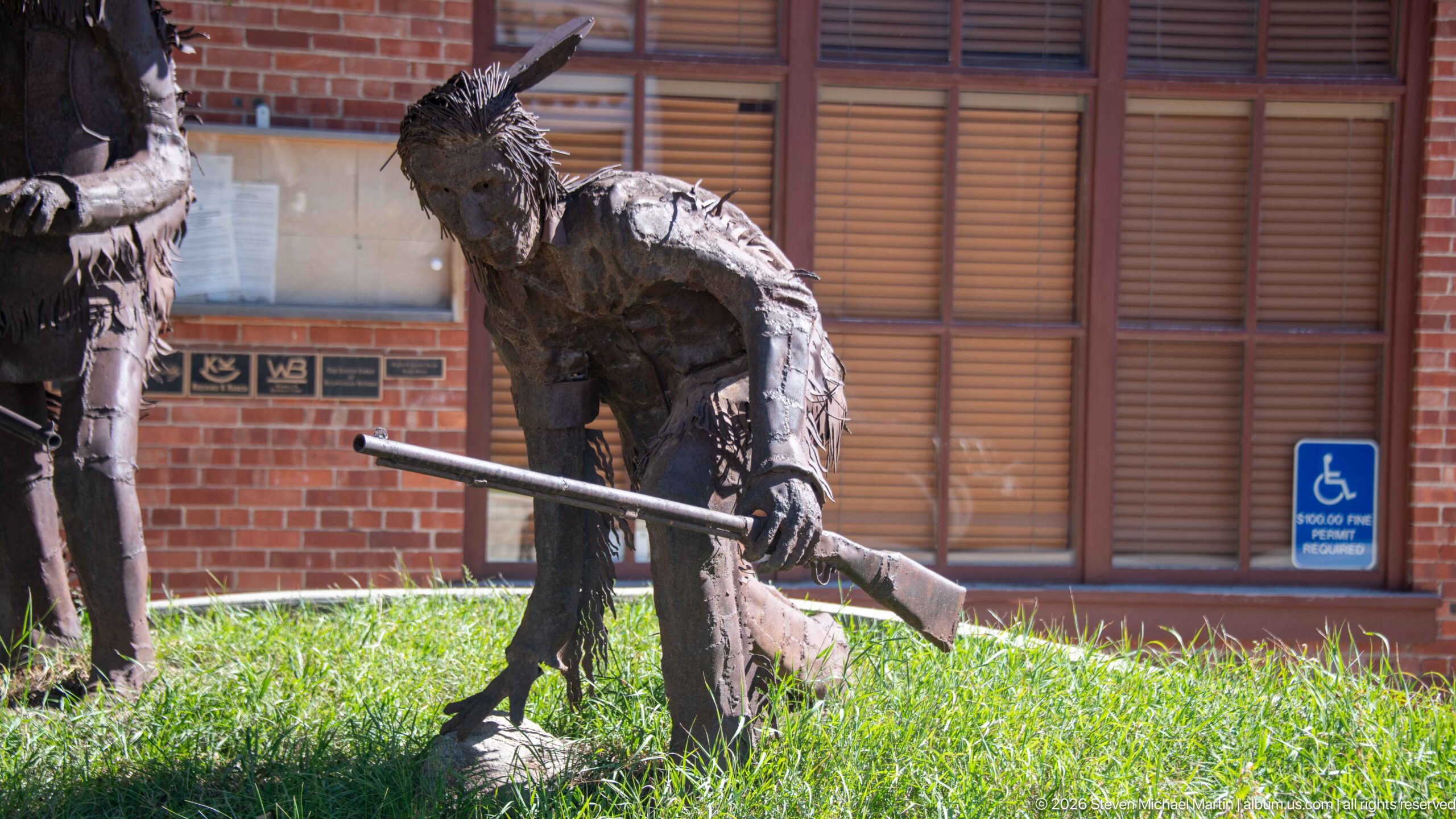
A weathered metal figure leans forward while gripping a long rifle-like object, one of several life-size sculptures arranged on the grass beside a brick building. Layered strips and plates form the clothing and body, producing a deliberately rough, handmade surface. The pose suggests a historical narrative, but the photograph alone does not securely identify the represented individual or event.
Caption
A weathered metal figure leans forward while gripping a long rifle-like object, one of several life-size sculptures arranged on the grass beside a brick building. Layered strips and plates form the clothing and body, producing a deliberately rough, handmade surface. The pose suggests a historical narrative, but the photograph alone does not securely identify the represented individual or event.
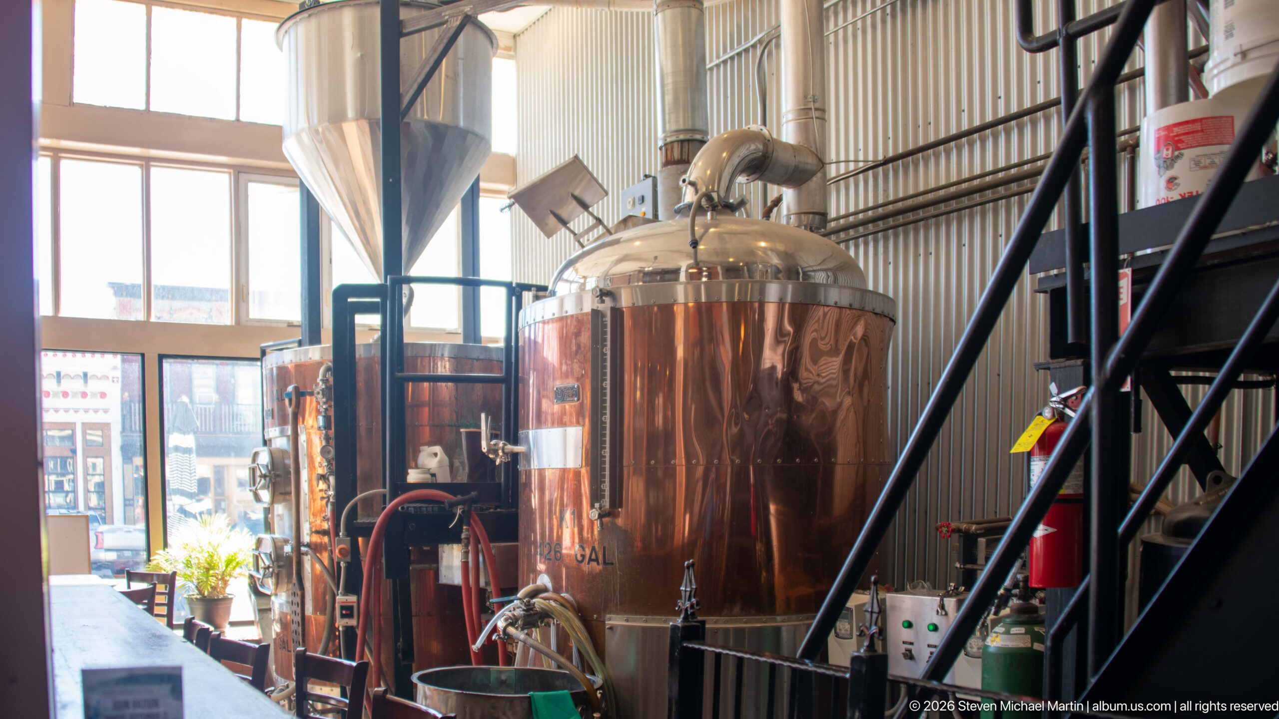
Polished copper-clad brewing vessels stand beside stainless piping, hoses, platforms, and fermentation equipment in the production area of Philipsburg Brewing Company. Daylight from the storefront windows reflects across the curved tanks, emphasizing the brewhouse’s combination of traditional copper appearance and modern fittings. The compact arrangement places active beer production directly behind the brewery’s downtown public spaces.
Caption
Polished copper-clad brewing vessels stand beside stainless piping, hoses, platforms, and fermentation equipment in the production area of Philipsburg Brewing Company. Daylight from the storefront windows reflects across the curved tanks, emphasizing the brewhouse’s combination of traditional copper appearance and modern fittings. The compact arrangement places active beer production directly behind the brewery’s downtown public spaces.
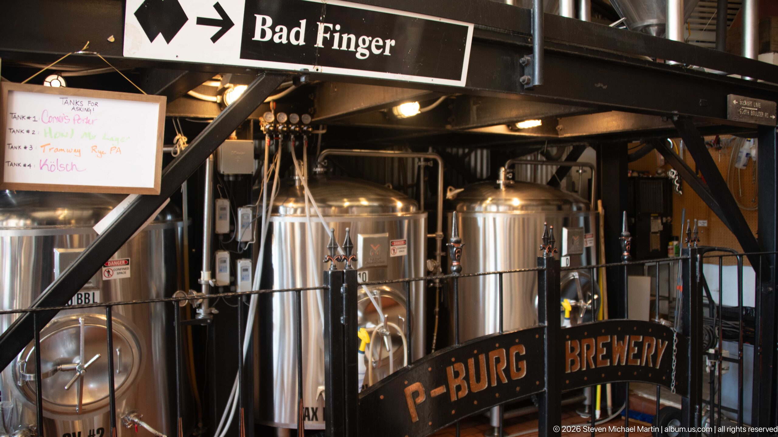
Stainless brewing tanks crowd the production floor beneath black steel framing at Philipsburg Brewing Company. A cut-metal P-BURG BREWERY sign spans the foreground while a BAD FINGER sign hangs overhead, naming one of the brewery’s beer labels or production references. Valves, hoses, gauges, and vessel doors expose the working infrastructure normally hidden behind the taproom experience.
Caption
Stainless brewing tanks crowd the production floor beneath black steel framing at Philipsburg Brewing Company. A cut-metal P-BURG BREWERY sign spans the foreground while a BAD FINGER sign hangs overhead, naming one of the brewery’s beer labels or production references. Valves, hoses, gauges, and vessel doors expose the working infrastructure normally hidden behind the taproom experience.
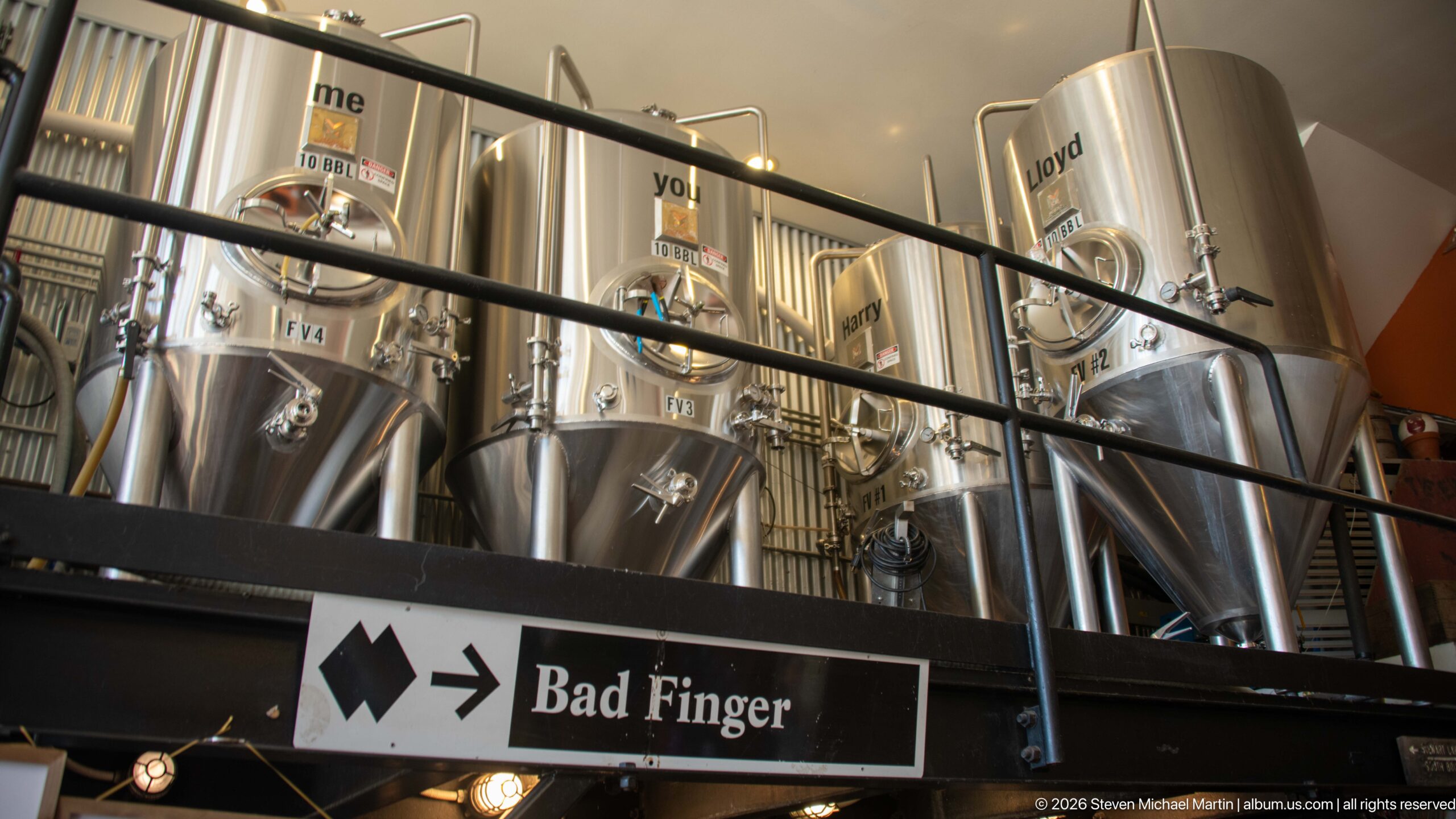
Large stainless-steel tanks rise above the brewery floor on an elevated platform, their conical bottoms, valves, and fittings visible behind the railing. Handwritten or applied labels mark individual vessels, while a BAD FINGER directional sign occupies the lower frame. The upward viewpoint emphasizes the vertical density required to fit modern brewing equipment within a constrained downtown building.
Caption
Large stainless-steel tanks rise above the brewery floor on an elevated platform, their conical bottoms, valves, and fittings visible behind the railing. Handwritten or applied labels mark individual vessels, while a BAD FINGER directional sign occupies the lower frame. The upward viewpoint emphasizes the vertical density required to fit modern brewing equipment within a constrained downtown building.
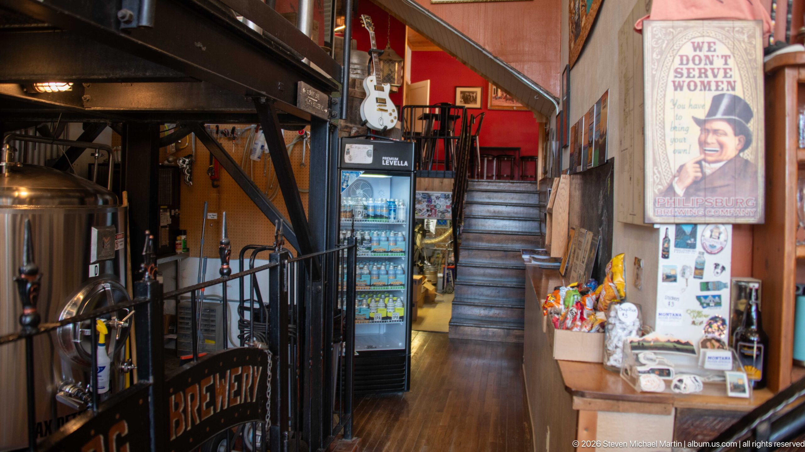
The production floor and public-facing interior meet in this narrow passage at Philipsburg Brewing Company. Stainless tanks and the P-BURG BREWERY railing occupy the left side, while a beverage cooler, merchandise display, staircase, guitar, and a historical-style poster line the right. The mixed-use view shows how brewing equipment, taproom circulation, and decorative references share the limited space of the downtown operation.
Caption
The production floor and public-facing interior meet in this narrow passage at Philipsburg Brewing Company. Stainless tanks and the P-BURG BREWERY railing occupy the left side, while a beverage cooler, merchandise display, staircase, guitar, and a historical-style poster line the right. The mixed-use view shows how brewing equipment, taproom circulation, and decorative references share the limited space of the downtown operation.
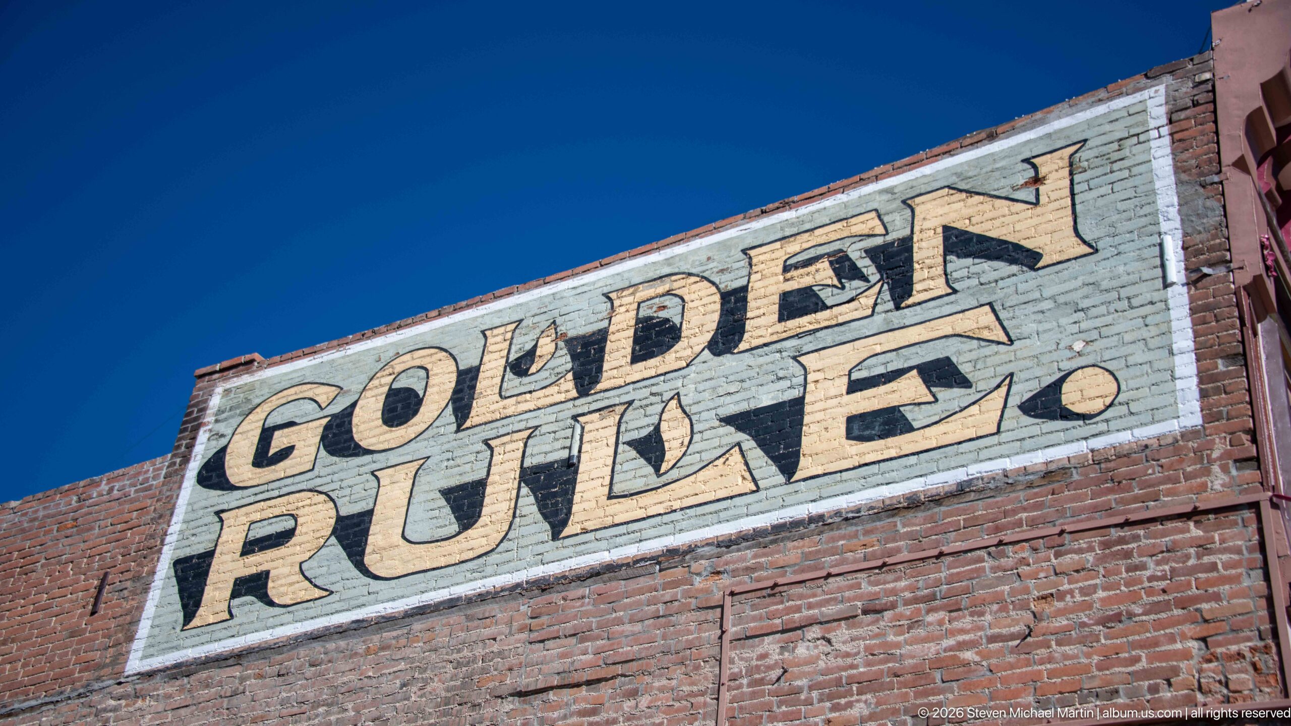
Enormous faded letters spelling GOLDEN RULE cover the upper brick wall of a downtown Philipsburg building. The painted sign survives as a prominent commercial ghost sign, its cream field and dark outlined lettering weathered but still highly legible against the red masonry. Seen in isolation against a deep blue sky, the advertisement becomes both graphic landmark and evidence of the district’s long retail history.
Caption
Enormous faded letters spelling GOLDEN RULE cover the upper brick wall of a downtown Philipsburg building. The painted sign survives as a prominent commercial ghost sign, its cream field and dark outlined lettering weathered but still highly legible against the red masonry. Seen in isolation against a deep blue sky, the advertisement becomes both graphic landmark and evidence of the district’s long retail history.
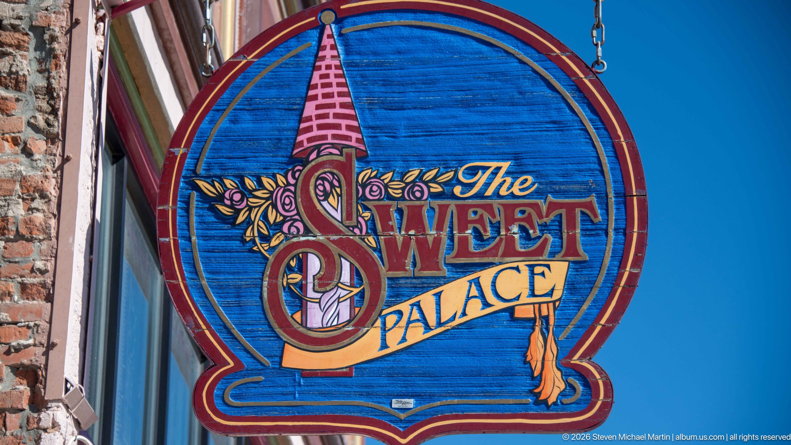
A brightly painted hanging sign announces The Sweet Palace against a clear Montana sky. Its barrel-shaped blue field, oversized ornamental initial, floral scrollwork, and small orange cat turn ordinary storefront signage into a piece of folk-style commercial art. The close view isolates the handcrafted character of the sign from the surrounding historic brick architecture of downtown Philipsburg.
Caption
A brightly painted hanging sign announces The Sweet Palace against a clear Montana sky. Its barrel-shaped blue field, oversized ornamental initial, floral scrollwork, and small orange cat turn ordinary storefront signage into a piece of folk-style commercial art. The close view isolates the handcrafted character of the sign from the surrounding historic brick architecture of downtown Philipsburg.
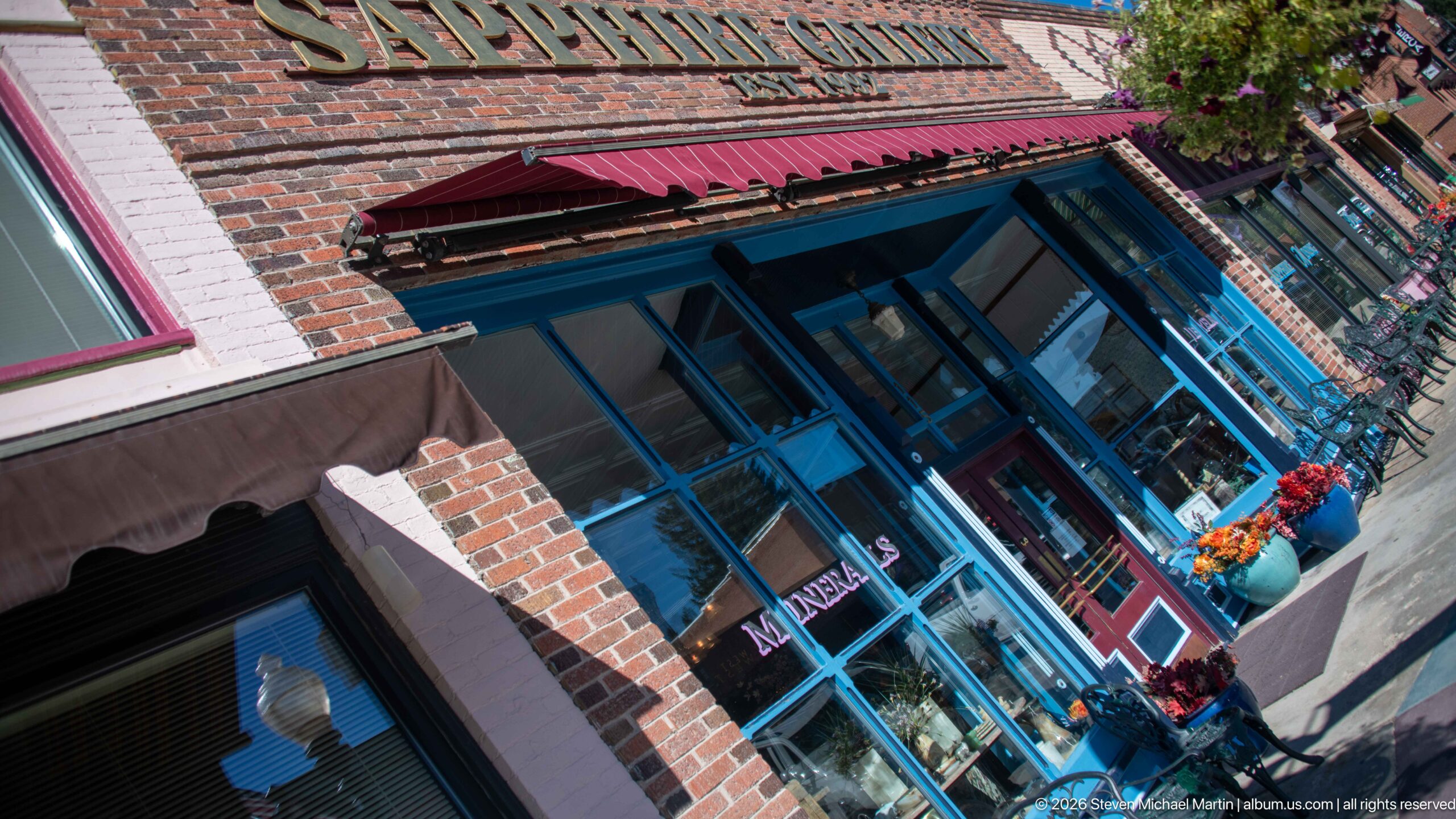
The former C.T. Huffman Grocery building now houses Sapphire Gallery, as documented in the supplied Philipsburg walking-tour article. Blue-painted storefront framing, red awnings, brick walls, and large display windows define the street level, while gallery lettering is visible through the glass. The oblique composition emphasizes the depth of the historic commercial frontage and its continued retail use.
Caption
The former C.T. Huffman Grocery building now houses Sapphire Gallery, as documented in the supplied Philipsburg walking-tour article. Blue-painted storefront framing, red awnings, brick walls, and large display windows define the street level, while gallery lettering is visible through the glass. The oblique composition emphasizes the depth of the historic commercial frontage and its continued retail use.
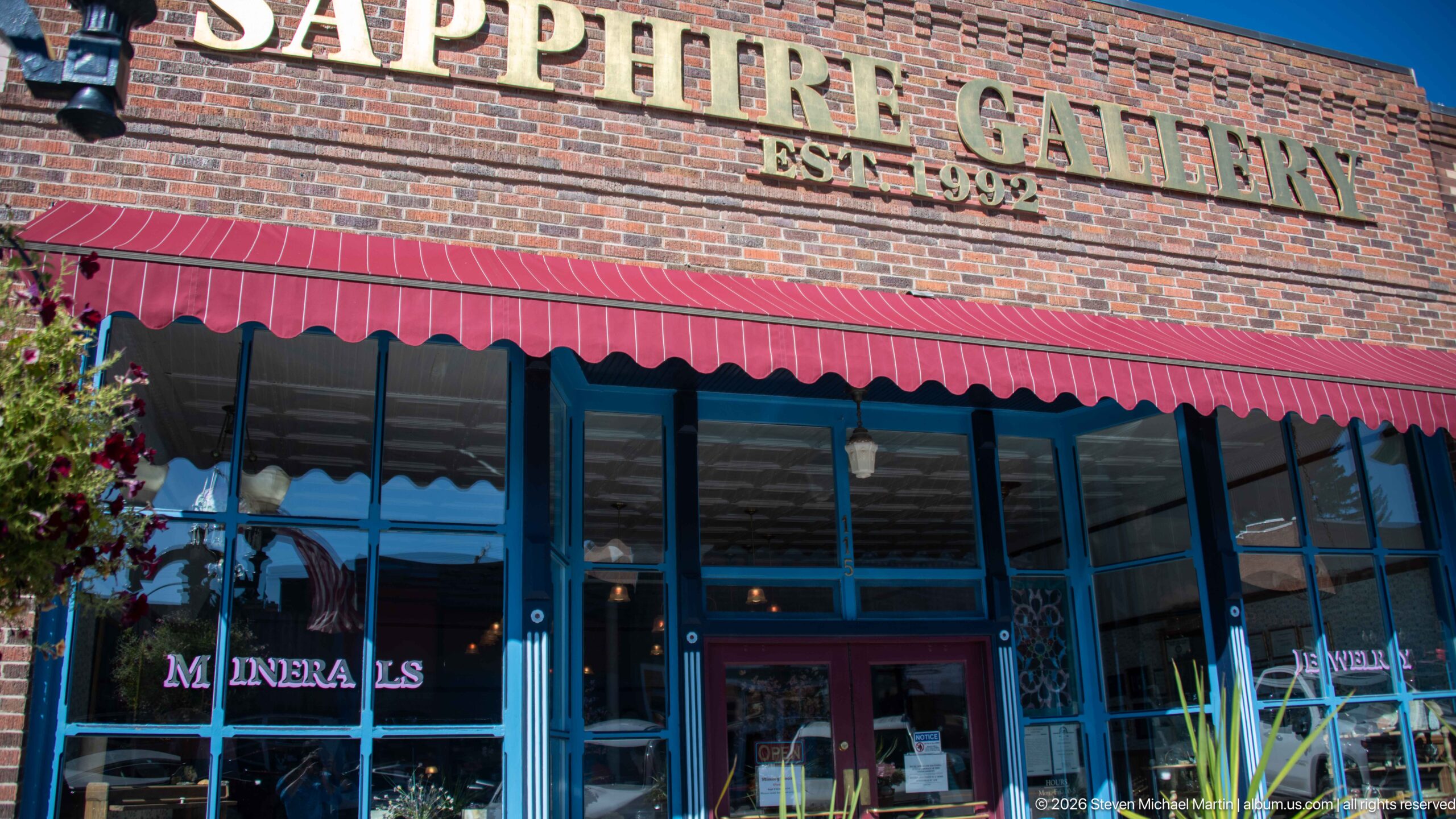
Gold SAPPHIRE GALLERY lettering spans the brick façade above the blue-framed storefront of the former C.T. Huffman Grocery building. The supplied walking-tour article identifies this historic property as the present home of Sapphire Gallery. A red awning shades the tall windows, where additional lettering advertises minerals and related merchandise, linking contemporary gemstone retail with Philipsburg’s mining heritage.
Caption
Gold SAPPHIRE GALLERY lettering spans the brick façade above the blue-framed storefront of the former C.T. Huffman Grocery building. The supplied walking-tour article identifies this historic property as the present home of Sapphire Gallery. A red awning shades the tall windows, where additional lettering advertises minerals and related merchandise, linking contemporary gemstone retail with Philipsburg’s mining heritage.
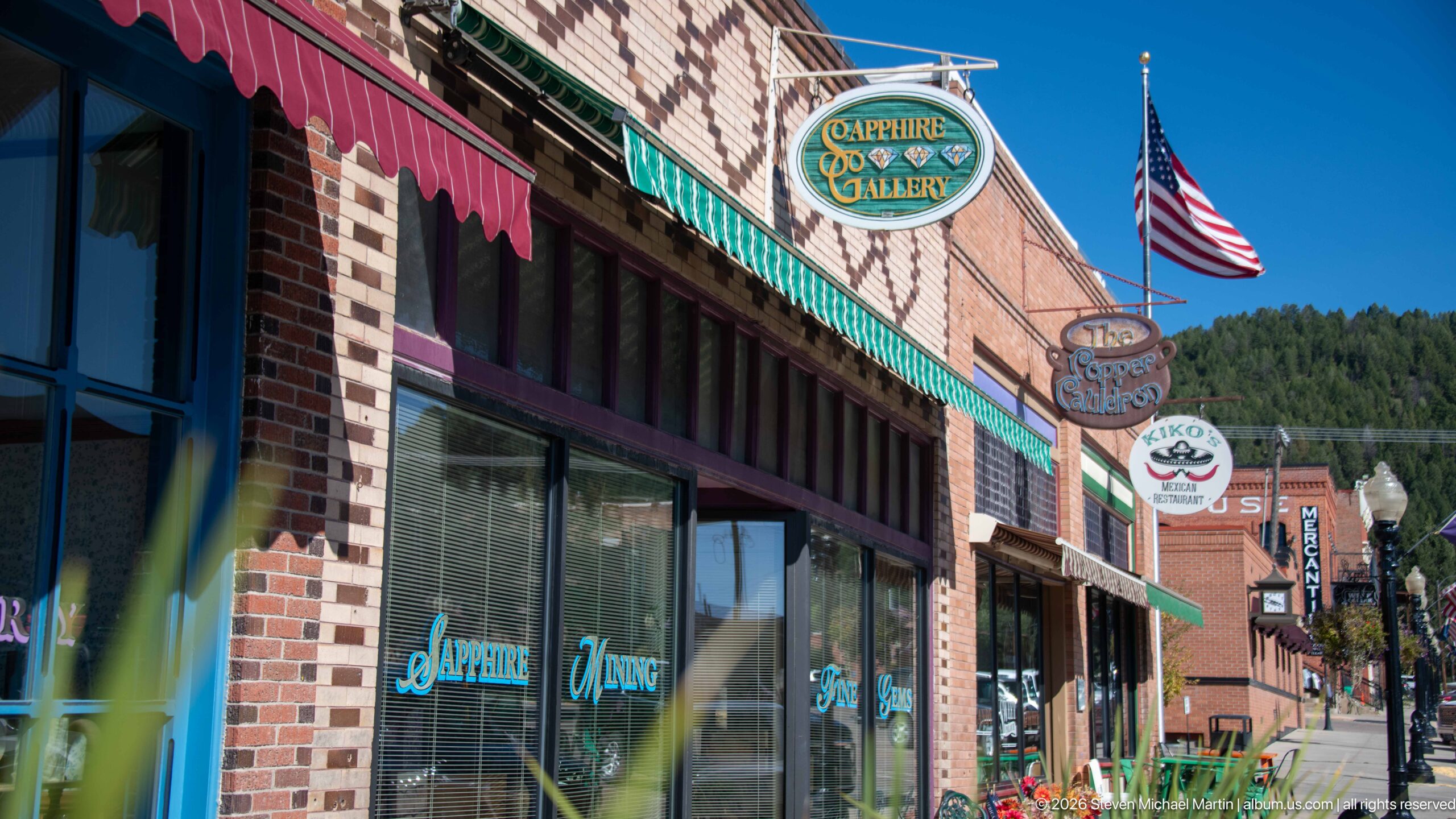
Sapphire Gallery occupies the former C.T. Huffman Grocery building at the near end of this East Broadway streetscape. The supplied walking-tour article identifies the historic property, while the photograph extends the view along neighboring storefronts beneath projecting signs and an American flag. Mountain slopes beyond the block reconnect the compact commercial district with Philipsburg’s surrounding western Montana landscape.
Caption
Sapphire Gallery occupies the former C.T. Huffman Grocery building at the near end of this East Broadway streetscape. The supplied walking-tour article identifies the historic property, while the photograph extends the view along neighboring storefronts beneath projecting signs and an American flag. Mountain slopes beyond the block reconnect the compact commercial district with Philipsburg’s surrounding western Montana landscape.
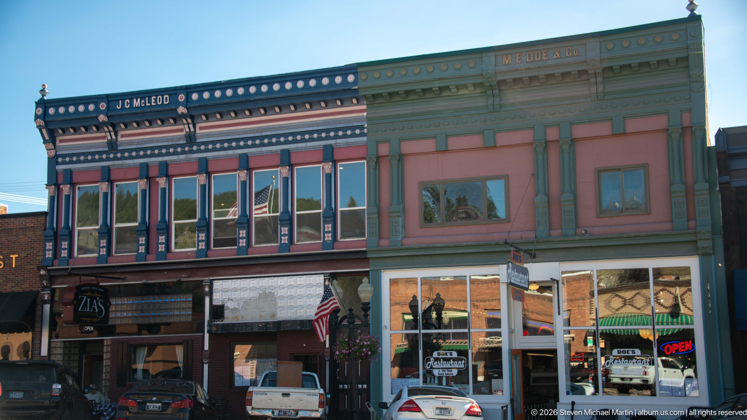
Two documented Philipsburg landmarks stand side by side: the richly ornamented J.C. McLeod Building at left and the M.E. Doe Building at right. The supplied walking-tour article illustrates and names both façades. McLeod’s dark polychrome storefront is crowned by circular motifs and elaborate trim, while the Doe building uses a lighter painted palette and a more restrained cornice above its modern ground-floor businesses.
Caption
Two documented Philipsburg landmarks stand side by side: the richly ornamented J.C. McLeod Building at left and the M.E. Doe Building at right. The supplied walking-tour article illustrates and names both façades. McLeod’s dark polychrome storefront is crowned by circular motifs and elaborate trim, while the Doe building uses a lighter painted palette and a more restrained cornice above its modern ground-floor businesses.
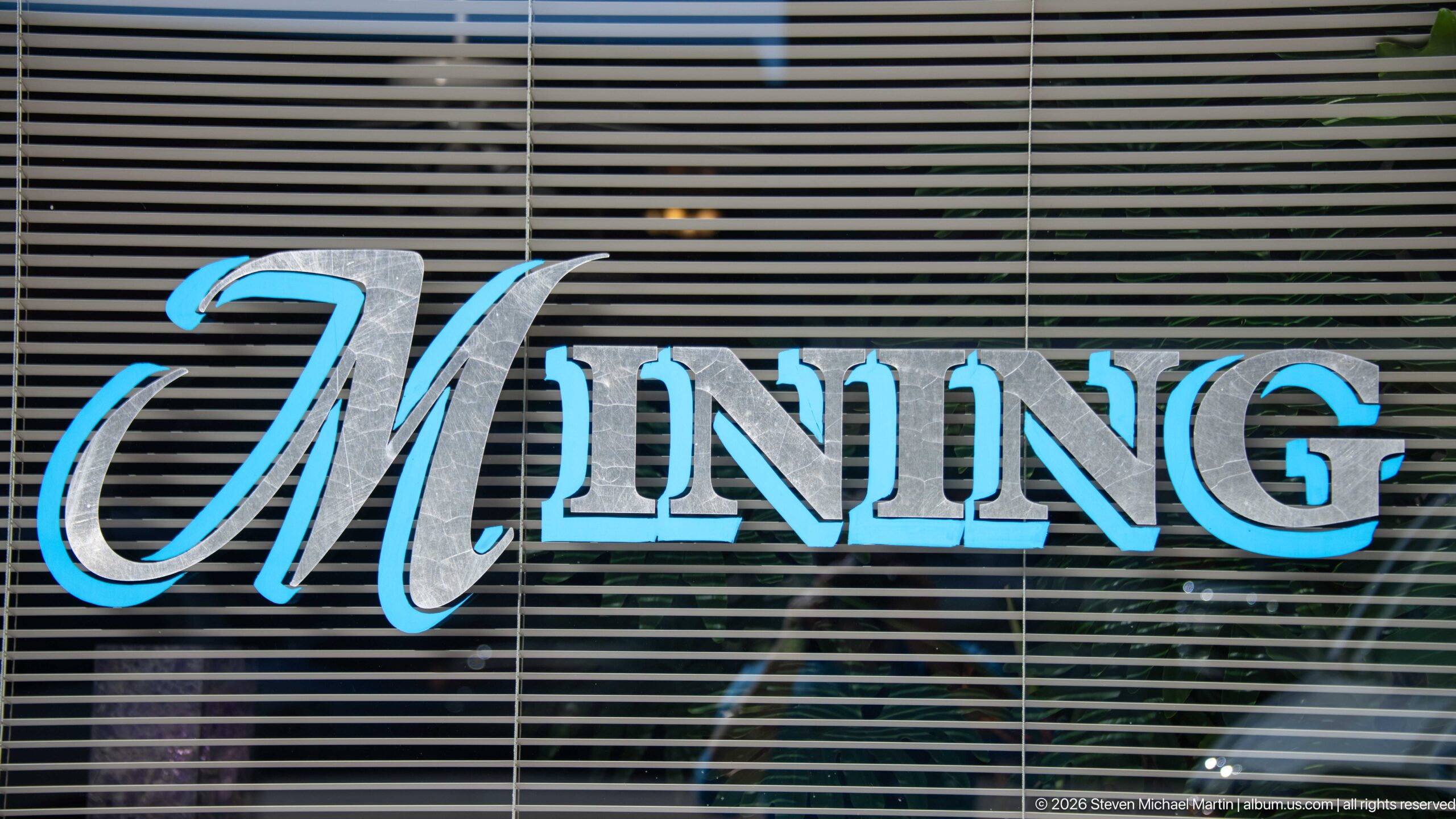
Stylized MINING lettering fills a storefront window in pale blue and silver, backed by horizontal blinds. The oversized script initial and shadowed block letters turn a simple word into a graphic reference to the industry that shaped Philipsburg and the surrounding Flint Creek mining district. Reflections and the layered blinds give the sign additional depth while keeping the composition tightly focused on typography.
Caption
Stylized MINING lettering fills a storefront window in pale blue and silver, backed by horizontal blinds. The oversized script initial and shadowed block letters turn a simple word into a graphic reference to the industry that shaped Philipsburg and the surrounding Flint Creek mining district. Reflections and the layered blinds give the sign additional depth while keeping the composition tightly focused on typography.

Large SAPPHIRE lettering in blue and silver fills this storefront window, pairing an elaborate script initial with bold shadowed capitals. The word directly evokes the gemstones for which the Philipsburg area is known and complements the mineral-oriented businesses visible elsewhere in the downtown portfolio. Horizontal blinds provide a neutral backdrop that isolates the sign’s carefully styled typography.
Caption
Large SAPPHIRE lettering in blue and silver fills this storefront window, pairing an elaborate script initial with bold shadowed capitals. The word directly evokes the gemstones for which the Philipsburg area is known and complements the mineral-oriented businesses visible elsewhere in the downtown portfolio. Horizontal blinds provide a neutral backdrop that isolates the sign’s carefully styled typography.
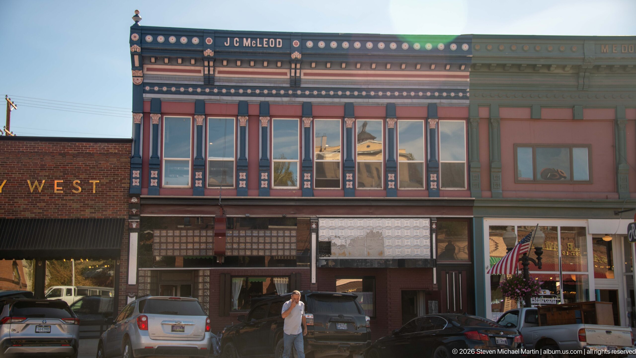
The J.C. McLeod Building fills the center of this frontal streetscape view, its name still visible along the elaborate upper cornice. The supplied walking-tour article identifies the 1890 commercial building and illustrates the same tall window band, circular ornaments, and richly painted trim. Modern storefront alterations occupy the ground floor, while the historic upper story remains the building’s defining visual feature.
Caption
The J.C. McLeod Building fills the center of this frontal streetscape view, its name still visible along the elaborate upper cornice. The supplied walking-tour article identifies the 1890 commercial building and illustrates the same tall window band, circular ornaments, and richly painted trim. Modern storefront alterations occupy the ground floor, while the historic upper story remains the building’s defining visual feature.
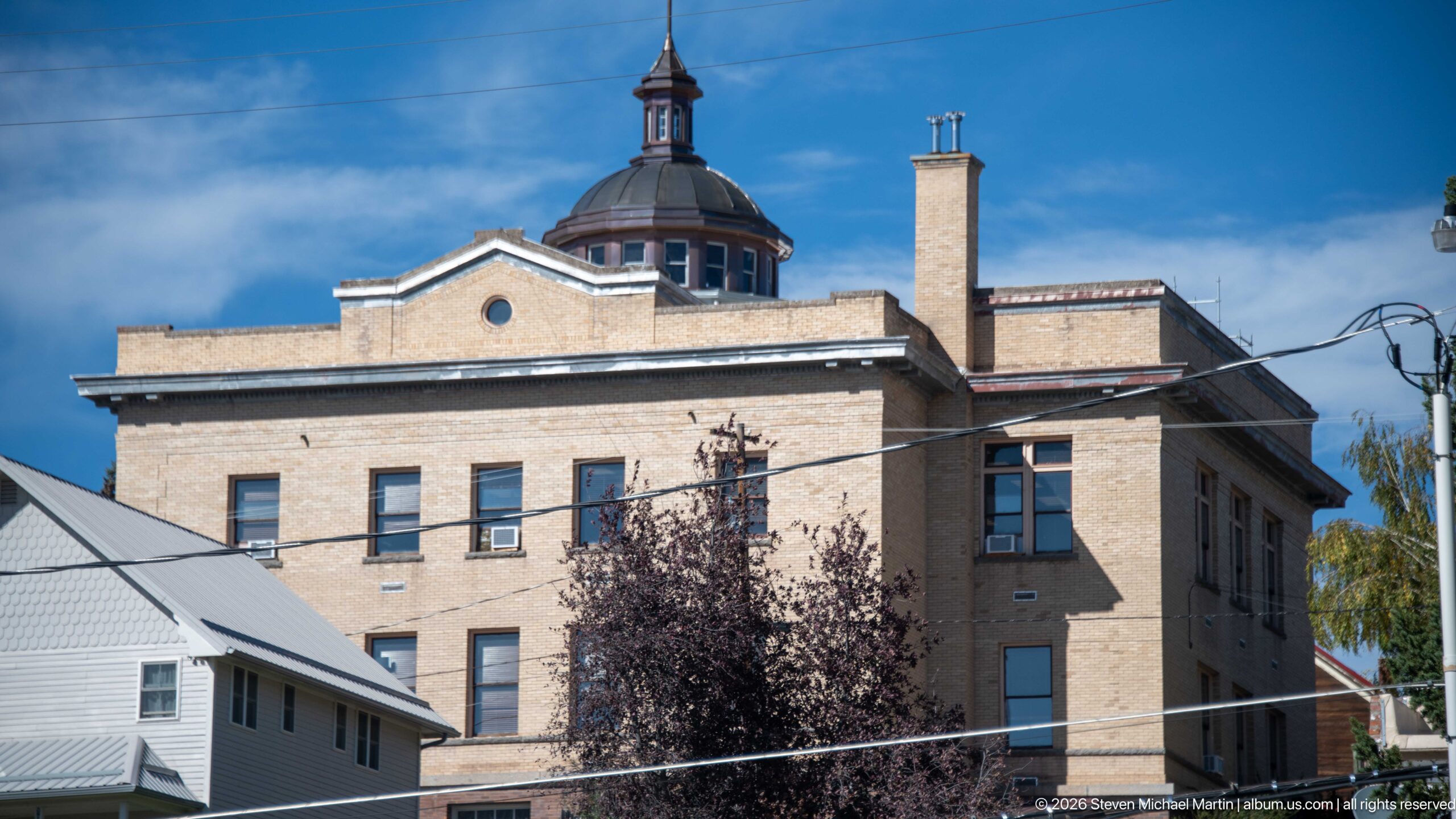
The Granite County Courthouse rises above nearby roofs with its pale masonry walls and prominent domed cupola. The supplied walking-tour article identifies the courthouse as a 1912 building constructed of granite and trimmed in oak inside. From this side view, the raised central roofline, dome, chimneys, and orderly window rows distinguish the civic landmark from Philipsburg’s lower commercial streetscape.
Caption
The Granite County Courthouse rises above nearby roofs with its pale masonry walls and prominent domed cupola. The supplied walking-tour article identifies the courthouse as a 1912 building constructed of granite and trimmed in oak inside. From this side view, the raised central roofline, dome, chimneys, and orderly window rows distinguish the civic landmark from Philipsburg’s lower commercial streetscape.
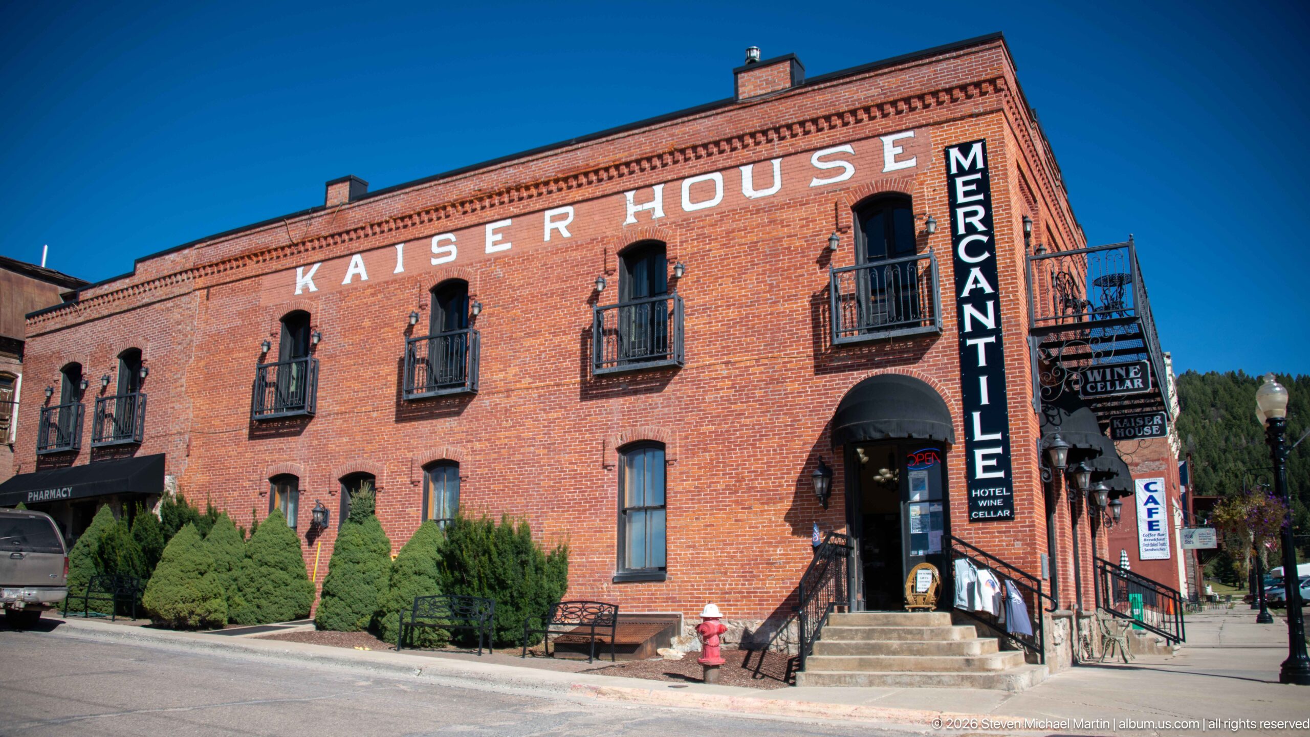
KAISER HOUSE lettering stretches across the upper brick wall of this substantial two-story building, one of the properties identified in the supplied Philipsburg walking-tour article. Tall segmental-arched windows with small iron balconies line the second floor, while a corner entrance and projecting MERCANTILE sign serve contemporary businesses below. The broad masonry façade preserves the scale of a major historic downtown commercial property.
Caption
KAISER HOUSE lettering stretches across the upper brick wall of this substantial two-story building, one of the properties identified in the supplied Philipsburg walking-tour article. Tall segmental-arched windows with small iron balconies line the second floor, while a corner entrance and projecting MERCANTILE sign serve contemporary businesses below. The broad masonry façade preserves the scale of a major historic downtown commercial property.
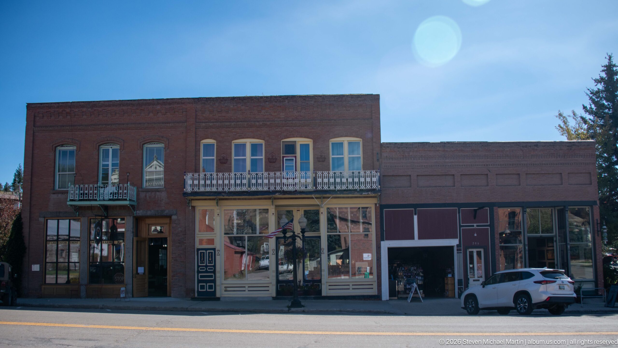
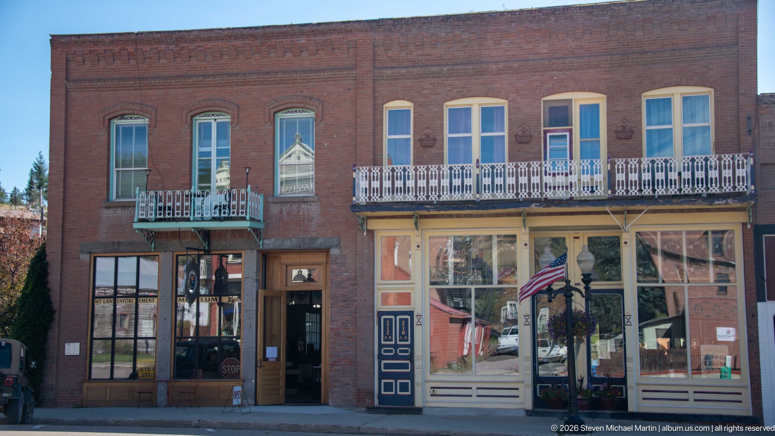
The Weinstein Building forms the left portion of this brick commercial frontage, identifiable through the supplied walking-tour article by its paired upper windows and small iron balcony. The article recounts the building’s origins with merchant William Weinstein and its long sequence of commercial and lodging uses. The wider view places the historic block beside an adjoining lower storefront, showing how individual properties merge into Philipsburg’s continuous street wall.
Caption
The Weinstein Building forms the left portion of this brick commercial frontage, identifiable through the supplied walking-tour article by its paired upper windows and small iron balcony. The article recounts the building’s origins with merchant William Weinstein and its long sequence of commercial and lodging uses. The wider view places the historic block beside an adjoining lower storefront, showing how individual properties merge into Philipsburg’s continuous street wall.
A closer view of the Weinstein Building concentrates on its second-story brickwork, tall windows, and two iron balconies above altered street-level storefronts. The supplied walking-tour article identifies the property and notes its succession of commercial, lodging, and office uses. Decorative brick panels between the windows and the surviving balcony ironwork preserve much of the building’s nineteenth-century upper façade despite later changes below.
Caption
A closer view of the Weinstein Building concentrates on its second-story brickwork, tall windows, and two iron balconies above altered street-level storefronts. The supplied walking-tour article identifies the property and notes its succession of commercial, lodging, and office uses. Decorative brick panels between the windows and the surviving balcony ironwork preserve much of the building’s nineteenth-century upper façade despite later changes below.
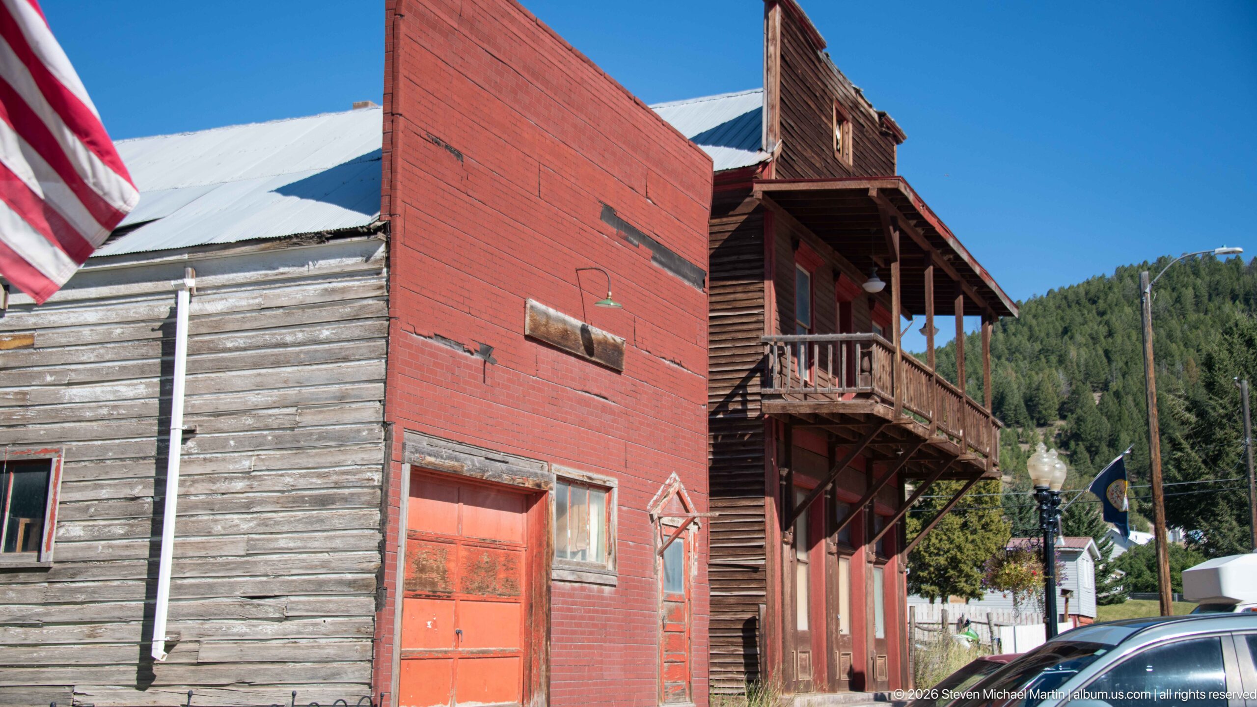
Weathered rear and side elevations reveal a less polished layer of Philipsburg’s historic commercial district. Rough horizontal boards, faded red-painted masonry, garage openings, exterior stairs, and a second-story wooden gallery expose service spaces that contrast with the decorated storefronts facing the main streets. The mountain slope beyond reinforces how tightly the town’s historic building fabric sits against its western Montana setting.
Caption
Weathered rear and side elevations reveal a less polished layer of Philipsburg’s historic commercial district. Rough horizontal boards, faded red-painted masonry, garage openings, exterior stairs, and a second-story wooden gallery expose service spaces that contrast with the decorated storefronts facing the main streets. The mountain slope beyond reinforces how tightly the town’s historic building fabric sits against its western Montana setting.
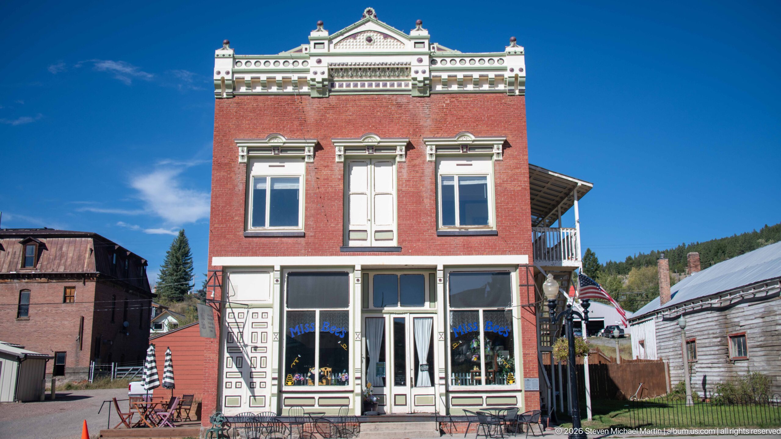
A narrow red-brick commercial building rises three bays wide beneath an elaborate white-painted cornice and shaped parapet. Hooded upper windows, small finials, decorative panels, and a carefully articulated storefront give the slender façade unusual vertical emphasis. Outdoor tables at the side and neighboring weathered structures place the restored building within a varied block of Philipsburg’s historic district.
Caption
A narrow red-brick commercial building rises three bays wide beneath an elaborate white-painted cornice and shaped parapet. Hooded upper windows, small finials, decorative panels, and a carefully articulated storefront give the slender façade unusual vertical emphasis. Outdoor tables at the side and neighboring weathered structures place the restored building within a varied block of Philipsburg’s historic district.
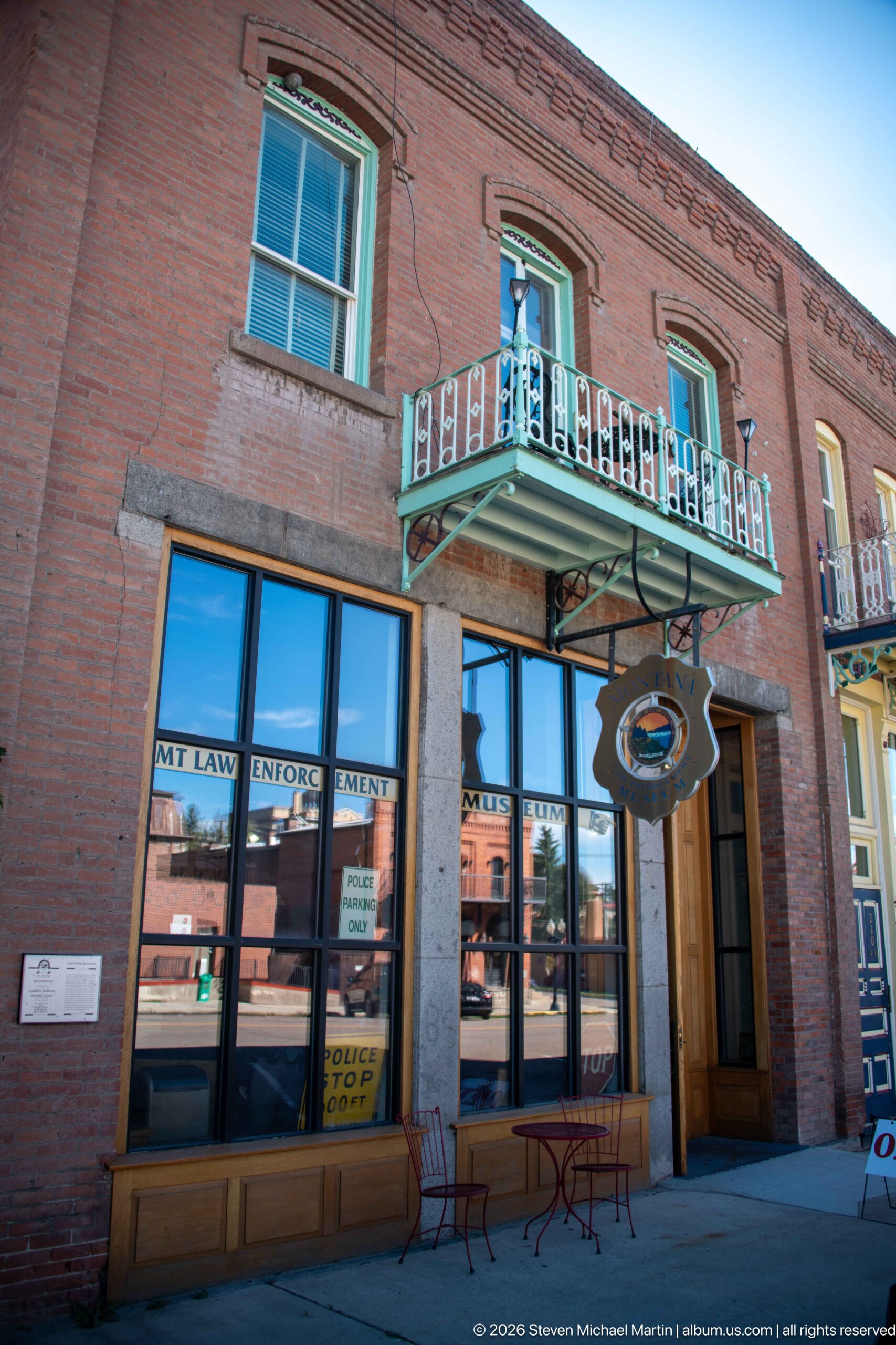
The Weinstein Building’s street level appears in close perspective beneath one of its ornate iron balconies. A window marked MT LAW ENFORCEMENT occupies part of the ground floor, while a projecting oval sign and café-style tables animate the sidewalk. The supplied walking-tour article identifies the building and documents its long history of changing tenants, making the contemporary offices another chapter in that continuing commercial use.
Caption
The Weinstein Building’s street level appears in close perspective beneath one of its ornate iron balconies. A window marked MT LAW ENFORCEMENT occupies part of the ground floor, while a projecting oval sign and café-style tables animate the sidewalk. The supplied walking-tour article identifies the building and documents its long history of changing tenants, making the contemporary offices another chapter in that continuing commercial use.
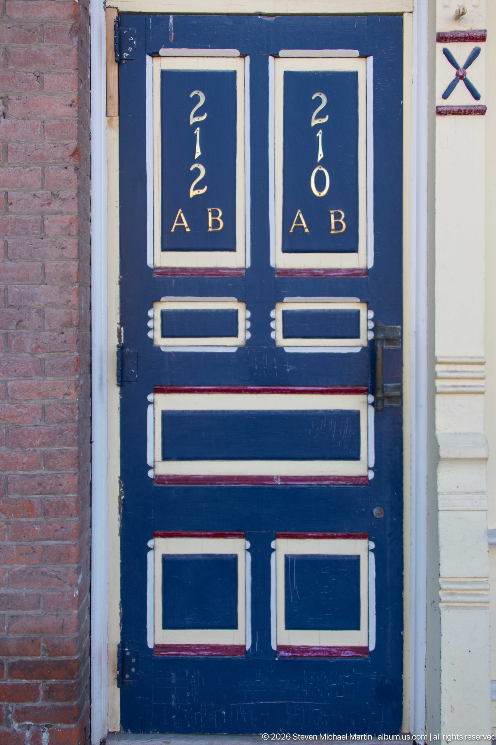
Blue-and-cream double doors marked 212 A and 212 B provide a tightly framed architectural detail within the historic district. Gold numbering, rectangular inset panels, and contrasting cream moldings give the entrance a formal decorative rhythm, while brick at one edge and carved trim at the other reveal the doorway’s relationship to an older commercial façade. The close composition preserves details easily lost in a full-building view.
Caption
Blue-and-cream double doors marked 212 A and 212 B provide a tightly framed architectural detail within the historic district. Gold numbering, rectangular inset panels, and contrasting cream moldings give the entrance a formal decorative rhythm, while brick at one edge and carved trim at the other reveal the doorway’s relationship to an older commercial façade. The close composition preserves details easily lost in a full-building view.
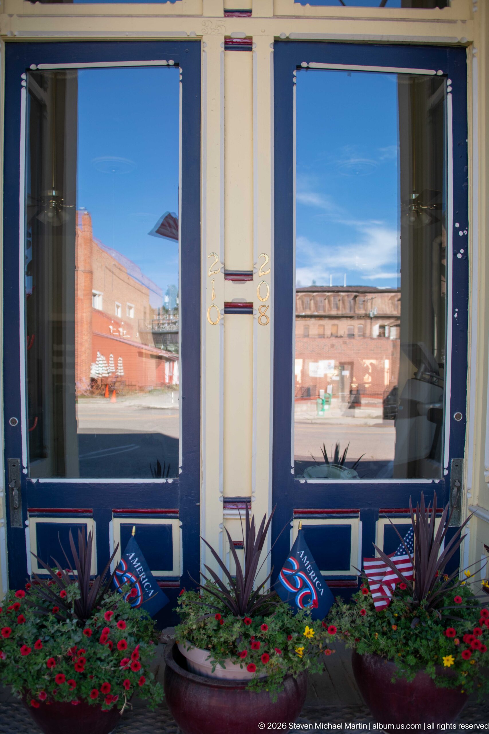
Flower-filled planters run beneath tall blue-framed storefront windows, where the opposite side of Philipsburg’s commercial district appears in crisp reflection. Cream pilasters divide the openings, and small American flags and patriotic pennants punctuate the red blossoms below. By using the glass as a mirror, the photograph records both the decorated façade and a second layer of historic brick streetscape across the road.
Caption
Flower-filled planters run beneath tall blue-framed storefront windows, where the opposite side of Philipsburg’s commercial district appears in crisp reflection. Cream pilasters divide the openings, and small American flags and patriotic pennants punctuate the red blossoms below. By using the glass as a mirror, the photograph records both the decorated façade and a second layer of historic brick streetscape across the road.
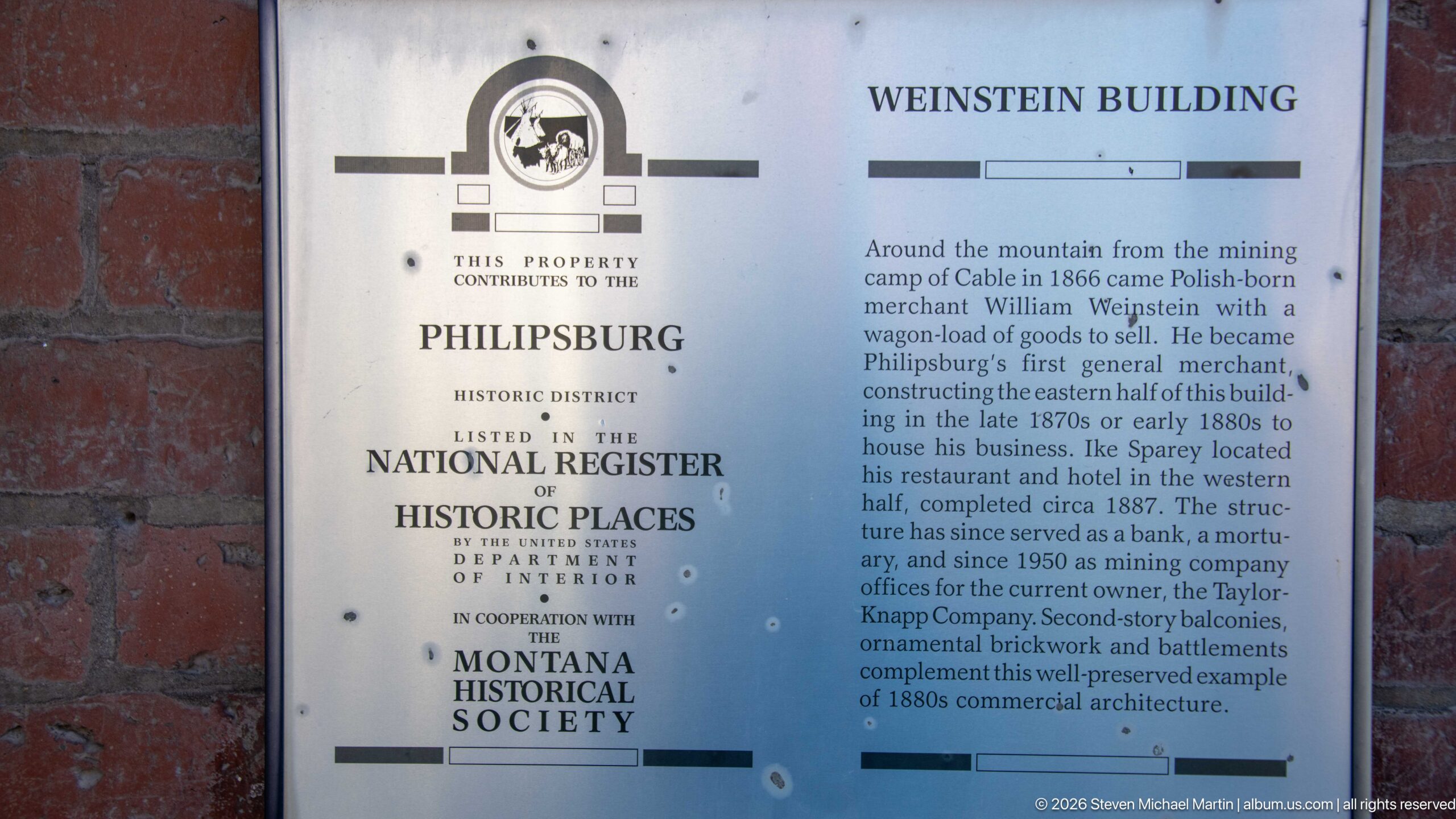
A mounted historical marker identifies the Weinstein Building and explains its association with Polish-born merchant William Weinstein, who arrived in Philipsburg from Cable with a wagonload of dry goods. The plaque describes the building’s construction and later uses while also identifying the property as contributing to the Philipsburg Historic District, listed in the National Register of Historic Places.
Caption
A mounted historical marker identifies the Weinstein Building and explains its association with Polish-born merchant William Weinstein, who arrived in Philipsburg from Cable with a wagonload of dry goods. The plaque describes the building’s construction and later uses while also identifying the property as contributing to the Philipsburg Historic District, listed in the National Register of Historic Places.
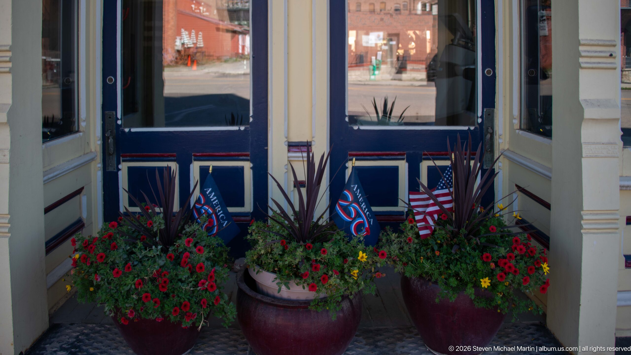
Large planters overflowing with red flowers and spiky foliage frame a recessed blue-and-cream storefront entrance. Small American flags and patriotic decorative pennants rise from the containers, while the glass doors reflect the brick buildings across the street. The close view turns a functional entry into a colorful seasonal detail within Philipsburg’s historic commercial district.
Caption
Large planters overflowing with red flowers and spiky foliage frame a recessed blue-and-cream storefront entrance. Small American flags and patriotic decorative pennants rise from the containers, while the glass doors reflect the brick buildings across the street. The close view turns a functional entry into a colorful seasonal detail within Philipsburg’s historic commercial district.
Field Guide
Overview
Philipsburg is presented in this portfolio as a surviving Montana mining-era town whose historic commercial district remains active rather than frozen in time. The photographs move between broad East Broadway streetscapes, individual nineteenth- and early-twentieth-century buildings, architectural details, historic walking-tour material, and contemporary businesses occupying older storefronts. Together they show how mining prosperity helped create a substantial town of brick commercial blocks, hotels, saloons, civic buildings, churches, residences, and service businesses, many of which continue to shape Philipsburg’s visual identity.
Mining History
The portfolio connects Philipsburg’s built environment to the mining economy that established the town in the Flint Creek Valley. Historic walking-tour pages document businesses and institutions that served a growing mining community, while surviving commercial buildings demonstrate the permanence that followed the earliest settlement period. A storefront window explicitly references MINING, and the sequence of hotels, saloons, mercantile buildings, garages, residences, and civic structures shows the broader town that developed around extraction rather than depicting mining as an isolated industrial activity.
Ore Body & Geology
The source package establishes mining as central to Philipsburg’s history but does not photograph or document an ore body closely enough to support a detailed geological interpretation. Mineral culture is instead visible indirectly in the town’s commercial identity, including prominent SAPPHIRE lettering and businesses that reference the mineral resources of the Philipsburg area. These photographs are best used to explain how geology and mineral extraction remain part of the town’s public identity while avoiding unsupported claims about specific formations, ore minerals, or underground workings.
Open-Pit Engineering & Industrial Landscape
This portfolio does not document an open-pit mine, so the strongest industrial evidence is found in Philipsburg’s surviving townscape and working commercial interiors. Historic masonry blocks, former mercantile buildings, service alleys, rear elevations, and adapted storefronts show the infrastructure of a community built to support regional industry. Contemporary brewing equipment adds a modern industrial layer: copper-clad and stainless-steel vessels, tanks, valves, platforms, and piping occupy historic commercial space, demonstrating continued production within the inherited mining-town fabric.
Environmental Legacy & Remediation
The 6.4.3.7 source package does not provide direct photographic evidence of mine remediation, contaminated land, tailings treatment, or other environmental cleanup work, so those subjects should not be inferred here. What the photographs do establish is the continuing relationship between Philipsburg’s historic built environment and its mountain setting. Broad streetscape views place the commercial district against forested slopes, while wildlife moving through downtown demonstrates how the contemporary town and surrounding environment remain visually intertwined.
Visitor Experience
Philipsburg rewards exploration at walking pace. The portfolio repeatedly shifts from complete streetscapes to cornices, balconies, painted advertisements, storefront signs, plaques, shop interiors, galleries, brewery spaces, and the historic walking-tour article used to identify individual buildings. Contemporary businesses occupy many of the older structures, so architectural history is encountered alongside cafés, galleries, shops, lodging, and brewing rather than as a separate museum district. The result is a visitor experience built around close observation of a compact, active historic town.
Photography Notes
The portfolio demonstrates the value of alternating broad contextual views with tight architectural studies. Wider photographs establish the continuity of East Broadway and its mountain backdrop, while frontal compositions clarify individual façades such as the J.C. McLeod Building and Walker Commercial Company building. Close views isolate cornices, painted ornament, ghost signs, balconies, doors, and commercial lettering. Reflections in storefront glass and oblique sidewalk views add depth, while the walking-tour pages provide an important visual reference for matching photographed buildings to documented historic names.