Fort Donelson National Battlefield
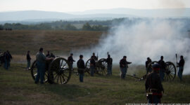
Fort Donelson National Battlefield commemorates one of the first major Union victories of the Civil War and the battle that brought national recognition to General Ulysses S. Grant. Captured in February 1862, the fort’s surrender secured control of the Cumberland River and opened key transportation routes into the Confederate interior. The victory played an important role in shaping the early momentum of Union military strategy.
The site preserves extensive earthworks, artillery positions, and river batteries that illustrate the strategic importance of the fort’s location. Positioned along the Cumberland River, Fort Donelson formed part of a defensive system designed to protect vital transportation corridors. The preserved terrain helps visitors understand the tactical decisions and battlefield movements that influenced the outcome of the engagement.
Today, visitors can follow driving routes and walking trails that connect major interpretive points throughout the battlefield. Scenic views of the river and surrounding landscape help convey the strategic significance of the site while encouraging reflection on the broader consequences of the Civil War.
A tall, pale stone obelisk rises from a low stepped base in a grassy clearing, with a small sculpted figure attached near its lower section. Leafless trees surround the monument and fill the background, while sunlight picks out the tapered shaft against the blue sky. The image records the monument’s vertical form and setting; its inscription is not legible at this distance. A tall, pale stone obelisk rises from a low stepped base in a grassy clearing, with a small sculpted figure attached near its lower section. Leafless trees surround the monument and fill the background, while sunlight picks out the tapered shaft against the blue sky. The image records the monument’s vertical form and setting; its inscription is not legible at this distance. An orange arrowhead-shaped National Park Service emblem is mounted against pale, rough-cut stone. The stylized evergreen tree, mountain, and bison appear below bold white lettering spelling “National Park Service.” The close crop removes the surrounding structure, turning the agency symbol and its contrasting colors into the entire subject. An orange arrowhead-shaped National Park Service emblem is mounted against pale, rough-cut stone. The stylized evergreen tree, mountain, and bison appear below bold white lettering spelling “National Park Service.” The close crop removes the surrounding structure, turning the agency symbol and its contrasting colors into the entire subject. A square stone pillar fills the frame, its inset plaque reading “U.S. Fort Donelson National Military Park.” A small pyramid of cannonballs caps the structure, with bare tree branches crossing a bright blue sky behind it. The close angle brings the park’s older naming and masonry texture forward, distinct from the wider entrance road view. A square stone pillar fills the frame, its inset plaque reading “U.S. Fort Donelson National Military Park.” A small pyramid of cannonballs caps the structure, with bare tree branches crossing a bright blue sky behind it. The close angle brings the park’s older naming and masonry texture forward, distinct from the wider entrance road view. A single green cannon points across broad water from within a low, rectangular emplacement reinforced with logs and earth. The gun occupies the foreground, while the river and wooded opposite bank extend across the background. This closer position makes the relationship between weapon, protective earthwork, and waterway explicit, complementing the preceding overview of several batteries. A single green cannon points across broad water from within a low, rectangular emplacement reinforced with logs and earth. The gun occupies the foreground, while the river and wooded opposite bank extend across the background. This closer position makes the relationship between weapon, protective earthwork, and waterway explicit, complementing the preceding overview of several batteries. Two green field cannons stand side by side on open grass, their long trails extending behind the large spoked wheels. A thin metal barrier separates the artillery from the visitor path, while leafless trees fill the background. The broad side view makes the similarity of the two pieces and their spacing across the clearing easy to compare. Two green field cannons stand side by side on open grass, their long trails extending behind the large spoked wheels. A thin metal barrier separates the artillery from the visitor path, while leafless trees fill the background. The broad side view makes the similarity of the two pieces and their spacing across the clearing easy to compare. Several low, rectangular earthwork positions descend across a grassy slope, each edged with logs or sandbags and some holding a dark cannon. A river curves along the right side, with wooded banks beyond. The elevated viewpoint reveals the arrangement of the gun positions in relation to the water, showing the defensive layout rather than focusing on one artillery piece. Several low, rectangular earthwork positions descend across a grassy slope, each edged with logs or sandbags and some holding a dark cannon. A river curves along the right side, with wooded banks beyond. The elevated viewpoint reveals the arrangement of the gun positions in relation to the water, showing the defensive layout rather than focusing on one artillery piece. A dark-bodied bird perches high among a web of bare branches, its profile silhouetted against a clear blue sky. The long tail and hooked-looking bill suggest a raptor, though the proof-sheet view does not resolve markings well enough for a secure species identification. The upward angle isolates the bird within the tree canopy, a brief natural-history detail amid the battlefield’s monuments and artillery. A dark-bodied bird perches high among a web of bare branches, its profile silhouetted against a clear blue sky. The long tail and hooked-looking bill suggest a raptor, though the proof-sheet view does not resolve markings well enough for a secure species identification. The upward angle isolates the bird within the tree canopy, a brief natural-history detail amid the battlefield’s monuments and artillery. A brown sign reading “Fort Donelson National Battlefield” is mounted on a low gray-stone wall beside a gently rising lawn. A smaller National Park Service line appears beneath the title, while leafless trees and a paved entrance road frame the site. The wide composition establishes the battlefield entrance and identifies the protected place before visitors reach its historic earthworks. A brown sign reading “Fort Donelson National Battlefield” is mounted on a low gray-stone wall beside a gently rising lawn. A smaller National Park Service line appears beneath the title, while leafless trees and a paved entrance road frame the site. The wide composition establishes the battlefield entrance and identifies the protected place before visitors reach its historic earthworks. A compact pyramid of dark iron cannonballs rests on a square stone pedestal in an open grassy area. A small metal plaque marked “U.S.” is fixed to the front, while leafless trees and another low stone border recede behind it. The tight framing emphasizes the cannonballs’ rounded forms and the federal mark, without assigning the display to a particular battery or engagement. A compact pyramid of dark iron cannonballs rests on a square stone pedestal in an open grassy area. A small metal plaque marked “U.S.” is fixed to the front, while leafless trees and another low stone border recede behind it. The tight framing emphasizes the cannonballs’ rounded forms and the federal mark, without assigning the display to a particular battery or engagement. A two-lane road curves between low stone walls and tall square pillars, each topped with a small cluster of cannonballs. Yellow center lines guide the eye toward the trees beyond the entrance, while winter grass and bare branches frame the route. This view moves from the sign and marker details to the spatial experience of entering the battlefield grounds. A two-lane road curves between low stone walls and tall square pillars, each topped with a small cluster of cannonballs. Yellow center lines guide the eye toward the trees beyond the entrance, while winter grass and bare branches frame the route. This view moves from the sign and marker details to the spatial experience of entering the battlefield grounds. An open-sided pavilion stands among leafless trees, supported by square stone columns beneath a long, weathered green roof. A National Park Service emblem is attached to one pillar, and a small “You Are Here” sign stands near the paved approach. The sheltered tables and benches are visible within the shaded structure, placing visitor amenities in the historic landscape. An open-sided pavilion stands among leafless trees, supported by square stone columns beneath a long, weathered green roof. A National Park Service emblem is attached to one pillar, and a small “You Are Here” sign stands near the paved approach. The sheltered tables and benches are visible within the shaded structure, placing visitor amenities in the historic landscape. Dozens of small shield-shaped and round badges are arranged in neat rows across a fabric-covered display table. Their enamel-like surfaces vary in color and carry miniature symbols, numbers, or lettering that cannot be read at this scale. Framed pictures and additional exhibits appear beyond the table. The oblique view emphasizes the collection’s quantity and varied designs rather than identifying individual units. Dozens of small shield-shaped and round badges are arranged in neat rows across a fabric-covered display table. Their enamel-like surfaces vary in color and carry miniature symbols, numbers, or lettering that cannot be read at this scale. Framed pictures and additional exhibits appear beyond the table. The oblique view emphasizes the collection’s quantity and varied designs rather than identifying individual units. A yellowed military plan titled “Plan of Fort Henry and its Outworks” depicts a river bend, surrounding terrain, and the fort’s defensive lines. Fine labels and a date appear near the top, while dark brown shading marks the earthworks against the pale map. The framed document concerns Fort Henry rather than the battlefield named in this portfolio, a distinction made explicit by its title. A yellowed military plan titled “Plan of Fort Henry and its Outworks” depicts a river bend, surrounding terrain, and the fort’s defensive lines. Fine labels and a date appear near the top, while dark brown shading marks the earthworks against the pale map. The framed document concerns Fort Henry rather than the battlefield named in this portfolio, a distinction made explicit by its title. A museum panel combines a large historic image of steamboats and a crowded riverfront with a regional map and explanatory text. Blue and orange lines distinguish waterways and military positions across the map, while the lower section discusses the importance of river routes. The composition connects transportation and wartime geography without requiring the small print to carry the scene alone. A museum panel combines a large historic image of steamboats and a crowded riverfront with a regional map and explanatory text. Blue and orange lines distinguish waterways and military positions across the map, while the lower section discusses the importance of river routes. The composition connects transportation and wartime geography without requiring the small print to carry the scene alone. A pale historic military map records a network of winding waterways, contour-like terrain marks, roads, and defensive positions. A title and engineering credit sit near the upper center, while a compass rose and smaller inset appear along the right. The original paper’s pink and gray tones remain visible beneath the fine linework; individual labels are too small to transcribe confidently. A pale historic military map records a network of winding waterways, contour-like terrain marks, roads, and defensive positions. A title and engineering credit sit near the upper center, while a compass rose and smaller inset appear along the right. The original paper’s pink and gray tones remain visible beneath the fine linework; individual labels are too small to transcribe confidently. An interpretive panel presents a painted scene of people gathered outside a long, two-story building, with reproduced handwritten letters and explanatory text arranged around it. The central image shows figures assembled along a porch and roadway, while the documents at right connect the scene with named military leaders. The display’s composition brings a public event and written records together without requiring the small text to carry the image alone. An interpretive panel presents a painted scene of people gathered outside a long, two-story building, with reproduced handwritten letters and explanatory text arranged around it. The central image shows figures assembled along a porch and roadway, while the documents at right connect the scene with named military leaders. The display’s composition brings a public event and written records together without requiring the small text to carry the image alone. A dark green field cannon rests on a two-wheeled carriage in a quiet clearing, its barrel angled slightly upward and its trail extending toward the viewer. Bare trees stand closely behind it, while the ground rises gently beneath the wheels. The isolated display gives the artillery piece room in the frame, revealing its barrel, carriage, and broad wooden-spoked wheels. A dark green field cannon rests on a two-wheeled carriage in a quiet clearing, its barrel angled slightly upward and its trail extending toward the viewer. Bare trees stand closely behind it, while the ground rises gently beneath the wheels. The isolated display gives the artillery piece room in the frame, revealing its barrel, carriage, and broad wooden-spoked wheels. A wall panel titled “Control the Rivers and Railroads” places a blue-and-orange regional map between archival photographs of river traffic and industrial waterfronts. Text below explains the strategic importance of transportation routes during the conflict. The map’s branching waterways and rail lines organize the display, while the historic images show the vessels and crowded riverfronts associated with those routes. A wall panel titled “Control the Rivers and Railroads” places a blue-and-orange regional map between archival photographs of river traffic and industrial waterfronts. Text below explains the strategic importance of transportation routes during the conflict. The map’s branching waterways and rail lines organize the display, while the historic images show the vessels and crowded riverfronts associated with those routes. A broad, blue-toned interpretive panel titled “Ironclads” combines painted battle imagery, a map, inset photographs, and explanatory text. Smoke, water, and low armored vessels fill the central illustration, while headings and captions run across the top and sides. The design presents river warfare through layered visual sources, with the turbulent painted scene contrasting against the panel’s smaller documentary images. A broad, blue-toned interpretive panel titled “Ironclads” combines painted battle imagery, a map, inset photographs, and explanatory text. Smoke, water, and low armored vessels fill the central illustration, while headings and captions run across the top and sides. The design presents river warfare through layered visual sources, with the turbulent painted scene contrasting against the panel’s smaller documentary images. A blue-toned interpretive panel titled “Gunboat Flotilla” overlays river-battle imagery with short text sections, a small U.S. flag, and a historic portrait. Armored vessels and smoke appear across the lower scene, while a smaller archival photograph sits near the bottom left. The panel shifts attention from individual batteries to the flotilla and its role on the river. A blue-toned interpretive panel titled “Gunboat Flotilla” overlays river-battle imagery with short text sections, a small U.S. flag, and a historic portrait. Armored vessels and smoke appear across the lower scene, while a smaller archival photograph sits near the bottom left. The panel shifts attention from individual batteries to the flotilla and its role on the river. A dark cannon stands on a green carriage beside a white sign with a red border identifying the river batteries and naming two officers. Stacked protective material lines the ground behind the gun, with blue water visible beyond. The shallow focus keeps both the artillery piece and its interpretive label in view, linking the weapon to a named battery display. A dark cannon stands on a green carriage beside a white sign with a red border identifying the river batteries and naming two officers. Stacked protective material lines the ground behind the gun, with blue water visible beyond. The shallow focus keeps both the artillery piece and its interpretive label in view, linking the weapon to a named battery display. A zigzag split-rail fence crosses a grassy, tree-shaded area beside broad water. Several picnic tables sit between the fence and the riverbank, and bare trunks frame the view. The quiet visitor area occupies ground close to the battlefield’s river setting, contrasting with the weapons and interpretive displays shown elsewhere in the series. A zigzag split-rail fence crosses a grassy, tree-shaded area beside broad water. Several picnic tables sit between the fence and the riverbank, and bare trunks frame the view. The quiet visitor area occupies ground close to the battlefield’s river setting, contrasting with the weapons and interpretive displays shown elsewhere in the series. From a wooden-railed overlook, the broad river curves into the distance between wooded banks. A cannon and a slanted interpretive panel occupy the lower left, tying the water view to the site’s artillery history. The elevated composition gives the river most of the frame while retaining the interpretive features as foreground context. From a wooden-railed overlook, the broad river curves into the distance between wooded banks. A cannon and a slanted interpretive panel occupy the lower left, tying the water view to the site’s artillery history. The elevated composition gives the river most of the frame while retaining the interpretive features as foreground context. A Fort Donelson interpretive panel titled “From Henry to Donelson” arranges historical text, two portraits, route maps, and a lower plan across several horizontal sections. A painted battle scene forms the banner at the top, while colored lines trace the connected forts and waterways. The display explains a sequence of military events through maps and documentary imagery rather than a single view of the battlefield. A Fort Donelson interpretive panel titled “From Henry to Donelson” arranges historical text, two portraits, route maps, and a lower plan across several horizontal sections. A painted battle scene forms the banner at the top, while colored lines trace the connected forts and waterways. The display explains a sequence of military events through maps and documentary imagery rather than a single view of the battlefield. A printed interpretive page organizes visitor questions beneath short headings, including questions about the surrender structure, the Dover Hotel, and the battlefield’s preservation. Reproduced cursive signatures cross the pale background behind the text, giving the page a manuscript-like texture. The layout pairs practical questions with historical interpretation, though the smaller paragraphs are not all legible at proof-sheet scale. A printed interpretive page organizes visitor questions beneath short headings, including questions about the surrender structure, the Dover Hotel, and the battlefield’s preservation. Reproduced cursive signatures cross the pale background behind the text, giving the page a manuscript-like texture. The layout pairs practical questions with historical interpretation, though the smaller paragraphs are not all legible at proof-sheet scale. A brochure page headed “Fort Donelson Today” presents a guide to the park in three columns of text. Small photographs of a monument and park structures run across the top, while a colored site map spans the middle and lower portion. The layout combines current visitor orientation with historical context, using the map to connect the written guidance to locations throughout the battlefield. A brochure page headed “Fort Donelson Today” presents a guide to the park in three columns of text. Small photographs of a monument and park structures run across the top, while a colored site map spans the middle and lower portion. The layout combines current visitor orientation with historical context, using the map to connect the written guidance to locations throughout the battlefield. A brochure page titled “Fort Donelson” and “Surrender House” places a color photograph of a long, two-story building near the top. Beneath it, several text sections and a portrait explain the building’s association with the surrender and the site’s history. The photograph shows the structure from the lawn, with its deep porch and white walls visible against bare trees. A brochure page titled “Fort Donelson” and “Surrender House” places a color photograph of a long, two-story building near the top. Beneath it, several text sections and a portrait explain the building’s association with the surrender and the site’s history. The photograph shows the structure from the lawn, with its deep porch and white walls visible against bare trees.
Caption

Caption

Caption

Caption

Caption

Caption

Caption

Caption

Caption

Caption

Caption

Caption

Caption

Caption

Caption

Caption

Caption

Caption

Caption

Caption

Caption

Caption

Caption

Caption

Caption

Caption

Caption