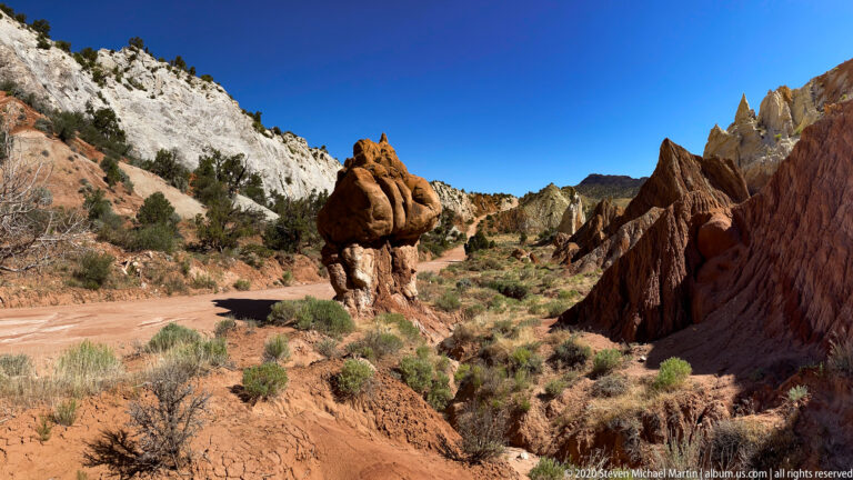
The Colorado Plateau contains one of the most visually distinctive collections of geological landscapes in North America. Deep canyons, sandstone cliffs, mesas, and desert basins reveal layers of rock shaped by tectonic uplift and long-term erosion. The region presents an opportunity to observe how water, wind, and geological forces combine to create dramatic landforms across the American Southwest.
Stretching across portions of Utah, Arizona, New Mexico, and Colorado, the Colorado Plateau preserves extensive exposures of sedimentary rock formed over hundreds of millions of years. Rivers such as the Colorado and Green carved deep canyon systems through uplifted strata, exposing layers that record changing environmental conditions across prehistoric eras. The region is widely recognized for its concentration of national parks, monuments, and protected landscapes that illustrate the diversity of geological processes shaping desert environments.
In addition to geological features, the plateau contains one of the highest concentrations of archaeological sites in North America. Ancestral Puebloan communities constructed cliff dwellings, masonry structures, and extensive settlement networks across canyon systems and high desert plateaus. These cultural landscapes demonstrate long-term adaptation to arid environments influenced by seasonal precipitation and limited water resources.
Travel across the Colorado Plateau highlights the visual scale of geological time, where exposed rock layers reveal gradual transformation through erosion, deposition, and tectonic uplift. The diversity of landforms encountered throughout the region contributes to a cohesive exploration of canyon landscapes, desert plateaus, and archaeological sites connected through shared geological history.
Browns Canyon National Monument Browns Canyon National Monument preserves a rugged river corridor along the Arkansas River characterized by granite […]
Horseshoe Canyon – Canyonlands National Park Horseshoe Canyon preserves a remote canyon environment within Canyonlands National Park known for significant […]
Castle Valley Castle Valley preserves a dramatic desert landscape characterized by towering sandstone formations rising from open valley terrain. The […]
Colorado National Monument Colorado National Monument preserves a dramatic landscape of red sandstone canyons, towering monoliths, and high desert plateaus […]
Goblin Valley State Park Goblin Valley State Park preserves a unique landscape of mushroom-shaped rock formations created through differential erosion […]
Cottonwood Narrows – Grand Staircase–Escalante National Monument Cottonwood Narrows preserves a narrow slot canyon environment formed through erosion acting upon […]
Heart of the Cockscomb – Grand Staircase–Escalante National Monument The Cockscomb formation represents a dramatic geologic feature created by compressional […]
Hovenweep National Monument Hovenweep National Monument preserves a series of ancestral Puebloan sites distributed across canyon heads and mesa edges […]
Rattlesnake Arches – McInnis Canyons National Conservation Area Rattlesnake Arches preserves one of the largest concentrations of natural sandstone arches […]
Natural Bridges National Monument Natural Bridges National Monument preserves three large natural bridges formed through erosion acting upon sandstone canyon […]
Alpine Meadows – Rocky Mountain National Park Alpine meadows within Rocky Mountain National Park preserve high elevation tundra environments shaped […]
The itinerary moves through portions of the Four Corners region where uplifted sandstone formations, canyon systems, and archaeological landscapes occur in close geographic proximity. Travel routes connect high desert plateaus with deeply incised river corridors shaped by the Colorado River system. Scenic drives provide views of layered rock formations and expansive desert terrain that illustrate the long-term influence of erosion and tectonic forces across the plateau. The concentration of protected lands allows visitors to experience a wide variety of geological environments within a relatively compact region.